Throwback Thursday; Canyon de Chelly National Monument and Hubbell Trading Post National Historic Site
Back in 2012 I visited Canyon de Chelly National Monument in the Navajo Nation in Apache County Arizona located just east of US Route 191.

Canyon de Chelly National Monument was created back in 1931 and consists of several interconnected canyons. The Canyon lands of Canyon de Chelly National Monument have evidence of human habitation going back close to 4,000 years with various cliff dwellings as old as possible 350 AD. Members of what is now the Hopi Tribe inhabited Canyon de Chelly until about 1,300 AD when they migrated to the west. Canyon de Chelly is still inhabited by members of the Navajo Nation making the National Monument one of the oldest continually inhabited places in North America.

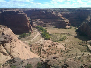
From US 191 to I took BIA 7 into Canyon de Chelly towards Spider Rock. BIA 7 is actually a maintained roadway all the way west to the New Mexico State Line but apparently is poorly graded dirt east of the National Monument boundary. From high above the canyon walls it is very obvious the floor of Canyon de Chelly is still inhabited. The "White House" which is a large cliff dwelling was easily observed climbing to the Spider Rock Overlook.


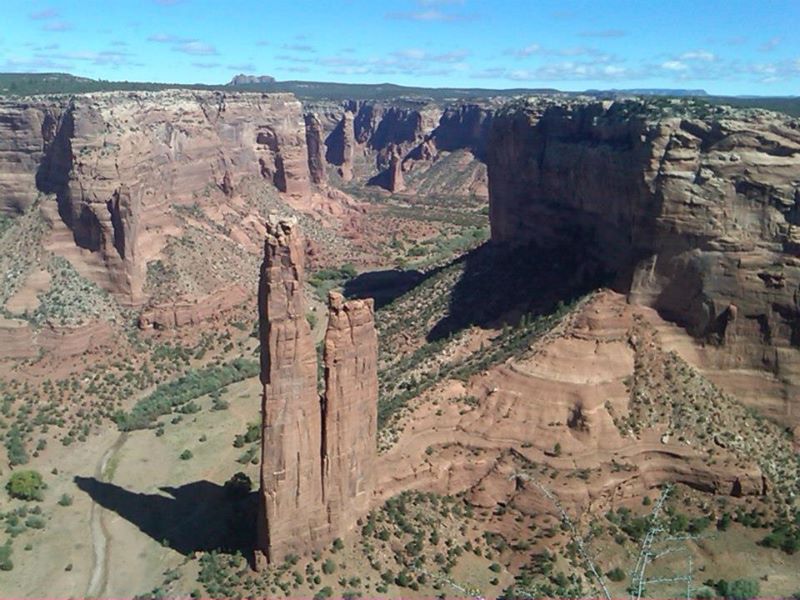
The most notable feature of Canyon de Chelly is the Spider Rock which is a 750 sandstone spire jutting up from the canyon floor. Navajo tribal tradition holds that the Spider Rock is home to the Spider Woman who created the Navajo.

On my way back south from Canyon de Chelly National Monument I stopped in Ganado on US 191/AZ 264 to see the Hubbell Trading Post National Historic Site.

The Hubbell Trading Post was established by John Lorenzo Hubbell in 1878 which was ten years after the Navajo were allowed to return to the Ganado area. The Hubbell Trading Post essentially was the only outlet for Navajo to receive goods from the outside world in the late 19th century. The National Park Service purchased the Hubbell Trading Post in 1967 although it was a National Historic Site by 1965.


Canyon de Chelly National Monument was created back in 1931 and consists of several interconnected canyons. The Canyon lands of Canyon de Chelly National Monument have evidence of human habitation going back close to 4,000 years with various cliff dwellings as old as possible 350 AD. Members of what is now the Hopi Tribe inhabited Canyon de Chelly until about 1,300 AD when they migrated to the west. Canyon de Chelly is still inhabited by members of the Navajo Nation making the National Monument one of the oldest continually inhabited places in North America.

From US 191 to I took BIA 7 into Canyon de Chelly towards Spider Rock. BIA 7 is actually a maintained roadway all the way west to the New Mexico State Line but apparently is poorly graded dirt east of the National Monument boundary. From high above the canyon walls it is very obvious the floor of Canyon de Chelly is still inhabited. The "White House" which is a large cliff dwelling was easily observed climbing to the Spider Rock Overlook.


The most notable feature of Canyon de Chelly is the Spider Rock which is a 750 sandstone spire jutting up from the canyon floor. Navajo tribal tradition holds that the Spider Rock is home to the Spider Woman who created the Navajo.

On my way back south from Canyon de Chelly National Monument I stopped in Ganado on US 191/AZ 264 to see the Hubbell Trading Post National Historic Site.

The Hubbell Trading Post was established by John Lorenzo Hubbell in 1878 which was ten years after the Navajo were allowed to return to the Ganado area. The Hubbell Trading Post essentially was the only outlet for Navajo to receive goods from the outside world in the late 19th century. The National Park Service purchased the Hubbell Trading Post in 1967 although it was a National Historic Site by 1965.


Comments