
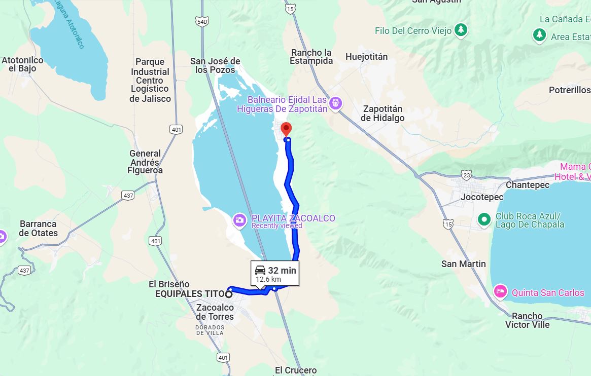
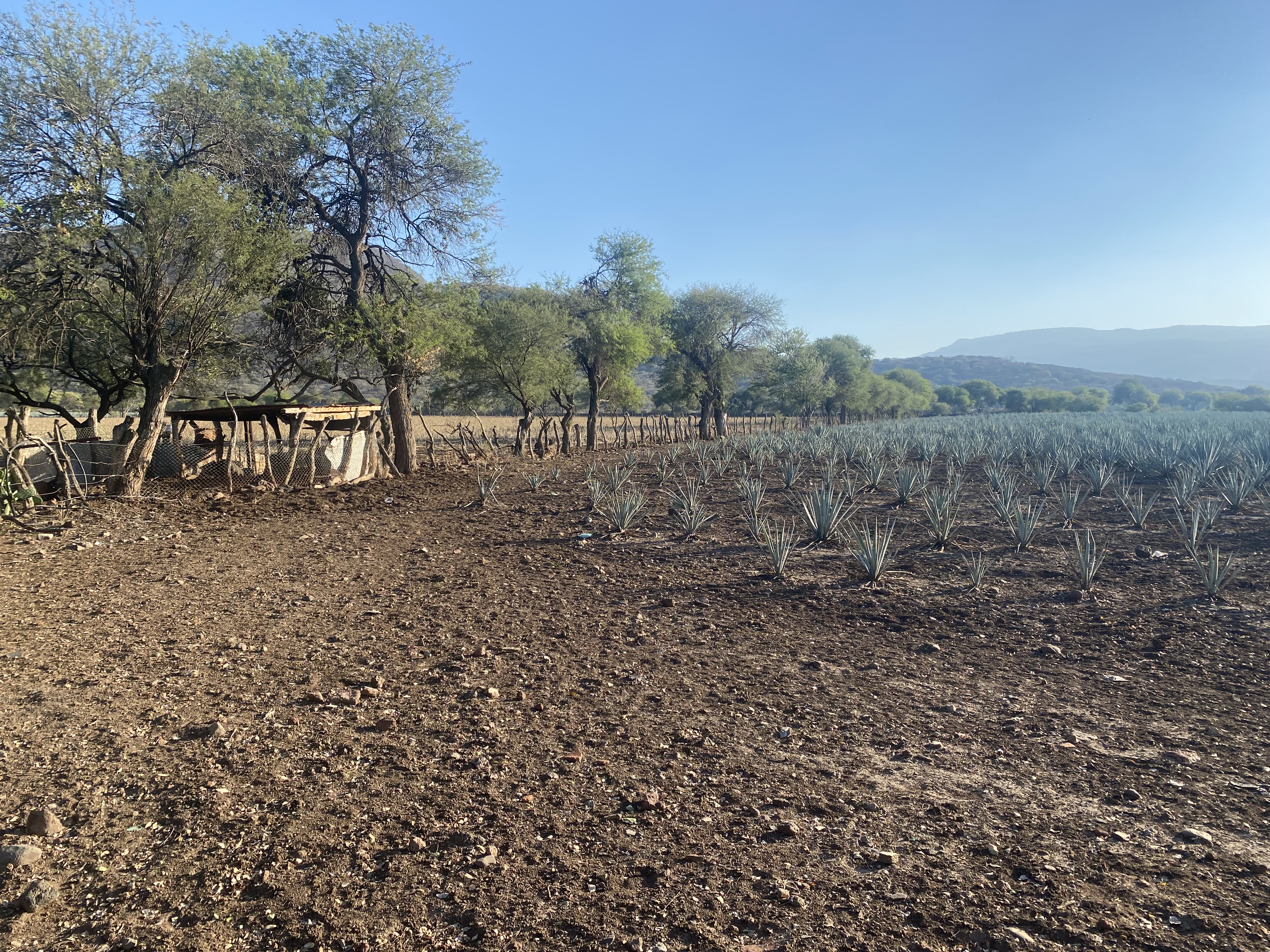
Camino Real is a 12.6-kilometer rural highway located in southern Jalisco. Said corridor was the original highway which connected the communities of Zacoalco de Torres and San Marcos and forms a semi-circle of Laguna San Marcos. Camino Real is comprised of a paved cobblestone segment near Zacoalco de Torres and a dirt portion east of Federal Highway 54D. Numerous ranching properties and agave farms can be found along the dirt portion. Functionally Camino Real has been replaced by modern Jalisco State Highway 402 in modern times.
A drive on Camino Real between Zacoalco de Torres and San Marcos Evangelista
Zacoalco de Torres and San Marcos are both located on opposite on sides of Laguna San Marcos in southern Jalisco. Camino Real is the original highway which connected the two towns.
The entomology of "Zacoalco" comes from the word "Tzacoalco" which is thought to have meant "place of confinement," "in the pyramind," or "place where eagles perch." The area that is now Zacoalco de Torres was settled by the Aztecs in 1264. The Aztecs settled upon Chiquihuitillo Hill which rests between Laguna de Zacoalco and Laguna de San Marcos. In 1524 the Spanish arrived in the Aztec lands surrounding Laguna de Zacoalco. Most Aztecs fled to the south towards Laguna de Sayula in response to Spanish Conquistador Francisco Cortes de San Buenaventura attempting to subdue them by force. The Spanish invasion prompted the commissioning of the Town of Zacoalco.
In 1810 during the Mexican War of Independence the Town of Zacoalco was taken by revolutionary Jose Antonio Torres during the Battle of Zacoalco. The Town of Zacoalco was renamed to Zacoalco de Torres in 1829 in memory of Jose Antonio Torres and the battle which took place there. During Mexican rule Zacoalco de Torres mostly came to be known for the numerous homemade wood furniture (equipales) stores which are located in the town.
In 1810 during the Mexican War of Independence the Town of Zacoalco was taken by revolutionary Jose Antonio Torres during the Battle of Zacoalco. The Town of Zacoalco was renamed to Zacoalco de Torres in 1829 in memory of Jose Antonio Torres and the battle which took place there. During Mexican rule Zacoalco de Torres mostly came to be known for the numerous homemade wood furniture (equipales) stores which are located in the town.
What is now San Marcos was the site of a Toltec village which was called Chistic or Xistic. The area was extensively visited by the Spanish after the founding of nearby Zacoalco. A village was plotted at the site of San Marcos during June 1740. Upon San Marcos being annexed into the then new state of Jalisco in 1823 the community was under the governance of Etzatlán Township. San Marcos was legally designated a town during April 1907 and later a Municipality seat in 1915.
Camino Real can be seen connecting Zacoalco de Torres to San Marcos on the 1922 Direccion de Estudios Geograficos y Climatologicos map. The highway is shown circling the southern and eastern shores of Laguna San Marcos. In modern times Jalisco State Highway 402 has functionally replaced Camino Real as the primary corridor into San Marcos. Said State Highway originates at Jalisco State Highway 401 near Acatlán de Juárez and tracks east to San Marcos via San José de los Pozos.

From Zacoalco de Torres traffic can follow Pino Suárez north over the Ferromex railroad towards a terminus at Camino Real.

Camino Real within Zacoalco de Torres is a paved with cobblestone. The highway approaches Federal Highway 54D and dips underneath the Autopista via a dirt underpass.


Camino Real becomes a grade dirt roadway east of Federal Highway 54D. The corridor swings north towards San Marcos along the eastern shore of Laguna San Marcos.

The portion of Camino Real east of Federal Highway 54D provides access to numerous agave farms and ranching plots which line the foothills of the nearby mountains.




Comments