The original California State Route 51 was a short-lived designation which was assigned to a former section of US Route 101 at the western outskirts of Orange. The original California State Route 51 was defined as part of the wider 1964 State Highway Renumbering along Chapman Avenue and Main Street. This corridor would be deleted by way of 1965 Legislative Chapter 1372 and relinquished from the State Highway System.
Chapman Avenue and Main Street were commissioned as components of Legislative Route Number 2 following the passage of the 1909 First State Highway Bond Act. Chapman Avenue and Main Street would become part of US Route 101 from November 1926 when the American Association of State Highway Officials commissioned the US Route System. Mainline US Route 101 was shifted of Chapman Avenue and Main Street during 1953 when the Santa Ana Freeway reached Santa Ana.
The history of the original California State Route 51The era of State Highway Maintenance in the Orange corridor would begin with the 1909 First State Highway Bond Act which was approved by voters in 1910. One of the highways approved through the 1909 First State Highway Bond Act was a 481.8-mile highway originating at the City Limits of San Francisco which terminated in San Diego. This highway would ultimately come to be known in time as Legislative Route Number 2 ("LRN 2").
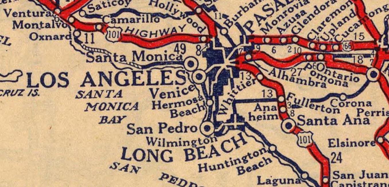
LRN 2 between Los Angeles and Orange is shown as part of the Old Spanish Trail on the 1924 Rand McNally Map of California.
During November 1926 the US Route System was created by the American Association of State Highway Officials (AASHO and later AASHTO). US Route 101 was applied to the existing corridor of LRN 2 between Los Angeles and Orange. US Route 101 can be seen following LRN 2 between the Los Angeles city limit to Orange on the 1927 Rand McNally Map of California.
LRN 174 would be defined during 1933 as a highway passing bypassing Orange. LRN 174 was defined as "LRN 60 via Manchester Avenue to LRN 2/US Route 101 near Miraflores." LRN 174 was part of the then unfinished Manchester Boulevard Extension. LRN 174 can be seen for the first time on the
1934 Division of Highways Map.
US Route 101/LRN 2 can be seen passing through the western outskirts of Orange along Chapman Avenue and Main Street on the 1935 United States Geological Survey Maps of Garden Grove and Orange.


The
May 1937 California Highways & Public Works discusses the opening the final segment of the "Manchester Boulevard Extension" which was dedicated on April 30, 1937. The Manchester Boulevard Extension provided a direct link between Downey and Anaheim which followed the Southern Pacific Railroad. The Manchester Boulevard Extension bypassed downtown Anaheim and tied into existing alignment of California State Route 10/LRN 174 on southern Manchester Boulevard at Miraflores near the outskirts of Santa Ana (bypassing Orange). The Manchester Boulevard Extension is stated to have been conceptualized during 1924 by the Greater Manchester Avenue Improvement Association. The Manchester Boulevard Extension concept was taken over by the Division of Highways when LRN 174 was added as a State Highway circa 1933.
California State Route 10/LRN 174 can be seen in detail on the
1938 Division of Highways State Map. CA 10/LRN 174 is shown to originate at US Route 101A/LRN 60 in Los Angeles County. California State Route 10/LRN 174 is shown following Manchester Boulevard and Firestone Boulevard eastward to US Route 101/LRN 2 south of Anaheim of Orange County.

US Route 101 Bypass appears co-signed with California State Route 10/LRN 174 on the
1940 Division of Highways Map from CA 19/LRN 168 on Rosemead Boulevard in Downey to US Route 101/LRN 2 near south of Anaheim and Orange. It is unclear when US Route 101 Bypass in the Los Angeles Area was created due to it not appearing anywhere in the AASHTO Database. US Route 101 Bypass is shown departing US Route 101/LRN 2 in Los Angeles via LRN 166/Indiana Street and LRN 166/Anaheim-Telegraph Road to California State Route 19/Rosemead Boulevard.
California State Route 10 is shown to be truncated to an eastern terminus at US Route 101 Bypass/California State Route 19 at Rosemead Boulevard in Downey on the
1942 Division of Highways Map. A planned extension of LRN 166/Anaheim Telegraph Road appears for the first time.

The
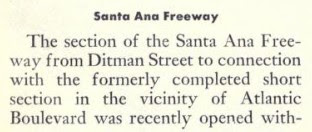
1954 Division of Highways Map shows the Santa Ana Freeway completed to Pioneer Boulevard near Norwalk. Mainline US Route 101 is shown realigned onto the Santa Ana Freeway (LRN 166), an interim routing on Pioneer Boulevard and Firestone Boulevard/Manchester Boulevard (LRN 174) between Los Angeles-Santa Ana. The former mainline of US Route 101 on LRN 2 is shown to no longer be part of the highway. Former mainline US Route 101 along Chapman Avenue and Main Street is shown to be an un-signed segment of LRN 2.
On June 29, 1956, the Federal Highway Aid Act of 1956 was signed into law on the Federal Level. The Federal Highway Aid Act of 1956 was the genesis point of the Interstate Highway System and would see the Santa Ana Freeway assigned to Interstate 5.
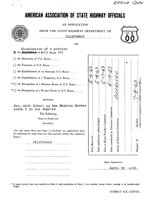
On June 19, 1963, AASHO approved a Division of Highways request to truncate US Route 101 from the Mexican Border to downtown Los Angeles. This measure removed US Route 101 from the Santa Ana Freeway in Anaheim and left Interstate 5 as a standalone route designation.
As part of the 1964 State Highway Renumbering the Legislative Route Numbers were dropped in favor or Sign Route designations. Former mainline US Route 101 in Orange was subsequently reassigned to as
California State Route 51. The initial definition of the first California State Route 51 was "Route 5 to Route 5 near Santa Ana." The original California State Route 51 appears for the first time on the
1964 Division of Highways Map.
The original California State Route 51 was deleted via 1965 Legislative Chapter 1372. The original California State Route 51 no longer appears on the
1966 Division of Highways Map.
The California State Route 51 designation was repurposed as part of 1981 Legislative Chapter 282 following Interstate 80 being realigned north of downtown Sacramento. The modern California State Route 51 is a hidden designation for what is signed as the Interstate 80 Business Route on the Capital City Freeway from Interstate 80 to US Route 50.








Comments