Canal Street-Algiers Point Ferry (New Orleans, LA)


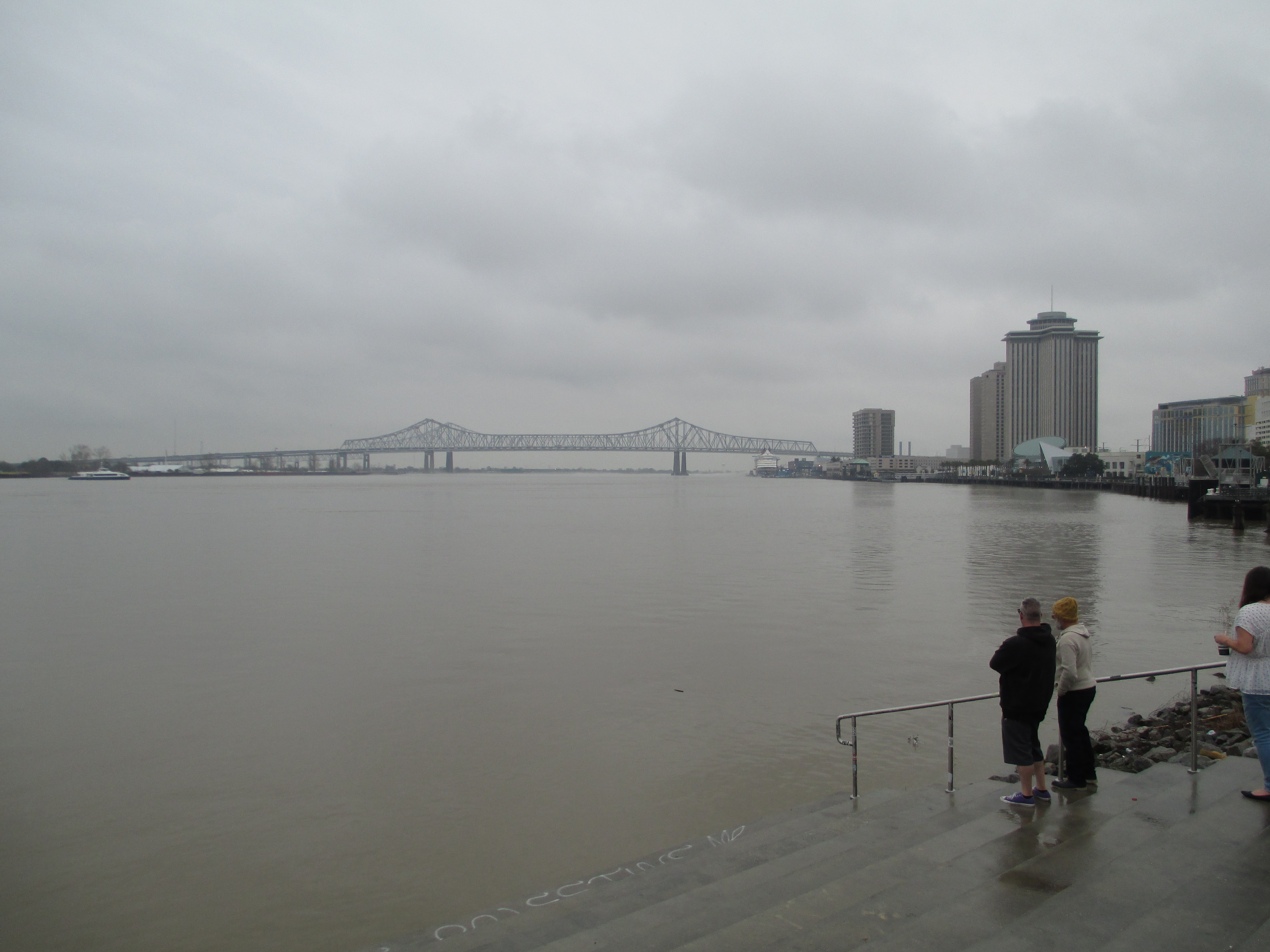
The Canal Street-Algiers Point Ferry is one of two crossings of the Mississippi River located at downtown New Orleans, connecting the foot of Canal Street in town with the Algiers Point section of the city on the river’s west bank. Like its neighboring ferries downriver, this crossing requires the payment of a toll and ferries depart from each landing every 30 minutes on most days. Unlike the other ferries, this crossing is not open to vehicles and is a pedestrian-only river crossing. The ferry is located at the deepest part of the Mississippi River, where the depth is about 210 ft across from Jackson Square. At this point, the typical flowrate is 600,000 cubic feet per second. That volume is roughly the equivalent of seven Olympic-sized swimming pools for every second that passes.

The initial French settlement of New Orleans in 1718 was centered around what’s now Jackson Square and the historic French Quarter neighborhood in the city. The area around Algiers Point was first developed as a plantation in 1719 and an informal ferry service was started and remained present in the following 100 years. The commercialization of the ferry service at this location was made official in 1827, making this ferry one of the longest-running commercial operations on the Mississippi River. The ferry became essential as time went on, as Algiers grew in the 19th Century as its own community, and following the annexation of the area into the city of New Orleans in 1870. It was not until the 1950s when the construction of the Greater New Orleans Bridge (nowadays known as the Crescent City Connection) enabled residents to directly access both sides of the city by vehicle.

Algiers is sometimes also known as the 15th Ward, one of the city’s 17 Wards and the only such subdivision located on the west bank of the river, while downtown and the remainder of the city limit is located on the river’s east bank. Since the Mississippi River flows due north for a substantial distance in this area, an anomaly along the lower river, the river’s west bank is in fact located compass east of downtown and the river’s east bank, and vice versa.


The Canal Street Ferry operates on a passenger-only catamaran-style vessel like the one pictured here bound for the Algiers ferry terminal.

This ferry is my personal favorite of the services on the lower Mississippi River. The ride across the river affords passengers the opportunity to take in the sweeping views of downtown, the French Quarter, and the Crescent City Connection and along with the city’s famous streetcar lines, is a quintessential New Orleans transportation experience that should not be passed up if you ever get the chance to visit.

The following pictures from my visits to the Canal Street Ferry in February 2024 showcase the Algiers Point Ferry Terminal on the west bank of the Mississippi River in the historic Algiers Point neighborhood of New Orleans. Click on each photo to see a larger version.


The following pictures from my visits to the Canal Street Ferry in February 2024 showcase the Canal Street Ferry Terminal on the east bank of the Mississippi River in downtown New Orleans. Click on each photo to see a larger version.


The following pictures from my visits to the Canal Street Ferry in February 2024 showcase the round trip voyage on the ferry, including the interiors of the ferry itself and the surrounding scenery. Click on each photo to see a larger version.


The following pictures from my visits to the Canal Street Ferry in February 2024 showcase general views of the ferry and its surrounding scenery on the Mississippi River. Click on each photo to see a larger version.

How To Get There:

Bridges, Crossings, and Structures of the Lower Mississippi River
Next Crossing upriver: Crescent City Connection Bridge (New Orleans, LA)
Next Crossing downriver: Chalmette-Lower Algiers Ferry (Chalmette, LA)
Return to the Bridges of the Lower Mississippi River Home Page
__________________________________________________

Comments

Popular posts from this blog

The case to move Interstate 73 in Southern Ohio onto US 33

Every decade or so, Ohio pushes to revisit the proposed Interstate 73 that would connect Michigan to Myrtle Beach, South Carolina.  It's been happening since Congress legislated the route in 1991.  Within Ohio, Interstate 73 generally follows the US 23 corridor from Portsmouth through Columbus to Toledo, and into Michigan. Since High Priority Corridor Five was created , Ohio has really done nothing to move forward with Interstate 73.  Sure, there have been feasibility studies here and there.  But actual dollars and construction just haven't occurred. The US 33 Nelsonville Bypass appears to have been built to Interstate standards. However, Ohio has been slowly upgrading US 33 to a full freeway through Southeastern Ohio.  Bypasses of Lancaster and Nelsonville opened in 2004 and 2013, respectively.  Other sections of two-lane road are being twinned, some to freeway or, at a minimum, to expressway standards.  Currently, a $274 million widening project in...

Local Sign Find - The last remnant of Business Interstate 95 between Kenly and Rocky Mount , NC

As you head north on Interstate 95 at Exit 107 for Kenly and US 301, you'll notice something odd about the overhead sign for the exit.  Peeling off the sign for all that can see is the word 'NORTH' off-center from the US 301.  This old sign (probably close to original from when this section of I-95 opened - more on that in a little bit) gives a hint to a short-lived Business Interstate Route that ran from here to Rocky Mount. The last hint of the Kenly-Wilson-Rocky Mount Business I-95 (Shaun White - August 2020) Interstate 95 in North Carolina has a unique history.  But one of the overlooked and forgotten pieces of Interstate 95 in North Carolina is the 38 mile section between Kenly and Rocky Mount.  When opened to traffic in late 1978, it was the next to last piece of Interstate 95 in North Carolina to open replacing a four lane US 301 from Battleboro through Rocky Mount and Wilson to eventually tying back into the Interstate in Kenly. Though it was not delayed in l...

Nostalgia fast food with style - Returning to Rax

Nostalgia. It sells. It evokes, and more accurately, warps memories of days gone by.  Things were better, simpler, and we eat it up. Nostalgia can make you drive three hours and over a hundred miles out of your way just to reconnect with a dying fast-food restaurant you last enjoyed in the early to mid-90s.  That person was me - that restaurant was Rax. I could go on about Rax's history, but in short, Rax was briefly a very popular roast beef fast-food chain.  Growing up in the 80s and early 90s in Western PA, Rax was the good fast-food spot.  The milkshakes.  (Personally, the chocolate chip milkshake was heaven.)  Uncle Alligator Kids Meal with the chocolate chip cookie. Take that McDonald's Happy Meal!  The fancy salad and hot foods bar.  Going to Rax was special.  Like so many similar restaurants, various investments, management decisions, etc., led Rax to almost disappear overnight.  By the time I graduated college in late 1999, abou...