
Interstate 605 is a 27.4-mile freeway located in the Los Angeles Metropolitain Area. Interstate 605 begins at Interstate 210 near Duarte and terminates at the Interstate 405/California State Route 22 junction to the south near the boundary to the city of Long Beach. Interstate 605 is known as the San Gabriel River Freeway and has three unconstructed miles which would extend it south to California State Route 1 near Seal Beach. Much of the corridor of Interstate 605 was built up from what was the original California State Route 35. The blog cover photo is taken from the July/August 1964 California Highways & Public Works which featured the initial segment of Interstate 605 to open between Whittier Boulevard and Peck Road


The origin of what is now Interstate 605 begins during 1933 with the addition of Legislative Route Number 170 (LRN 170) to the State Highway System. The original definition of LRN 170 was as follows:
"LRN 179 near Seal Springs via Santa Fe Springs to LRN 26 near West Covina."
The August 1934 California Highways & Public Works announced the initial run of Sign State Routes. California State Route 35 was assigned completely concurrent with LRN 170 between US Route 99-60-70/LRN 26 in West Covina and California State Route 22/LRN 179 near Seal Beach.


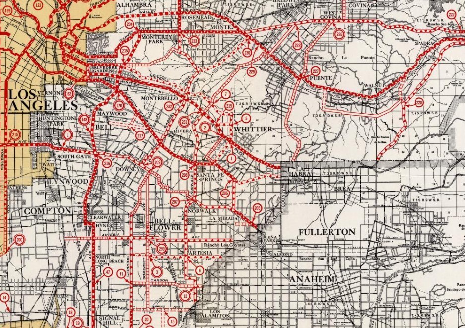
California State Route 35/LRN 170 can be seen in clear detail on the 1938 Division of Highways Map.
The November/December 1956 California Highways & Public Works noted the entire 23-mile corridor of the San Gabriel River Freeway/LRN 170 was adopted by the California Highway Commission on December 15, 1954.


The corridor of LRN 170 was approved to become a chargeable Interstate on September 15, 1955. On June 29, 1956, the Federal Highway Aid Act of 1956 was signed into law on the Federal Level. The Federal Highway Aid Act of 1956 was the genesis point of the Interstate Highway System.
1957 Legislative Chapter 36 extended the definition of LRN 170 south to US Route 101A/LRN 60 near Seal Beach.
A November 8, 1957, map from the Division of Highways to the American Association of State Highway Officials shows LRN 170 and the San Gabriel River Freeway proposed as Interstate 13.


The legislative extension of LRN 170 to US Route 101A/LRN 60 can be seen on the 1958 Division of Highways Map.


1959 Legislative Chapter 1062 extended the definition of LRN 170 to US Route 66/LRN 9 in Duarte. The entirety of LRN 170 was added to the Freeway & Expressway System upon it being created during 1959.
The November/December 1959 California Highways & Public Works announced a 1.3-mile realignment of California State Route 35/LRN 170 from Workman Mill Road to the San Gabriel River Freeway was budgeted for the 1960-61 Fiscal Year. The project zone is noted to include a railroad underpass.

The legislative extension of LRN 170 to US Route 66/LRN 9 to Duarte appears on the 1960 Division of Highways Map.


The March/April 1961 California Highways & Public Works announced construction the Peck Road Interchange of the San Gabriel River Freeway was expected to commence during September.


The November/December 1961 California Highways & Public Works announced construction of the San Gabriel River Freeway from the vicinity of Whittier Boulevard north to the San Bernardino Freeway had been budgeted for the 1962-63 Fiscal Year.

The November/December 1962 California Highways & Public Works announced numerous construction allocations budgeted for the construction of the San Gabriel River Freeway for the 1963-64 Fiscal Year.


The July/August 1964 California Highways & Public Works features the first segment of Interstate 605 to open. Interstate 605 between Peck Road and Whittier Boulevard is noted to have been dedicated on June 10, 1964. The entire planned scale of the San Gabriel River Freeway is depicted in a planning map.


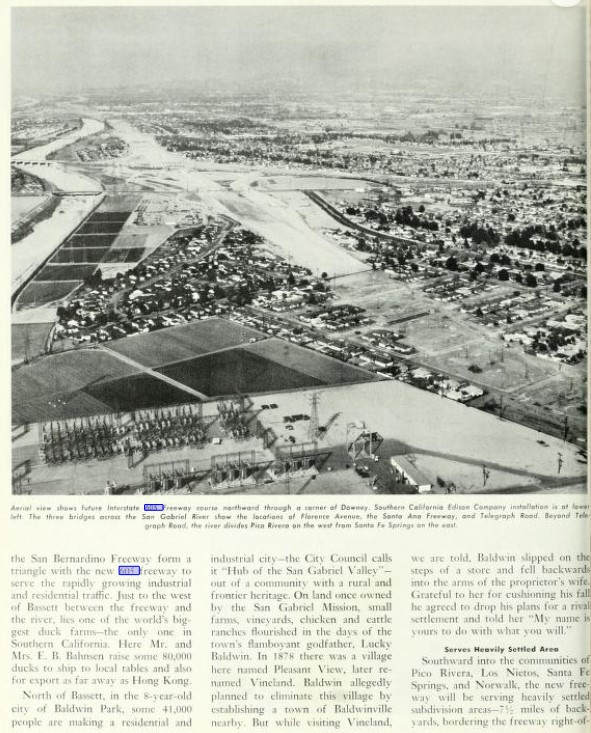


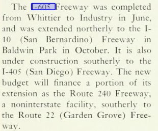
The November/December 1964 California Highways & Public Works noted Interstate 605 and the San Gabriel River Freeway was extended to Interstate 10 during the past October. Construction of the California State Route 240 portion of the San Gabriel River Freeway to California State Route 22 is stated to be partially financed in the next budget.
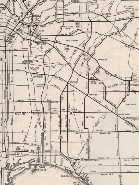
Interstate 605 appears complete between Whittier Boulevard and Interstate 10 on the 1965 Division of Highways Map. The former portions of the original California State Route 35 between Whittier Boulevard and Interstate 10 no longer appears as State Highway.

The November/December 1965 California Highways & Public Works noted 4.7-mile portion the Interstate 605 segment of the San Gabriel River Freeway south of Whittier Boulevard during the previous September. The California State Route 240 segment of San Gabriel River Freeway to California State Route 22 is noted to have a planned completion during Fall 1966.

Interstate 605 appears complete slightly south of Interstate 5/US Route 101 at the Santa Ana Freeway on the 1966 Division of Highways Map. Former California State Route 35 on Norwalk Boulevard no longer appears as State Highway.

The January 1967 California Highways & Public Works referenced Interstate 605 between Interstate 5 and Interstate 405 as having opened on July 1, 1966.
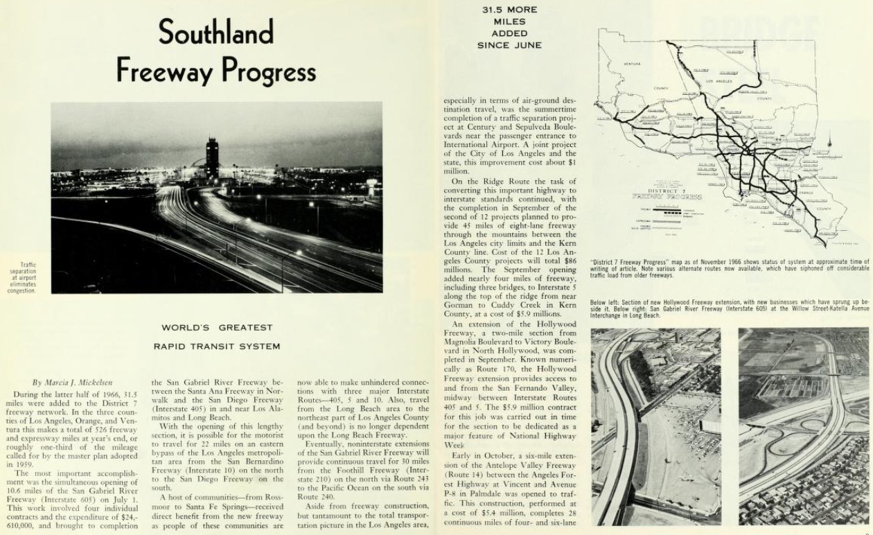
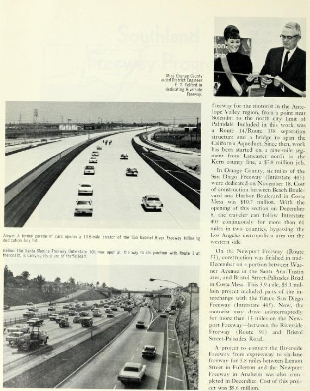
The 1967 Division of Highways Map displays Interstate 605 as being complete between Interstate 5 and Interstate 405. The California State Route 240 stub of the San Gabriel River Freeway to California State Route 22 is also shown completed. The remaining portion of the original California State Route 35 is shown to be relinquished from the State Highway System.

1967 Senate Bill 99, Chapter 1101 codified the name of Interstate 605 between Interstate 405 and Interstate 10 as the San Gabriel River Freeway.
1968 Legislative Chapter 282 reclassified the California State Route 240 and California State Route 243 portions of the planned San Gabriel River Freeway as Route 605. During December 1968 the Federal Highway Administration added the San Gabriel River Freeway north of Interstate 10 as chargeable Interstate. The addition of Interstate 605 as being chargeable north of Interstate 10 was made due to the provisions of the 1968 Federal Highway Aid Act.
The two unbuilt segments of the San Gabriel River Freeway appear as Route 605 as on the 1969 Division of Highways Map.

Interstate 605 north from Interstate 10 to Interstate 210 opened to traffic during 1971 which can be seen on the 1975 Caltrans Map.

Despite Interstate 605 being completed to Interstate 10 the 1967 legislation describing the portion officially named the San Gabriel River Freeway has never been amended. The unconstructed portion of Route 605 south of Interstate 405 and California State Route 22 is not classified by the Federal Highway Administration as Interstate.

Part 2; a drive on Interstate 605
During 2020 Dan Murphy of the Roadwaywiz Youtube channel featured real-time drives on Interstate 605. Below Interstate 605 can be viewed northbound originating from Interstate 405.
Below Interstate 605 can be viewed southbound originating from former US Route 66 at Huntington Drive.
On May 2, 2020, Interstate 605 was featured on the Roadwaywiz webinar on the Los Angeles area. Panelists Dan Murphy, Scott Onson and Steve Alps discuss Interstate 605 between timestamps 24:20-27:00.
Comments