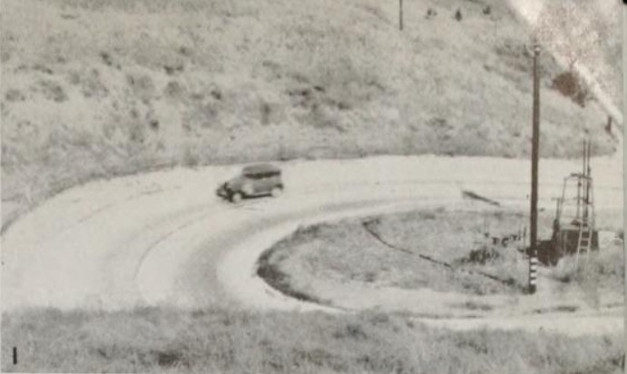
California State Route 142 as presently constructed is a twelve-mile State Highway located in Orange County and San Bernardino County. The constructed part of California State Route 142 begins in Yorba Linda at California State Route 90. From Yorba Linda the alignment of California State Route 142 follows Valenica Avenue and Carbon Canyon Road through the Chino Hills into San Bernardino County. Upon entering San Bernardino County, the constructed segment of California State Route 142 terminates at California State Route 71 via Chino Hills Parkway. California State Route 142 has a nine-mile unconstructed segment which would carry it from California State Route 71 to California State Route 210 in Upland. Depicted above is Carbon Canyon Road as seen in the January 1939 California Highways & Public Works when it was part of Legislative Route Number 177 prior to being renumbered California State Route 142.
The history of California State Route 142What was to become California State Route 142 was added to the State Highway System via 1933 Legislative Chapter 767 as Legislative Route Number 177 (LRN 177). The original definition of LRN 177 was as follows:
"LRN 176 near Brea to LRN 77 near Chino"
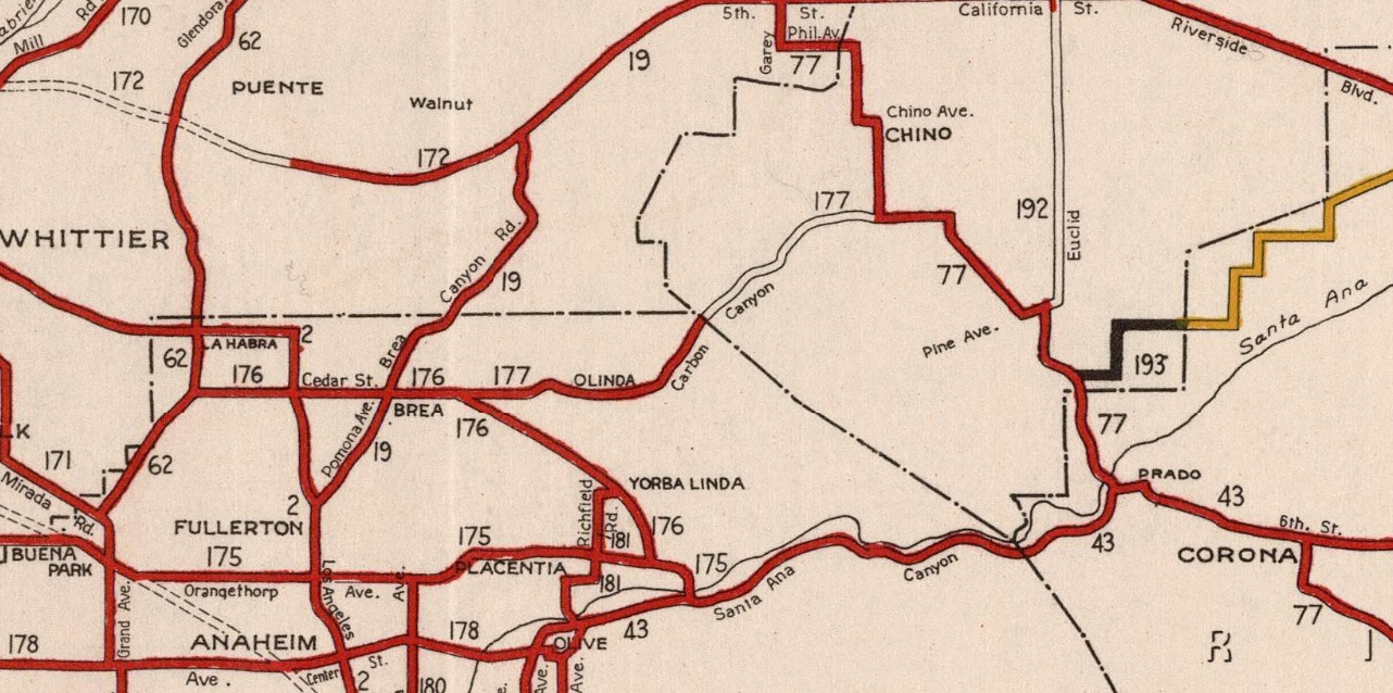
LRN 177 appears for the first time on the 1934 Division of Highways Map. LRN 177 can be seen crossing the Chino Hills from LRN 176 in Brea via Carbon Canyon Road to LRN 77 south of Chino. LRN 177 was not assigned on of the initial Sign State Routes announced in the August 1934 California Highways & Public Works.
The 1935 Division of Highways Map of Orange County depicts LRN 177 beginning from LRN 176 at Loftus at LRN 176 via Carolina Street (now Kreamer Boulevard). LRN 177 is shown following Olinda Boulevard (now Birch Street) and Valenica Avenue to Carbon Canyon Road. LRN 177 is displayed following Carbon Canyon Road east through the Chino Hills to the San Bernardino County Line.
The
1935 Division of Highways Map of San Bernardino County depicts LRN 176 terminating at California State Route 71/LRN 77 at Pipeline Avenue via Merrill Avenue (now Chino Hills Parkway) south of Chino.
The second segment of what would become California State Route 142 was added to the State Highway System by way of 1959 Legislative Chapter 1062 which defined
LRN 274. The original definition of LRN 274 was as follows:
"LRN 77 (California State Route 71) near Chino to LRN 190 (California State Route 30) near Upland"
LRN 274 can be seen for the first time on the
1960 Division of Highways Map. LRN 274 was apparently known in concept as the Carbon Canyon Freeway. No formal route adoption was ever made for the Carbon Canyon Freeway.
As part of the 1964 State Highway Renumbering the Legislative Route Numbers were dropped. Legislative Route Numbers without a Sign State Route were given new designations. LRN 177 and LRN 274 subsequently became defined as California State Route 142. California State Route 142 was defined as "Route 42 near Brea to Route 30 near Upland." California State Route 142 can be seen on the
1964 Division of Highways Map.
1972 Legislative Chapter changed "Route 42" to "Route 90" as the southern terminus of California State Route 142.
California State Route 142 is shown to be realigned to a new terminus at California State Route 90 directly via Valencia Avenue on the
1982 Caltrans Map. The alignment was likely constructed during 1981 given it does not appear on Caltrans Map from said year.
California State Route 30 was legislatively changed to California State Route 210 via 1998 Assembly Bill 2388, Chapter 221. The northern terminus of California State Route 142 was likewise altered to California State Route 210 via 1999 Assembly Bill 1650, Chapter 724. The northern terminus of California State Route 142 at California State Route 210 appears on the
2005 Caltrans Map.






Comments