Back in 2016 I drove California State Route 2 over the Angeles Crest Highway from California State Route 138 in the Mojave Desert to Interstate 210 in La Canada Flintridge.

The Angeles Crest Highway refers to a 66 mile portion of CA 2 straddles the ridge of the San Gabriel Mountains within Angeles National Forest. The route of CA 2 on the Angeles Crest Highway is a signed as a National Forest Scenic Byway and California Scenic Highway.
CA 2 as a State Highway was created in 1934 from several Legislative Route Numbers:
- LRN 162 from CA 3/LRN 60 (future US 101A and CA 1) Santa Monica to US 99/LRN 4 on San Fernando Road north of downtown Los Angeles .
- LRN 61 from US 99/LRN 4 to LRN 59 near Phelan.
- LRN 59 east over Cajon Pass by way of Arrowhead Lake to CA 18/LRN 43.
CA 2 has been heavily altered over the years and has had several notable multiplexes. The present highway is gradually being truncated from Santa Monica towards the Hollywood Freeway at it's west terminus and presently has an east terminus at CA 138. The focus of this blog is on the Angeles Crest Highway/LRN 61 portion of CA 2. The histories of the other sections of CA 2 can be found on these previous blogs.
- CA 2 on what was LRN 162/US Route 66 west of the Hollywood Freeway.
Route 66 Wednesdays; Santa Monica to Pasadena
- CA 2 on the Hollywood Freeway.
Hollywood Freeway; California State Route 170, US 101, US 66 and California State Route 2
- CA 2 on LRN 59 over Cajon Pass and LRN 188.
California State Route 138
- The original alignment of CA 2 over what is now CA 173 to CA 18 via Lake Arrowhead.
California State Route 173; former California State Route 2 and the last stand of the dirt State Highway
The route LRN 61 was first defined by the State Legislature in 1915 loosely running from La Canada Flintridge north/northwest to Antelope Valley. It wasn't until 1919 that funds were allocated to build the route LRN 61 from La Canada Flintridge to the vicinity of Mount Wilson.
CAhighways.org on LRN 61
LRN 61 first appears as a 1919 Legislative roadway running slightly north of La Canada Flintridge on the 1920 State Highway Map.
1920 State Highway Map
Construction of LRN 61 reported didn't start until 1929. LRN 61 was extended Legislatively in 1931 eastward to the route of LRN 62 (future CA 39) in San Gabriel Canyon. LRN 61 and LRN 62 can be seen as a mostly unimproved Secondary Road looping through Angeles National Forest on the 1932 State Highway Map (both were far from complete in reality).
1932 State Highway Map
In 1933 the definition of LRN 61 was extended east to LRN 59 and west from LRN 9 (future CA 118) to LRN 4 (US 99). The 1934 State Highway Map shows LRN 61 completed to the vicinity of Mount Lowe.
1934 State Highway Map
The 1935 California Division of Highways Map shows the route LRN 61/CA 2 from LRN 4 in great detail. LRN 61/CA 2 was originally routed from San Fernando Road on La Canada Flintridge; Fletcher Drive, Verdugo and Foothill Bouelvard.
1935 Los Angeles Highway Map
The 1936-37 State Highway Map shows LRN 61 partially completed to the vicinity of the West Fork San Gabriel River.
1936-37 State Highway Map
The 1938 State Highway Map shows CA 2 for the first time on LRN 61 and the highway closing in from both sides towards LRN 62 at San Gabriel Canyon.
1938 State Highway Map
Not much change is shown aside from surface improvements on CA 2/LRN 61 on the 1940 State Highway Map. Work on the Angeles Crest Highway would shutter in 1941 due to World War II and wouldn't resume until 1946.
1940 State Highway Map
CA 2/LRN 61 on the Angeles Crest Highway opened in 1956. The completed highway over the ridge of the San Gabriel Mountains can be seen on the 1957 State Highway Map.
1957 State Highway Map
The planned realignment of CA 2/LRN 162 onto the Glendale Freeway over the Los Angeles River first appears on the 1961 State Highway Map City Insert.
1961 State Highway Map City Insert
On the 1963 State Highway map CA 2 is shown realigned onto the southern segment of the Glendale Freeway and Glendale Boulevard from Fletcher Drive to US 101/US on the Hollywood Freeway.
1963 State Highway Map City Insert
1963 was also notable since it was the first year CA 39 reached CA 2 via San Gabriel Canyon.
1963 State Highway Map
During the 1964 State Highway Renumbering all LRNs were dropped and CA 2 was truncated to CA 138.
1964 State Highway Map
The future route of CA 2 on the Glendale Freeway to La Canada Flintridge appears first on the 1965 State Highway Map.
1965 State Highway Map
A portion of the Glendale Freeway is shown complete south of La Canada Flintridge on the 1975 State Highway Map.
1975 State Highway Map City Insert
Conversely the 1977 State Highway Map shows the Glendale Freeway/CA 2 complete from I-5 north to CA 134.
1977 State Highway Map City Insert
CA 2 on the Glendale Freeway is shown complete to I-210 and La Canada Flintridge on the 1979 State Highway Map.
1979 State Highway Map City Insert
With the above history of the Angeles Crest Highway in mind back in 2016 I approached CA 2 from CA 138 west in western San Bernardino County.


CA 2 west on the Angeles Crest Highway ascends into the San Gabriel Mountains passing through Wrightwood before entering Los Angeles County. The first major overlook on CA 2 west of Wrightwood is Blue Ridge at 7,381 feet above sea level.


West of Blue Ridge CA 2 briefly descends to the overlook at Vincent Gulch Divide located at 6,565 feet above sea level.


West of Vincent Gulch CA 2 begins to run along a ridge line facing the Mojave Desert.

At Dawson Saddle CA 2 and the Angeles Crest Highway peak out at a high elevation 7,901 feet above sea level.


CA 2 west on the Angeles Crest Highway meets the closed portion of CA 39 on San Gabriel Canyon Road at 6,680 feet above sea level at Islip Saddle.

Suffice to say the view south through San Gabriel Canyon on the closed portion of CA 39 is pretty breath taking.

CA 39 in Islip Saddle has been closed since rock slides in 1978, more information can be found below.
Long closed California State Route 39 in Islip Saddle
CA 2 west from Islip Saddle has a large parking lot for the Pacific Crest Trail. West of the Pacific Crest Trail CA 2 is signed as a Safety Corridor.

CA 2 west of CA 39 passes through the Angeles Crest Tunnels which were completed by 1950.


CA 2 west on the Angeles Crest Highway continues towards La Canada Flintridge amid countless vistas of the surrounding mountains. The Mount Wilson Observatory can even be viewed from the Angeles Crest Highway. At the Forest Service Clear Creek Fire Station CA 2 west meets Signed County Route N3 on Angeles Forest Highway.


Approaching Dark Canyon CA 2 begins to descend southward along the west bank of Arroyo Seco towards La Canada Flintridge. There are numerous view points overlooking the Santa Monica Mountains and downtown Los Angeles.


Looking northward through Dark Canyon offers a nice view of the eastbound climb of the Angeles Crest Highway.
Angeles Crest Highway ends La Canada Flintridge at I-210/Foothill Freeway.

CA 2 west briefly jumps onto a multiplex of I-210 before splitting southward on the Glendale Freeway. Suffice to say the Glendale Freeway has some awesome views of downtown Los Angeles from CA 2 west. CA 2 westbound meets CA 134 on the Ventura Freeway in Glendale before meeting the Hollywood Freeway/US 101 in Los Angeles via Glendale Boulevard.


More regarding the history of the Glendale Freeway can be found below:
California State Route 2 on the Glendale Freeway

CA 2 as a State Highway was created in 1934 from several Legislative Route Numbers:
- LRN 162 from CA 3/LRN 60 (future US 101A and CA 1) Santa Monica to US 99/LRN 4 on San Fernando Road north of downtown Los Angeles .
- LRN 61 from US 99/LRN 4 to LRN 59 near Phelan.
- LRN 59 east over Cajon Pass by way of Arrowhead Lake to CA 18/LRN 43.
CA 2 has been heavily altered over the years and has had several notable multiplexes. The present highway is gradually being truncated from Santa Monica towards the Hollywood Freeway at it's west terminus and presently has an east terminus at CA 138. The focus of this blog is on the Angeles Crest Highway/LRN 61 portion of CA 2. The histories of the other sections of CA 2 can be found on these previous blogs.
- CA 2 on what was LRN 162/US Route 66 west of the Hollywood Freeway.
Route 66 Wednesdays; Santa Monica to Pasadena
- CA 2 on the Hollywood Freeway.
Hollywood Freeway; California State Route 170, US 101, US 66 and California State Route 2
- CA 2 on LRN 59 over Cajon Pass and LRN 188.
California State Route 138
- The original alignment of CA 2 over what is now CA 173 to CA 18 via Lake Arrowhead.
California State Route 173; former California State Route 2 and the last stand of the dirt State Highway
The route LRN 61 was first defined by the State Legislature in 1915 loosely running from La Canada Flintridge north/northwest to Antelope Valley. It wasn't until 1919 that funds were allocated to build the route LRN 61 from La Canada Flintridge to the vicinity of Mount Wilson.
CAhighways.org on LRN 61
LRN 61 first appears as a 1919 Legislative roadway running slightly north of La Canada Flintridge on the 1920 State Highway Map.
1920 State Highway Map
Construction of LRN 61 reported didn't start until 1929. LRN 61 was extended Legislatively in 1931 eastward to the route of LRN 62 (future CA 39) in San Gabriel Canyon. LRN 61 and LRN 62 can be seen as a mostly unimproved Secondary Road looping through Angeles National Forest on the 1932 State Highway Map (both were far from complete in reality).
1932 State Highway Map
In 1933 the definition of LRN 61 was extended east to LRN 59 and west from LRN 9 (future CA 118) to LRN 4 (US 99). The 1934 State Highway Map shows LRN 61 completed to the vicinity of Mount Lowe.
1934 State Highway Map
The 1935 California Division of Highways Map shows the route LRN 61/CA 2 from LRN 4 in great detail. LRN 61/CA 2 was originally routed from San Fernando Road on La Canada Flintridge; Fletcher Drive, Verdugo and Foothill Bouelvard.
1935 Los Angeles Highway Map
The 1936-37 State Highway Map shows LRN 61 partially completed to the vicinity of the West Fork San Gabriel River.
1936-37 State Highway Map
The 1938 State Highway Map shows CA 2 for the first time on LRN 61 and the highway closing in from both sides towards LRN 62 at San Gabriel Canyon.
1938 State Highway Map
Not much change is shown aside from surface improvements on CA 2/LRN 61 on the 1940 State Highway Map. Work on the Angeles Crest Highway would shutter in 1941 due to World War II and wouldn't resume until 1946.
1940 State Highway Map
CA 2/LRN 61 on the Angeles Crest Highway opened in 1956. The completed highway over the ridge of the San Gabriel Mountains can be seen on the 1957 State Highway Map.
1957 State Highway Map
The planned realignment of CA 2/LRN 162 onto the Glendale Freeway over the Los Angeles River first appears on the 1961 State Highway Map City Insert.
1961 State Highway Map City Insert
On the 1963 State Highway map CA 2 is shown realigned onto the southern segment of the Glendale Freeway and Glendale Boulevard from Fletcher Drive to US 101/US on the Hollywood Freeway.
1963 State Highway Map City Insert
1963 was also notable since it was the first year CA 39 reached CA 2 via San Gabriel Canyon.
1963 State Highway Map
During the 1964 State Highway Renumbering all LRNs were dropped and CA 2 was truncated to CA 138.
1964 State Highway Map
The future route of CA 2 on the Glendale Freeway to La Canada Flintridge appears first on the 1965 State Highway Map.
1965 State Highway Map
A portion of the Glendale Freeway is shown complete south of La Canada Flintridge on the 1975 State Highway Map.
1975 State Highway Map City Insert
Conversely the 1977 State Highway Map shows the Glendale Freeway/CA 2 complete from I-5 north to CA 134.
1977 State Highway Map City Insert
CA 2 on the Glendale Freeway is shown complete to I-210 and La Canada Flintridge on the 1979 State Highway Map.
1979 State Highway Map City Insert
With the above history of the Angeles Crest Highway in mind back in 2016 I approached CA 2 from CA 138 west in western San Bernardino County.


CA 2 west on the Angeles Crest Highway ascends into the San Gabriel Mountains passing through Wrightwood before entering Los Angeles County. The first major overlook on CA 2 west of Wrightwood is Blue Ridge at 7,381 feet above sea level.


West of Blue Ridge CA 2 briefly descends to the overlook at Vincent Gulch Divide located at 6,565 feet above sea level.
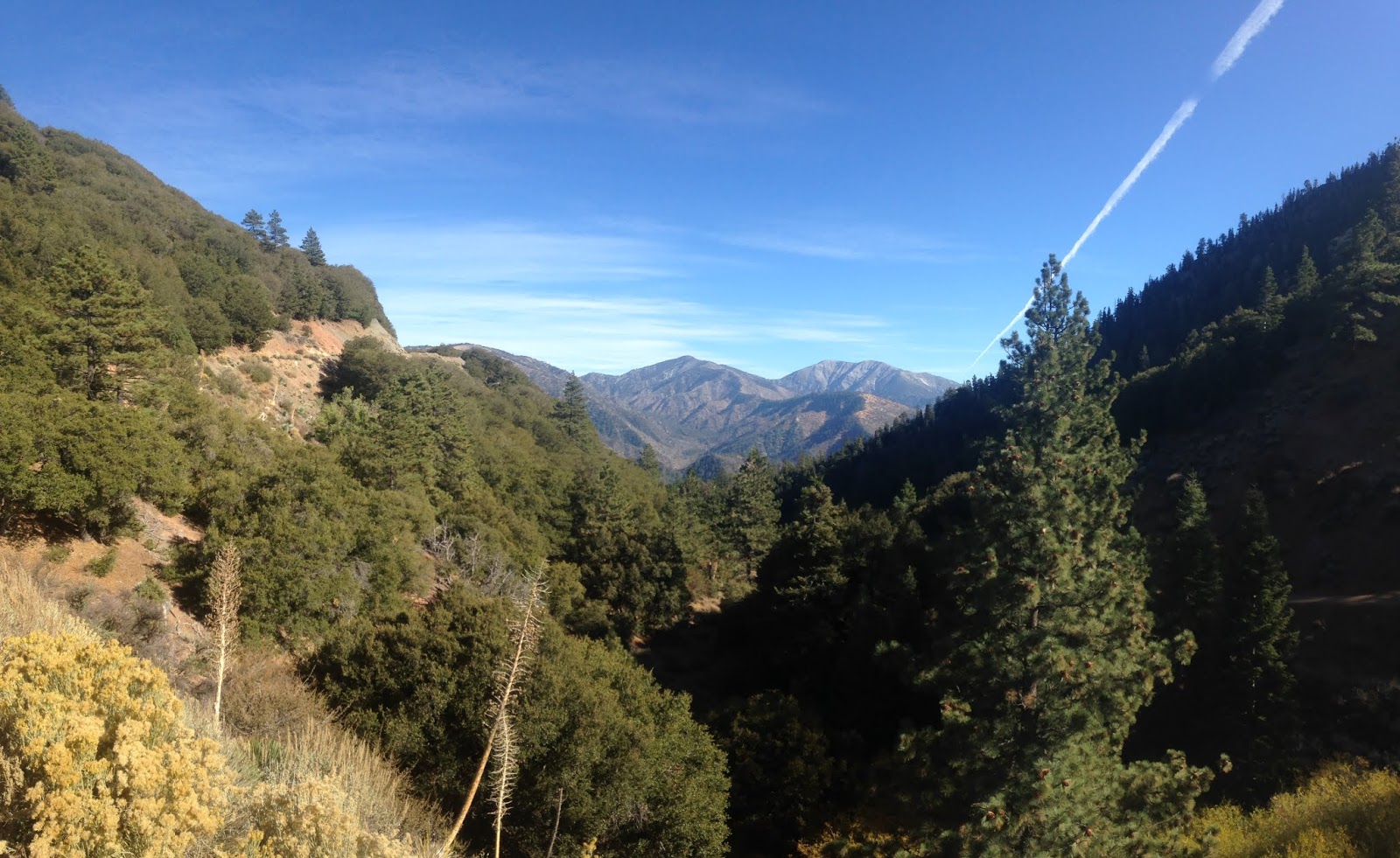

West of Vincent Gulch CA 2 begins to run along a ridge line facing the Mojave Desert.

At Dawson Saddle CA 2 and the Angeles Crest Highway peak out at a high elevation 7,901 feet above sea level.


CA 2 west on the Angeles Crest Highway meets the closed portion of CA 39 on San Gabriel Canyon Road at 6,680 feet above sea level at Islip Saddle.

Suffice to say the view south through San Gabriel Canyon on the closed portion of CA 39 is pretty breath taking.

CA 39 in Islip Saddle has been closed since rock slides in 1978, more information can be found below.
Long closed California State Route 39 in Islip Saddle
CA 2 west from Islip Saddle has a large parking lot for the Pacific Crest Trail. West of the Pacific Crest Trail CA 2 is signed as a Safety Corridor.

CA 2 west of CA 39 passes through the Angeles Crest Tunnels which were completed by 1950.


CA 2 west on the Angeles Crest Highway continues towards La Canada Flintridge amid countless vistas of the surrounding mountains. The Mount Wilson Observatory can even be viewed from the Angeles Crest Highway. At the Forest Service Clear Creek Fire Station CA 2 west meets Signed County Route N3 on Angeles Forest Highway.


Approaching Dark Canyon CA 2 begins to descend southward along the west bank of Arroyo Seco towards La Canada Flintridge. There are numerous view points overlooking the Santa Monica Mountains and downtown Los Angeles.


Looking northward through Dark Canyon offers a nice view of the eastbound climb of the Angeles Crest Highway.
Angeles Crest Highway ends La Canada Flintridge at I-210/Foothill Freeway.

CA 2 west briefly jumps onto a multiplex of I-210 before splitting southward on the Glendale Freeway. Suffice to say the Glendale Freeway has some awesome views of downtown Los Angeles from CA 2 west. CA 2 westbound meets CA 134 on the Ventura Freeway in Glendale before meeting the Hollywood Freeway/US 101 in Los Angeles via Glendale Boulevard.


More regarding the history of the Glendale Freeway can be found below:
California State Route 2 on the Glendale Freeway
Comments