While visiting San Bernardino this past week I drove the small California State Route 259 freeway.

While often called a glorified ramp the route of CA 259 is a one mile full-fledged freeway which connects Interstate 215 to California State Route 210. Legislatively the route that became the modern CA 259 was part of Legislative Route Number 43 which was adopted into the State Highway system in 1933 according to CAhighways.org.
CAhighways.org on LRN 43
LRN 43 in San Bernardino originally ran from along E Street. In 1934 the route of CA 18 added to E Street between LRN 190 on Highland Avenue south to LRN 26 on Colton Avenue which also carried US 99/70. CA 18 can be seen on E Street in San Bernardino on this 1938 State Highway Map.
1938 State Highway Map
In 1960 CA 18/LRN 43 appears to have been aligned onto I Street.
1960 State Highway Map
The I Street alignment is made more clear on a 1961 Traffic Census.
Annual Traffic Census 1961
The route number assigned during the California State Highway Renumbering of 1964 is unclear. The route likely was remained signed as CA 18 but the new route number if any is unknown.
1964 State Highway Map
According to CAhighways.org CA 259 was assigned in 1965. The route of CA 259 makes it's first appearance on the 1966 State Highway Map routed between I-15/US 66/US 395 north on I Street and east on 30th Street to CA 18/CA 206 at E Street.
1966 State Highway Map
On the 1970 State Highway Map CA 259 appears as a full freeway between I-15/US 66/US 395 to CA 18/CA 206. The 1967 and 1969 State Highway Map editions do not display CA 259 at all which makes it unclear when the freeway grade was complete.
1970 State Highway Map City Insert
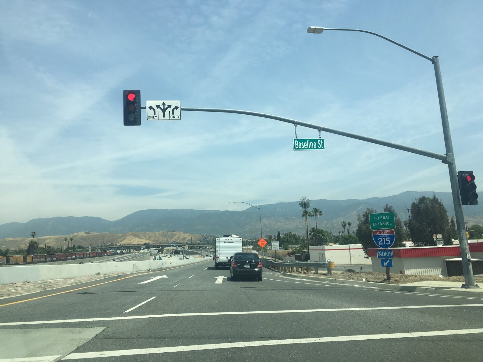
My approach to CA 259 was from the northbound Base Line Street Ramp in San Bernardino. Ahead the interchange between I-215 and CA 259 can be seen.

CA 259 is not given any reassurance shields and is as access to CA 210 headed northbound. Even the reassurance shields state "To CA 210."


Northbound CA 259 Exit 1A accesses former CA 30 on Highland Avenue. CA 259 traffic is advised the freeway provides access to CA 330.


Exit 1B on CA 259 north accesses E Street.


CA 259 terminates at CA 210 east near the exit for CA 18 at Waterman Avenue. It should be noted that the current CA 210 freeway was once signed as CA 30.


While often called a glorified ramp the route of CA 259 is a one mile full-fledged freeway which connects Interstate 215 to California State Route 210. Legislatively the route that became the modern CA 259 was part of Legislative Route Number 43 which was adopted into the State Highway system in 1933 according to CAhighways.org.
CAhighways.org on LRN 43
LRN 43 in San Bernardino originally ran from along E Street. In 1934 the route of CA 18 added to E Street between LRN 190 on Highland Avenue south to LRN 26 on Colton Avenue which also carried US 99/70. CA 18 can be seen on E Street in San Bernardino on this 1938 State Highway Map.
1938 State Highway Map
In 1960 CA 18/LRN 43 appears to have been aligned onto I Street.
1960 State Highway Map
The I Street alignment is made more clear on a 1961 Traffic Census.
Annual Traffic Census 1961
The route number assigned during the California State Highway Renumbering of 1964 is unclear. The route likely was remained signed as CA 18 but the new route number if any is unknown.
1964 State Highway Map
According to CAhighways.org CA 259 was assigned in 1965. The route of CA 259 makes it's first appearance on the 1966 State Highway Map routed between I-15/US 66/US 395 north on I Street and east on 30th Street to CA 18/CA 206 at E Street.
1966 State Highway Map
On the 1970 State Highway Map CA 259 appears as a full freeway between I-15/US 66/US 395 to CA 18/CA 206. The 1967 and 1969 State Highway Map editions do not display CA 259 at all which makes it unclear when the freeway grade was complete.
1970 State Highway Map City Insert
My approach to CA 259 was from the northbound Base Line Street Ramp in San Bernardino. Ahead the interchange between I-215 and CA 259 can be seen.
CA 259 is not given any reassurance shields and is as access to CA 210 headed northbound. Even the reassurance shields state "To CA 210."


Northbound CA 259 Exit 1A accesses former CA 30 on Highland Avenue. CA 259 traffic is advised the freeway provides access to CA 330.


Exit 1B on CA 259 north accesses E Street.


CA 259 terminates at CA 210 east near the exit for CA 18 at Waterman Avenue. It should be noted that the current CA 210 freeway was once signed as CA 30.

Comments