Recently while visiting the San Diego Area I drove a portion of Interstate 805 in northern San Diego to California State Route 163.
I-805 is a 28 mile spur route of I-5 which begins in northern San Diego and ends near the Mexican Border in the southern extent of the City in San Ysidro. I-805 was approved as a chargeable Interstate in 1958 and was added to State Highway System as Legislative Route Number 241 in 1959 according to CAhighways.org.
CAhighways.org on I-805
The planned route of I-805 on LRN 241 first appears on the 1960 State Highway City Insert.
1960 State Highway Map City Insert
According to CAhighways.org construction of I-805 began in 1966 and was completed by 1975. The 1970 State Highway Map City Insert shows I-805 under construction between CA 274 south to CA 15 (future CA 15) and in Chula Vista.
1970 State Highway Map City Insert
I-805 is shown as fully completed on the 1975 State Highway Map City Insert.
1975 State Highway Map City Insert
My approach to I-805 was on southbound I-5 in northern San Diego. I-805 is known as the "Jacob Dekema Freeway" and was named after a long term Division of Highways/Caltrans engineer who served from 1938 to 1980.


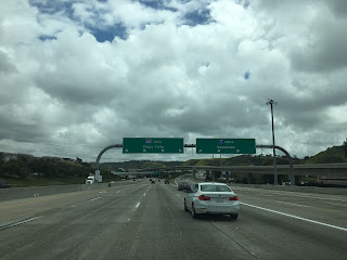
Signage on I-805 south indicates I-8 is 10 miles away and the International Border on I-5 as 30 miles away.

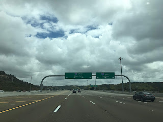
Exit numbers on I-805 descend starting from Exit 27 at Mira Mesa Boulevard/Sorrento Valley Road.

Many freeways in San Diego including I-805 contain somewhat ornate modern bridge designs such as the Eastgate Mall overpass.


Exit 25B on I-805 south accesses Miramar Road and La Jolla Village Drive.

Exit 24 on I-805 south accesses Governor Road.

The first major junction on I-805 south is at Exit 23 which accesses CA 52/San Clemente Canyon Freeway.


Exit 22 on I-805 south accesses Clairemont Mesa Boulevard.

At Exit 21 I-805 south accesses Balboa Avenue which is former CA 274. All of CA 274 was deleted in 1999 and relinquished by 2001.

At Exit 20 I-805 meets former US 395 on CA 163/Cabrillo Freeway. I turned south on CA 163 and headed towards downtown San Diego.


I-805 is a 28 mile spur route of I-5 which begins in northern San Diego and ends near the Mexican Border in the southern extent of the City in San Ysidro. I-805 was approved as a chargeable Interstate in 1958 and was added to State Highway System as Legislative Route Number 241 in 1959 according to CAhighways.org.
CAhighways.org on I-805
The planned route of I-805 on LRN 241 first appears on the 1960 State Highway City Insert.
1960 State Highway Map City Insert
According to CAhighways.org construction of I-805 began in 1966 and was completed by 1975. The 1970 State Highway Map City Insert shows I-805 under construction between CA 274 south to CA 15 (future CA 15) and in Chula Vista.
1970 State Highway Map City Insert
I-805 is shown as fully completed on the 1975 State Highway Map City Insert.
1975 State Highway Map City Insert
My approach to I-805 was on southbound I-5 in northern San Diego. I-805 is known as the "Jacob Dekema Freeway" and was named after a long term Division of Highways/Caltrans engineer who served from 1938 to 1980.


Signage on I-805 south indicates I-8 is 10 miles away and the International Border on I-5 as 30 miles away.

Exit numbers on I-805 descend starting from Exit 27 at Mira Mesa Boulevard/Sorrento Valley Road.

Many freeways in San Diego including I-805 contain somewhat ornate modern bridge designs such as the Eastgate Mall overpass.


Exit 25B on I-805 south accesses Miramar Road and La Jolla Village Drive.

Exit 24 on I-805 south accesses Governor Road.

The first major junction on I-805 south is at Exit 23 which accesses CA 52/San Clemente Canyon Freeway.


Exit 22 on I-805 south accesses Clairemont Mesa Boulevard.

At Exit 21 I-805 south accesses Balboa Avenue which is former CA 274. All of CA 274 was deleted in 1999 and relinquished by 2001.

At Exit 20 I-805 meets former US 395 on CA 163/Cabrillo Freeway. I turned south on CA 163 and headed towards downtown San Diego.


Comments