
As it travels
from Zanesville towards Columbus, US 40 goes
through numerous small towns, changes from two to four lanes and back numerous times, but most importantly the old road keeps its rural charm. Between Zanesville and
Gratiot, there are four former alignments of the old road that can be found:
just west of Zanesville, Mt. Sterling, Hopewell, and Gratiot. Most
stretches are very short and can be easily recognized with names such as "Old
US 40", "Old National Road", or some combination of the two.
Zanesville:
Just west of US 40's interchange with Interstate 70 (Exit 152) runs an old alignment.
Zanesville:
Just west of US 40's interchange with Interstate 70 (Exit 152) runs an old alignment.
 |
| Looking Eastbound on Old US 40 with the four-lane US 40 at right. (Mike Austing) |
 |
| An abandoned ice cream stand sits between the old and the new highways. (Mike Austing) |
Mt. Sterling:
Another old alignment goes through this small Muskingum County village.
Another old alignment goes through this small Muskingum County village.
 |
| Old Route 40 runs quietly towards Mt. Sterling. (Mike Austing) |
Hopewell:
Today, US 40 passes south of the community of Hopewell. The old two-lane road is known as Hopewell National Road.
Today, US 40 passes south of the community of Hopewell. The old two-lane road is known as Hopewell National Road.
 |
| Hopewell National Road bears off from US 40. (Mike Austing) |
 |
| Old US 40 can be seen near Hopewell Elementary. (Mike Austing) |
Gratiot:
Old US 40 is known as Main Street in this tiny village of 200 or so residents. The old highway at times seems forgotten through here.
Just
west of Gratiot, US 40 returns to a rural two-lane road. The next town along this stretch of US 40 is Brownsville.
Small enough that if you'd blink your eyes you'd miss it, Brownsville captures
the historic highway's best feature, the rural charm of the towns and people along it. Located in this tiny village is the Brownsville School. The schoolhouse was built in 1900 and served local school children until 1948. Around 2001, the schoolhouse was transformed into a bed and breakfast. The school now turned B&B
has been renamed 'The National Trail Schoolhouse Inn.'
Also nearby is the Eagle's Nest Monument. The monument, a large inscribed boulder sitting on a stone pedestal and may date as far back as 1914, reads, "Old National Road, built 1825, rebuilt 1914 through the efforts of James M. Cox, Governor of Ohio." The engraving includes an early roadster and a covered wagon. The location of the Eagle's Nest Monument is also the highest point of the National Road within Ohio.
Another
section of the old National Road can be found just outside of Linnville.
The next town along US 40 is Jacksontown. This Licking County village was home to two mainstays along US 40. Clark's Dining Room and the Jack Town Pub were both well-known and historic eateries in the area that have closed in recent years. Clark's Dining Room had been in operation since 1918 until it closed in 2009. The nearby Jack Town Pub was located in an old inn that was built in 1860. In October of 2016 after 23 years of operation, the Jack Town Pub closed for business.
Off of Interstate 70 at Exit 122, there is an odd piece in both the Interstate and US 40's history. In 1959, US 40 was moved onto a new four-lane freeway from near Brownsville (I-70 Exit 141) to Kirkersville (I-70 Exit 122). This road would later become I-70. From 1962 to 1968, Interstate 70 would end here. After I-70 was built on to Columbus, a small one-mile piece of this freeway became detached from the Interstate. When US 40 returned to the original two-lane highway in 1970, the four-lane stub - now serving as a connector - became even less necessary. Over time, the former westbound roadway was removed and the highway became a typical two-lane road. However, you can still see the old right-of-way from this former freeway, and a bridge overpass still carries a local road over the highway. Currently, OH 158 is routed on what was once US 40 and I-70.
 Site Navigation:
Old US 40 is known as Main Street in this tiny village of 200 or so residents. The old highway at times seems forgotten through here.
 |
| Old US 40 entering the Village of Gratiot. (Mike Austing) |
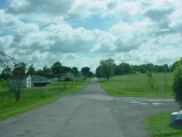 |
| A quiet old highway runs through rural farmland. (Mike Austing) |
 |
| The National Trail Schoolhouse Inn, formerly Brownsville School. (Mike Austing) |
Also nearby is the Eagle's Nest Monument. The monument, a large inscribed boulder sitting on a stone pedestal and may date as far back as 1914, reads, "Old National Road, built 1825, rebuilt 1914 through the efforts of James M. Cox, Governor of Ohio." The engraving includes an early roadster and a covered wagon. The location of the Eagle's Nest Monument is also the highest point of the National Road within Ohio.
 |
| Eagle's Nest Monument (Mike Ketner) |
 |
| Former alignment of US 40 in Linnville (Mike Kentner) |
The next town along US 40 is Jacksontown. This Licking County village was home to two mainstays along US 40. Clark's Dining Room and the Jack Town Pub were both well-known and historic eateries in the area that have closed in recent years. Clark's Dining Room had been in operation since 1918 until it closed in 2009. The nearby Jack Town Pub was located in an old inn that was built in 1860. In October of 2016 after 23 years of operation, the Jack Town Pub closed for business.
 |
| The former Jack Town Pub. (Mike Austing) |
Off of Interstate 70 at Exit 122, there is an odd piece in both the Interstate and US 40's history. In 1959, US 40 was moved onto a new four-lane freeway from near Brownsville (I-70 Exit 141) to Kirkersville (I-70 Exit 122). This road would later become I-70. From 1962 to 1968, Interstate 70 would end here. After I-70 was built on to Columbus, a small one-mile piece of this freeway became detached from the Interstate. When US 40 returned to the original two-lane highway in 1970, the four-lane stub - now serving as a connector - became even less necessary. Over time, the former westbound roadway was removed and the highway became a typical two-lane road. However, you can still see the old right-of-way from this former freeway, and a bridge overpass still carries a local road over the highway. Currently, OH 158 is routed on what was once US 40 and I-70.
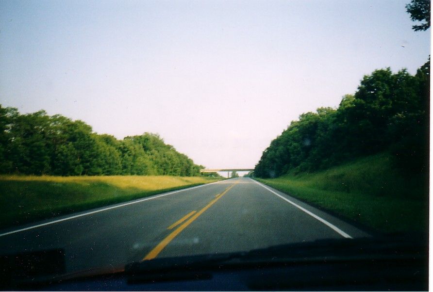 |
| Old I-70/US 40 near Kirkersville. (Adam Prince) |
- West to Vandalia, Illinois
- East over the Zanesville 'Y' Bridge
- Return to The National Road - US 40 Index
- Mike Austing
- Mike Ketner
- Ohio National Road Association
Comments