
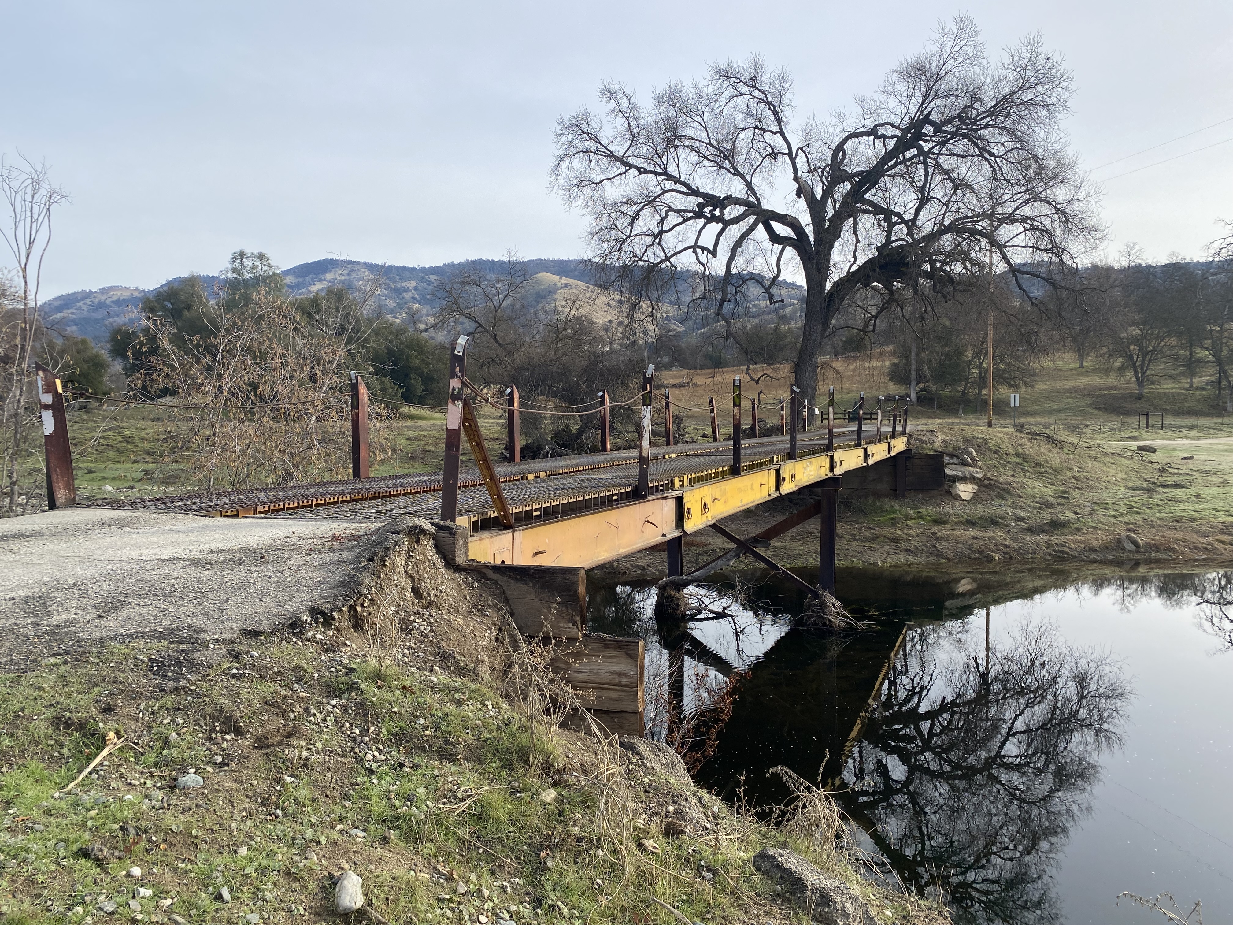
The Acton Grade Bridge is a deck plate span crossing the East Fork Chowchilla River on Madera County Road 810 (formerly Acton Grade Road). The bridge likely was installed during the early 1970s to replace the earthen ford which once connected the California Gold Rush communities of Bailey Flats and Grub Gulch. The name of the structure is an homage to late nineteenth century property owner Mary E. Acton who granted an easement to construct what is now Road 810. Road 810 itself is an approximately four-mile dirt road which connects Road 800 (formerly Bailey Flats Road) southeast to Road 600 (formerly Grub Gulch Road).

Part 1; the history of the Acton Grade
The Acton Grade (now Madera County Road 810) connected the Gold Rush era communities of Grub Gulch and Bailey Flats via the East Fork Chowchilla River.
Bailey Flats was named after Gillium Baley a settler from Gallatin, Illinois. Baley emigrated to California with his family during 1858-1859 and initially settle in Visalia. Baley would move to the original Fresno County seat of Millerton during 1860. While in Millerton, Baley would stake mining claims along the San Joaquin River, Fresno River and Chowchilla River. Baley's mining claims along the Chowchilla River were located near the confluence of the three forks of the watershed at what came to be known as "Bailey Flats." Baley would establish his homestead along the Chowchilla River during 1862-1863.
Baley would be elected as Fresno County judge during 1867 and would return to Millerton. Baley would remain the Fresno County Judge during the change of county seat to Fresno in 1874 and would retire in 1878. Following his retirement Baley would return to Bailey Flats.
Grub Gulch developed after the opening of the Gambetta Mine in 1880. Grub Gulch obtained Post Office service during 1883 and reportedly may have had a population as high as 5,000 residents. Grub Gulch can be seen along the Yosemite Stage Road in a public domain photo from 1885.
.jpg)

Bailey Flats and Grub Gulch are located in Townships 6-7 South, Range 20 East which can be seen on the 1891 Thompson Atlas of Fresno County. Grub Gluch is shown at the time not to have a direct road connection with Bailey Flats. The map displays property along the East Fork Chowchilla River belonging to Mary E Acton can be seen. Madera County would split from what was northern Fresno County on May 16, 1893.


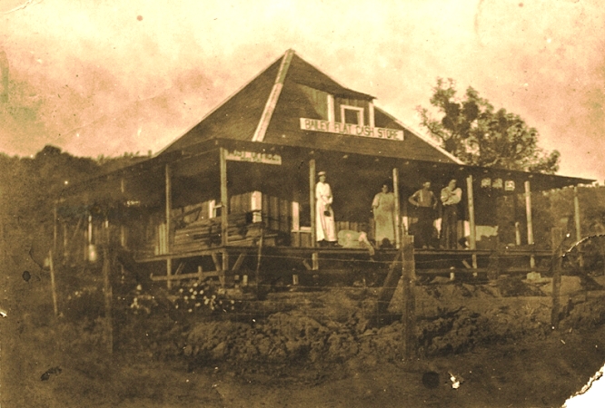
Following the death of Gillium Bailey during November 1895 a small community would begin to develop at Bailey Flats. The Bailey Flats School opened in 1900 and the community once had a general store (the below image is image hosted at cagenweb.org).
Bailey Flats can be seen connected to Grub Gulch via the then new Acton Grade Road on the 1912 United States Geological Survey Map of Mariposa. The road through Bailey Flats is shown to terminate to the west at Coleman Flat. It is likely that the Acton Grade Road initially crossed the East Fork Chowchilla River via an earthen ford.

Bailey Flats obtained Post Office service in 1913 and was renamed as "Mist." Bailey Flats can be seen on the 1914 Smith Map of Madera County in Township 6 South, Range 20 East.

The Mist Post Office would be shuttered in 1935 and service would move to Raymond. Mist can be connected to Grub Gluch via Acton Grade Road along with the then newly completed Bailey Flats Road to Raymond on the 1935 Division of Highways Map of Madera County.

The Bailey Flats School would close in 1947. Today the only traces of Bailey Flats remaining are a handful of abandoned buildings. Bailey Flats is no longer displayed at the western end of Acton Grade Road on the 1947 United States Geological Survey Map of Mariposa.

Madera County would eventually drop their county road names in favor of a numbering system. Within the Sierra Nevada range the road system began in the 100s and ascended westward to the 800 range. What was Bailey Flats Road was renumbered as Road 800 whereas Acton Grade Road became Road 810.
It isn't clear when the Acton Grade Bridge was constructed. The structure first appears on aerial imagery of the Bailey Flats area beginning in 1983. The span may have been installed during 1972 according to the Madera County History Facebook page.
Part 2; a visit to the Acton Grade Bridge
Northbound Madera County Road 800 intersects eastbound Road 810 via a right-hand turn at the site of the community of Bailey Flats.

Road 810 crosses the East Fork Chowchilla River via the deck plate bridge Acton Grade Bridge. An earthen ford can be seen just south of the span.



Comments