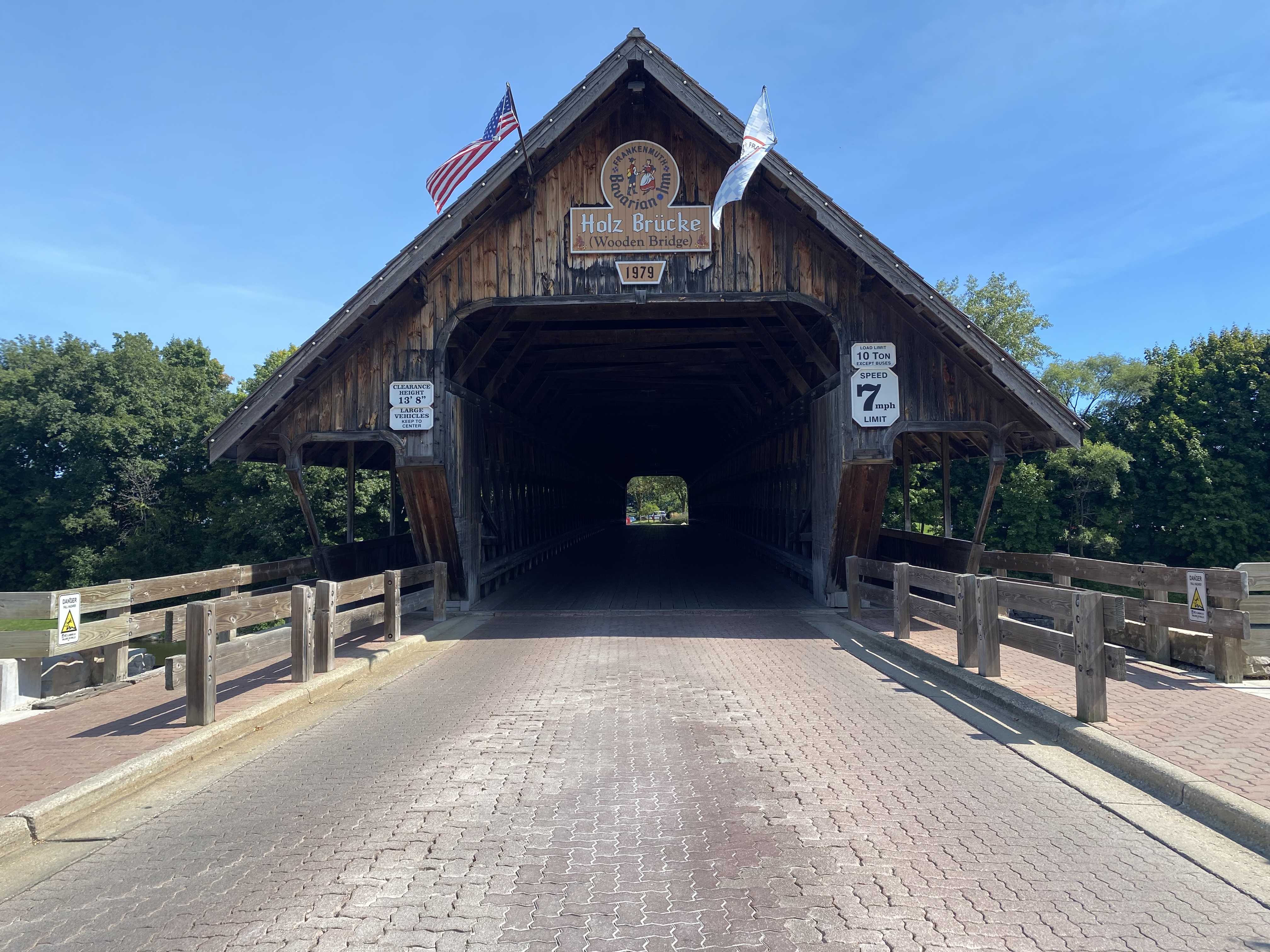
Zehnder's Holzbrücke (Zehnder's Wooden Bridge)


Zehnder's Holzbrücke (German for Wooden Bridge) is a covered bridge located on the Cass River on Covered Bridge Lane in the city of Frankenmuth, Michigan.  This structure was completed in 1979 and hauled into place by a team of oxen during 1980.  Unlike many modern covered bridges, the structure is not a facade and is constructed fully of wooden materials.  The span was installed promote tourism in Frankenmuth and provide access to the lands own by the Bavarian Inn south of the Cass River. 


Part 1; the history of Zehnder's Holzbrücke

Zehnder's Holzbrücke (German for wooden bridge) is a structure located on Covered Bridge Lane along the Cass River in the city of Frankenmuth River.  The structure is currently part of the Bavarian Inn complex.  Eddie (the Zehnder's of Frankenmuth family) and William Zehnder (Bavarian Inn family) originally began to explore the prospects of installing a covered bridge in 1962.  Both brothers owned portions of land along the eastern half of the Cass River.  The purpose of a new bridge was to serve as a tourist attraction and expand the parking capacity for the Bavarian Inn south of the Cass River.  

By 1979 the Zehnder brothers hired Milton Grade which was one of the last construction firms which specialized in building authentic covered bridges.  The 239-foot-long structure was completed during 1979 but had to installed at the Cass River.  Beginning during 1980 a team of oxen was used to pull the structure into place on the Cass River.  The bridge was dedicated on September 9, 1980. 

In 1985 the first phase of the Bavarian Inn Lodge complex completed east of the Cass River.  Much of the attractions south of the river were either built or purchased by Eddie Zehnder's family during the remaining balance of the 1980s.  During 2015 ownership of Zehnder's Holzbrücke was transferred to Frankenmuth Bavarian Inn Incorporated.  


Part 2; visiting Zehnder's Holzbrücke

Zehnder's Holzbrücke is located immediately east of M-83 in Frankenmuth along Covered Bridge Lane.  The structure is located next to the Covered Bridge Shop west of the Cass River.  


Zehnder's Holzbrücke facing east over the Cass River from a stylized pedestrian bridge.  


Zehnder's Holzbrücke facing northeast from the Bavarian Belle Riverboat


Zehnder's Holzbrücke facing was along Covered Bridge Lane.  The structure is rated for 10 tons and has an overhead clearance of 13'8 feet.  


Facing northeast on the Cass River from one of the pedestrian walkways on the bridge.  


Comments

Popular posts from this blog

Grand Loop Road of Yellowstone National Park

  Grand Loop Road is a 140 mile loop highway which traverses the interior of Yellowstone National Park.  Grand Loop Road connects all of the major attractions and geological features of Yellowstone National Park along with the entrance roads.  Grand Loop Road is a seasonal highway and despite some conjecture never has been part of the US Route System.   Part 1; the history of Grand Loop Road The majority of history pertaining to Grand Loop Road was taken from the below National Park Service article: Historic Roads - Yellowstone National Park (U.S. National Park Service) (nps.gov) Yellowstone was declared the first National Park of the United States on March 1st, 1872.  The first real highway to access Yellowstone National Park came in 1873 when a tolled facility was constructed from Bozeman, Montana via Yankee Jim Canyon to Mammoth Hot Springs.  Numerous attempts were made to fund construction of roadway infrastructure during the early years of Yellows...

The last 1956-63 era California Sign State Route Spade?

Along southbound California State Route 170 (the Hollywood Freeway Extension) approaching the Hollywood Freeway/Ventura Freeway interchange a white California State Route 134 Sign State Route Spade can be observed on guide sign.  These white spades were specifically used during the 1956-63 era and have become increasingly rare.  This blog is intended to serve as a brief history of the Sign State Route Spade.  We also ask you as the reader, is this last 1956-63 era Sign State Route Spade or do you know of others?  Part 1; the history of the California Sign State Route Spade Prior to the Sign State Route System, the US Route System and the Auto Trails were the only highways in California signed with reassurance markers.  The creation of the US Route System by the American Association of State Highway Officials during November 1926 brought a system of standardized reassurance shields to major highways in California.  Early efforts to create a Sign State Route ...

California State Route 70; the Feather River Highway

From 2017 through to early 2019 I drove the majority of the California State Route 70; the Feather River Highway from CA 89 southwest to CA 99. CA 70 is an approximately 178.5 mile state highway which starts at US 395 near the Nevada State Line and travels west through the Feather River Canyon to CA 99.  CA 70 is often referred to as the Feather River Highway" given it's close association with the river.  Historically CA 70 was previously signed as US 40A and CA 24.  The Legislative Routes prior to the 1964 California Highway Renumbering that made up the current route of CA 70 are as follows: -  Legislative Route Number 21 from US 395 westward to Oroville. -  LRN 87 from Oroville south to Marysville. -  LRN 232 from Marysville to the current junction with CA 99.  CA 70 was even dual signed with CA 99 into Sacramento on what was LRN 232 for a time. The change from US 40A/LRN 21/LRN 87/LRN 232 can be seen by comparing the 1963 State Highway Ma...