
The Lincoln Highway, US Route 99 and US Route 50 in Lodi and Galt


The Cities of Lodi and Galt were once part of several historic highways of national importance.  Historically in the City of Lodi US Route 99 and US Route 50 were aligned on Cherokee Lane whereas the early Lincoln Highway was aligned on Lower Sacramento Road.  Within the City of Galt US Route 99, US Route 50 and the Lincoln Highway were all once aligned on Lincoln Way.


This blog is part of the larger Gribblenation US Route 99 Page.  For more information pertaining to the other various segments of US Route 99 and it's three-digit child routes check out the link the below.


Part 1; the history of the Lincoln Highway, US Route 99 and US Route 50 in Lodi and Galt

Lodi is located in northern San Joaquin County near the Mokelumne River.  Lodi traces it's origins back to 1859 when a group of families settled and built a school at what is now the intersection so Cherokee Lane and Turner Road.  In 1869 the Central Pacific Railroad was in the process of developing a new line south of Sacramento.  The Central Pacific Railroad was offered 160 acres of land by local settlers to develop a town site and a siding which was originally known as Mokelumne Station.  The modern name of Lodi was taken in early 1870s to avoid confusion with other nearby communities but it isn't clear what the true namesake was.  Lodi would incorporate as a City during December of 1906.  

Galt of southern Sacramento County traces it's origins back to 1850 when a group of farmers settled at Dry Creek.  The community that began to grow on Dry Creek was for a time was known as Dry Creek Township.  In 1869 the siding of Galt at Dry Creek Township was plotted out by the Central Pacific Railroad.   Galt was selected as the siding name by request of local rancher John McFarland in honor of his hometown in Canada.  Galt would not incorporate as a City until August of 1946.  

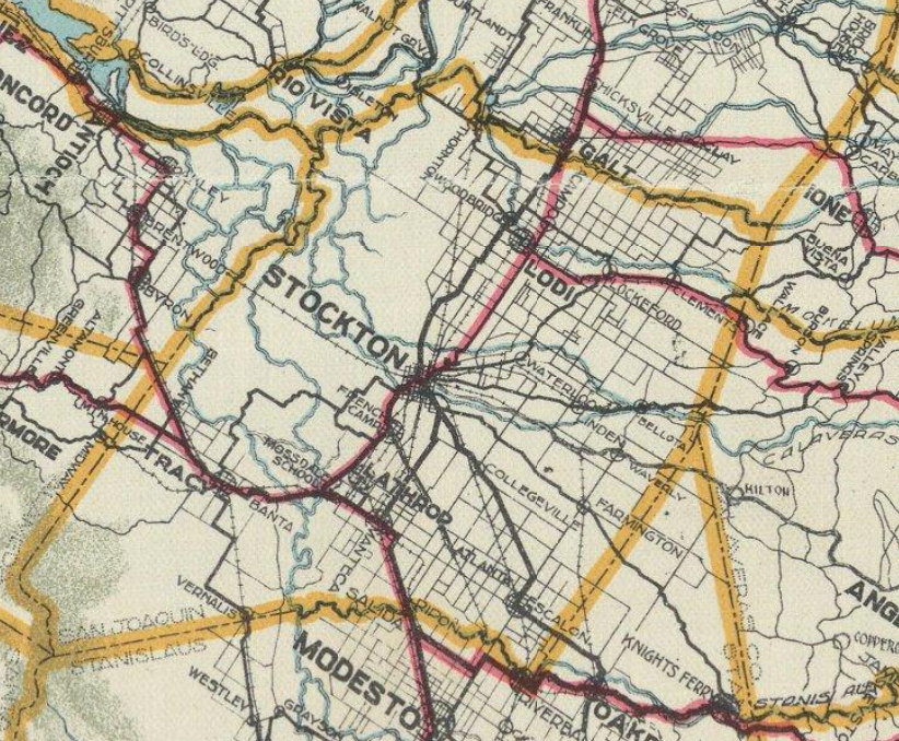
Mokelumne Station and Galt can be seen on the 1873 Bancroft's Map of California.

The emergence of the automobile in the early 20th Century in California led to the 1909 First State Highway Bond Act which was approved by voters during 1910.  The majority of the highways approved as part of the First State Highway Bond Act were largely well established routes of travel.  One such highway was Legislative Route Number 4 ("LRN 4") which was defined as a highway from "Sacramento to Los Angeles." 

During 1912 Indiana Businessman Carl G. Fisher conceptualized the Lincoln Highway as a major transcontinental Auto Trail.  The Lincoln Highway was formally dedicated on October 31st, 1913 and would be aligned south from Sacramento southward towards Stockton via the existing highway corridor.  From Galt the Lincoln Highway southwards followed existing LRN 4 on Lincoln Way and Lower Sacramento Road through Woodbridge onward to Lodi.  This early alignment of the Lincoln Highway through Lodi and Galt can be seen on the Lincoln Highway Association's Official Map.

The planned route of LRN 4 can be seen on the on the 1917 California State Automobile Association Map.  The planned route of LRN 4 (denoted as the red line) was conceived as a direct alignment from Galt to Lodi which would bypass Woodbridge.  LRN 4 was planned to be realigned towards an eastern approach to Stockton via what is now known as Woodson Road and Cherokee Lane.  

LRN 4/Lincoln Highway (then also known as the Inland Route) is shown realigned onto the more direct routing from Galt to Lodi via Woodson Road and Cherokee Lane on the 1920 Clason Highway Map of California.   


The September 1924 California Highways & Public Works details the issues presented by upgrading LRN 4/Lincoln Highway between Sacramento and Stockton.  A segment of oil bound macadam surface extending thirteen miles southward from Sacramento laid by Sacramento County in 1910 is cited as a problematic area.  This segment of the Lincoln Highway was transferred to the State Highway System as part of LRN 4 during July of 1915 and had become functionally obsolete due to increasing traffic.  The macadam surface is described as being replaced by a twenty foot wide Portland Cement surface.  


The below photo is a illuminated warning sign on the Lincoln Highway/LRN 4 denoted thirteen bridges were under construction between Sacramento and Stockton.  This photo can be seen in the September 1924 California Highways & Public Works.  


The January 1925 California Highways & Public Works notes that twelve new bridges along the Upper Stockton Road (Lincoln Highway and LRN 4) had been completed.  


The initial draft of the US Route System was approved by the Secretary of Agriculture during November of 1925.  The US Route System within California was approved by California Highway Commission with no changes recommended by January 1926.  The initial alignment of US Route 99 ("US 99") was planned to follow the Inland Route via LRN 4 from Sacramento to Los Angeles.  US 99 is shown on a map published in the 1926 California Highways & Public Works following LRN 4 south from Sacramento through Galt and Lodi.


Early US 99/LRN 4 through Galt and Lodi can be seen on the 1927 National Map Company Highway Map of California


The May 1927 California Highways & Public Works announced the first Carquinez Bridge over Carquinez Strait near Vallejo had opened to traffic on May 21st.  Upon completion of the Carquinez Bridge the Lincoln Highway was realigned out of Stockton and Altamont Pass onto the new structure multiplexed with the Pacific Highway.   The realignment of the Lincoln Highway left US 99 as the primary highway corridor through Galt and Lodi.   


The November/December 1928 California Highways & Public Works announced five miles of US 99/LRN 4 between Cherokee Station (near the modern northern City Limit of Stockton) northward towards Lodi was in the process of being widened.  

The April 1930 California Highways & Public Works announced US 99/LRN 4 between Lodi and Stockton was under contract to be paved in 20 feet of Portland Cement.  


The June 1930 California Highways & Public Works announced a new 162 foot long concrete bridge was slated to built over the Mokelumne River as an upgrade to US 99/LRN 4.  


The January 1931 California Highways & Public Works cited seven miles of US 99/LRN 4 from Stockton north towards Lodi as being repaved in Portland Cement.  

During June of 1931 the Division of Highways made a request to the AASHO to extend US 50 from Sacramento to Oakland.  The AASHO approved US 50 to subsume all of remaining US 48 shortly after the Division of Highways request was made. The extension of US 50 aligned it through Galt and Lodi via a multiplex of US 99.  


The December 1931 California Highways & Public Works discusses the full repaving of US 99/US 50/LRN 4 north of Stockton to Lodi on Cherokee Lane in Portland Cement.  The full scale of the repaving project included fourteen miles Cherokee Lane which had been upgraded from a macadam surface.  A segment of Cherokee Lane is cited to be 76 feet wide and the project is stated to have preserved numerous trees which had been planted in 1921 north of downtown Lodi. 


The February 1932 California Highways & Public Works shows the full scale of the 76 foot widening of US 99/US 50/LRN 4 on Cherokee Lane (incorrectly stated to be Stockton Boulevard) in Lodi via a before and after set of photos.  


In the August 1934 California Highways & Public Works the Sign State Routes were announced.  California State Route 12 ("CA 12") was announced as the highway originating at CA 1 near Jenner and terminating at CA 49 at San Andreas via Lodi.  CA 12 eastbound originally entered Lodi via LRN 53 on Turner Road where it intersected US 99/US 50/LRN 4 at Cherokee Lane.   CA 12 was carried through downtown Lodi via a brief multiplex of US 99/US 50/LRN 4 to LRN 24 at Victor Road.  CA 12 followed LRN 24 east from Lodi towards San Andreas.  

US 99/US 50/LRN 4 through Lodi and Galt can be seen on the 1935 Division of Highways Maps of San Joaquin County and Sacramento County.  


The October 1938 California Highways & Public Works details the realignment of US 99/US 50/LRN 4 in Galt.  US 99/US 50/LRN 4 is stated to be realigned off of Lincoln Way and Woodson Road in Galt onto a bypass route.  The new bypass route of Galt eliminated numerous curves and saved traffic 0.57 miles of travel.  


The September 1942 California Highways & Public Works details the opening of the Mokelumne River Bridge west of Lodi on a new alignment of CA 12/LRN 53.  The Mokelumne River Bridge project included an adoption of existing Kettleman Lane east from Terminous to Lodi.  This new alignment of CA 12/LRN 53 shifted the multiplex of US 99/US 50/LRN north from Kettleman Lane to Victor Road.  


The November/December 1946 California Highways & Public Works cites an ongoing project to convert 8.2 miles of US 99/US 50/LRN 4 between Stockton and Lodi as a limited access four lane freeway (which was in reality more in line with modern surface expressway standards).  The freeway project is cited to originate at the Calaveras River four miles north of Stockton at the end of Wilson Way and included construction of two new concrete surfaced travel lanes. 

The Stockton-Lodi Freeway is cited as being completed in the July/August 1947 California Highways & Public Works.  The Stockton-Lodi Freeway is cited to be a feature of the upcoming 1947 California State Fair.  The article cites plans to convert US 99/LRN 4 to freeway from the Calaveras River south to Mariposa Road via a bypass of Stockton.  

The November/December 1947 California Highways & Public Works features a photo of the Stockton-Lodi Freeway segment of US 99/US 50/LRN 4.  

The January/February 1955 California Highways & Public Works describes the opening of construction on the Sacramento-Lodi Freeway segment of US 99/US 50/LRN 4.  Construction of the first phase of the Sacramento-Lodi Freeway began in Elk Grove via a ground breaking ceremony held on December 21st, 1954.  

The March/April 1956 California Highways & Public Works announced the US 99/US 50/LRN 4 Sacramento-Lodi Freeway as completed north of Lodi towards Galt.  US 99/US 50/LRN 4 is stated to have been converted to a full freeway from Jahant Road in San Joaquin County a half mile northward into Sacramento County.  A second unit of the Sacramento-Lodi Freeway is stated to be near beginning construction which would extend the freeway northward 7.1 miles through Galt.  Another project is stated to be planned to connect the Sacramento-Lodi Freeway southward to Lodi.  


The September/October 1956 California Highways & Public Works announced a freeway alignment of US 99/US 50/LRN 4 in Lodi had been adopted.  


The January/February 1957 California Highways & Public Works displays the completed segment of the Sacramento-Lodi Freeway between Lodi and Galt.  


The May/June 1957 California Highways & Public Works notes US 99/US 50/LRN 4 had been completed to freeway standards north of Lodi aside from two structures.  


The Mokelumne River Bridges north of Lodi are shown during construction in the May/June 1957 California Highways & Public Works.  


The July/August 1958 California Highways & Public Works noted US 99/US 50/LRN 4 was slated to be completed in Galt before the 1958 California State Fair.  


The November/December 1960 California Highways & Public Works notes that the freeway grade of US 99/US 50/LRN 4 was under construction in Lodi.  


The November/December 1963 California Highways & Public Works notes US 99/US 50/LRN 4 were moved onto the freeway bypass of Lodi which opened during November 1963.  


The 1964 California State Highway Renumbering saw numerous US Routes eliminated to avoid numbering duplications of Interstates and long multiplexes.  Given a large portion of US 99 was slated to be replaced with Interstate 5 it also was targeted for removal from California.  The AASHO Renumbering database shows that US 99 was approved to be truncated out of California by the AASHO Executive Committee on June 29th, 1965.  This measure was put Lodi and Galt on what is now California State Route 99 ("CA 99") which would have become effective on New Years Day 1966.  


Pertaining to the truncation of US 50; on April 13th, 1963 the Division of Highways petitioned the AASHO to scale the highway back from San Francisco to Sacramento due to it being multiplexed by numerous Interstate highways.  The AASHO Executive Committee approved the truncation of US 50 to Sacramento during June of 1963 but it remained field signed into the early 1970s to San Francisco.  US 50 was likely field signed to San Francisco due to the I-5/West Side Freeway segment not yet being completed.  By proxy US 50 remained co-signed with CA 99 through Lodi and Galt.   


According to CAhighways.org the West Side Freeway segment of I-5 was completed to Sacramento by 1975.  USends.com notes that field signage of US 50 was scaled back from San Francisco to Sacramento likely by 1972. 


Part 2; a drive on former US Route 99 and US Route 50 on Cherokee Lane in Lodi

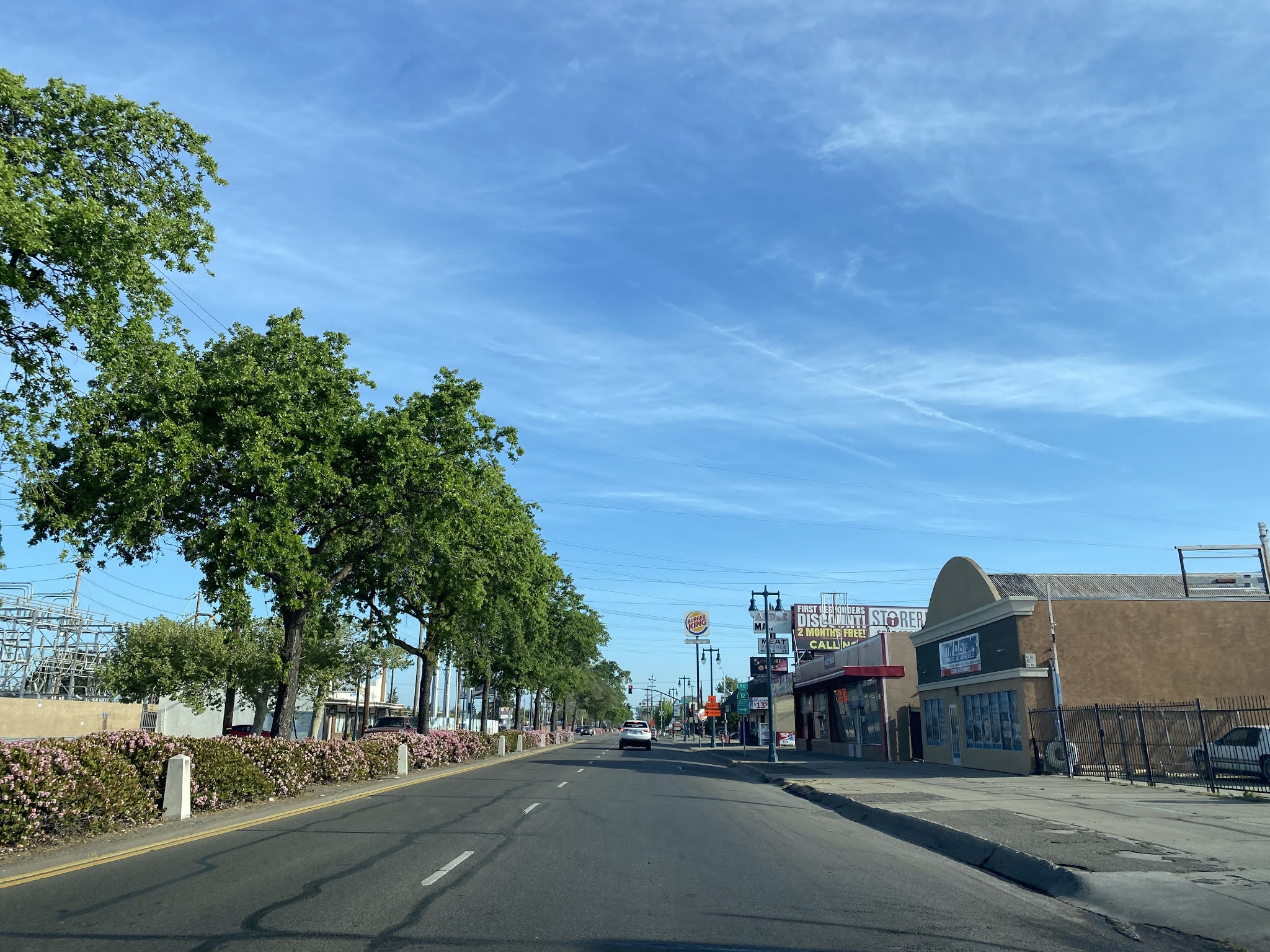
From CA 99 northbound former US 99/US 50 on Cherokee Lane is accessible via Exit 264A.


Cherokee Lane northbound intersects CA 12 at Kettleman Lane.  Before the freeway bypass this would have been where CA 12 eastbound would have begun a multiplex with US 99/US 50.  


Cherokee Lane northbound continues as a divided roadway which is adorned with numerous scenic trees and ornate light posts.  At Pine Street traffic on US 99/US 50/CA 12 could once access the nearby Lodi Mission Arch.  


Cherokee Lane continues northbound to Victor Road where CA 12 eastbound and the CA 99 freeway can be accessed.  Victor Road is where CA 12 would have split from US 99/US 50 at Cherokee Lane.  US 99/US 50 would have continued northward on Cherokee Lane towards Galt and the Mokelumne River via a grade subsumed by the CA 99 freeway  


Further Reading

Interested in learning more regarding the Lodi Mission Arch? 


Continuing north on US Route 99 to Sacramento?


Continuing south on US Route 99 to Stockton?

Comments

Popular posts from this blog

Did Caltrans just kill the G26 cutout US Route shields?

The US Route System was formally created by the American Association of State Highway Officials during November 1926.  Through the history of the system the only state to which has elected to maintain cutout US Route shields has been California.  The G26 series cutout US Route shields have become a favorite in the road enthusiast hobby and are generally considered to be much more visually pleasing than the standard Federal Highway Administration variant.  However, the G26 shield series appears to have been killed off on January 18, 2026, when Caltrans updated their Manual of Uniform Traffic Control Devices.  This blog will examine the history of the US Route shield specifications in California and what is happening with the 2026 changes.  The blog cover photo is facing towards the terminus of California State Route 136 and at a G26-2 specification US Route 395 shield.  In the background Mount Whitney can be seen in the Sierra Nevada range.   ...

May 2023 Ontario Trip (Part 3 of 3)

  Over the years, I have made plenty of trips to Ontario, crisscrossing the southern, central and eastern parts of the province. Living in Upstate New York, it's pretty easy to visit our neighbor to the north, or is that our neighbor to the west? Ottawa is one of my favorite cities to visit anywhere in the world, plus I've discovered the charm of Kingston, the waterfalls of Hamilton (which is on the same Niagara Escarpment that brings us Niagara Falls), the sheer beauty of the Bruce Peninsula, and more. But I hadn't explored much of Cottage Country. So I decided to change that, and what better time to go than over Memorial Day weekend, when the daylight is long and I have an extra day to explore. On the third and final day of my trip, I started in Huntsville and made my way through Muskoka District and Haliburton County, passing by many lakes along the way. I stopped in towns such as Dorset, Haliburton and Bancroft before making a beeline down to Belleville and then over th...

Ghost Town Tuesday; Nichols, FL

A couple years ago I spent a lot of spare time exploring phosphate mining ghost towns in the Bone Valley of Polk County, Florida.  One ghost town in particular called Nichols on Polk County Route 676 west of Mulberry caught my eye due to a relative lack of documentation on ghosttowns.com. Nichols was created in 1905 during the early phosphate mining boom in the Bone Valley region.  For the time Nichols was unusual since it had company housing in the Nichols Mine site and private residences outside the gate.  Nichols is only about two miles west of Mulberry which probably made it a somewhat reasonable commute even by the wonky standards of the early 20th Century.  Most of the Bone Valley region was relatively remote which made commuting or homesteading impractical which is why there are so many ghost towns in the area.  The company housing section of Nichols was phased out and abandoned by 1950. The Nichols town site is largely abandoned and could "possibl...