Earlimart and Pixley are communities located in southern Tulare County, California which were on the original surface alignments of US Route 99. Within Earlimart former US Route 99 was aligned on Front Road whereas in Pixley it was aligned on Main Street. Pictured above in the cover photo is the US Route 99 freeway in Earlimart shortly after it opened.
This blog is part of the larger Gribblenation US Route 99 Page. For more information pertaining to the other various segments of US Route 99 and it's three-digit child routes check out the link the below.
Part 1; the history of US Route 99 in Earlimart and Pixley
The history of Earlimart and Pixley are both tied to the Southern Pacific Railroad (now Union Pacific) corridor through San Joaquin Valley. The construction of the Southern Pacific Railroad through San Joaquin Valley pushed the main corridor of travel westward from the Sierra Nevada Foothills and Stockton-Los Angeles Road. Previous to the construction of the Southern Pacific Railroad travel through San Joaquin Valley was difficult due to the numerous sloughs and Tule Marshes of the Tulare Lake watershed obstructing overland travel.
What is now Earlimart was founded in the early 1880s along the Southern Pacific Railroad between Deer Creek and the White River under it's original name of Alila (information pertaining to Earlimart provided courtesy Douglas Mclntosh of Sierra Valley Cultural Planning). By 1885 the Southern Pacific Railroad constructed a depot in Alila which led to a small boom in the community. Alila would be virtually abandoned in the 1890s after being stricken by numerous fires and droughts which led to crop failure. Alila can be seen on the Southern Pacific Railroad on the 1892 T.H. Thomson Map of Tulare County.


In 1910 the Earlimart Fruit and Alfalfa Company founded Early Market Farms approximately one mile southeast of Alila. Subsequently a small community known as "Earlimart" soon began to be developed at Early Market Farms. The Earlimart Fruit and Alfalfa Company failed in their bid to convince the Southern Pacific Railroad to build a depot at the original Earlimart town site. Earlimart Fruit and Alfalfa moved their operations to Alila in 1916 which led to the community taking the name of "Earlimart."
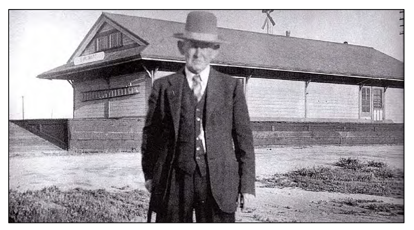
Littleton Dalton who was one of the founders of the Earlimart Fruit and Alfalfa Company can be seen in this photo below in 1937 at the Earlimart Rail Depot. The Earlimart Rail Depot was located on former US Route 99 on Front Road.
Pixley traces it's origins to real estate speculation along the Southern Pacific Railroad during 1884. Investors Darwin C. Allen and William B. Bradbury sought assistance from Frank Pixley to ensure the Southern Pacific Railroad would build a stop at the planned community. Frank Pixley was a friend of Leland Stanford who was the President of the Southern Pacific Railroad from 1885-1890. In 1886 the Pixley Townsite Company was founded which led to the purchase of the lands the community now sits upon. Early Pixley thrived when the Southern Pacific Railroad built a stop in the community. Pixley can be seen on the
1892 T.H. Thomson Map of Tulare County.
The emergence of the automobile in the early 20th Century in California led to the 1909 First State Highway Bond Act which was approved by voters during 1910. The majority of the highways approved as part of the First State Highway Bond Act were largely well established routes of travel. One such highway was Legislative Route Number 4 ("LRN 4") which was defined as a highway from "Sacramento to Los Angeles."
A very early LRN 4 in northern Kern County and southern Tulare County can be seen on the 1917 California State Automobile Association Map. The California State Automobile Association Map show LRN 4 unconstructed via a plotted line (highlighted in red) along the Southern Pacific Railroad between Pixley and Earlimart southward towards to Delano. The pre-existing right-of-way between Pixley-Earlimart appears to follow modern day Park Drive, Main Street, Avenue 96, Road 128 and Bishop Street. The Pre-existing right-of-way between Earlimart-Delano appears to follow modern Armstrong Avenue, Road 144 and Girard Street.
LRN 4 through southern Tulare County can be seen signed as the Inland Route and National Park-to-Park Highway on the 1920 Clason Highway Map of California. The Clason Highway Map shows a realigned direct route of LRN 4 following the Southern Pacific Railroad southward of Tipton through Pixley and Delano towards the Kern County Line.
The initial draft of the US Route System was approved by the Secretary of Agriculture during November of 1925. The US Route System within California was approved by California Highway Commission with no changes recommended by January 1926. The initial alignment of US Route 99 ("US 99") was planned to follow the Inland Route via LRN 4 from Sacramento to Los Angeles. US 99 is shown on a map published in the 1926 California Highways & Public Works following LRN 4 south from Sacramento through Pixley and Earlimart.
During November of 1926 the US Route System was approved by the AASHO. US 99 can be seen aligned from Pixley southward through Earlimart to the Kern County Line towards Delano on the 1927 National Map Company Sectional Map.
The May 1930 California Highways & Public Works cites that US 99/LRN 4 was resurfaced between Pixley south to the Kern County Line. The original 15 foot Portland cement road base surface is cited to have been widened to 20 feet paved in concrete.
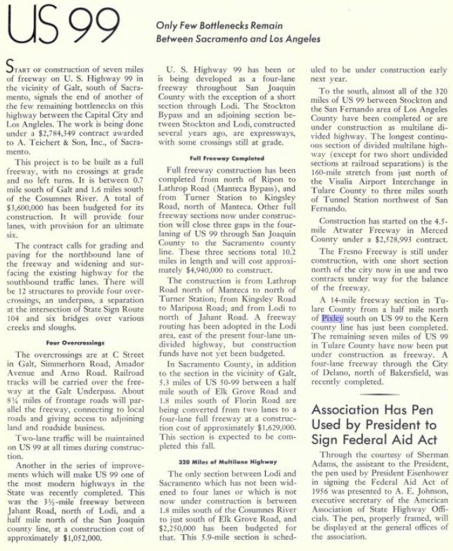
The September/October 1956 California Highways & Public works announced US 99/LRN 4 a half mile north of Pixley southward 14 miles to the Kern County Line was upgraded to freeway standards. The opening of this freeway segment US 99/LRN 4 bypassed Main Street in Pixley and Front Road in Earlimart. The overpass structures on present day California State Route 99 ("CA 99") show date stamps of 1955 in Earlimart and 1956 in Pixley. The bypasses of Earlimart and Pixley were among the earliest true freeway segments of US 99.
The September/October 1958 California Highways & Public Works showcases the recently opened US 99/LRN 4 freeway in Earlimart.
The 1964 California State Highway Renumbering saw numerous US Routes eliminated to avoid numbering duplications of Interstates and long multiplexes. Given a large portion of US 99 was slated to be replaced with Interstate 5 it also was targeted for removal from California. The AASHO Renumbering database shows that US 99 was approved to be truncated out of California by the AASHO Executive Committee on June 29th, 1965. This measure was put Earlimart and Pixley on what is now CA 99.
Part 2; former US Route 99 on Front Road in Earlimart
From northbound CA 99 Earlimart and former US 99 on Front Road can be accessed via Exit 64 to Avenue 48.
Avenue 48 westbound crosses the CA 99 freeway to former US 99/Front Road.
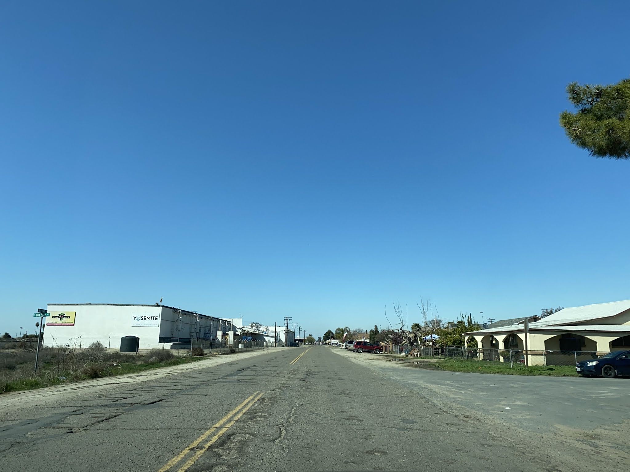
Former US 99/Front Road northbound traverses through central Earlimart. The Earlimart Rail Depot was located at the northwest corner of Front Road and Washington Avenue.
Former US 99/Front Road continues north through central Earlimart and intersects Tulare County Route J22 at Avenue 56. Traffic headed northbound on Front Road is forced to turn around approaching the southbound lanes of the CA 99 freeway.
Part 3; former US Route 99 on Main Street in Pixley
Former US 99 on Main Street and Pixley are accessible from CA 99 northbound via Exit 70A onto Avenue 96/Tulare County Route J24.
Avenue 96 westbound crosses over the CA 99 freeway and intersects former US 99 at Main Street.
Former US 99 on Main Street northbound passes through central Pixley. Just as Earlimart traffic on northbound Main Street is forced to turn around approaching the southbound lanes of the CA 99 freeway.
Further Reading
Continuing north on US Route 99 to Tipton, Tulare and Tagus Ranch?
Continuing south on US Route 99 to Delano and McFarland?










Comments