
In 2019 the Gribblenation Blog Series covered the history of the Hyde Street Pier and the original surface alignment of US Route 101 in San Francisco. Given the Golden Gate Bridge opened to traffic in May of 1937 coupled with the fact that the Sign State Routes had been announced in August of 1934 there were still some open questions regarding the original highway alignments in San Francisco. Namely the question of this blog is; where was California State Route 1 prior to the completion of the Golden Gate Bridge? Thanks the to the discovery of a 1936 Shell Highway Map of San Francisco and the California Highways & Public Works the answer can be conveyed clearly.
Part 1; the history of early California State Route 1 in San Francisco
The genesis point for California State Route 1 ("CA 1") in San Francisco dates to 1933. 1933 was significant due to the State Legislature allowing the Division of Highways to assume maintenance of highways in Cities for the first time. This action by the Legislature led to a large addition of highway mileage throughout the State of California during 1933. One such extension of Legislative Route Number 56 ("LRN 56") which extended the northern terminus from Carmel to Fernbridge. The extended definition of LRN 56 had it pass through the City of San Francisco. The 1933 definition of LRN 56 is described on CAhighways.org as follows:
"(a) a segment from [LRN 2] near Las Cruces via Lompoc and Guadalupe to [LRN 2] near Pismo; (b) [LRN 56] near Carmel to Santa Cruz; (c) Santa Cruz to San Francisco via Coast; (d) State Highway near the Southerly end of the Marin Peninsula to the Marin-Sonoma County Line via the Coast Route; (e) Russian River near Jenner to Westport; and (f) Ferndale to [LRN 1] near Fernbridge."
In the August 1934 California Highways and Public Works Guide the Sign State Routes were announced. CA 1 was applied to LRN 56 from Las Cruces northward towards Fortuna. CA 1 was to be aligned with LRN 56 through the City of San Francisco.

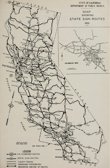
The 1934 Division of Highways State Map City Insert offers not real substantial information of where LRN 56 and CA 1 would be located in the City of San Francisco.

The October 1934 California Highways & Public Works describes the local importance of Junipero Serra Boulevard. The article goes onto cite a new extension of 19th Avenue from Sloat Boulevard southward as a feeder road to existing Junipero Serra Boulevard near the San Mateo County Line. A further State Highway extension via 19th Avenue and Funston Avenue towards the Golden Gate Bridge site is briefly cited.


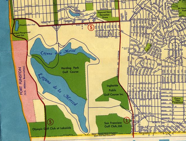
The interim alignment of CA 1 is shown in full detail on a 1936 Shell Highway Map of San Francisco and Oakland (clink the 1936 map and pan left from Oakland). CA 1 is shown using the following alignment from the San Mateo County Line north to the Hyde Street Pier:
- CA 1 northbound enters the City of San Francisco via Junipero Serra Boulevard/LRN 56.
- CA 1 merged on 19th Avenue via the 19th Avenue Extension towards Golden Gate Park on what was part of LRN 56. CA 1 intersected CA 5 on 19th Avenue at Sloat Boulevard.
- CA 1 entered Golden Gate Park via 19th Avenue where State Maintenance terminated at Lincoln Way. CA 1 is shown to traverse the local roads of Gold Gate Park around the western and northern shore of Stow Lake to Fulton Street. CA 1 is shown to have a planned bypass of Stow Lake which would follow the southern and eastern shores to a planned new alignment via Funston Avenue. The planned Funston Avenue alignment of CA 1 is shown traversing the Presidio to the Golden Gate Bridge construction site.
- CA 1 is shown heading east via Fulton Street to the City Hall complex at Franklin Street. CA 1 is shown traversing the City Hall complex via Franklin Street and McAllister Street to reach US Route 101/LRN 2 at Van Ness Avenue.
- CA 1 followed a multiplex of US Route 101 via; Van Ness Avenue, Bay Street and Hyde Street to the Hyde Street Pier.


The Golden Gate Bridge was completed April 19th, 1937 and was dedicated on May 28th. The ceremonies leading up to the opening of the Golden Gate Bridge are discussed in the May 1937 California Highways & Public Works.


No California Highways & Public Works nor the 1938 Division of Highways State Map City Insert gives a clear indication as to what interim route CA 1 was signed on after the opening of the Golden Gate Bridge. It is highly likely that CA 1 simply multiplexed US Route 101 from City Hall via Van Ness Avenue and Lombard Street to the Golden Gate Bridge.

The June 1939 California Highways & Public Works details the ongoing construction of what was now termed the "Park-Presidio Boulevard" approach (CA 1/LRN 56) to the Golden Gate Bridge. The article cites negotiations for construction through the Presidio began in 1935 between the; Military, Golden Gate Bridge & Highway District and City of San Francisco with the Division of Highways not taking part. In 1937 the Division of Highways assumed control the Presidio connector to the Golden Gate Bridge and also took over negotiations with the Military. Construction through the Presidio was issued via Military permit to the Division of Highways on July 27th, 1938. An U.S. Army requirement was for the Presidio project to be fully limited access through the military reservation. The tunnel under the Presidio Golf Course is shown in false work and a diagram shows the full scale of the Presidio connector project.


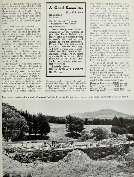
The March 1940 California Highways & Public Works shows the Park-Presidio Boulevard/Funston Avenue Approach of CA 1/LRN 56 in ongoing construction. The article cites the Park-Presidio Boulevard Funston Avenue Approach as having an anticipated completion date of April 15th. The 1,300 foot long tunnel under the Presidio Golf Course is cited as having been completed in January of 1940.

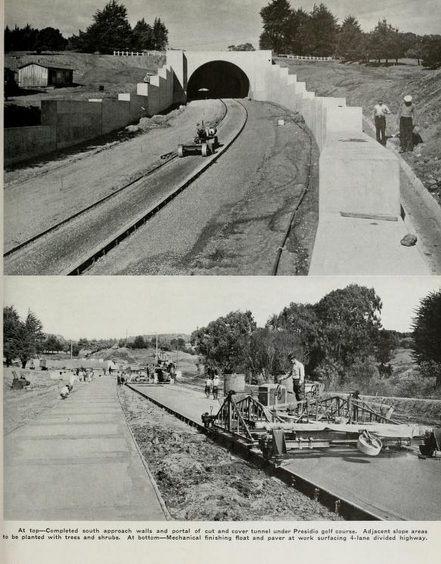

The May 1940 California Highways & Public Works cites the Park-Presidio Boulevard/Funston Avenue Approach along with the 19th Avenue Approach to Golden Gate Park of CA 1/LRN 56 as being completed by April 21st.


The November 1940 California Highways & Public Works provides some clarity as to how CA 1 through Golden Gate Park was constructed. The article primarily details the widening of CA 1/LRN 56 on 19th Avenue but briefly mentions CA 1 being constructed as a divided highway through Golden Gate Park via a Work Progress Administration project. It is conveyed clearly at the time CA 1 through Golden Gate Park was not State Maintained as part of LRN 56. The reasoning for why CA 1 was aligned along the western and northern shores of Stow Lake in Golden Gate Park are not made clear in the article. With the completion of the Golden Gate Park segment and widening of 19th Avenue the present alignment of CA 1 in San Francisco took shape.


Part 2; a replicated drive on the original alignment of California State Route 1 in San Francisco
Our replicated drive on the original alignment of CA 1 begins at the Hyde Street Pier. Hyde Street Pier opened in 1922 and was purpose built to receive car
ferries coming from Sausalito Point. Hyde Street Pier is now part of
San Francisco Maritime National Historic Park and can be toured as a
National Park Service exhibit.

Hyde Street Pier still displays it's US 101 "Redwood Highway" shield.

A centerpiece to Hyde Street Pier is the Eureka car ferry ship. The Eureka was one of the ships that moved cars along US 101 from Sausalito Point over San Francisco Bay to San Francisco. The Eureka was built in 1890 and was designated as the Tiburon until it was retrofitted in 1922.

The Eureka is filled with vehicles that would have dated back to the heyday of ferry service to Hyde Street Pier.


Traffic on US 101/CA 1 southbound would have seen a far less modern skyline disembarking the Hyde Street Pier.

From Hyde Street Pier US 101/CA 1 southbound would have headed south on Hyde Street. Hyde Street almost immediately begins to ascend Russian Hill.

The grade on Hyde Street ascending Russian Hill is extremely steep. Russian Hill is more known for the curvy segment of Lombard Street and is one of the original Seven Hills in the city.

Traffic heading to modern US 101 on southbound Hyde Street is directed to turn onto North Pointe Street.

Southbound US 101/CA 1 would have originally stayed on Hyde Street to Bay Street where it would have taken a right hand turn onto Bay Street.


US 101/CA 1 southbound would have stayed on Bay Street and taken a left hand turn onto Van Ness Avenue.


At Lombard Street the original alignment of US 101/CA 1 on Van Ness Avenue picks up the modern alignment of US 101.

Van Ness Avenue south of Lombard Street is still part of US 101 south and has to carry the weight of rush hour traffic every day. That being the case Van Ness Avenue tends to have poor asphalt condition and is very rough to drive on (or at least when these photos were taken)


US 101 south continues on Van Ness Avenue and intersects San Francisco City Hall at McAllister Street. CA 1 southbound would have split right onto McAllister Street.


The current San Francisco City Hall building was completed in 1916 and replaced the 1899 City Hall which was destroyed in the 1906 San Francisco Earthquake.
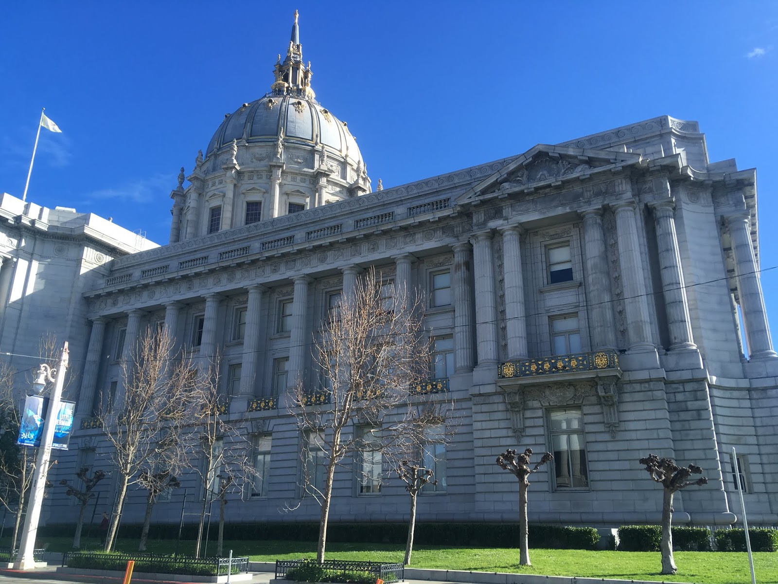

Replicating the original alignment of CA 1 southbound from McAllister Street is no longer possible. From McAllister Street left turns are prohibited due to the now converted one-way northbound Franklin Street.

Comments