Back in 2012 I was out in Northern Arizona finishing up some loose ends in the Arizona state highway system. On my short list was routes I needed to finish was US Route 89 which required crossing Glen Canyon Dam.

Glen Canyon is a 710 (only slightly shorter than Hoover Dam) foot talk concrete arch-gravity dam near the town of Page which was built along the Colorado River between 1956 and 1966. Glen Canyon Dam forms the large reservoir known as Lake Powell which has the second largest storage capacity in the United States only behind Lake Mead. Lake Powell became part of the Lake Mead National Recreation Area when it was created in 1972.
At the beginning of the Glen Canyon Dam construction project the area around Glen Canyon was uninhabited. US 89 at the time to the south over the Navajo Bridge near Marble Canyon. The Arizona Highway System in 1956 can be seen on this map.
1956 State Highway Map
Construction on the Glen Canyon Bridge began in 1957 and was completed by 1959. The Glen Canyon Bridge is a steel arch design 1,271 feet in length. The Glen Canyon Bridge is more known for its 700-foot clearance above the waters of the Colorado River.


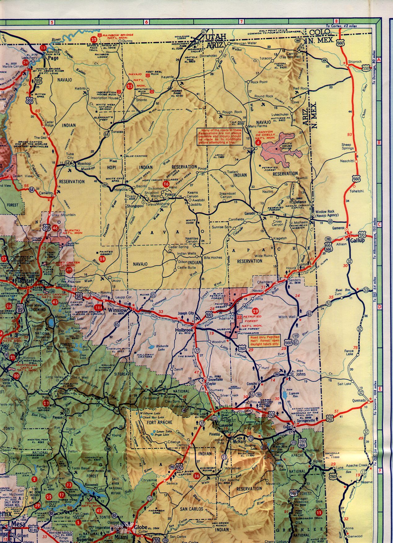
Upon the completion of the Glen Canyon Bridge main line US 89 was shifted onto it. The former routing over the Navajo Bridge became US Route 89A. Oddly on the Utah side the routing of US 89A was signed as Utah State Route 11 until fairly recently. The new routing of US 89 over Glen Canyon Bridge can be seen on this 1961 Sectional Map of Arizona.
1961 Arizona Highway Sectional Map

Glen Canyon is a 710 (only slightly shorter than Hoover Dam) foot talk concrete arch-gravity dam near the town of Page which was built along the Colorado River between 1956 and 1966. Glen Canyon Dam forms the large reservoir known as Lake Powell which has the second largest storage capacity in the United States only behind Lake Mead. Lake Powell became part of the Lake Mead National Recreation Area when it was created in 1972.
At the beginning of the Glen Canyon Dam construction project the area around Glen Canyon was uninhabited. US 89 at the time to the south over the Navajo Bridge near Marble Canyon. The Arizona Highway System in 1956 can be seen on this map.
1956 State Highway Map
Construction on the Glen Canyon Bridge began in 1957 and was completed by 1959. The Glen Canyon Bridge is a steel arch design 1,271 feet in length. The Glen Canyon Bridge is more known for its 700-foot clearance above the waters of the Colorado River.


Upon the completion of the Glen Canyon Bridge main line US 89 was shifted onto it. The former routing over the Navajo Bridge became US Route 89A. Oddly on the Utah side the routing of US 89A was signed as Utah State Route 11 until fairly recently. The new routing of US 89 over Glen Canyon Bridge can be seen on this 1961 Sectional Map of Arizona.
1961 Arizona Highway Sectional Map
Comments