In the Vulture Mountains south of the town of Wickenburg, AZ is abandoned mining camp along Vulture Mine Road known as Vulture City.

I heard of the Vulture Mine back in 2012 after watching a news segment in Phoenix about the role the gold mines played in early Arizona history. The Vulture Mine was discovered by Henry Wickenburg in 1863 which led to the oddly named Vulture City springing to life. The Vulture Mine one was one Arizona's most productive gold and silver mines and was in operation from 1863 to 1942 when it was shut down during World War II. It wasn't uncommon for mines that were processing non-essential metals during World War II to be shut down. The Vulture Mine reopened but didn't last much past World War II which led to the abandonment of Vulture City. Vulture City at one point had a population of approximately 5,000 people at the peak of the mining activity.
After I heard the story of the Vulture Mine, I traveled down Vulture Mine Road from US Route 60 to see what I could find. Vulture City was gated off but there was a phone number and website listed on a sign. Apparently, Saturday tours were being offered by a mining company which had just brought the Vulture Mine property. I returned the following Saturday and found the mine gate open, after paying a nominal fee I was on a tour with a couple other people of the Vulture Mine. It turned out time had been kind not only to the Vulture Mine but also Vulture City as there was plenty of intact structures.
According to rumor Grand Avenue/US 60 is routed northwest directly from downtown Phoenix because it was the quickest access path to the Vulture Mine. Given the town of Wickenburg is located below the Vulture Mine on US 60 I would tend to believe that speculation about Grand Avenue to be true. I encountered this historic plaque early in the story.

There were some interesting old buildings near the gate at Vulture Mine Road. One building was called the "Vultures Roost" while the other was an old derelict gas station.


Some of the abandoned residential structures from Vulture City.

There is tons of abandoned Pre-War cars and various random machinery littered about the Vulture Mine and Vulture City.


A look southward towards the mining operation buildings. There were plenty of abandoned power lines that were still surprisingly standing after about 70 years of monsoons and dust storms.


A look at the mine mess hall which actually stable enough to enter still.


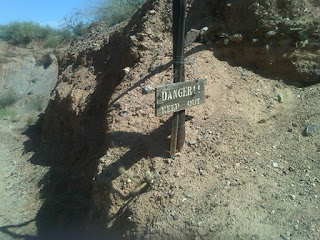
I'm not sure what these structures were but they don't appear to have much time until they fall apart completely.


I'm to understand this was Henry Wickenburg's residence and the tree behind the house was used for hangings.


The ruins of the Assay Building, the mine mutt added a nice touch of ambiance.


Most of the actual Vulture Mine was done through shafts which had long since caved in. Apparently, the new mining company was going to start open pit mining but preserve Vulture City.


Apparently, the Vulture Mine tours have been a success as they have been greatly expanded. Information can be found at the link below.
Vulture Mine Tours

I heard of the Vulture Mine back in 2012 after watching a news segment in Phoenix about the role the gold mines played in early Arizona history. The Vulture Mine was discovered by Henry Wickenburg in 1863 which led to the oddly named Vulture City springing to life. The Vulture Mine one was one Arizona's most productive gold and silver mines and was in operation from 1863 to 1942 when it was shut down during World War II. It wasn't uncommon for mines that were processing non-essential metals during World War II to be shut down. The Vulture Mine reopened but didn't last much past World War II which led to the abandonment of Vulture City. Vulture City at one point had a population of approximately 5,000 people at the peak of the mining activity.
After I heard the story of the Vulture Mine, I traveled down Vulture Mine Road from US Route 60 to see what I could find. Vulture City was gated off but there was a phone number and website listed on a sign. Apparently, Saturday tours were being offered by a mining company which had just brought the Vulture Mine property. I returned the following Saturday and found the mine gate open, after paying a nominal fee I was on a tour with a couple other people of the Vulture Mine. It turned out time had been kind not only to the Vulture Mine but also Vulture City as there was plenty of intact structures.
According to rumor Grand Avenue/US 60 is routed northwest directly from downtown Phoenix because it was the quickest access path to the Vulture Mine. Given the town of Wickenburg is located below the Vulture Mine on US 60 I would tend to believe that speculation about Grand Avenue to be true. I encountered this historic plaque early in the story.

There were some interesting old buildings near the gate at Vulture Mine Road. One building was called the "Vultures Roost" while the other was an old derelict gas station.


Some of the abandoned residential structures from Vulture City.

There is tons of abandoned Pre-War cars and various random machinery littered about the Vulture Mine and Vulture City.


A look southward towards the mining operation buildings. There were plenty of abandoned power lines that were still surprisingly standing after about 70 years of monsoons and dust storms.


A look at the mine mess hall which actually stable enough to enter still.


I'm not sure what these structures were but they don't appear to have much time until they fall apart completely.


I'm to understand this was Henry Wickenburg's residence and the tree behind the house was used for hangings.


The ruins of the Assay Building, the mine mutt added a nice touch of ambiance.


Most of the actual Vulture Mine was done through shafts which had long since caved in. Apparently, the new mining company was going to start open pit mining but preserve Vulture City.


Apparently, the Vulture Mine tours have been a success as they have been greatly expanded. Information can be found at the link below.
Vulture Mine Tours
Comments