After leaving Death Valley Thursday afternoon I took US 95 to partially built County Route 215 to bypass most of Las Vegas. From there I took I-15 to Utah State Route 9 where my hotel for the evening was. The primary destination Friday morning was Zion National Park.

I've been to Zion National Park four times in the past five years. Generally I've found Zion to be drastically overwhelmed during the busy season with required shuttle buses. The winter months in December and January don't have mandatory shuttles which makes it easy to access some of the more notable trails. Given that Zion is located on the boundary of the Mojave Desert and Colorado Plateau I've never found cold weather to be much of a factor.
Zion National Park is accessed via Utah State Route 9 which has a segment known as the Mount Carmel Highway. Given that I didn't take all of UT 9 all I took was a handful of shield pictures. Back in 2016 I completed a photo album of all of UT 9 and will I get that online sometime this year.
UT 9 was a 1977 renumbering of the previous UT 15 designation which had been in place since the 1920s. UT 9 currently is a 57 mile east/west route running from I-15 to US 89, from I-15 to Zion National Park it largely follows the course of the Virgin River. The route of UT 9 has been in the state highway system since 1916 when a state maintained road from La Verkin to Zion National Park was adopted. The legislative routing that is now UT 9 was extended to US 89 at Mount Carmel Junction in 1927. Construction of the Mount Carmel Tunnel began in 1927 and was completed by 1930.
The Rand McNally Map below shows what is now UT 9 running only to Zion National Park near Springdale in 1924 before the Mount Carmel Tunnel was planned.
1924 Rand McNally Map of the Four Corners Region
The 1950 Utah State Highway Map shows UT 15 running from Anderson Junction at US 91 all the way east to US 89. UT 17 from US 91 east to UT 15 would later become the western most segment of modern UT 9.
1950 State Highway Map
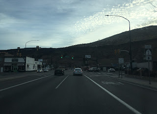
On the day of my visit to Zion UT 9 in Springdale was undergoing a major reconstruction. The National Park Service listed the highway as having a possible 25-45 minute wait through the flag zones on one-way traffic control. Some of the segments were manned while others had traffic lights like this one entering Springdale. The mouth of Zion Canyon can be seen up ahead in the distance. I found my morning wait only to be about 10-15 minutes to get through Springdale and there was no delay leaving due to a happy coincidence of hitting the flagmen as traffic was flowing westbound.

Zion Canyon is a long but narrow north/south oriented canyon largely following the path of the Virgin River. Zion Canyon has walls as high as 3,000 feet and I believe the elevation about sea level at the National Park Visitor Center is at 4,300 feet. The lower Virgin River was settled in 1861 in a community known as Northrop. Northrop was wiped out by a flood on the Virgin River in 1862 and the community was moved to higher ground to what is known today as Springdale. Zion Canyon was first designated as Mukuntuweap National Monument in 1909 which was eventually upgraded to Zion National Park by 1919. After entering Zion Canyon I stopped at the National Park Visitor Center to get a view from the Virgin River.

Zion Canyon Scenic Drive is mostly inaccessible to anything but bikes and shuttle buses for most of the year. I took the opportunity to drive north through Zion Canyon for awhile and stopped at the Big Bend of the Virgin River just north of Angel's Landing.

The big stop for the day was the Angel's Landing Trail. My traveling companions (which included my significant other) were on the there first trip to Zion National Park and wanted to try the most notable trail. The Angel's Landing Trail is accessible from the West Rim Trail which in turn can be most easily reached from The Grotto or Zion Lodge. Since parking was open at The Grotto I parked there and crossed the Virgin River with Angel's Landing in sight high above.


Angel's Landing is no joke as evidenced by this sign at the crossing of the Virgin River. I believe one of the six fatalities was actually a suspected murder but I can't find anything to corroborate it. Either way it is almost a vertical fall from Angel's Landing and parts of the Western Trail.

Two miles from the Virgin River Bridge northward the West Rim Trail meets the Angel's Landing Trail at Scout's Lookout.

Most of the West Rim Trail to Scout's Landing is mostly paved with concrete. Despite the constant incline and switchbacks I didn't find the trail to be very difficult. The path is generously wide and doesn't put you on the cliff face unless you want to be there.


The West Rim Trail flattens out slightly at Refrigerator Canyon with this view of Zion Canyon Looking south.

Which also has a nice view of the drop below and switchbacks that you just climbed.

As I stated above the trail through Refrigerator Canyon is somewhat mild at first.


As the West Rim Trail nears the final climb to Scout's Lookout the switchbacks resume.


The final switchbacks up to Scout's Lookout are about 15-20% in grade an are in a ladder configuration. The ascent was the turnaround point for several people.


At Scout's Lookout we finally reached the start of the Angel's Landing Trail.

One last final warning about what you're about to attempt on Angel's Landing.

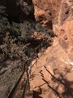
There is a chain system that assists climbers to the top of Angel's Landing. The sandstone was covered in moist dirt which made it difficult for me to get traction on the already slippery surface. I'm confident in my physical abilities but rather than tempt fate with the poor surface I went to a high location on the West Rim Trail where I watched two members of my group (including my girlfriend who really wanted to me emphasize that she did go up Angel's Landing like a bad ass) make it half-way up Angel's Landing before turning back.


Fortunately I had a really good view of the Big Bend from way up high.

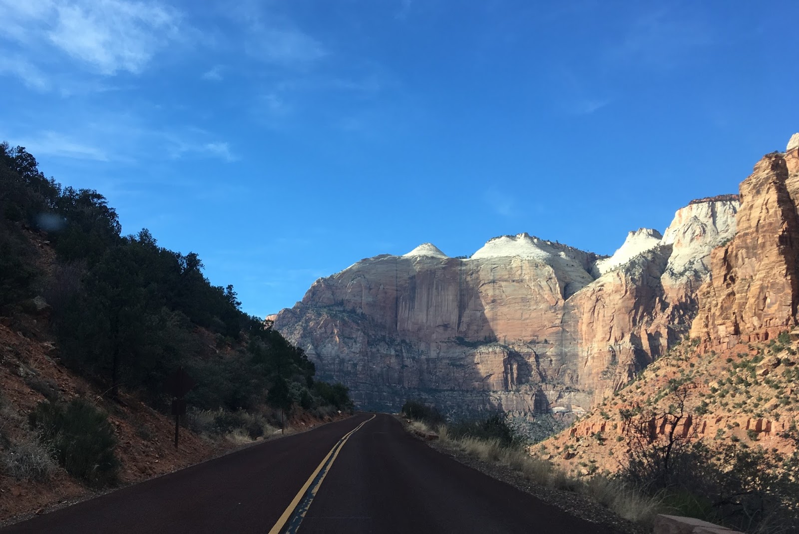
In total it took about 1.75 hours to get to Angel's Landing and back. After returning to the car I drove south down to the implied route of UT 9 eastbound up towards the Mount Carmel Tunnel. The Mount Carmel Highway ascends Pine Creek Canyon as has sweeping views of Zion Canyon to the west.


The Mount Carmel Highway Tunnel is 1.1 miles long and is a constant 21 feet from the edge of Pine Creek Canyon. Given the old design the Mount Carmel Highway Tunnel isn't wide enough for modern heavy trucks which requires the tunnel to be temporarily routed as one-way with manned traffic control at both sides. Bikes are prohibited in the Mount Carmel Highway Tunnel and there various windows in the rock which provide light in addition to fresh air. Really it is a beautiful design and has really stood up to the passing of time.


The Canyon Overlook Trail is at the east entrance to the Mount Carmel Highway Tunnel. The trail isn't as steep as the West Rim Trail leading up to Angel's Landing but is far more rocky and haggard. The route to the Canyon Overlook is only a 1 mile round trip and I run it several times.




The Canyon Overlook is well worth the trip and has a wide view of the Mount Carmel Highway below and Zion Canyon off in the distance.

This sign shows what the names off all the high peaks ahead are.

Fortunately this trip had been planned out with the advanced notice of a looming Federal Shutdown which was slated to commence at midnight Friday. After the Canyon Overlook we took UT 9 back to I-15 and headed towards Las Vegas for the night.

I've been to Zion National Park four times in the past five years. Generally I've found Zion to be drastically overwhelmed during the busy season with required shuttle buses. The winter months in December and January don't have mandatory shuttles which makes it easy to access some of the more notable trails. Given that Zion is located on the boundary of the Mojave Desert and Colorado Plateau I've never found cold weather to be much of a factor.
Zion National Park is accessed via Utah State Route 9 which has a segment known as the Mount Carmel Highway. Given that I didn't take all of UT 9 all I took was a handful of shield pictures. Back in 2016 I completed a photo album of all of UT 9 and will I get that online sometime this year.

UT 9 was a 1977 renumbering of the previous UT 15 designation which had been in place since the 1920s. UT 9 currently is a 57 mile east/west route running from I-15 to US 89, from I-15 to Zion National Park it largely follows the course of the Virgin River. The route of UT 9 has been in the state highway system since 1916 when a state maintained road from La Verkin to Zion National Park was adopted. The legislative routing that is now UT 9 was extended to US 89 at Mount Carmel Junction in 1927. Construction of the Mount Carmel Tunnel began in 1927 and was completed by 1930.
The Rand McNally Map below shows what is now UT 9 running only to Zion National Park near Springdale in 1924 before the Mount Carmel Tunnel was planned.
1924 Rand McNally Map of the Four Corners Region
The 1950 Utah State Highway Map shows UT 15 running from Anderson Junction at US 91 all the way east to US 89. UT 17 from US 91 east to UT 15 would later become the western most segment of modern UT 9.
1950 State Highway Map
On the day of my visit to Zion UT 9 in Springdale was undergoing a major reconstruction. The National Park Service listed the highway as having a possible 25-45 minute wait through the flag zones on one-way traffic control. Some of the segments were manned while others had traffic lights like this one entering Springdale. The mouth of Zion Canyon can be seen up ahead in the distance. I found my morning wait only to be about 10-15 minutes to get through Springdale and there was no delay leaving due to a happy coincidence of hitting the flagmen as traffic was flowing westbound.

Zion Canyon is a long but narrow north/south oriented canyon largely following the path of the Virgin River. Zion Canyon has walls as high as 3,000 feet and I believe the elevation about sea level at the National Park Visitor Center is at 4,300 feet. The lower Virgin River was settled in 1861 in a community known as Northrop. Northrop was wiped out by a flood on the Virgin River in 1862 and the community was moved to higher ground to what is known today as Springdale. Zion Canyon was first designated as Mukuntuweap National Monument in 1909 which was eventually upgraded to Zion National Park by 1919. After entering Zion Canyon I stopped at the National Park Visitor Center to get a view from the Virgin River.

Zion Canyon Scenic Drive is mostly inaccessible to anything but bikes and shuttle buses for most of the year. I took the opportunity to drive north through Zion Canyon for awhile and stopped at the Big Bend of the Virgin River just north of Angel's Landing.

The big stop for the day was the Angel's Landing Trail. My traveling companions (which included my significant other) were on the there first trip to Zion National Park and wanted to try the most notable trail. The Angel's Landing Trail is accessible from the West Rim Trail which in turn can be most easily reached from The Grotto or Zion Lodge. Since parking was open at The Grotto I parked there and crossed the Virgin River with Angel's Landing in sight high above.


Angel's Landing is no joke as evidenced by this sign at the crossing of the Virgin River. I believe one of the six fatalities was actually a suspected murder but I can't find anything to corroborate it. Either way it is almost a vertical fall from Angel's Landing and parts of the Western Trail.

Two miles from the Virgin River Bridge northward the West Rim Trail meets the Angel's Landing Trail at Scout's Lookout.

Most of the West Rim Trail to Scout's Landing is mostly paved with concrete. Despite the constant incline and switchbacks I didn't find the trail to be very difficult. The path is generously wide and doesn't put you on the cliff face unless you want to be there.


The West Rim Trail flattens out slightly at Refrigerator Canyon with this view of Zion Canyon Looking south.

Which also has a nice view of the drop below and switchbacks that you just climbed.

As I stated above the trail through Refrigerator Canyon is somewhat mild at first.


As the West Rim Trail nears the final climb to Scout's Lookout the switchbacks resume.
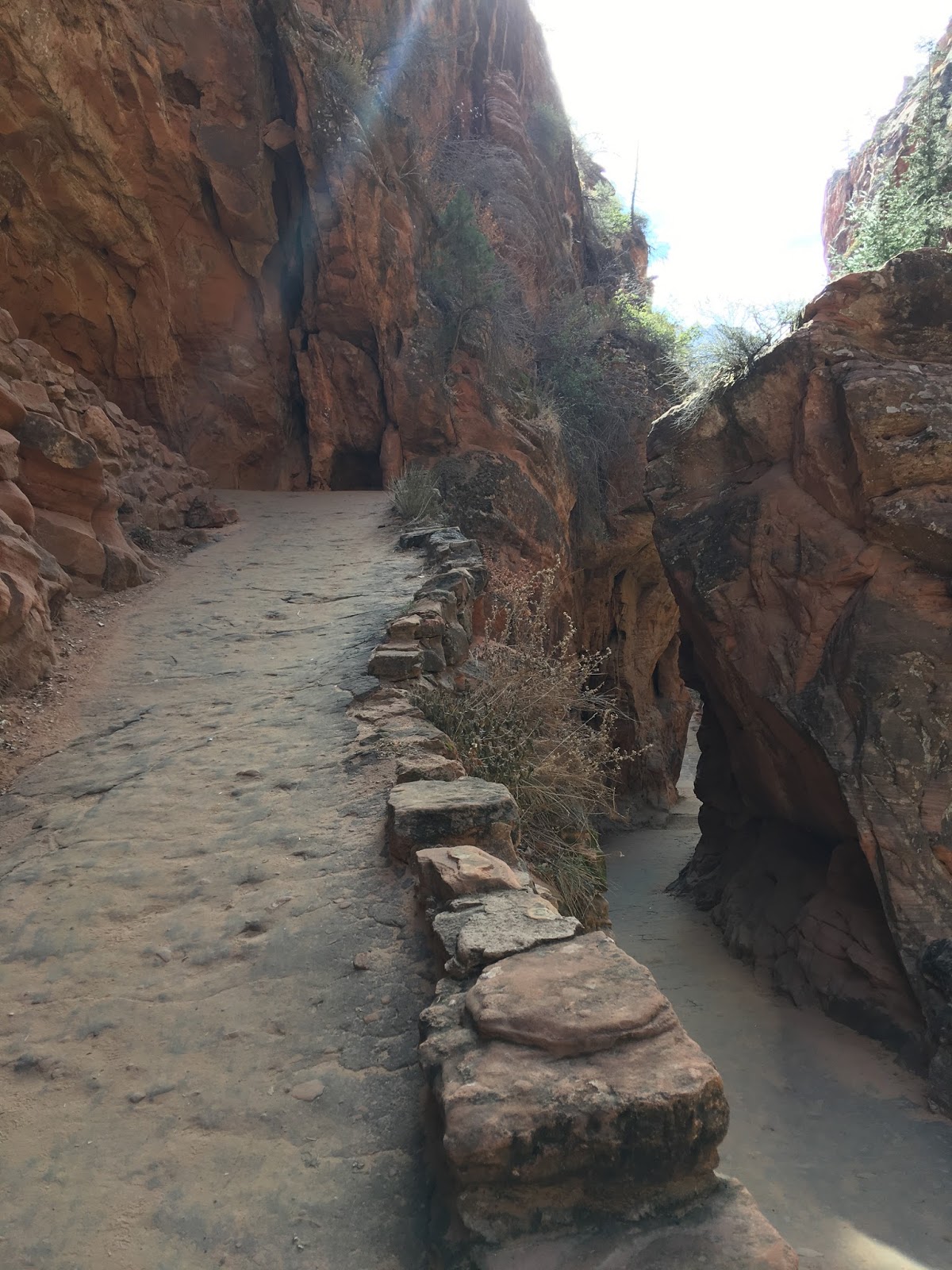


The final switchbacks up to Scout's Lookout are about 15-20% in grade an are in a ladder configuration. The ascent was the turnaround point for several people.


At Scout's Lookout we finally reached the start of the Angel's Landing Trail.

One last final warning about what you're about to attempt on Angel's Landing.

There is a chain system that assists climbers to the top of Angel's Landing. The sandstone was covered in moist dirt which made it difficult for me to get traction on the already slippery surface. I'm confident in my physical abilities but rather than tempt fate with the poor surface I went to a high location on the West Rim Trail where I watched two members of my group (including my girlfriend who really wanted to me emphasize that she did go up Angel's Landing like a bad ass) make it half-way up Angel's Landing before turning back.


Fortunately I had a really good view of the Big Bend from way up high.

In total it took about 1.75 hours to get to Angel's Landing and back. After returning to the car I drove south down to the implied route of UT 9 eastbound up towards the Mount Carmel Tunnel. The Mount Carmel Highway ascends Pine Creek Canyon as has sweeping views of Zion Canyon to the west.



The Mount Carmel Highway Tunnel is 1.1 miles long and is a constant 21 feet from the edge of Pine Creek Canyon. Given the old design the Mount Carmel Highway Tunnel isn't wide enough for modern heavy trucks which requires the tunnel to be temporarily routed as one-way with manned traffic control at both sides. Bikes are prohibited in the Mount Carmel Highway Tunnel and there various windows in the rock which provide light in addition to fresh air. Really it is a beautiful design and has really stood up to the passing of time.


The Canyon Overlook Trail is at the east entrance to the Mount Carmel Highway Tunnel. The trail isn't as steep as the West Rim Trail leading up to Angel's Landing but is far more rocky and haggard. The route to the Canyon Overlook is only a 1 mile round trip and I run it several times.


The Canyon Overlook is well worth the trip and has a wide view of the Mount Carmel Highway below and Zion Canyon off in the distance.

This sign shows what the names off all the high peaks ahead are.

Fortunately this trip had been planned out with the advanced notice of a looming Federal Shutdown which was slated to commence at midnight Friday. After the Canyon Overlook we took UT 9 back to I-15 and headed towards Las Vegas for the night.
Comments