After making my way over the Marin Hills via the Panoramic Highway I was finally within close proximity of Point Reyes which was my big destination for the second day of the Disaster Tourism Trip.

Interestingly while at the end of the Panoramic Highway past the closure of CA 1 in Stinson Beach I snagged a picture of a street blade. I ended up purchasing an almost identical Panoramic Highway street blade later in 2017.


The community of Stinson Beach dates back to 1866 along the the Pacific Coast and Bolinas Lagoon. Back when the Mount Tamalpais-Muir Woods Railroad opened in 1896 a stage route between Stinson Beach and Mount Tamalpais was opened. I believe this stage route eventually became the western segment of the Panoramic Highway.

CA 1 north of Stinson Beach on the eastern edge of the Bolinas Lagoon was actually flooded in various places from heavy rain water.


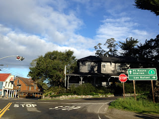
In Olema CA 1 enters the the Point Reyes Peninsula and meets the eastern segment of Sir Francis Drake Boulevard which goes all the way eastward to I-580. Olema apparently has been around since at least the 1850s and might have been the epicenter the 1906 San Francisco Earthquake.

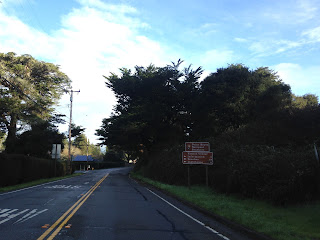
I took a turn on Bear Valley Road to meet the western Sir Francis Drake Boulevard which is used to access the Point Reyes National Seashore.
The western Sir Francis Drake Boulevard swings northwest following the shores of Tomales Bay. Tomales Bay is generally thought to have been found in 1603 by the Vizcanio Expedition. The first community encountered on Sir Francis Drake Boulevard is Inverness which has been around since the 1890s. There is a neighboring community called Seahaven but I don't know much about it.


West of Inverness Sir Francis Drake Boulevard swings inland and enters the Point Reyes National Seashore. After fording a flooded creek (I took a picture on the way back) I met the shore of Drake's Estero. Drake's Estero is the likely landing place of the 1579 expedition of the Californian shore by Sir Francis Drake.

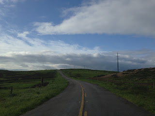
Sir Francis Drake Boulevard begins to swing south past Drake's Estero towards Point Reyes. The road is in rough shape and has several ranches on it. The views of the hills and ocean landscape are absolutely spectacular as they tend to draw out to wide vistas.


Approaching Point Reyes Sir Francis Drake Boulevard begins to make a steep westward uphill climb. The roadway has large sand drifts on it which need to be crossed.

About a half mile from the western tip of Point Reyes the road is closed to through traffic and Sir Francis Drake Boulevard must be walked the final half mile. There are two overlooks at the parking lot; the Sea Lion overlook to the south and South Beach overlook to the north.


Sir Francis Drake Boulevard ends at the Point Reyes Lighthouse.


The Point Reyes Lighthouse is actually located on a low point at the bottom of a large staircase. The Point Reyes Lighthouse was built back in 1870 and was automated by 1975 thirteen years after the Point Reyes National Seashore was created.


Heading back on Sir Francis Drake Boulevard to CA 1 had more roadway vistas.


Point Reyes has Tule Elk, all I got was run of the mill deer.


A couple more vistas before hitting Drake's Estero.


Luckily the flood waters had subsided somewhat east of Drake's Estero. On the way back I could see a clear path through the mud and water unlike when I was heading to Point Reyes.


After reaching CA 1 I headed north towards Point Reyes Station and back eastwards from there inland.


Interestingly while at the end of the Panoramic Highway past the closure of CA 1 in Stinson Beach I snagged a picture of a street blade. I ended up purchasing an almost identical Panoramic Highway street blade later in 2017.


The community of Stinson Beach dates back to 1866 along the the Pacific Coast and Bolinas Lagoon. Back when the Mount Tamalpais-Muir Woods Railroad opened in 1896 a stage route between Stinson Beach and Mount Tamalpais was opened. I believe this stage route eventually became the western segment of the Panoramic Highway.

CA 1 north of Stinson Beach on the eastern edge of the Bolinas Lagoon was actually flooded in various places from heavy rain water.


In Olema CA 1 enters the the Point Reyes Peninsula and meets the eastern segment of Sir Francis Drake Boulevard which goes all the way eastward to I-580. Olema apparently has been around since at least the 1850s and might have been the epicenter the 1906 San Francisco Earthquake.


I took a turn on Bear Valley Road to meet the western Sir Francis Drake Boulevard which is used to access the Point Reyes National Seashore.

The western Sir Francis Drake Boulevard swings northwest following the shores of Tomales Bay. Tomales Bay is generally thought to have been found in 1603 by the Vizcanio Expedition. The first community encountered on Sir Francis Drake Boulevard is Inverness which has been around since the 1890s. There is a neighboring community called Seahaven but I don't know much about it.


West of Inverness Sir Francis Drake Boulevard swings inland and enters the Point Reyes National Seashore. After fording a flooded creek (I took a picture on the way back) I met the shore of Drake's Estero. Drake's Estero is the likely landing place of the 1579 expedition of the Californian shore by Sir Francis Drake.

Sir Francis Drake Boulevard begins to swing south past Drake's Estero towards Point Reyes. The road is in rough shape and has several ranches on it. The views of the hills and ocean landscape are absolutely spectacular as they tend to draw out to wide vistas.


Approaching Point Reyes Sir Francis Drake Boulevard begins to make a steep westward uphill climb. The roadway has large sand drifts on it which need to be crossed.

About a half mile from the western tip of Point Reyes the road is closed to through traffic and Sir Francis Drake Boulevard must be walked the final half mile. There are two overlooks at the parking lot; the Sea Lion overlook to the south and South Beach overlook to the north.


Sir Francis Drake Boulevard ends at the Point Reyes Lighthouse.


The Point Reyes Lighthouse is actually located on a low point at the bottom of a large staircase. The Point Reyes Lighthouse was built back in 1870 and was automated by 1975 thirteen years after the Point Reyes National Seashore was created.


Heading back on Sir Francis Drake Boulevard to CA 1 had more roadway vistas.


Point Reyes has Tule Elk, all I got was run of the mill deer.


A couple more vistas before hitting Drake's Estero.


Luckily the flood waters had subsided somewhat east of Drake's Estero. On the way back I could see a clear path through the mud and water unlike when I was heading to Point Reyes.


After reaching CA 1 I headed north towards Point Reyes Station and back eastwards from there inland.

Comments