
Harris Grade Road is an approximately eight-mile mountain roadway constructed in 1916 near Lompoc of Santa Barbara County. The grade was the original alignment of California State Route 1 which served as part of the highway from 1934 through 1988. Harris Grade Road was ultimately maintenance swapped with the far gentler Santa Barbara County Route S20. The grade in modern times despite being accident prone is still in frequent use by those seeking a more direct route between Lompoc and Santa Maria.

Part 1; the history of Harris Grade Road
Prior to the construction of Harris Grade Road traffic wishing to access Lompoc Valley had to utilize roads originating from Casmalia or the Santa Ynez River. Harris Grade Road was opened by Santa Barbara County in 1916 (courtesy Lompoc Record). The then new highway provided a direct connection via an unnamed summit at 867 feet above sea level. The corridor originated at Harris siding (near Harris Canyon) at the Southern Pacific Railroad in Santa Maria Valley and crossed to Lompoc Valley.
Harris Grade Road can be seen as the "Purisima Grade" on the 1917 California State Automobile Association map.

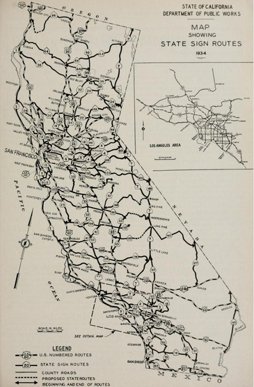
Harris Grade Road would be added to Legislative Route Number 56 (LRN 56) in 1933. During said year the highway was extended from San Luis Obispo to US Route 101 (LRN 2) near Gaviota Pass (Las Cruces). The entirety of LRN 56 would be assigned as California State Route 1 when the initial run of Sign Routes was announced in the August 1934 California Highways & Public Works.

California State Route 1 can be seen crossing Harris Grade Road on the 1935 Division of Highways map of Santa Barbara County.

The expansion of Vandenburg Air Force base saw massive increase in traffic in the Lompoc area. This led to the proliferation of numerous freeway and expressway corridors north of Lompoc being adopted by the California Highway Commision and Santa Barbara County. A straightening the Harris Grade appears as an adopted alignment of California State Route 1 in the January/February 1964 California Highways & Public Works. The article notes the Harris Grade corridor was planned long range as part of the expressway extension south of the Harriston-Orcutt portion segment already earmarked to for the 1964-1965 Fiscal Year. The article details the extension of Casmalia Road by Santa Barbara County which was extended from the main gate of Vandenburg Air Force Base to California State Route 1 in Santa Maria Valley. The then new 6.7-mile segment of Casmalia Road was completed on August 19, 1963.


During 1967 Santa Barbara County Route S20 was commissioned as a low elevation alternative to Harris Grade Road. The then new County Route used the existing Casmalia Road over Burton Mesa which served Vandenburg Airforce Base.
During 1988 Santa Barbara County Route S20 was maintenance swapped with the Caltrans held Harris Grade Road. Casmalia Road became a component of California State Route 1 whereas Harris Grade Road was not assigned a County Route designation. The two corridors can be seen contrasted to each other on a cahighways.org sourced map.

Casmalia Road can be seen as the new alignment of California State Route 1 on the 1990 Caltrans map. Despite the realignment of California State Route 1 to Casmalia Road the adopted straightening of the Harris Grade as never been rescinded by the California Transportation Commission.

Part 2; a drive on Harris Grade Road
Modern California State Route 1 north of downtown Lompoc splits from Harris Grade Road onto the 13.28-mile long Casmalia Road. The much shorter route over Harris Grade Road carries a 30-foot length prohibition.


Northbound Harris Grade Road quickly ascends to an unnamed 867-foot-high summit that overlooks Lompoc Valley.


Northbound Harris Grade Road descends through a series of winding grades and enters Santa Maria Valley. The corridor ends at California State Route 135 (former US Route 101) near the former site of Harris siding (alternatively Harriston).


Part 3; scenes along modern California State Route 1 north of Lompoc (former Santa Barbara County Route 20 on Casmalia Road)
Modern California State Route 1 from the southern terminus of Harris Grade Road turns northwest along Casmalia Road towards the main gate to Vandenburg Space Force Base (photos circa 2014 when it was still Air Force).


From the gate of Vandenburg Space Force Base the 1963 era extension of Casmalia Road carries California State Route 1 northeast to California State Route 135 in Santa Maria Valley.


Comments