
Marsh Creek Road is an approximately twenty-one-mile rural highway in the Diablo Range of Contra Costa County, California. The roadway begins in the city of Clayton near Mount Diablo and follows the namesake Marsh Creek to the outskirts of Discovery Bay. Since 2012 a portion of Marsh Creek Road between Vasco Road and Byron Road has been signed as part of California State Route 4. The highway is named after Alta California settler John Marsh who settled in the area during 1838.

Part 1; the history of Marsh Creek Road
Marsh Creek and the namesake road are named after Alta California settler John Marsh. John Marsh would acquire Rancho Los Meganos from Jose Noriega during 1838. John Marsh would construct his home along the creek that would later bear his name after California became an American state.
In 1857 John Clayton would plot a town north of Mount Diablo bearing his last name. Clayton would begin to boom with the rise of coal mining in eastern Contra County. The community would obtain Postal Service during 1861. Clayton was also located near Jerimah Morgan's ranch known as Morgan Territory which had been plotted near the source of Marsh Creek in 1857.
The 1882 Bancroft Map of California depicts a road extending east from Clayton towards the coal mines of Nortonville and Stewartville. No established road can be seen following Marsh Creek through Morgan Territory east towards Byron and Brentwood.

The 1896 United States Geological Survey Map of Mount Diablo displays Marsh Creek Road originating in Clayton and spanning east near Morgan Territory towards Marsh Ranch. It is likely that the road continued east to Byron.


The 1914 C.F. Weber Map of Contra Costa County depicts Marsh Creek Road connecting Clayton east to Byron by way of Morgan Territory.


During 1927 the privately owned Marsh Creek Springs Park was developed along Marsh Creek Road north of Morgan Territory. The 1935 Division of Highways Map of Contra Costa County depicts Marsh Creek Road as a major rural highway connecting Clayton to near California State Route 4 south of Brentwood. The highway is shown to be realigned away from Byron following Marsh Creek and Dry Creek.

The realigned eastern segment of Marsh Creek Road can be seen in detail on the 1940 United States Geological Survey map of Byron. The older alignment to Byron appears as Kellogg Road and is now named Camino Diablo. March Creek Road is shown terminating at Bixler Road near what is now Discovery Bay.

Marsh Creek Springs would suffer substantial flooding in 1957 and 1962. These floods led eventually led to the park permanently closing and the abandonment of several building.
During 2012 the California State Route 4 bypass of Brentwood was complete. The eastern end of the freeway emptied onto Marsh Creek Road near Vasco Road. The new alignment of California State Route 4 followed Marsh Creek Road east to Byron Highway where it continues through the San Joaquin River Delta.
The present overlay of California State Route 4 on Marsh Creek Road between Vasco Road and Byron Highway appears on the 2018 United States Geological Survey map of Brentwood.


Below Morgan Territory Road can observed with a northern terminus at Marsh Creek Road near Clayton.

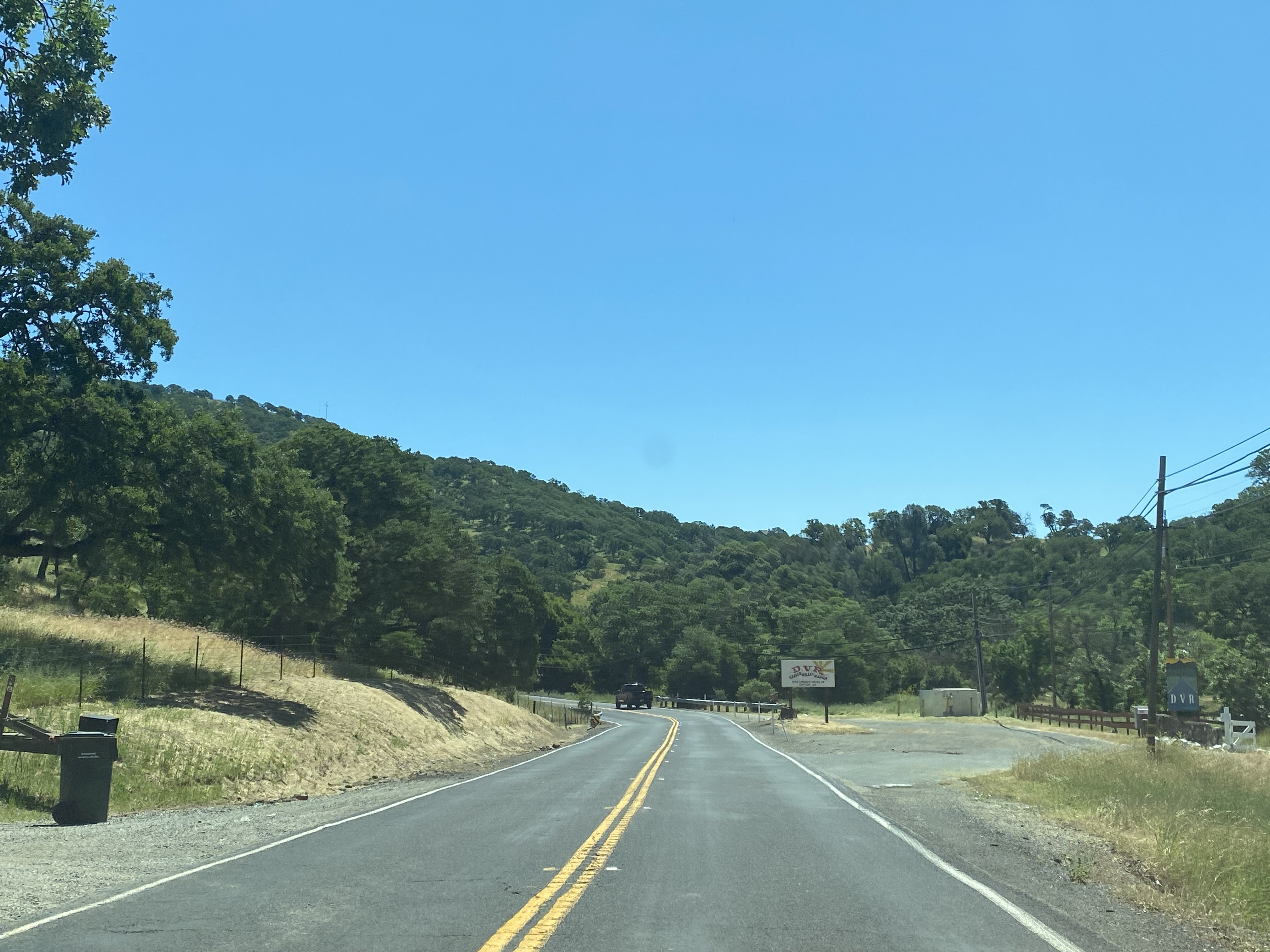
Eastbound Marsh Creek Road follows the namesake creek past the former location of Marsh Creek Springs. The road emerges onto a bluff overlooking the ruins of the Marsh Creek Hotel. Marsh Creek Road is displayed as Contra Costa County Route 106 on roadside callboxes.




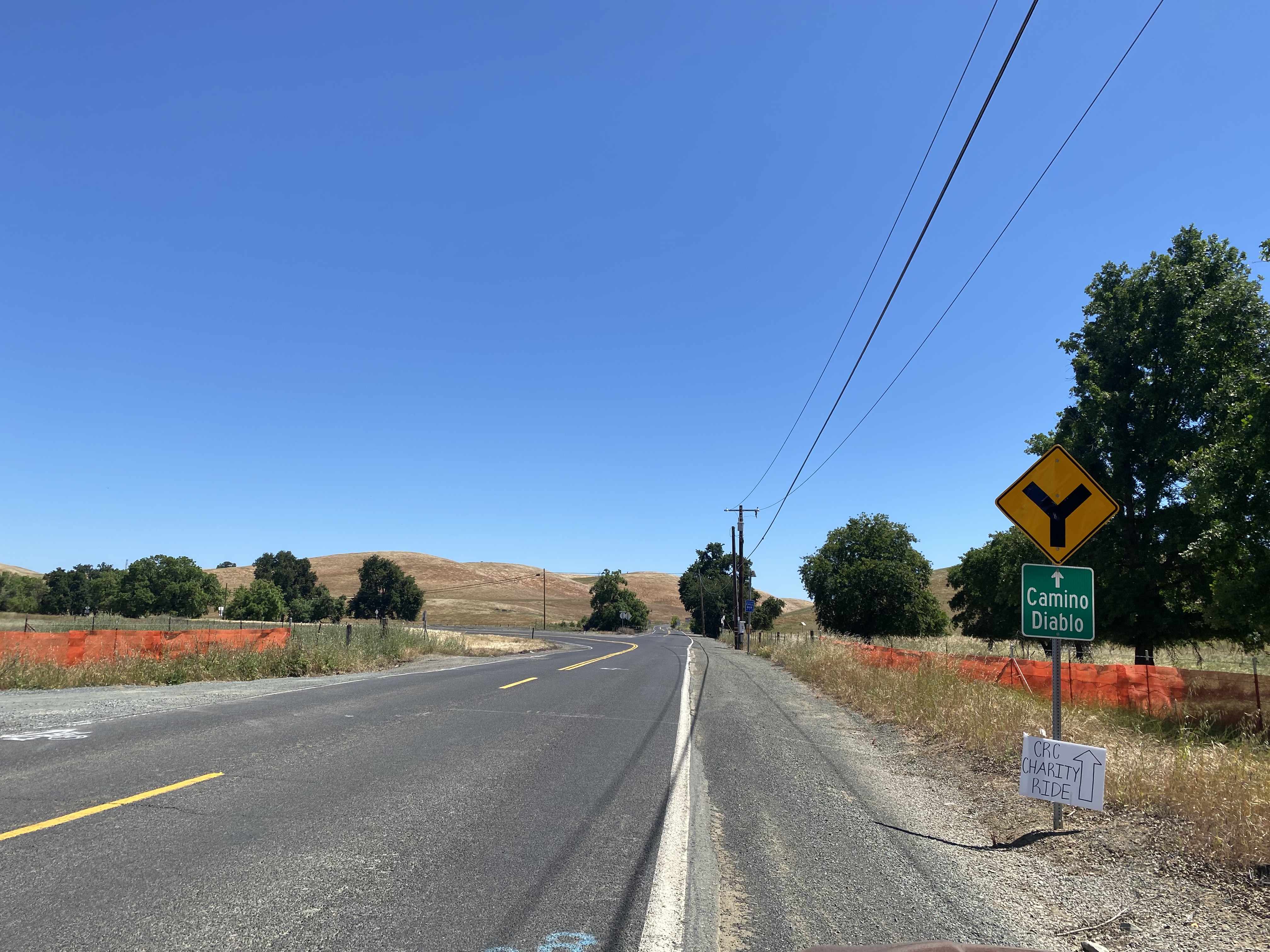
Marsh Creek Road reaches Camino Diablo at a Y Junction located five miles from Brentwood and Byron. As noted in Part 1, Marsh Creek Road originally continued east to Byron.


Part 3; California State Route 4 on Marsh Creek Road near Brentwood
At Post Mile CC R44.367 CA 4 westbound intersects County Route J4 on Byron Highway.


California State Route 4 briefly swings northward on Byron Highway before turning west onto Marsh Creek Road.


California State Route 4 westbound continues on Marsh Creek Road to Vasco Road at Post Mile CC R37.987. Brentwood is signed as four miles to the west as California State Route 4 turns right onto Vasco Road.


California State Route 4 westbound quickly becomes a two-lane freeway which is known as the John Marsh Heritage Highway. California State Route 4 westbound Exit 35 accesses Balfour Road.


California State Route 4 briefly swings northward on Byron Highway before turning west onto Marsh Creek Road.


California State Route 4 westbound continues on Marsh Creek Road to Vasco Road at Post Mile CC R37.987. Brentwood is signed as four miles to the west as California State Route 4 turns right onto Vasco Road.


California State Route 4 westbound quickly becomes a two-lane freeway which is known as the John Marsh Heritage Highway. California State Route 4 westbound Exit 35 accesses Balfour Road.


Comments