
Mines Road is an approximately twenty-eight-mile highway located in the rural parts of the Diablo Range east of the San Francisco Bay Area. Mines Road begins in San Antonio Valley in Santa Clara County and terminates at Tesla Road near Livermore of Alameda County. The highway essentially is a modern overlay of the 1840s Mexican haul trail up Arroyo Mocho known as La Vereda del Monte. The modern corridor of Mines Road took shape in the early twentieth century following development of San Antonio Valley amid a magnesite mining boom.

Part 1; the history of Mines Road
Modern Mines Road partially overlays the historic corridor used by La Vereda del Monte (Mountain Trail). La Vereda del Monte was part of a remote overland route through the Diablo Range primarily used to drive cattle from Alta California to Sonora. The trail was most heavily used during the latter days of Alta California during the 1840s.
La Vereda del Monte originated at Point of Timber between modern day Byron and Brentwood in what is now Contra Costa County. The trail initially crossed part of the Diablo Range south closely approximating the corridor of Vasco Road to take advantage of the waters of Las Tinajas. From Las Tinajas the trail continued south to the site of modern-day Livermore.
La Vereda del Monte south from Livermore Valley ascended back into the Diablo Range towards San Antonio Valley approximating the current corridor of Mines Road. From San Antonio Valley the trail continued south towards Pacheco Pass following a fold in the Diablo Range. From Pacheco Pass the trail continued south towards Panoche Pass onwards to the vicinity of Coalinga near Murrieta Spring where it met up with El Camino Viejo Los Angeles (Old Los Angeles Road).
La Vereda del Monte would largely decline following the conclusion of the Mexican-American War. Following California becoming an American state the trail would be repurposed by those seeking mining claims in the Diablo Range. Arroyo Mocho in general was found to have numerous deposits of magnesite.
The 1876 Thompson & West Atlas of Santa Clara County displays a trail entering San Antonio Valley from the south via Horse Valley and Isabel Valley. The trail is shown to continue north out of San Antonio Valley but ending before reaching Alameda County.


The 1880 Oakland Tribune Map of Alameda County displays what is now Mines Road beginning near Tesla Road near Livermore and extending south via Arroyo Mocho to the property of Henry Issac.

By the 1890s San Antonio Valley had grown enough to merit Postal service. The Deforest Post Office would open in 1892 and would be named after the first community Postmaster Ransford S. Deforest. Post Office service in San Antonio Valley would cease in 1909.
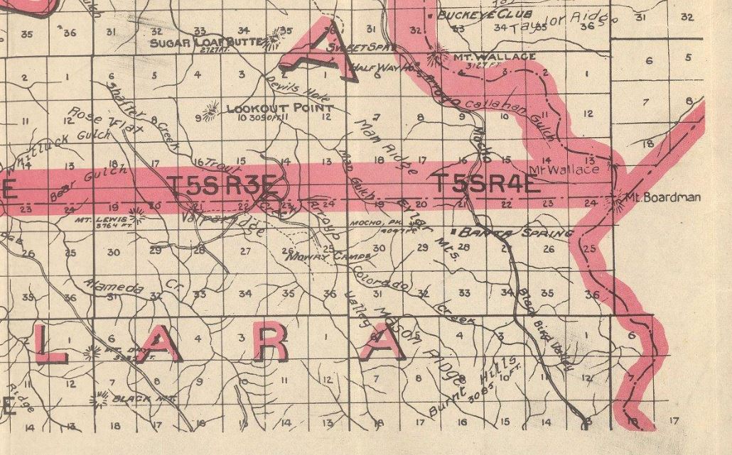
The 1914 Punnett Brothers Map is one of the earliest maps to display Mines Road connecting from San Antonio Valley north to the outskirts of Livermore. The highway is shown to largely follow Arroyo Mocho south from Livermore towards the Santa Clara County line.

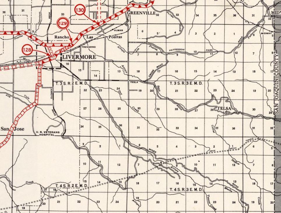
Mines Road can be seen connecting San Antonio Valley Road to Tesla Road near Livermore on the 1935 Division of Highways Maps of Santa Clara County and Alameda County. A road branching east towards the site of the Jones mine (T6SR5E) in Del Puerto Canyon of Stanislaus County can also be seen. Modern Del Puerto Canyon Road was not completed between Patterson and Mines Road until 1942.


Part 2; a drive on Mines Road
Northbound Mines Road begins in San Antonio Valley at the mutual junction with San Antonio Valley Road and Del Puerto Canyon Road. San Antonio Valley Road and Del Puerto Canyon Road is signed as an extension of California State Route 130 east from the official terminus at Mount Hamilton by Santa Clara County. Livermore is signed as being thirty-one miles away as Mines Road begins.


Northbound Mines Road passes through Blackbird Valley and picks up Arroyo Mocho approaching Alameda County. Upon entering Alameda County, the road narrows from two-lanes to a single lane.


Traffic is advised of one lane conditions on the first nine miles of northbound Mines Road in Alameda County.

Mines Roads continues mostly as a single lane road which frequently fords Arroyo Mocho. Mines Road blows out completely to a two-lane configuration near Mud Springs.


Mines Road continues to descend along Arroyo Mocho and makes a right-hand turn at Del Valle Road.


Mines Road enters the outskirts of Livermore and terminates at Tesla Road (County Route J2).


Comments