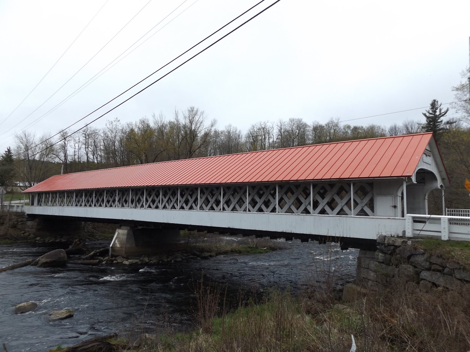
Ashuelot Covered Bridge - New Hampshire


New Hampshire has dozens of covered bridges that grace their presence throughout the Granite State. One such covered bridge is the Ashuelot Covered Bridge, which spans over the Ashuelot River in the Cheshire County community of Ashuelot. Built by master covered bridge builder Nicholas Powers in 1864 at a length of 169 feet, the bridge is designed in the Town lattice style of covered bridges developed by Ithiel Town in 1820 and was rehabilitated in 1999. The bridge was built of the Ashuelot Covered Bridge is considered by local historians to be one of New Hampshire's most elaborate covered bridges. The original purpose of the bridge was to transport wood across the river for use by the Ashuelot Railroad, as the railroad had a station in the upper village of Ashuelot. Eventually, the bridge was converted for use by motor vehicles. At times. this covered bridge has also been called the Village Bridge or Village Station Bridge.


The beauty of the Ashuelot Covered Bridge, as of other covered bridges, is that it is still carrying out its original purpose, to get people and goods from Point A to Point B. There are covered walkways on each end of the bridge, so pedestrians and the occasional vehicle (the bridge sees an average of 510 vehicles a day) don't have to intermingle. At times, special events take place on the bridge, such as an annual dinner event that takes place. But in the end, the covered bridge is about bridging together the community, both now and then.


How to Get There:


Sources and Links:
Ashuelot Bridge - New Hampshire Covered Bridges
Ashuelot Covered Bridge - Bridgehunter.com
New England: True Northeast; Covered Bridge; Ashuelot, N.H. - New York Times  (June 3, 2001)

Comments

Anonymous said…
The Ashuelot covered bridge was NOT built to carry wood across the river for the Ashuelot Railroad. There was plenty of wood on both sides of the railroad. It was built during the Civil War to bring raw materials to the Ashuelot Manufacturing Company that was located on the opposite side of the river and to bring the finished woolen cloths to the railroad. The legend of the "carrying wood" began in the early 1950s when someone speculated in a newspaper article. That legend refuses to die.

Popular posts from this blog

Grand Loop Road of Yellowstone National Park

  Grand Loop Road is a 140 mile loop highway which traverses the interior of Yellowstone National Park.  Grand Loop Road connects all of the major attractions and geological features of Yellowstone National Park along with the entrance roads.  Grand Loop Road is a seasonal highway and despite some conjecture never has been part of the US Route System.   Part 1; the history of Grand Loop Road The majority of history pertaining to Grand Loop Road was taken from the below National Park Service article: Historic Roads - Yellowstone National Park (U.S. National Park Service) (nps.gov) Yellowstone was declared the first National Park of the United States on March 1st, 1872.  The first real highway to access Yellowstone National Park came in 1873 when a tolled facility was constructed from Bozeman, Montana via Yankee Jim Canyon to Mammoth Hot Springs.  Numerous attempts were made to fund construction of roadway infrastructure during the early years of Yellows...

The last 1956-63 era California Sign State Route Spade?

Along southbound California State Route 170 (the Hollywood Freeway Extension) approaching the Hollywood Freeway/Ventura Freeway interchange a white California State Route 134 Sign State Route Spade can be observed on guide sign.  These white spades were specifically used during the 1956-63 era and have become increasingly rare.  This blog is intended to serve as a brief history of the Sign State Route Spade.  We also ask you as the reader, is this last 1956-63 era Sign State Route Spade or do you know of others?  Part 1; the history of the California Sign State Route Spade Prior to the Sign State Route System, the US Route System and the Auto Trails were the only highways in California signed with reassurance markers.  The creation of the US Route System by the American Association of State Highway Officials during November 1926 brought a system of standardized reassurance shields to major highways in California.  Early efforts to create a Sign State Route ...

California State Route 70; the Feather River Highway

From 2017 through to early 2019 I drove the majority of the California State Route 70; the Feather River Highway from CA 89 southwest to CA 99. CA 70 is an approximately 178.5 mile state highway which starts at US 395 near the Nevada State Line and travels west through the Feather River Canyon to CA 99.  CA 70 is often referred to as the Feather River Highway" given it's close association with the river.  Historically CA 70 was previously signed as US 40A and CA 24.  The Legislative Routes prior to the 1964 California Highway Renumbering that made up the current route of CA 70 are as follows: -  Legislative Route Number 21 from US 395 westward to Oroville. -  LRN 87 from Oroville south to Marysville. -  LRN 232 from Marysville to the current junction with CA 99.  CA 70 was even dual signed with CA 99 into Sacramento on what was LRN 232 for a time. The change from US 40A/LRN 21/LRN 87/LRN 232 can be seen by comparing the 1963 State Highway Ma...