2016 Fall Mountain Trip Part 22; Grand Canyon National Park, Arizona State Route 64, and the weird terminus of US Route 180
As noted in Part 21 of the 2016 Fall Mountain Trip series I made a western turn from US Route 89 onto Arizona State Route 64 towards Grand Canyon National Park.

This article serves the 22nd entry in the 2016 Fall Mountain Trip Series. Part 21 covers former US Route 89 over the 1911 Cameron Suspension Bridge.
2016 Fall Mountain Trip Part 21; former US Route 89 over the Cameron Suspension Bridge
AZ 64 is a 108.31 mile State Highway which begins at US 89 in Cameron and travels directly west to Grand Canyon National Park near Desert View. While AZ 64 technically doesn't exist within Grand Canyon National Park the signage posted by the Park Service on Desert View Road and South Entrance Road imply it is a continuation of the route. AZ 64 resumes co-signed with US Route 180 the South Entrance of Grand Canyon National Park in Kaibab National Forest. AZ 64/US 180 multiplex to Valle where the latter splits southeast towards Flagstaff. AZ 64 continues south from Valle towards Williams where passes through Coconino National Forest. AZ 64 terminates at Interstate 40 and Historic US Route 66.

What is currently AZ 64 between the South Entrance of Grand Canyon National Park and Williams predates the Arizona State Highway System. AZ 64 between the Grand Canyon and Williams was part of two Auto Trails; the National Part-to-Park Highway and Southern National Highway. Both Auto Trails can be seen on the 1925 Rand McNally Highway Map of Arizona/New Mexico.


The Arizona State Highway System was created in 1927 to accentuate the new US Route System. Interestingly AZ 64 was not among the original run of Arizona State Routes. Current AZ 64 between the Grand Canyon and Williams is shown as a major road nonetheless on the 1927 Rand McNally Highway Map of Arizona/New Mexico. Interestingly an alternate highway known as "El Paso Grand Canyon Route" is shown to have originated in Parks. This alternate route quickly fell out of favor but exists as a series of Forest Service Roads today.

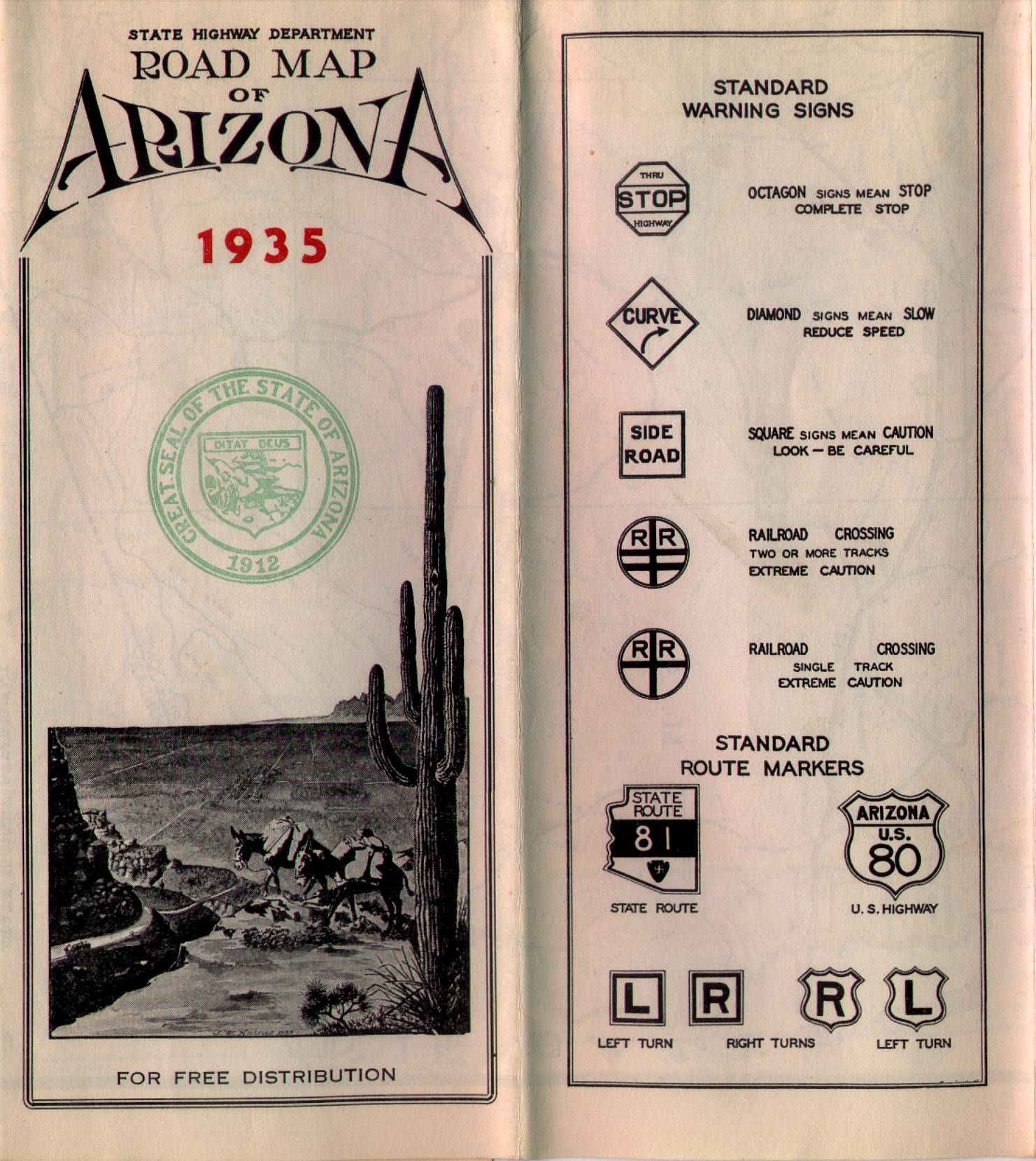
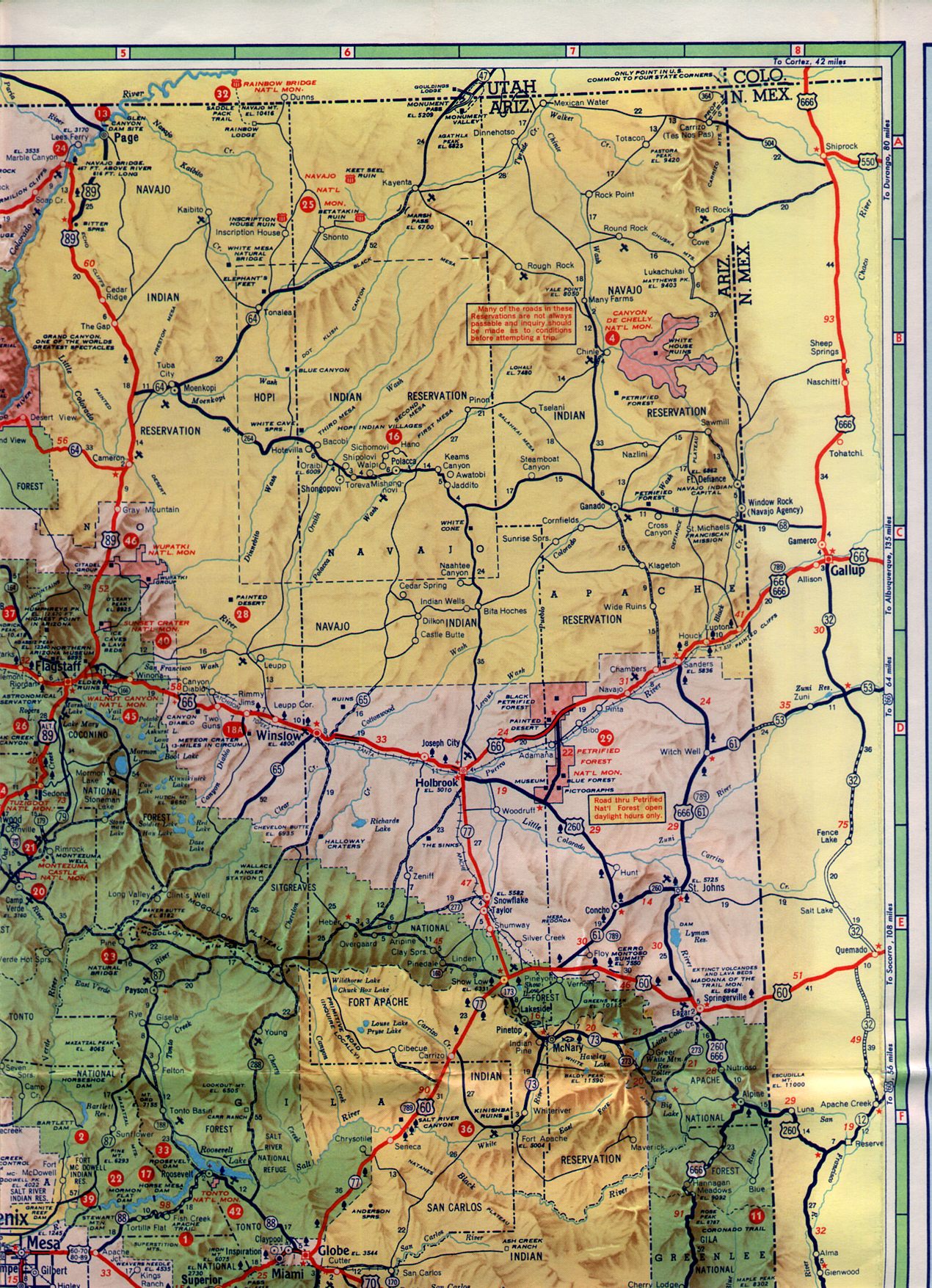
AZ 64 was added to the State Highway System between the Grand Canyon and Williams in 1932. By 1935 AZ 64 was extended east from Grand Canyon National Park to US 89 in Cameron. AZ 64 can be seen on the 1935 Arizona State Highway Department Map.


In 1961 AZ 64 was extended east from Cameron through the Navajo Nation to the New Mexico State Line. AZ 64 can be seen functionally completed to Kayenta on the 1961 Rand McNally Highway Map of Arizona. Note; AZ 364 can be seen as a proposed route in the Four Corners Region on the 1961 Rand McNally Map.

In 1966 AZ 64 from the New Mexico State Line west US 89 was designated as part of US 164. US 164 from Arizona extended eastward to a terminus at Cortez, Colorado. Within Arizona the route of US 164 apparently multiplexed US 89 all the way to Flagstaff. Some of the US 164 field signage can be seen on USends.com.
USends on US 164
In 1970 US 160 was rerouted from Crescent Junction, Utah onto it's current route in Arizona over what was US 164. The change to US 160 can be seen on the 1971 Arizona State Highway Department Map.

My approach to AZ 64 was from US 89 south where I turned westward through a newly constructed (at the time) roundabout in Cameron. AZ 64 west of Cameron is signed as the Bushmaster Memorial Highway.


From Cameron AZ 64 westbound follows the Little Colorado River towards Grand Canyon National Park. The Desert View area within Grand Canyon National Park is located approximately 31 miles west of Cameron. The Desert View area lies atop the the eastern rim of the Grand Canyon where the bend in the Colorado River can be seen. The confluence of the Colorado River/Little Colorado River along with much of the Navajo National can be seen north/northeast from Desert View.


The Desert View area serves as the eastern entrance of Grand Canyon National Park. One of the major attractions in the Desert View area is the Desert View Watchtower. The Desert View Watchtower is a 70 foot structure which was designed by Mary Colter and completed in 1932.


Regarding the National Park status of the Grand Canyon it hasn't always been a certainty which is incredibly surprising in retrospect. The first legislation to establish Grand Canyon National Park came in 1882 when it was introduced by then Senator Benjamin Harrison. The legislation proposed by Harrison failed and did so twice more (in 1883 and 1886) when reintroduced. When Benjamin Harrison became the 23rd U.S. President in 1893 he proclaimed the Grand Canyon National Forest Reserve.
In 1903 then sitting President Theodore Roosevelt stating the following regarding the Grand Canyon which I think far better describes it than I can:
"The Grand Canyon fills me with awe. It is beyond comparison—beyond description; absolutely unparalleled through-out the wide world... Let this great wonder of nature remain as it now is. Do nothing to mar its grandeur, sublimity and loveliness. You cannot improve on it. But what you can do is to keep it for your children, your children's children, and all who come after you, as the one great sight which every American should see."
To that end President Roosevelt declared the Grand Canyon National Game Preserve in November 1906 and later Grand Canyon National Monument in 1908. Additional legislation in 1910 and 1911 was introduced which STILL failed to make the Grand Canyon a National Park. Grand Canyon National Park wasn't declared until February 1919 when it was signed into law by President Woodrow Wilson.
By 1919 the Grand Canyon was the "FIFTEENTH" National Park that was created. Seriously lets examine how fucked up (if it isn't obvious by now this is a rare "hot take") it is that the Grand Canyon (in my opinion the most well known natural landmark in the world) was the fifteenth National Park:
1. Yellowstone had been a National Park since 1872. I love Yellowstone but the Grand Canyon is definitely on par with it.
2. The Wind Cave was a National Park by 1903, Mesa Verde was a National Park by 1906, and Lassen Volcanic National Park was declared in 1916. I'm not saying any of those aren't worthy of being a National Park but who seriously thought they deserved to be added before the Grand Canyon?
3. Woodrow Wilson had to sign the ultimate legislation that made created Grand Canyon National Park. If a total stiff like Woodrow Wilson could recognize the importance of making the Grand Canyon a National Park it is totally inexcusable that so much legislation had failed in the Senate in the decades beforehand.
As noted above AZ 64 is more or less signed by the Park Service within Grand Canyon National Park. This sign can be seen from the exit of the Desert View Area implying Desert View Road as part of AZ 64.

From Desert View I traveled approximately 20 miles westward to Mather Point in Grand Canyon Village. Mather Point may be somewhat of a cliche tourist destination but it does has some awesome views of the Grand Canyon from the South Rim. After hitting a deer on UT 95, descending the Moki Dugway, and driving across the Navajo Nation earlier in the day a couple miles of smooth trail running was in order.


From Mather Point I turned towards Tusayan via South Entrance Road. Much like the Desert View Area the NPS signage seems to imply AZ 64 is continuous through Grand Canyon National Park.

Upon leaving the boundary of Grand Canyon National Park via the South Entrance AZ 64 resumes co-signed with US Route 180 within Kaibab National Forest. US 180 is a functionally westbound route but lacks a directional placard.

The current US 180 is the second iteration of the highway. The current US 180 was designated in 1943 as a new highway entirely contained within in Texas between El Paso and Weatherford. By 1979 US 180 had been extended all the way west to the South Rim of the Grand Canyon in an apparent attempt to chain several National Parks onto a single route (which would make sense since Carlsbad Caverns, Petrified Forest, and Guadalupe Mountains were all National Parks by then). ADOT apparently elected to truncate US 180 to AZ 64 in Valle in 1997 but extended it back to Grand Canyon National Park around 2004. USends.com has numerous photos of the endpoints of US 180 over the years which can be viewed on their US 180 Page.
AZ 64/US 180 travel directly south through Kaibab National Forest and Tusayan before emerging onto a plain atop the Colorado Plateau. As noted above US 180 splits from AZ 64 towards Flagstaff in Valle. This photo from Valle shows AZ 64/US 180 co-signed with a "north" directional placard.

AZ 64 from Valle travels directly south and passes through Coconino National Forest before terminating at Historic US 66/I-40 in Williams.

Part 23 regarding Williams, US 66, and even US 89 can be found below:
2016 Fall Mountain Trip Part 23; former US Route 66 and US Route 89 in Williams

This article serves the 22nd entry in the 2016 Fall Mountain Trip Series. Part 21 covers former US Route 89 over the 1911 Cameron Suspension Bridge.
2016 Fall Mountain Trip Part 21; former US Route 89 over the Cameron Suspension Bridge
AZ 64 is a 108.31 mile State Highway which begins at US 89 in Cameron and travels directly west to Grand Canyon National Park near Desert View. While AZ 64 technically doesn't exist within Grand Canyon National Park the signage posted by the Park Service on Desert View Road and South Entrance Road imply it is a continuation of the route. AZ 64 resumes co-signed with US Route 180 the South Entrance of Grand Canyon National Park in Kaibab National Forest. AZ 64/US 180 multiplex to Valle where the latter splits southeast towards Flagstaff. AZ 64 continues south from Valle towards Williams where passes through Coconino National Forest. AZ 64 terminates at Interstate 40 and Historic US Route 66.

What is currently AZ 64 between the South Entrance of Grand Canyon National Park and Williams predates the Arizona State Highway System. AZ 64 between the Grand Canyon and Williams was part of two Auto Trails; the National Part-to-Park Highway and Southern National Highway. Both Auto Trails can be seen on the 1925 Rand McNally Highway Map of Arizona/New Mexico.


The Arizona State Highway System was created in 1927 to accentuate the new US Route System. Interestingly AZ 64 was not among the original run of Arizona State Routes. Current AZ 64 between the Grand Canyon and Williams is shown as a major road nonetheless on the 1927 Rand McNally Highway Map of Arizona/New Mexico. Interestingly an alternate highway known as "El Paso Grand Canyon Route" is shown to have originated in Parks. This alternate route quickly fell out of favor but exists as a series of Forest Service Roads today.

AZ 64 was added to the State Highway System between the Grand Canyon and Williams in 1932. By 1935 AZ 64 was extended east from Grand Canyon National Park to US 89 in Cameron. AZ 64 can be seen on the 1935 Arizona State Highway Department Map.


In 1961 AZ 64 was extended east from Cameron through the Navajo Nation to the New Mexico State Line. AZ 64 can be seen functionally completed to Kayenta on the 1961 Rand McNally Highway Map of Arizona. Note; AZ 364 can be seen as a proposed route in the Four Corners Region on the 1961 Rand McNally Map.

In 1966 AZ 64 from the New Mexico State Line west US 89 was designated as part of US 164. US 164 from Arizona extended eastward to a terminus at Cortez, Colorado. Within Arizona the route of US 164 apparently multiplexed US 89 all the way to Flagstaff. Some of the US 164 field signage can be seen on USends.com.
USends on US 164
In 1970 US 160 was rerouted from Crescent Junction, Utah onto it's current route in Arizona over what was US 164. The change to US 160 can be seen on the 1971 Arizona State Highway Department Map.

My approach to AZ 64 was from US 89 south where I turned westward through a newly constructed (at the time) roundabout in Cameron. AZ 64 west of Cameron is signed as the Bushmaster Memorial Highway.


From Cameron AZ 64 westbound follows the Little Colorado River towards Grand Canyon National Park. The Desert View area within Grand Canyon National Park is located approximately 31 miles west of Cameron. The Desert View area lies atop the the eastern rim of the Grand Canyon where the bend in the Colorado River can be seen. The confluence of the Colorado River/Little Colorado River along with much of the Navajo National can be seen north/northeast from Desert View.


The Desert View area serves as the eastern entrance of Grand Canyon National Park. One of the major attractions in the Desert View area is the Desert View Watchtower. The Desert View Watchtower is a 70 foot structure which was designed by Mary Colter and completed in 1932.


Regarding the National Park status of the Grand Canyon it hasn't always been a certainty which is incredibly surprising in retrospect. The first legislation to establish Grand Canyon National Park came in 1882 when it was introduced by then Senator Benjamin Harrison. The legislation proposed by Harrison failed and did so twice more (in 1883 and 1886) when reintroduced. When Benjamin Harrison became the 23rd U.S. President in 1893 he proclaimed the Grand Canyon National Forest Reserve.
In 1903 then sitting President Theodore Roosevelt stating the following regarding the Grand Canyon which I think far better describes it than I can:
"The Grand Canyon fills me with awe. It is beyond comparison—beyond description; absolutely unparalleled through-out the wide world... Let this great wonder of nature remain as it now is. Do nothing to mar its grandeur, sublimity and loveliness. You cannot improve on it. But what you can do is to keep it for your children, your children's children, and all who come after you, as the one great sight which every American should see."
To that end President Roosevelt declared the Grand Canyon National Game Preserve in November 1906 and later Grand Canyon National Monument in 1908. Additional legislation in 1910 and 1911 was introduced which STILL failed to make the Grand Canyon a National Park. Grand Canyon National Park wasn't declared until February 1919 when it was signed into law by President Woodrow Wilson.
By 1919 the Grand Canyon was the "FIFTEENTH" National Park that was created. Seriously lets examine how fucked up (if it isn't obvious by now this is a rare "hot take") it is that the Grand Canyon (in my opinion the most well known natural landmark in the world) was the fifteenth National Park:
1. Yellowstone had been a National Park since 1872. I love Yellowstone but the Grand Canyon is definitely on par with it.
2. The Wind Cave was a National Park by 1903, Mesa Verde was a National Park by 1906, and Lassen Volcanic National Park was declared in 1916. I'm not saying any of those aren't worthy of being a National Park but who seriously thought they deserved to be added before the Grand Canyon?
3. Woodrow Wilson had to sign the ultimate legislation that made created Grand Canyon National Park. If a total stiff like Woodrow Wilson could recognize the importance of making the Grand Canyon a National Park it is totally inexcusable that so much legislation had failed in the Senate in the decades beforehand.
As noted above AZ 64 is more or less signed by the Park Service within Grand Canyon National Park. This sign can be seen from the exit of the Desert View Area implying Desert View Road as part of AZ 64.

From Desert View I traveled approximately 20 miles westward to Mather Point in Grand Canyon Village. Mather Point may be somewhat of a cliche tourist destination but it does has some awesome views of the Grand Canyon from the South Rim. After hitting a deer on UT 95, descending the Moki Dugway, and driving across the Navajo Nation earlier in the day a couple miles of smooth trail running was in order.


From Mather Point I turned towards Tusayan via South Entrance Road. Much like the Desert View Area the NPS signage seems to imply AZ 64 is continuous through Grand Canyon National Park.

Upon leaving the boundary of Grand Canyon National Park via the South Entrance AZ 64 resumes co-signed with US Route 180 within Kaibab National Forest. US 180 is a functionally westbound route but lacks a directional placard.

The current US 180 is the second iteration of the highway. The current US 180 was designated in 1943 as a new highway entirely contained within in Texas between El Paso and Weatherford. By 1979 US 180 had been extended all the way west to the South Rim of the Grand Canyon in an apparent attempt to chain several National Parks onto a single route (which would make sense since Carlsbad Caverns, Petrified Forest, and Guadalupe Mountains were all National Parks by then). ADOT apparently elected to truncate US 180 to AZ 64 in Valle in 1997 but extended it back to Grand Canyon National Park around 2004. USends.com has numerous photos of the endpoints of US 180 over the years which can be viewed on their US 180 Page.
AZ 64/US 180 travel directly south through Kaibab National Forest and Tusayan before emerging onto a plain atop the Colorado Plateau. As noted above US 180 splits from AZ 64 towards Flagstaff in Valle. This photo from Valle shows AZ 64/US 180 co-signed with a "north" directional placard.

AZ 64 from Valle travels directly south and passes through Coconino National Forest before terminating at Historic US 66/I-40 in Williams.

Part 23 regarding Williams, US 66, and even US 89 can be found below:
2016 Fall Mountain Trip Part 23; former US Route 66 and US Route 89 in Williams
Comments