California State Route 51; failed Interstate 80 on the Capitol City Freeway, the I-80 Business Loop, and former US 40/99E
The final route I took on the way back from Lake Tahoe this past weekend was on California State Route 51 through Sacramento which is known as the Interstate 80 Business Loop/Capitol City Freeway.

CA 51 is a hidden designation for the 9 mile I-80 Business Loop on the Capitol City Freeway. In short most people known of CA 51 due to the signage oddity it carries with the I-80 Business Loop being entirely signed on the Capitol City Freeway which was once part of I-80. The story of CA 51 is incredibly complicated and dates back to the earliest times of the State Highway System in California.
What eventually became CA 51 was originally defined as a State Highway during the 1909 First State Highway Bond Issue. Said highway was to run from Sacramento north to the Oregon State Line and eventually would be assigned Legislative Route Number 3.
CAhighways.org on LRN 3
LRN 3 north out of Sacramento took the following route (for purposes of simplicity I'm including what was North Sacramento into this description):
- From L Street; 16th Street over the American River to Del Paso Boulevard.
- Del Paso Boulevard to El Camino Avenue to Auburn Boulevard.
- Auburn Boulevard towards Roseville.
When the US Route system was finalized the route of LRN 3 north out of Sacramento was assigned US Route 40 and US Route 99E. US 40/99E can be seen on LRN 3 north out of Sacramento on the first year to display a City Insert on the State Highway Map in 1934.

1934 was also the first year the Signed State Highways were plotted out. By 1938 they appear alongside all other State Highways in Sacramento, the route of US 40/99E is much more clear on said map.

In 1944 the first major change to LRN 3 in the Sacramento Area appears with a planned bypass of North Sacramento.
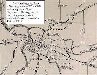
By 1948 the North Sacramento Bypass was completed. The North Sacramento Bypass would eventually became parts of CA 160 on the North Sacramento Freeway in addition to CA 51 on the Capitol City Freeway north of the American River.

By 1951 a new planned route for US 99E to cross the American River appears on the City Insert of Sacramento. This newly planned route of US 99E would be assigned to pre-existing LRN 98.

By 1955 a fully planned routing of US 99E over the American River to US 50 and the mainline US 99 appears on the City Insert for Sacramento.

By 1956 the new US 99E alignment was completed from US 40 north of the American River south to US 99. US 99E utilized 29th and 30th Street in one-way configurations to reach US 99.

During the 1964 State Highway renumbering LRN 80 was assigned onto US 99E to US 99 indicating it planned as the future route of Interstate 80. The planned route of Interstate-880 is shown bypassing Sacramento to the north.

By 1965 a new freeway grade is completed to US 99 and I-80 is co-signed into Sacramento on US 99E.

In 1966 a new planned alignment of I-80 appears next US 99E/I-80 from the American River north to the planned I-880.

In 1967 US 40, US 99E, and US 99W all disappear from California. US 99 is reassigned as CA 99.
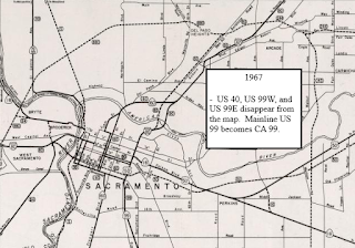
By 1969 I-80 is shown complete through downtown Sacramento but the former alignment of US 99E is shown as Temporary I-80. The routing of US 99E didn't meet Interstate standards despite being a freeway.

In 1981 the planned alignment of I-80 was cancelled by the State Legislature. This action led to the creation of CA 51 and the legislative definition that it must be signed as the I-80BL.
CAhighways.org on CA 51
On the 1982 LRN 51 first appears along I-80 in Sacramento. I-880 is still shown signed north of downtown Sacramento but it is shown with LRN 80 indicating that I-80 would soon shift.

On the 1986 State Highway Map the I-80 Business Loop appears and I-80 is shown north of downtown Sacramento. The I-80BL looped back to I-80 west of downtown Sacramento on LRN 50 which essentially was US 50.

According to CAhighways.org in 2015 Caltrans planned on removing the I-80BL shields from US 50 which essentially made it a Business Spur. The Capitol City Freeway designation was de-emphasized on US 50 and was to be displayed on CA 51 alone.
So with all the above in mind CA 51/I-80BL starts southbound at I-80 exit 95.

Southbound on CA 51/I-80BL the Capitol City Freeway designation is strongly emphasized. Exit numbers still follow the original configuration of the Capitol City Freeway on CA 51 and US 50.

CA 51/I-80BL enter the City of Sacramento 1 mile north of Exit 12 at Fulton Avenue.


At Marconi Avenue CA 51/I-80BL has something of Dead Man's curve which was part of the reason the alignment is not up to Interstate Standards.

At exit 9B CA 51/I-80BL meets CA 160 and the North Sacramento Freeway.

CA 51/I-80BL has one last exit at Exposition Boulevard (exit 9A) before crossing the American River.


CA 51/I-80BL ends at the junction of US 50/CA 99 at exit 6A. As originally envisioned the I-80BL continued west on US 50 via exit 6A back to I-80.


CA 51 is a hidden designation for the 9 mile I-80 Business Loop on the Capitol City Freeway. In short most people known of CA 51 due to the signage oddity it carries with the I-80 Business Loop being entirely signed on the Capitol City Freeway which was once part of I-80. The story of CA 51 is incredibly complicated and dates back to the earliest times of the State Highway System in California.
What eventually became CA 51 was originally defined as a State Highway during the 1909 First State Highway Bond Issue. Said highway was to run from Sacramento north to the Oregon State Line and eventually would be assigned Legislative Route Number 3.
CAhighways.org on LRN 3
LRN 3 north out of Sacramento took the following route (for purposes of simplicity I'm including what was North Sacramento into this description):
- From L Street; 16th Street over the American River to Del Paso Boulevard.
- Del Paso Boulevard to El Camino Avenue to Auburn Boulevard.
- Auburn Boulevard towards Roseville.
When the US Route system was finalized the route of LRN 3 north out of Sacramento was assigned US Route 40 and US Route 99E. US 40/99E can be seen on LRN 3 north out of Sacramento on the first year to display a City Insert on the State Highway Map in 1934.

1934 was also the first year the Signed State Highways were plotted out. By 1938 they appear alongside all other State Highways in Sacramento, the route of US 40/99E is much more clear on said map.

In 1944 the first major change to LRN 3 in the Sacramento Area appears with a planned bypass of North Sacramento.

By 1948 the North Sacramento Bypass was completed. The North Sacramento Bypass would eventually became parts of CA 160 on the North Sacramento Freeway in addition to CA 51 on the Capitol City Freeway north of the American River.

By 1951 a new planned route for US 99E to cross the American River appears on the City Insert of Sacramento. This newly planned route of US 99E would be assigned to pre-existing LRN 98.

By 1955 a fully planned routing of US 99E over the American River to US 50 and the mainline US 99 appears on the City Insert for Sacramento.

By 1956 the new US 99E alignment was completed from US 40 north of the American River south to US 99. US 99E utilized 29th and 30th Street in one-way configurations to reach US 99.

During the 1964 State Highway renumbering LRN 80 was assigned onto US 99E to US 99 indicating it planned as the future route of Interstate 80. The planned route of Interstate-880 is shown bypassing Sacramento to the north.

By 1965 a new freeway grade is completed to US 99 and I-80 is co-signed into Sacramento on US 99E.

In 1966 a new planned alignment of I-80 appears next US 99E/I-80 from the American River north to the planned I-880.

In 1967 US 40, US 99E, and US 99W all disappear from California. US 99 is reassigned as CA 99.

By 1969 I-80 is shown complete through downtown Sacramento but the former alignment of US 99E is shown as Temporary I-80. The routing of US 99E didn't meet Interstate standards despite being a freeway.

In 1981 the planned alignment of I-80 was cancelled by the State Legislature. This action led to the creation of CA 51 and the legislative definition that it must be signed as the I-80BL.
CAhighways.org on CA 51
On the 1982 LRN 51 first appears along I-80 in Sacramento. I-880 is still shown signed north of downtown Sacramento but it is shown with LRN 80 indicating that I-80 would soon shift.

On the 1986 State Highway Map the I-80 Business Loop appears and I-80 is shown north of downtown Sacramento. The I-80BL looped back to I-80 west of downtown Sacramento on LRN 50 which essentially was US 50.

According to CAhighways.org in 2015 Caltrans planned on removing the I-80BL shields from US 50 which essentially made it a Business Spur. The Capitol City Freeway designation was de-emphasized on US 50 and was to be displayed on CA 51 alone.
So with all the above in mind CA 51/I-80BL starts southbound at I-80 exit 95.

Southbound on CA 51/I-80BL the Capitol City Freeway designation is strongly emphasized. Exit numbers still follow the original configuration of the Capitol City Freeway on CA 51 and US 50.

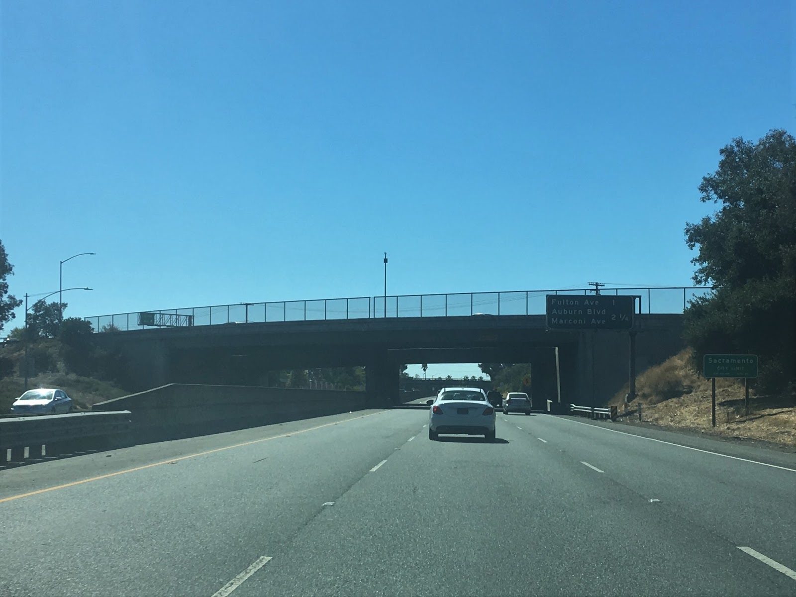

At Marconi Avenue CA 51/I-80BL has something of Dead Man's curve which was part of the reason the alignment is not up to Interstate Standards.

At exit 9B CA 51/I-80BL meets CA 160 and the North Sacramento Freeway.

CA 51/I-80BL has one last exit at Exposition Boulevard (exit 9A) before crossing the American River.


CA 51/I-80BL ends at the junction of US 50/CA 99 at exit 6A. As originally envisioned the I-80BL continued west on US 50 via exit 6A back to I-80.

Comments
CHRIS