Crossing back over to the western flank of the Sierras earlier this month I took the entirety of California State Route 174 from Grass Valley in Nevada County to Colfax in Placer County.

CA 174 is a short 13 mile State Highway between CA 20/49 in Grass Valley and I-80 in Colfax. CA 174 southbound begins at the CA 20/49 freeway at exit 182A in Grass Valley.


The southbound lane of CA 174 uses Tinloy Street to reach Colfax Avenue.

CA 174 southbound uses Colfax Avenue which becomes the Colfax Highway exiting Grass Valley. CA 174 is signed as the Officer Bill C. Bean Jr. Memorial Highway.


Empire Street from CA 174 southbound accesses Empire Mine State Historic Park.

There is a mining head frame located on Empire Street just off of CA 174.


The Empire Mine opened in 1850 after gold bearing quartz was found near Grass Valley. Much of early mining activity in California used Placer methods but the hard rock surface around Grass Valley made that impractical. Hard rock mining methods were used at the very beginning of the Empire Mine up until it's closure in 1956.

The State Park has many well preserved structures from the history of the Empire Mine such as the Empire Cottage from 1897 built for William Bourn Jr.. The Empire Mine was not very profitable until 1869 when it was acquired by William Bourn Sr. William Bourn Sr. died in 1874 and management of the Empire Mine eventually fell to his son William Bourn Jr. in 1879.

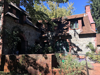

The 1905 Empire Clubhouse stands directly south of the 1897 Bourn Cottage.


Ahead is the remains of the Empire Mine Stamp Mill which once had 80 stamps. Gold was retrieved from the smashed ore via use of mercury which used to cover stamp tables.

The building ahead was constructed in 1898 to house the Mine Manager's Office, Assay Office, rescue station, and a refining room.


The metal building ahead is the 1886 Empire Mine Machine Shop.


Access to the Main Empire Shaft is located at the back of the Machine Shop. The Main Shaft was traversed approximately 4,600 feet via use of ore cart which doubled as transport for the miners.


The Compressor Building ahead pumped oxygen into the Empire Mine.


The Empire Mine visitor center has various mineral samples from various mines.


Returning to CA 174 southbound from the Empire Mine it crosses through Union Hill before entering Cedar Ridge.

CA 174 southbound traverses the low Sierra Foothills and consequently has some curvy terrain.


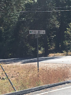
CA 174 has a notable junction with You Bet Road which heads east to the Gold Rush Community of the same name.
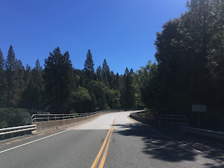
South from You Bet Road CA 174 traverses more of the Sierra Foothills before crossing the Bear River in Placer County. There is an older alignment of CA 174 crossing the Bear River just east of the modern bridge.


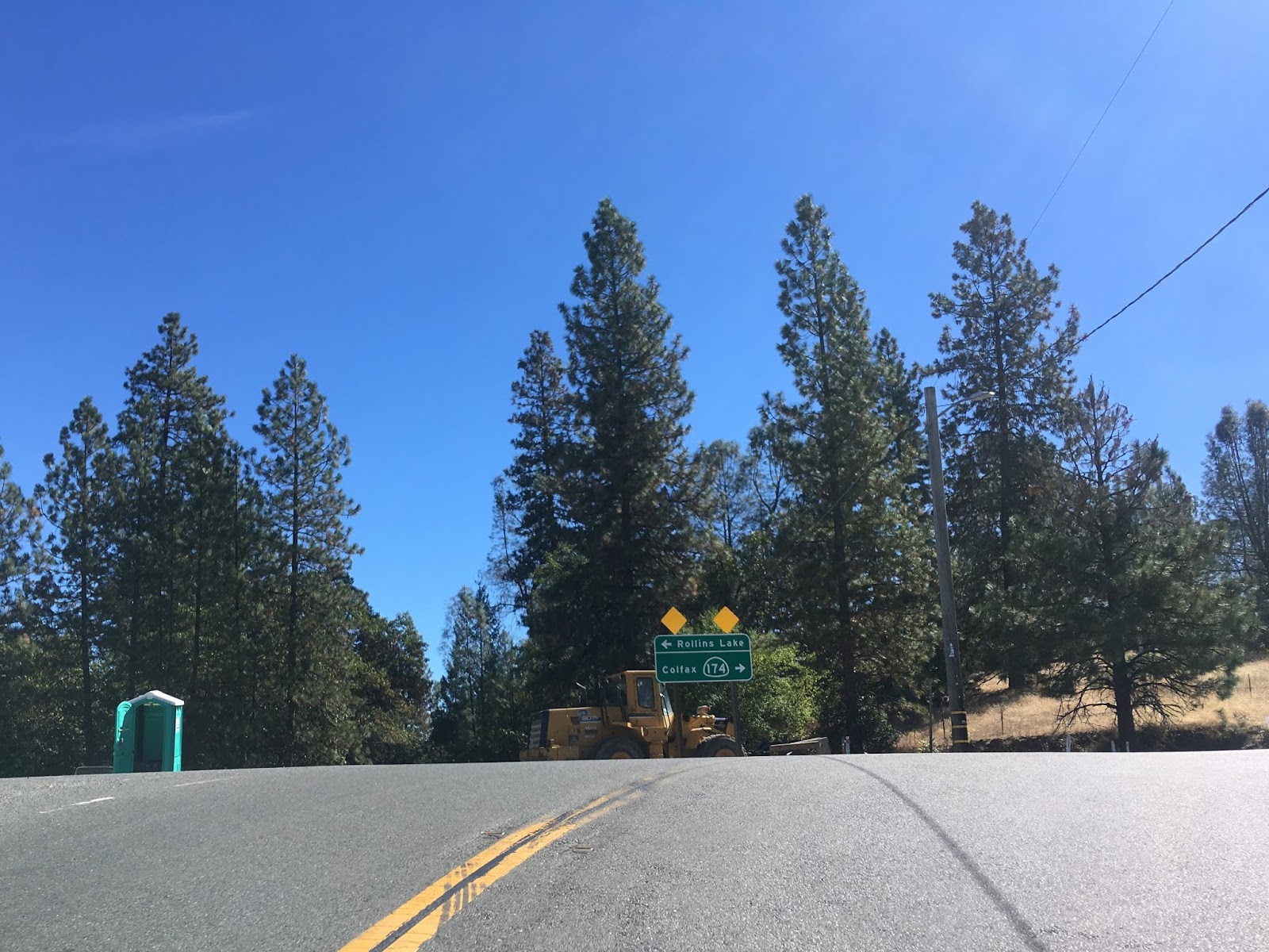
CA 174 ascends from the Bear River and continues south into Colfax.


CA 174 southbound crosses the Union Pacific tracks and turns on to Auburn Street in downtown Colfax.


CA 174 ends at a couple right-on/right-off ramps located at I-80 exit 135.

The routing of CA 174 was added to the State Highway system in 1933 as a southern extension of Legislative Route Number 25 from Nevada City to Colfax. The routing of LRN 25 south of Nevada City to Colfax was unnumbered until 1964 when it was assigned CA 174 during the California Highway Renumbering.
CAhighways.org on CA 174
CAhighways.org on LRN 25
The change from LRN 25 to CA 174 can be observed by comparing the 1963 and 1964 State Highway Maps.
1963 State Highway Map
1964 State Highway Map

CA 174 is a short 13 mile State Highway between CA 20/49 in Grass Valley and I-80 in Colfax. CA 174 southbound begins at the CA 20/49 freeway at exit 182A in Grass Valley.


The southbound lane of CA 174 uses Tinloy Street to reach Colfax Avenue.

CA 174 southbound uses Colfax Avenue which becomes the Colfax Highway exiting Grass Valley. CA 174 is signed as the Officer Bill C. Bean Jr. Memorial Highway.


Empire Street from CA 174 southbound accesses Empire Mine State Historic Park.

There is a mining head frame located on Empire Street just off of CA 174.


The Empire Mine opened in 1850 after gold bearing quartz was found near Grass Valley. Much of early mining activity in California used Placer methods but the hard rock surface around Grass Valley made that impractical. Hard rock mining methods were used at the very beginning of the Empire Mine up until it's closure in 1956.

The State Park has many well preserved structures from the history of the Empire Mine such as the Empire Cottage from 1897 built for William Bourn Jr.. The Empire Mine was not very profitable until 1869 when it was acquired by William Bourn Sr. William Bourn Sr. died in 1874 and management of the Empire Mine eventually fell to his son William Bourn Jr. in 1879.


The 1905 Empire Clubhouse stands directly south of the 1897 Bourn Cottage.


Ahead is the remains of the Empire Mine Stamp Mill which once had 80 stamps. Gold was retrieved from the smashed ore via use of mercury which used to cover stamp tables.

The building ahead was constructed in 1898 to house the Mine Manager's Office, Assay Office, rescue station, and a refining room.


The metal building ahead is the 1886 Empire Mine Machine Shop.


Access to the Main Empire Shaft is located at the back of the Machine Shop. The Main Shaft was traversed approximately 4,600 feet via use of ore cart which doubled as transport for the miners.


The Compressor Building ahead pumped oxygen into the Empire Mine.


The Empire Mine visitor center has various mineral samples from various mines.


Returning to CA 174 southbound from the Empire Mine it crosses through Union Hill before entering Cedar Ridge.

CA 174 southbound traverses the low Sierra Foothills and consequently has some curvy terrain.


CA 174 has a notable junction with You Bet Road which heads east to the Gold Rush Community of the same name.

South from You Bet Road CA 174 traverses more of the Sierra Foothills before crossing the Bear River in Placer County. There is an older alignment of CA 174 crossing the Bear River just east of the modern bridge.


CA 174 ascends from the Bear River and continues south into Colfax.


CA 174 southbound crosses the Union Pacific tracks and turns on to Auburn Street in downtown Colfax.


CA 174 ends at a couple right-on/right-off ramps located at I-80 exit 135.

The routing of CA 174 was added to the State Highway system in 1933 as a southern extension of Legislative Route Number 25 from Nevada City to Colfax. The routing of LRN 25 south of Nevada City to Colfax was unnumbered until 1964 when it was assigned CA 174 during the California Highway Renumbering.
CAhighways.org on CA 174
CAhighways.org on LRN 25
The change from LRN 25 to CA 174 can be observed by comparing the 1963 and 1964 State Highway Maps.
1963 State Highway Map
1964 State Highway Map
Comments