In keeping with the work legwork I had already done digging into the alignment history of US 99 and CA 168 in Fresno I decided to complete the circuit of the city with CA 180 in addition to CA 41. I started the day off with what was CA 180 westbound in 1934 and finished by mid-day on what was CA 41 southbound. Before I get into the photos of both highways I'll discuss my map findings first.
Starting with CA 180 the alignment of the highway westbound through Fresno was originally as follows in 1934:
- Kings Canyon Road
- Ventura Street
- A multiplex of US 99 on Broadway Street to Fresno Street where CA 41 would be picked up
- Fresno Street multiplexed with CA 41 to C Street, CA 180 continued west to B Street
- B Street to Whitesbridge Avenue
- Whitesbridge Avenue to exit the city of Fresno
In 1956 the first major alignment change for CA 180 Fresno occurred.
- Westbound and eastbound traffic was split onto one-way street alignments. Westbound CA 180 from Ventura Street ran on P Street and Stanislaus Street to Broadway Street. Eastbound CA 180 traffic utilized Tuolumne Street to O Street from Broadway Street to reach Ventura Street. This led to a situation where both CA 41 and CA 180 were multiplexed through almost all of downtown Fresno.
In 1959 the bridges on Stanislaus Street and Tuolumne Street over the Southern Pacific Railroad. CA 180 was extended over both Stanislaus Street and Tuolumne Street in one-way configurations to reach B Street. The previous alignment on Broadway Street and Fresno Street were removed from the state highway system.
In 1961 CA 180 was shifted to one-way configurations in west Fresno:
- Westbound traffic continued to use B Street from Tuolumne Street to reach Whitesbridge Avenue. Whitesbridge was only one-way westbound until Amador Street where two-way traffic would resume.
- Eastbound traffic split from Whitesbridge Avenue entering Fresno at Amador Street. Eastbound traffic used Amador Street and A Street to reach Tuolumne Street.
In the 1990s and early 2000s the surface alignments of CA 180 were replaced by the modern freeway that serves as part of a beltway around downtown Fresno. The maps I created showing the surface alignment history of CA 180 can be seen here.


CA 41 in my opinion had the stranger alignment history through downtown Fresno. Southbound the original alignment of CA 41 would have been the following in 1934:
- Blackstone Avenue
- Stanislaus Street
- Broadway Street on a brief multiplex of US 99
- Fresno Street on a multiplex with CA 180
- C Street splitting south from CA 180
- Elm Avenue
In 1956 CA 41 was split onto the same Stanislaus Street/Tuolumne one-way configuration as CA 180. CA 41 was also split between Blackstone Avenue and Abby Street from downtown north just a small ways past Olive Avenue. Blackstone Avenue carried southbound traffic while Abby Street carried northbound.
In 1957 CA 41 was extended south on Broadway Street away from Fresno Street to Ventura Street. CA 41 utilized Ventura Street to reach C Street and Elm Avenue. Oddly this configuration lasted only a year as in 1958 CA 41 was moved to O Street for Southbound traffic and P Street for northbound which multiplexed CA 180 to Ventura Street. CA 41 continued to use Ventura Street to reach C Street until the highway was ultimately upgraded to a freeway in the late 1970s and 1980s. My surface alignment maps of CA 41 that I drafted can be found below.


Note; in 2019 I did a new blog regarding the alignment of CA 41 in Pinedale to the 1889 Lanes Bridge. Said blog can be found below:
1889 Lanes Bridge Location (Old CA 41)
Starting with the picture portion of the blog I began my day out in east Fresno on Kings Canyon Road where it now dead ends at the CA 180 freeway. Previous to the freeway Kings Canyon Road would have continued east into the Sierras from this location.


Looking westbound on Kings Canyon Road I started out by checking out what appears to be an old school house. Apparently this building is still utilized as a local church, I was under the impression it was abandoned until I asked the people bringing stuff inside what it was these days.


Crossing Temperance Avenue on Kings Canyon Road the boundary of the city of Fresno is obvious when the roadway becomes divided.

I'm not sure when the change had occurred but originally all of Kings Canyon Road was part of Ventura Street. The Kings Canyon name in my opinion is far more fitting given that CA 180 has always had an eastern terminus at the canyon of the same name.

Kings Canyon Road is a direct shot westward towards downtown Fresno where it becomes Ventura Street at First Street.
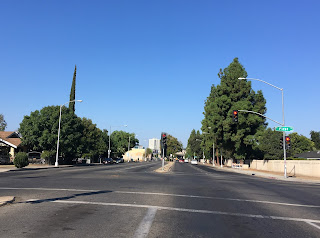

Ventura Street curves southward into downtown under the CA 41 freeway, CA 180 would have made a right onto US 99 at Broadway Street.


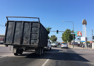
As I stated in my US 99 blog Broadway is gapped up by a baseball field at Inyo Street. CA 180 would have followed US 99 on along Broadway Street to Fresno Street when it was still accessible.


Given I used Van Ness to reach Fresno Street it gave me an opportunity to check in on the progress of the Fulton Street rebuilding project. Fulton Street has been closed to automobile traffic since the 1960s and is slated to reopen on October the 21st. Fulton Street appears to be almost finished from what I observed.


Resuming the original 1934 routing of CA 180 at Broadway and Fresno Street I continued westbound under the Southern Pacific Railroad tracks in addition to the CA 99 freeway to B Street. CA 41 would have multiplexed CA 180 along Fresno Street to C Street before splitting south.


On B Street the alignment drops to one-way westbound from Stanislaus Street. The one-way alignment continues onto Whitesbridge until it meets Amador Street directly next to Fresno Chandler Executive Airport. My understanding about Fresno Chandler is it was for a very short time after World War II the primary commercial airport until the bulk of the traffic was shifted to now what is Fresno-Yosemite International Airport.


Whitesbridge Avenue continues west passing a couple weird looking CA 180 shields before dead ending at the CA 180 freeway.


I backtracked to Marks Avenue and jumped on the CA 180 freeway to take it to the freeway CA 41 north. I got off at Shaw Avenue and made my way to the intersection with Blackstone Avenue which if you recall from the CA 168 thread was the original terminus of said highway at what was the original CA 41. 1934 CA 41 would have used Blackstone Avenue southbound to reach downtown Fresno.


South on Blackstone the one-way configuration with Abby Street is still in place to this very day.

Blackstone travels underneath the CA 180 freeway before ending at Stanislaus Street where southbound CA 41 would have once turned.

At Broadway Street CA 41 would have turned off of Stanislaus Street. The 1950s era bridge on Stanislaus Street is obvious given the height it carries over the rails.


CA 41 would have used Broadway Street multiplexed with US 99 until splitting off at Fresno Street to multiplex CA 180 to C Street. I actually went down C Street earlier in the day when I was driving the original CA 180 alignment hence the recycled pictures.


C Street used to continue to Elm Avenue but now it is cut off at San Benito Street. Elm Avenue can be seen from the intersection of San Benito Street and Elm Avenue, CA 41 would have continued south out of the city of Fresno towards Kings County.


Just for kicks to close out the day I drove over both the 1950s era CA 180 highway bridges over Stanislaus Street and Tuolumne Street. There is actually some really nice views of the valley and downtown Fresno from the bridges.


Both CA 41 and CA 180 have been frequent topics of discussion on Gribblenation, the links below will direct you to the other articles pertaining to the two highways.
CA 180 Articles
CA 180 from CA 99 west to CA 33
Signed County Route J1 and Old CA 180 on Panoche Road
California State Route 180 east of Fresno to Cedar Grove (Kings Canyon Highway)
Old California State Route 180 on Dunlap Road
CA 180 Kings Canyon Expressway and Sequoia-Kings Canyon Freeway
CA 41 Articles
1941 Lanes Bridge Renovations (Old_California_State_Route 41)
Old CA 180 and CA 41 surface alignments in Fresno
Old California State Route 41 on Road 425B
California State Route 41; Madera County Line north to Yosemite National Park
Legacy of US Route 466 Part 1; California State Route 46
Old California State Route 41 in Southern Fresno County and the expressway thatnever was
Legacy of US Route 466 Part 3; Morro Bay to Shandon (California State Route 229 and 41)
California State Route 41; CA 33 north to CA 180/168
1889 Lanes Bridge Location (Old CA 41)
Starting with CA 180 the alignment of the highway westbound through Fresno was originally as follows in 1934:
- Kings Canyon Road
- Ventura Street
- A multiplex of US 99 on Broadway Street to Fresno Street where CA 41 would be picked up
- Fresno Street multiplexed with CA 41 to C Street, CA 180 continued west to B Street
- B Street to Whitesbridge Avenue
- Whitesbridge Avenue to exit the city of Fresno
In 1956 the first major alignment change for CA 180 Fresno occurred.
- Westbound and eastbound traffic was split onto one-way street alignments. Westbound CA 180 from Ventura Street ran on P Street and Stanislaus Street to Broadway Street. Eastbound CA 180 traffic utilized Tuolumne Street to O Street from Broadway Street to reach Ventura Street. This led to a situation where both CA 41 and CA 180 were multiplexed through almost all of downtown Fresno.
In 1959 the bridges on Stanislaus Street and Tuolumne Street over the Southern Pacific Railroad. CA 180 was extended over both Stanislaus Street and Tuolumne Street in one-way configurations to reach B Street. The previous alignment on Broadway Street and Fresno Street were removed from the state highway system.
In 1961 CA 180 was shifted to one-way configurations in west Fresno:
- Westbound traffic continued to use B Street from Tuolumne Street to reach Whitesbridge Avenue. Whitesbridge was only one-way westbound until Amador Street where two-way traffic would resume.
- Eastbound traffic split from Whitesbridge Avenue entering Fresno at Amador Street. Eastbound traffic used Amador Street and A Street to reach Tuolumne Street.
In the 1990s and early 2000s the surface alignments of CA 180 were replaced by the modern freeway that serves as part of a beltway around downtown Fresno. The maps I created showing the surface alignment history of CA 180 can be seen here.


CA 41 in my opinion had the stranger alignment history through downtown Fresno. Southbound the original alignment of CA 41 would have been the following in 1934:
- Blackstone Avenue
- Stanislaus Street
- Broadway Street on a brief multiplex of US 99
- Fresno Street on a multiplex with CA 180
- C Street splitting south from CA 180
- Elm Avenue
In 1956 CA 41 was split onto the same Stanislaus Street/Tuolumne one-way configuration as CA 180. CA 41 was also split between Blackstone Avenue and Abby Street from downtown north just a small ways past Olive Avenue. Blackstone Avenue carried southbound traffic while Abby Street carried northbound.
In 1957 CA 41 was extended south on Broadway Street away from Fresno Street to Ventura Street. CA 41 utilized Ventura Street to reach C Street and Elm Avenue. Oddly this configuration lasted only a year as in 1958 CA 41 was moved to O Street for Southbound traffic and P Street for northbound which multiplexed CA 180 to Ventura Street. CA 41 continued to use Ventura Street to reach C Street until the highway was ultimately upgraded to a freeway in the late 1970s and 1980s. My surface alignment maps of CA 41 that I drafted can be found below.


Note; in 2019 I did a new blog regarding the alignment of CA 41 in Pinedale to the 1889 Lanes Bridge. Said blog can be found below:
1889 Lanes Bridge Location (Old CA 41)
Starting with the picture portion of the blog I began my day out in east Fresno on Kings Canyon Road where it now dead ends at the CA 180 freeway. Previous to the freeway Kings Canyon Road would have continued east into the Sierras from this location.


Looking westbound on Kings Canyon Road I started out by checking out what appears to be an old school house. Apparently this building is still utilized as a local church, I was under the impression it was abandoned until I asked the people bringing stuff inside what it was these days.


Crossing Temperance Avenue on Kings Canyon Road the boundary of the city of Fresno is obvious when the roadway becomes divided.

I'm not sure when the change had occurred but originally all of Kings Canyon Road was part of Ventura Street. The Kings Canyon name in my opinion is far more fitting given that CA 180 has always had an eastern terminus at the canyon of the same name.

Kings Canyon Road is a direct shot westward towards downtown Fresno where it becomes Ventura Street at First Street.


Ventura Street curves southward into downtown under the CA 41 freeway, CA 180 would have made a right onto US 99 at Broadway Street.


As I stated in my US 99 blog Broadway is gapped up by a baseball field at Inyo Street. CA 180 would have followed US 99 on along Broadway Street to Fresno Street when it was still accessible.


Given I used Van Ness to reach Fresno Street it gave me an opportunity to check in on the progress of the Fulton Street rebuilding project. Fulton Street has been closed to automobile traffic since the 1960s and is slated to reopen on October the 21st. Fulton Street appears to be almost finished from what I observed.


Resuming the original 1934 routing of CA 180 at Broadway and Fresno Street I continued westbound under the Southern Pacific Railroad tracks in addition to the CA 99 freeway to B Street. CA 41 would have multiplexed CA 180 along Fresno Street to C Street before splitting south.


On B Street the alignment drops to one-way westbound from Stanislaus Street. The one-way alignment continues onto Whitesbridge until it meets Amador Street directly next to Fresno Chandler Executive Airport. My understanding about Fresno Chandler is it was for a very short time after World War II the primary commercial airport until the bulk of the traffic was shifted to now what is Fresno-Yosemite International Airport.


Whitesbridge Avenue continues west passing a couple weird looking CA 180 shields before dead ending at the CA 180 freeway.


I backtracked to Marks Avenue and jumped on the CA 180 freeway to take it to the freeway CA 41 north. I got off at Shaw Avenue and made my way to the intersection with Blackstone Avenue which if you recall from the CA 168 thread was the original terminus of said highway at what was the original CA 41. 1934 CA 41 would have used Blackstone Avenue southbound to reach downtown Fresno.


South on Blackstone the one-way configuration with Abby Street is still in place to this very day.

Blackstone travels underneath the CA 180 freeway before ending at Stanislaus Street where southbound CA 41 would have once turned.

At Broadway Street CA 41 would have turned off of Stanislaus Street. The 1950s era bridge on Stanislaus Street is obvious given the height it carries over the rails.


CA 41 would have used Broadway Street multiplexed with US 99 until splitting off at Fresno Street to multiplex CA 180 to C Street. I actually went down C Street earlier in the day when I was driving the original CA 180 alignment hence the recycled pictures.


C Street used to continue to Elm Avenue but now it is cut off at San Benito Street. Elm Avenue can be seen from the intersection of San Benito Street and Elm Avenue, CA 41 would have continued south out of the city of Fresno towards Kings County.


Just for kicks to close out the day I drove over both the 1950s era CA 180 highway bridges over Stanislaus Street and Tuolumne Street. There is actually some really nice views of the valley and downtown Fresno from the bridges.


Both CA 41 and CA 180 have been frequent topics of discussion on Gribblenation, the links below will direct you to the other articles pertaining to the two highways.
CA 180 Articles
CA 180 from CA 99 west to CA 33
Signed County Route J1 and Old CA 180 on Panoche Road
California State Route 180 east of Fresno to Cedar Grove (Kings Canyon Highway)
Old California State Route 180 on Dunlap Road
CA 180 Kings Canyon Expressway and Sequoia-Kings Canyon Freeway
CA 41 Articles
1941 Lanes Bridge Renovations (Old_California_State_Route 41)
Old CA 180 and CA 41 surface alignments in Fresno
Old California State Route 41 on Road 425B
California State Route 41; Madera County Line north to Yosemite National Park
Legacy of US Route 466 Part 1; California State Route 46
Old California State Route 41 in Southern Fresno County and the expressway thatnever was
Legacy of US Route 466 Part 3; Morro Bay to Shandon (California State Route 229 and 41)
California State Route 41; CA 33 north to CA 180/168
1889 Lanes Bridge Location (Old CA 41)
Comments