The California State Highway Engineer sent a letter to the AASHO Executive Committee on January 24, 1930, requesting that the south terminus of US Route 91 be moved from Daggett to Barstow via the soon to be completed Barstow Overhead. The existing US Route 91/LRN 31 between Yermo and Daggett was slated to be relinquished as a State Highway.
According to a letter sent to the California State Highway Engineer dated November 11, 1930, the AASHO Executive Committee approved changing the terminus of US Route 91 from Daggett to Barstow on May 25th, 1930. The change in terminus along US Route 91 brought through North Barstow via what is now Old Highway 58 and 1st Avenue. US Route 91 followed the new routing of LRN 31 into Barstow via the Barstow Overhand to a terminus at US Route 66 (Main Street).

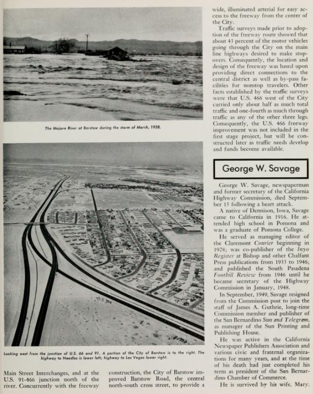
The Barstow Overhead is discussed in detail in the June 1930 California Highways & Public Works. The Barstow Overhead provided a grade separation of the Atchison, Topeka & Santa Fe Railroad (ATSF) which US Route 91/LRN 31 previously lacked at Daggett. The Barstow Overhead is stated to have opened on April 28, 1930.
1931 Legislative Chapter 82 authorized the extension of LRN 58 from Barstow west to Bakersfield via existing County Highways. LRN 58 departed US Route 91/LRN 31 in North Barstow via what is now Irwin Road and Old Highway 58. Prior to reaching Hinkley the routing of LRN 58 west of North Barstow crossed the ATSF via an at-grade rail crossing at Dixie Road.
LRN 58 west of Barstow to Bakersfield can be seen for the first time on the 1932 Division of Highways Map.
During June 1933 the California Division of Highways petitioned AASHO for an extension of US Route 64 west of Raton, New Mexico to Morro Bay, California. The extension of US Route 64 was not considered ideal by AASHO due to proposed routing including a lengthy multiplex of US Route 66 from Santa Fe, New Mexico to Barstow, California. An alternate proposed routing of US Route 64 in New Mexico did little to mitigate the lengthy multiplex of US Route 66 in Arizona. The proposal to extended US Route 64 was to be reviewed by the AASHO Executive Committee during their October 1933 meeting.


During their August 1933 meeting AASHO suggested US Route 466 to the California Division of Highways as an alternative to the lengthy extension of US Route 64. US Route 466 was initially proposed as originating in Barstow, California and terminating at Morro Bay. The Division of Highways via telegram to AASHO dated August 10, 1933, expressed that such a short US Route located entirely in-state would not provide the same utility as their US Route 64 extension proposal.

During the October 1933 AASHO meeting a compromise was reached which brought US Route 466 into existence. US Route 466 would begin at US Route 66 in Kingman, Arizona and travel northwest to the site of Boulder Dam (now Hoover Dam) at the Nevada state line. Within Nevada the routing of US Route 466 entered Las Vegas where it then followed US Route 91 into California towards North Barstow. US Route 466 split from US Route 91 initially at the intersection of 1st Avenue and Irwin Road. West of the Barstow area US Route 466 would retain the same Barstow-Morro Bay alignment on LRN 58 desired by the California Division of Highways for their US Route 64 extension proposal.
The split of LRN 58 (US Route 466) and US Route 91 in North Barstow can be seen on the 1934 United States Geological Survey Map of Barstow. US Route 466 is displayed branching from US Route 91/LRN 31 at 1st Avenue via Irwin Road. US Route 466/LRN 58 is shown following what is now Old Highway 58 to an at-grade crossing of the ATSF via Dixie Road near Hinkley. Upon crossing the ATSF the routing of US Route 466/LRN 58 is shown following modern Old Bakersfield Highway towards Kramer Junction.
The branching paths of US Route 91 and US Route 466 can be seen on the 1935 Division of Highways Map of San Bernardino.
The 1956 United States Geological Survey Map of Barstow displays changes to the routing of US Route 466 from North Barstow west towards Hinkley. US Route 466/LRN 58 are shown departing US Route 91 via a new bypass which connected it more directly with Irwin Road. The new alignment of US Route 466 removed the jog along 1st Avenue to reach Irwin Road. West of Barstow US Route 466 can be seen crossing the ATSF via an improved at-grade crossing which replaced the one located on Dixie Road.


The opening of the Barstow Bypass moved mainline US Route 91 to Interstate 15. The older surfacing routing through Barstow and North Barstow subsequently became US Route 91 Business. The opening of the Barstow Bypass did nothing to affect the alignment of US Route 466 in North Barstow but reroute LRN 58 directly to Interstate 15. The changes in the Barstow area following the opening of the Barstow Bypass can be seen on the
1962 Division of Highways Map.

During the 1964 State Highway Renumbering the Legislative Route Numbers were dropped from the State Highway System. What had been US Route 466 in North Barstow from Interstate 15 west to US Route 99 in Bakersfield was redesignated legislatively as part of
California State Route 58. Despite being assigned as California State Route 58 the Division of Highways would not seek truncation of US Route 466 to Baker until well into 1964. AASHO approved the truncation of US Route 466 from Morro Bay to California State Route 127 in Baker during June 1964. The truncation of US Route 466 left California State Route 58 as the only Sign Route in North Barstow.

During 1996 the new freeway routing of California State Route 58 opened in Barstow. The new segment of freeway was located south of downtown Barstow which connected to Interstate 15 via new crossing of the Mojave River. The previous routing of California State Route 58 through North Barstow was relinquished and renamed as "Old Highway 58." The at-grade rail crossing near Dixie Road was removed and traffic was rerouted into Lenwood Road to reach the new alignment of California State Route 58. The new bypass alignment of California State Route 58 appears on the
2005 Caltrans Map.
Part 2; a drive on Old Highway 58 (former US Route 466)
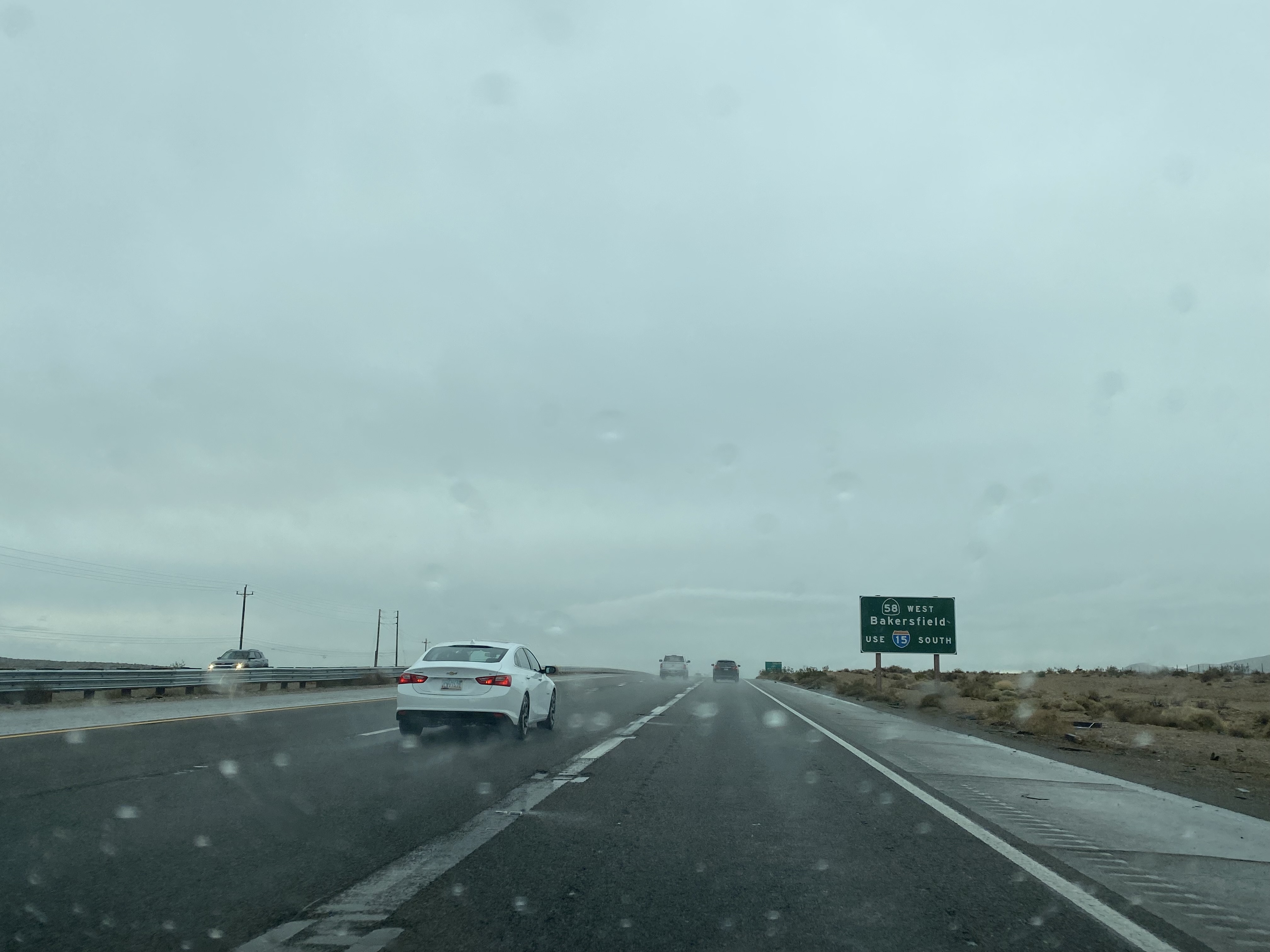
From Interstate 15 southbound Old Highway 58 can be accessed via Exit 186. Traffic wishing to use the modern alignment of California State Route 58 is directed to stay on Interstate 15 through Barstow. Strangely the guide sign approaching the Old Highway 58 exit displays "Exit 179" and a California State Route spade. The use of "Exit 179" appears to be a relic of a time before the original California State Route 103 was renumbered as California State Route 15.
Old Highway 58 westbound enters North Barstow and veers slightly right approaching 1st Avenue. This junction is where US Route 466 would have split from US Route 91 beginning in 1956.
Old Highway 58 westbound intersects Irwin Road. Traffic heading towards Bakersfield is directed to turn left on Irwin Road by way of leftover Caltrans signage.
Old Highway 58 resumes via an unsigned right-hand transition from Irwin Road.
As Old Highway 58 departs North Barstow westbound a Caltrans spec mileage sign notes Bakersfield to be 130 miles away.
Old Highway 58 continues west to the Hinkley area. The designation ends at the intersection of Old Highway 58, Lenwood Road and Santa Fe Avenue where US Route 466 would have once crossed the ATSF. Traffic is notified California State Route 58 can be reached via Lenwood Road.


Comments