
The Skaggs Crossing Bridge was a former component of California State Route 145 at the San Joaquin River. The Skaggs Crossing Bridge was completed during 1907 as a connection between the communities of Kerman and Madera. The Skaggs Crossing Bridge was added to the State Highway System during 1933 as part of Legislative Route Number 126 and would become part of California State Route 145 during 1948. The Skaggs Crossing Bridge would be removed during 2005 to make way for a new structure over the San Joaquin River. The blog cover photo is the Skaggs Crossing Bridge as it was featured in the 1913 book "The Concrete Bridge." Below the Skaggs Crossing Bridge can be seen crossing the San Joaquin River as part of Madera Avenue on the 1923 United States Geological Survey Map of Biola.

Part 1; the history of the Skaggs Crossing Bridge
The location of Skaggs Crossing was one of the furthest points upstream along San Joaquin River that steamships could navigate. Skaggs Crossing became a popular locale to unload goods bound for Stockton and Sacramento.
During 1907 a concrete bridge was constructed as Skaggs Crossing. The Skaggs Crossing Bridge was similar to the design of the 1906 Pollasky Bridge (now in ruins downstream from Friant Dam) which served as it's design inspiration. The Skaggs Crossing Bridge was featured in the 1913 book titled the "The Concrete Bridge."
The Skaggs Crossing Bridge can be seen on the 1914 Britton & Rey Map of Fresno County. The Skagss Crossing Bridge can be seen connecting Kerman to the Madera County Line via Madera Avenue.

The Skaggs Crossing Bridge can be seen crossing the San Joaquin River as part of Madera Avenue on the 1923 United States Geological Survey Map of Biola.
The Skaggs Crossing Bridge was added to the State Highway System as part of Legislative Route Number 126 (LRN 126) during 1933. The original definition of LRN 126 was defined as:
1. LRN 41 in Kerman to LRN 4 in Madera.
2. LRN 4 in Madera to LRN 125.
The Skaggs Crossing Bridge appears as part of LRN 126 on the 1934 Division of Highways Map.


The Skaggs Crossing Bridge can be seen as part of LRN 126 north of Kerman on the 1935 Division of Highways Map of Fresno.

California State Route 145 was applied to the entirety of LRN 126 during 1948. The Skaggs Crossing Bridge can be seen as part of California State Route 145 on the 1949 Division of Highways Map.

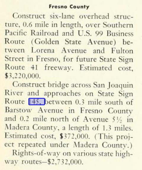
The November/December 1963 California Highways & Public Works announced a new bridge at Skaggs Crossing was funded for the 1964-65 Fiscal Year. The new Skaggs Crossing project consisted of work zone 1.3 miles in length originating at Barstow Avenue in Fresno County north to Avenue 5 1/2 in Madera County.
The January/February 1964 California Highways & Public Works announced the entirety of California State Route 145 from Kerman to Avenue 5 1/2 in Madera County was adopted by the California Highway Commision as a freeway corridor during late 1963. The proposed freeway corridor of California State Route 145 north of Kerman was intended to be located immediately east of the existing alignment.

The September/October 1964 California Highways & Public Works announced the California Highway Commission had extended the planned freeway corridor of California State Route 145 north from Avenue 5 1/2 to the southern outskirts of Madera.

The planned California State Route 145 freeway from Kerman north to the San Joaquin River appears with an adopted routing on the 1969 Division of Highways Map.

During 1974 Fresno County purchased the land parcels next to the Skaggs Crossing Bridge along the south bank of the San Joaquin River and formally created Skaggs Bridge Park. The creation of Skaggs Bridge Park seems to have dealt a fatal blow to the planned California State Route 145 freeway and replacement to the Skaggs Crossing Bridge. The planned California State Route 145 freeway north of Kerman no longer appears on the 1977 Caltrans Map.

A notice of determination via the provisions of the California Environmental Quality Act during February 2001 approved the replacement of the Skaggs Crossing Bridge with a modern highway span. The new San Joaquin River Bridge and alignment of the California State Route 145 were completed east of the Skaggs Crossing Bridge during 2005.

Upon the 2005 San Joaquin River Bridge opening the Skaggs Crossing Bridge was removed. The original alignment of California State Route 145 was repurposed as a disconnected part of Madera Avenue, a Skaggs Bridge Park road and River Gorge Lane. The new alignment of California State Route 145 at the San Joaquin River appears on the 2012 United States Geological Survey Map of Biola.

From the Madera County side of the San Joaquin River the original alignment of California State Route 145 can be explored on River Gorge Lane. River Gorge Lane terminates southbound at San Joaquin River where Skaggs Crossing Bridge was once located.


The original alignment of California State Route 145 in Fresno County is now a disconnected segment of Madera Avenue and a Skaggs Bridge Park road.


Comments