
California State Route 141 was a short State Highway located in Vallejo which was created out of a spur of what had been Legislative Route Number 74 during the 1964 State Highway Renumbering. California State Route 141 was aligned on Maine Street, Benicia Road and Lemon Street from California State Route 29/Sonoma Street to Interstate 780. California State Route 141 was planned to be constructed as the Waterfront Freeway through Vallejo. California State Route 141 was deleted during 1988 when the city of Vallejo took over construction of Curtola Parkway. Despite California State Route 141 being deleted it's planned freeway corridor exists today as the surface roads Curtola Parkway and Mare Island Way.
California State Route 141 and the planned Waterfront Freeway can be seen on the 1975 Caltrans Map.
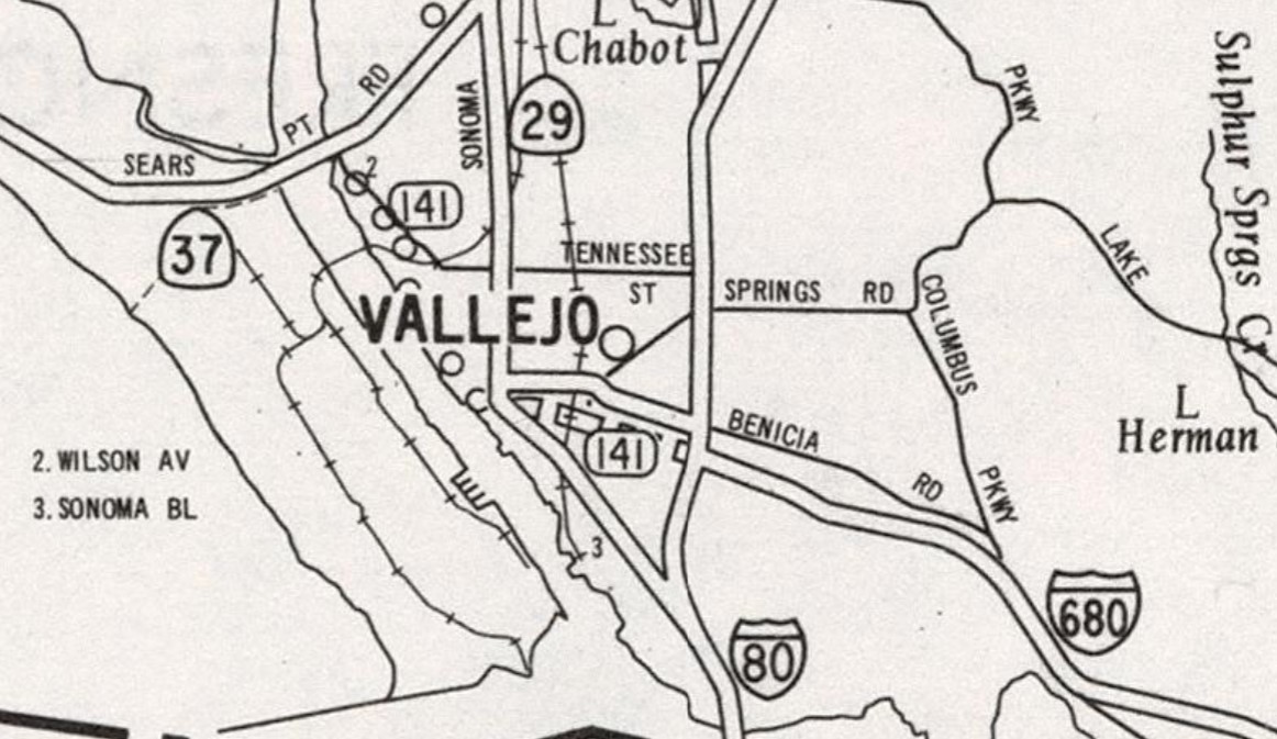
Part 1; the history of California State Route 141
What was to become California State Route 141 entered the State Highway System during 1935 as an extension of Legislative Route Number 74 (LRN 74). LRN 74 was extended from Vallejo beginning at Sonoma Boulevard (US Route 40/California State Route 29) via Maine Street and Benicia Road east to Benicia. From Benicia, LRN 74 continued north to Cordelia via what had been the original alignment of US Route 40 on LRN 7. LRN 74 specifically was amended by 1935 Legislative Chapter 274 as:
"A point on LRN 8 near the Napa Y to Cordelia via Vallejo and Benecia."
The extended LRN 74 appears for the first time on the 1936 Division of Highways Map.

The American Canyon Cutoff of LRN 7 opened on November 10, 1936, as the new alignment US Route 40 from Cordelia bypassing downtown Vallejo directly to the Carquinez Bridge. The opening of the American Canyon Cutoff was featured in the November 1936 California Highways & Public Works. The American Canyon Cutoff intersected the future alignment of California State Route 141 at Benicia Road.


The future route of California State Route 141 appears as LRN 74 in Vallejo on Maine Street and Benicia Road between California State Route 29/Sonoma Boulevard to US Route 40/LRN 7 on the 1938 Division of Highways Map.


The September/October 1961 California Highways & Public Works recapped the recently completed US Route 40/Interstate 80/LRN 7 upgrades in Vallejo. The US Route 40/Interstate 80 grade separation at Benicia Road/LRN 74 is noted to have been completed during mid-year 1960.


The January/February 1962 California Highways & Public Works featured the completed segment of Interstate 680/LRN 74 between Vallejo-Benicia. Interstate 680 from US Route 40/Interstate 80 in Vallejo east to the Benicia city limit is stated to hae partially opened during December 1960 and was completed on June 14, 1961. The opening of Interstate 680 between Vallejo and Benicia required LRN 74 to jog south from Benicia Road via Lemon Street to reach the beginning of the new freeway.

The March/April 1962 California Highways & Public Works announced the adoption of a new freeway corridor west from the terminus of Interstate 680 at Lemon Street to California State Route 48 through Vallejo. The new freeway corridor adoption of LRN 74 through Vallejo is stated to be 4.2 miles in length. The LRN 74 freeway through Vallejo is stated to have been adopted during the January/February 1962 California Highway Commission meetings.


As part of the 1964 State Highway Renumbering LRN 74 west from Interstate 80 to California State Route 29 was designed as California State Route 141. California State Route 141 was aligned over Maine Street, Benicia Road and Lemon Street within Vallejo and can be seen for the first time on the 1964 Division of Highways Map.


The definition of California State Route 141 was altered by way of 1965 Legislative Chapter 1371 to "the westerly extension of Route 680 from Route 80 into Vallejo." The altered definition of California State Route 14 appears on the 1966 Division of Highways Map.


At an unclear point the freeway corridor of California State Route 141 came to be known as the Waterfront Freeway. The corridor of the Waterfront Freeway was reported as being scaled back to a boulevard in the April 25, 1974, Vallejo Times Herald. The August 20, 1974, Vallejo Times Herald reported the city of Vallejo voted to speed up construction of Waterfront Boulevard. Waterfront Boulevard was constructed as what is now known as Mare Island Way.
The 1975 Caltrans Map depicts the freeway corridor of California State Route 141 west of California State Route 29 as being withdraw from having an adopted routing to being a planned facility.
1975 Legislative Chapter 1078 reworded the western terminus of California State Route 141 from "into Vallejo" to "Route 37." 1976 Legislative Chapter 1354 changed the "Route 680" as the point of origin of California State Route 141" to "Route 780" to reflect the newly commissioned Interstate 780.
California State Route 141 was deleted by way of Senate Bill 177, Chapter 106. The relinquishment of California State Route 141 ceded the acquired right-of-way for the Waterfront Freeway between Interstate 780 and California State Route 29 to the city of Vallejo. The city of Vallejo would construct and open Curtola Parkway along the planned corridor of California State Route 141 from Interstate 780 west to California State Route 29 during 1989.
Part 2; a drive on former California State Route 141
From California State Route 29 southbound, California State Route 141 would have begun with a left-hand turn onto Maine Street eastbound.


The former routing of California State Route 141 eastbound climbed Maine Street and transitioned onto Benicia Road.


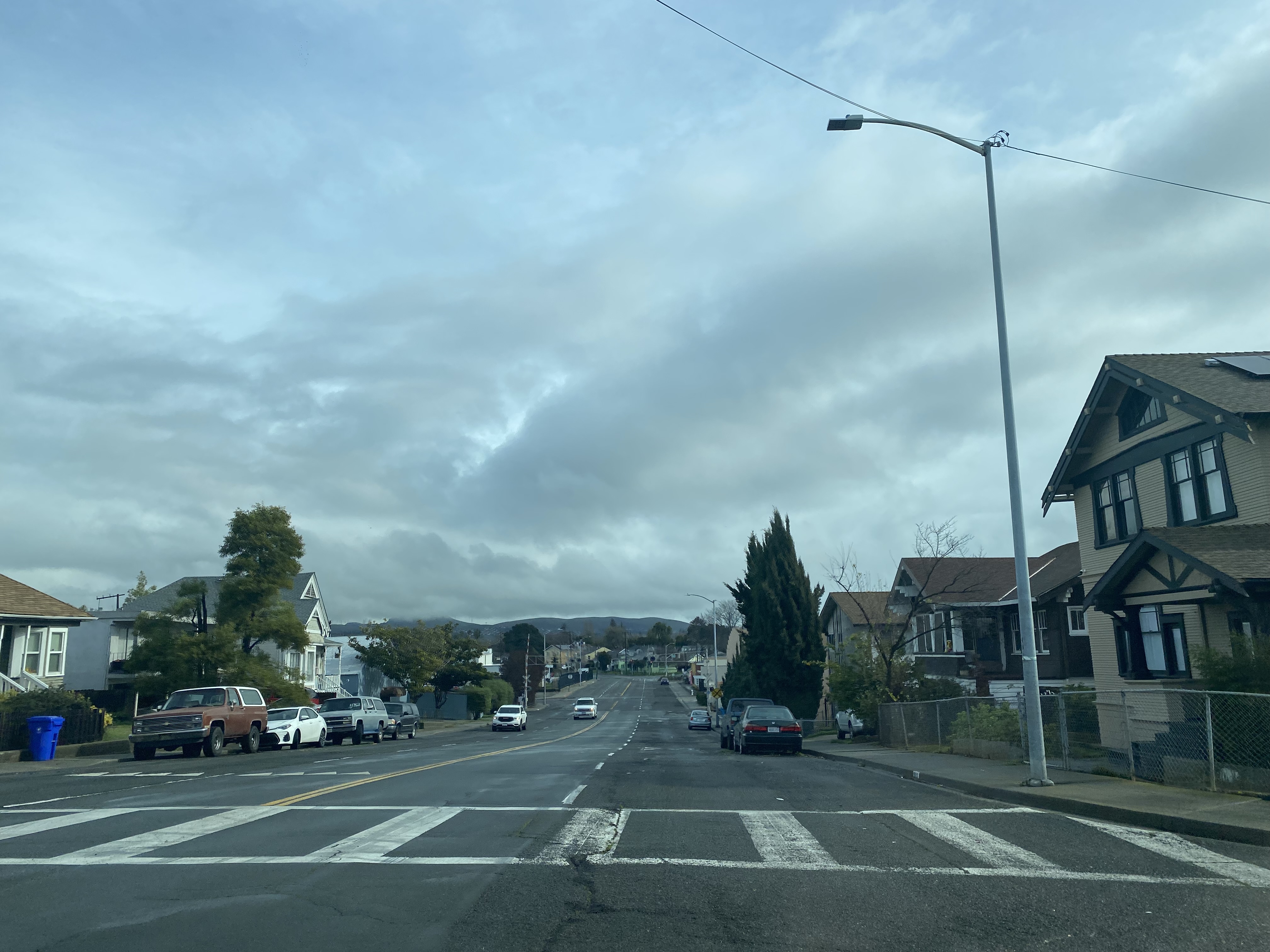


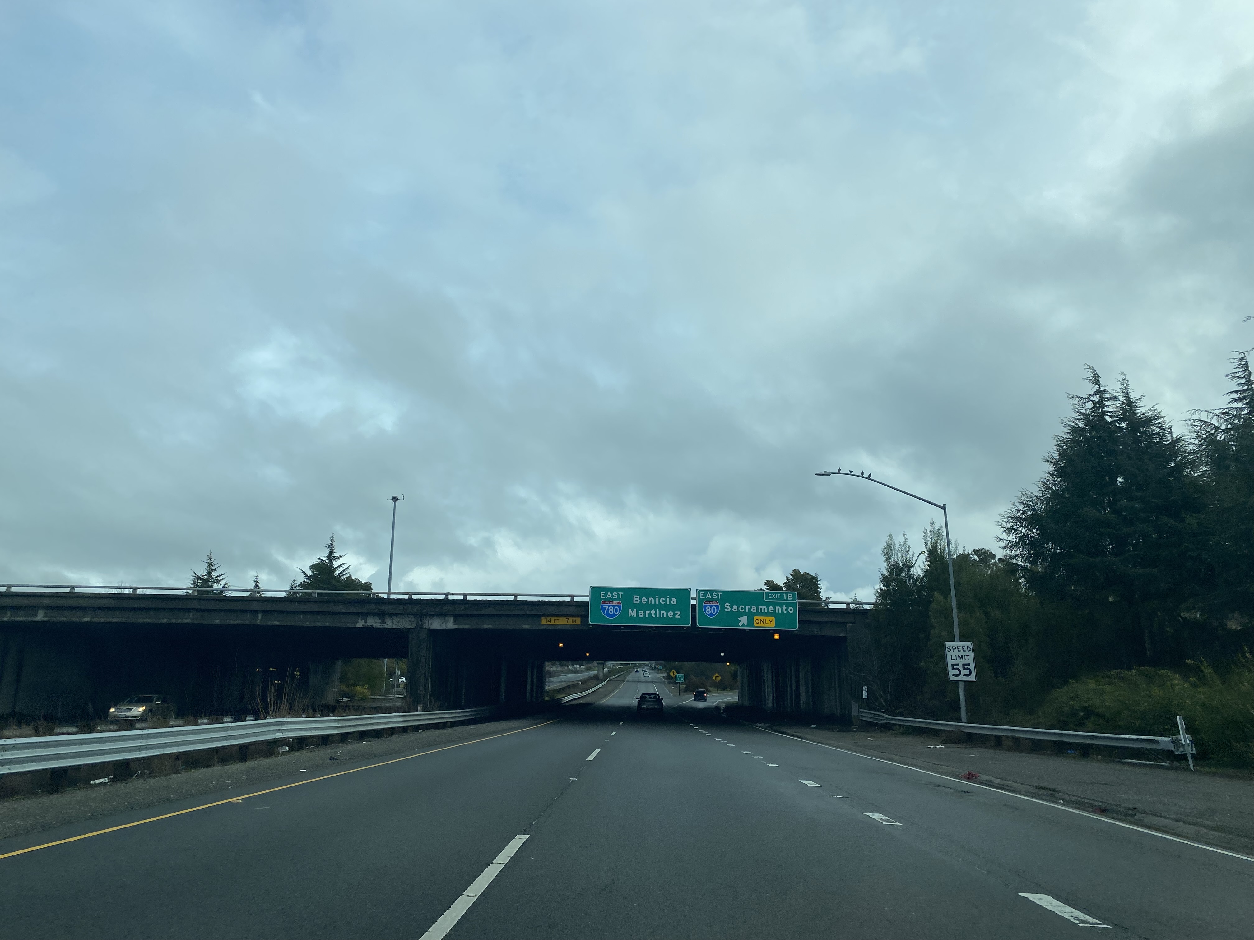
Eastbound California State Route 141 followed a jog on Lemon Street to terminus at Interstate 780.


Comments