California State Route 55


California State Route 55 is an eighteen-mile State Highway located within Orange County.  California State Route 55 begins at California State Route 91 at Santa Ana Canyon and ends at the Newport Beach Channel Bridge immediately south of California State Route 1 at Newport Beach.  California State Route 55 south from California State Route 91 to 19th Street in Costa Mesa is carried by the Costa Mesa Freeway.  The remaining surface balance of California State Route 55 south to the Newport Beach Channel Bridge is aligned on Newport Boulevard.  


The history of California State Route 55

What was to become California State Route 55 was added to the State Highway System during 1931 as an extension of Legislative Route Number 43.  LRN 43 was extended from Waterman Canyon near San Bernardino to south to Newport Beach via Santa Ana Canyon.  The extended definition of LRN 43 to Newport Beach first appears on the 1932 Division of Highways Map.  

The future alignment of California State Route 55 can be seen in the form of LRN 43 following Newport Road and Tustin Avenue north from LRN 60 to Santa Ana Canyon near Olive on the 1934 Division of Highways Map.  

The August 1934 California Highways & Public Works announced the initial run of Sign State Routes.  California State Route 55 was announced as following LRN 43 from California State Route 3/LRN 60 in Newport Beach to California State Route 18 near Olive. 


California State Route 55/LRN 43 can be seen terminating at Balboa Boulevard in Newport Beach on the 1935 Division of Highways Map of Orange County.  

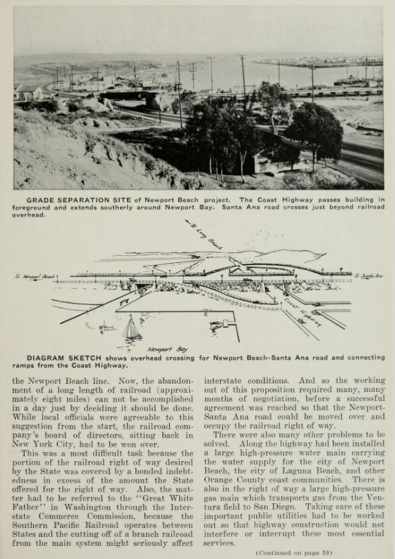
The February 1936 California Highways & Public Works featured the in-progress Newport Beach Grade Separation project which would serve as the new junction of California State Route 55/LRN 43 and US Route 101A/LRN 60 at Newport Beach.  The Newport Beach Grade Separation project is noted to have been first proposed as three-way cooperative between Orange County, the city of Newport Beach and Division of Highways.  The Newport Beach Grade Separation is noted to have an anticipated completion during September 1936.  


The September 1936 California Highways & Public Works featured the nearly completed Newport Beach Grade Separation.
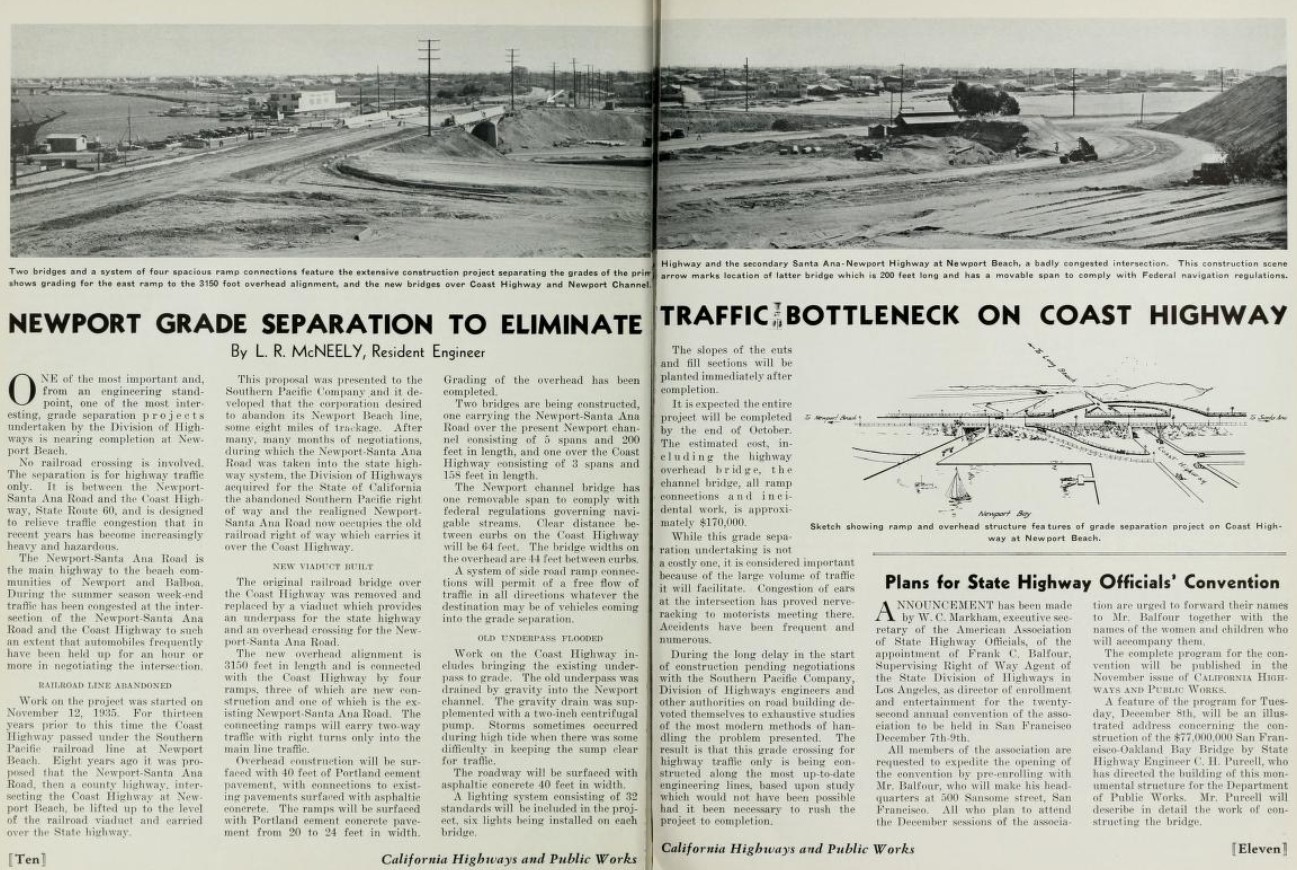
The opening of the Newport Beach Grade Separation is featured in the January 1937 California Highways & Public Works.  The Newport Beach Grade Separation was dedicated on November 28, 1936, by Governor Frank F. Merriam as the new junction of California State Route 55/LRN 43 and US Route 101A/LRN 60.  The article notes the Newport-Santa Ana Road was taken into the State Highway System on August 14, 1931.  


The 1938 Division of Highways Map features California State Route 55 applied to LRN 43 on Newport Avenue and Tustin Avenue.

The May 1941 California Highways & Public Works featured landscaping along California State Route 55/LRN 43 in Costa Mesa along Newport Boulevard.  The planted area along Newport Boulevard were repurposed from the abandoned grade of the Santa Ana & Newport Railway largely due to the efforts of W. Carl Spenser.  The history of community of Costa Mesa being renamed from Harper twenty-three years prior is referenced.  


The November/December 1951 California Highways & Public Works referenced allocations being made to install grade separation structures along California State Route 55/LRN 43 between Newport Beach and Costa Mesa during the 1952-53 Fiscal Year.  

The November/December 1953 California Highways & Public Works featured the freeway expansion of California State Route 55/LRN 43 in the newly incorporated Costa Mesa.  California State Route 55/LRN 43 is described as being expanded to six lanes from US Route 101A/LRN 60 north to 20th Street.  The existing grade of Newport Boulevard was repurposed into the grade of the northbound lanes of the expanded California State Route 55/LRN 43.  The completed freeway (expressway by modern standards) was accepted by the Division of Highways on October 2, 1953.  Costa Mesa incorporated as a city on June 29, 1953.  


The January/February 1954 California Highways & Public Works referenced the planned Santa Ana Canyon Freeway.  The Santa Ana Canyon Freeway is cited to be planned as originating at Newport Beach and ending at the Riverside County Line.  The article stub notes the two miles of completed expressway along California State Route 55/LRN 43 between Newport Beach-Costa Mesa as part of the greater Santa Ana Canyon Freeway.  

The January 1955 California Highways & Public Works referenced the entirety of California State Route 55 from Newport Beach north to US Route 91/California State Route 18 as being planned as part of the Santa Ana Canyon Freeway.  


The November/December 1957 California Highways & Public Works announced the California State Route 55 Freeway had been renamed the Newport Freeway by the California Highway Commission.

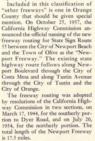
The January/February 1958 California Highways & Public Works cites when the segments of the California State Route 55/Newport Freeway had been adopted by the California Highway Commission.  The segment of the Newport Freeway south of Dyer Road was adopted by the California Highway Commission on March 17, 1954 (shown in error as 1944) whereas the northern segment was adopted on July 20, 1954.  The Newport Freeway is cited to have a planned length of 17.5 miles. 

The November/December 1958 California Highways & Public Works announced construction funds for 2.6 miles of frontage roads for the future Newport Freeway in Costa Mesa were funded for the 1959-60 Fiscal Year budget.  The freeway frontage road in Costa Mesa was intended to function as an interim one-way couplet alignment of California State Route 55.  

The November/December 1959 California Highways & Public Works noted the first unit of the Newport Freeway between Santa Ana Freeway and Riverside Freeway had been budgeted for the 1960-61 Fiscal Year. 

The March/April 1961 California Highways & Public Works noted the California State Route 55/Newport Freeway frontage road in Costa Mesa had been completed on May 31, 1960.  Numerous segments of the Newport Freeway north of the Santa Ana Freeway are noted to be under construction with the segment to Chapman Avenue anticipated to be complete by February 1962.  The article stub notes contract plans for 5.4 miles of the Newport Freeway south of the Santa Ana Freeway to Palisades were being prepared.  


The March/April 1962 California Highways & Public Works noted the California State Route 55/Newport Freeway had opened from the Santa Ana Freeway northward three miles to Chapman Avenue.  The segment of the Newport Freeway north to the Riverside Freeway is noted to have an anticipated opening during the coming September.  


The September/October 1962 California Highways & Public Works announced the California State Route 55/Newport Freeway had opened north of Chapman Avenue in Tustin to the Riverside Freeway on September 4, 1962.  

California State Route 55/LRN 43 is shown to be realigned onto the Newport Freeway between Interstate 5/US Route 101 at the Santa Freeway north through Tustin to US Route 91 at the Riverside Freeway on the 1963 Division of Highways Map. 


The March/April 1963 California Highways & Public Works featured a photo of the completed Newport Freeway north of the Santa Ana Freeway. 


The Newport Freeway from Chapman Avenue in Tustin is featured in the July/August 1963 California Highways & Public Works. 


The November/December 1963 California Highways & Public Works noted the Newport Freeway was under construction south from the Santa Ana Freeway towards Warner Avenue.  


As part of the 1964 State Highway Renumbering the Legislative Route Numbers were dropped in favor of Sign State Route designations.  California State Route 55 was legislatively designated as "From Newport Beach to Route 91 in Santa Ana Canyon."  The new legislative designation of California State Route appears for the first time on the 1964 Division of Highways Map. 


The March/April 1964 California Highways & Public Works announced the Newport Freeway extension to Warner Avenue was anticipated to be complete before the end of the calendar year.  Construction of the Newport Freeway 3.9 miles south from Warner Avenue to Bristol Street/Palisades Road is cited to have an anticipated groundbreaking during 1965. 


The November/December 1964 California Highways & Public Works announced California State Route 55 had been rerouted to the Warner Avenue extension of the Newport Freeway during December 1964.  


The 1965 Division of Highways Map displays California State Route 55 shifted to the Warner Avenue extension of the Newport Freeway. 


The January/February 1967 California Highways & Public Works announced the Newport Freeway was completed upon the opening of segment south of Warner Avenue to Bristol Street/Palisades Road during December 1966.  The new segment of the Newport Freeway included an interchange with the incomplete San Diego Freeway (Interstate 405). 


The Newport Freeway appears extended to Bristol Street in Costa Mesa on the 1967 Division of Highways Map.  


The Newport Freeway designation was changed to the "Costa Mesa Freeway" by 1976 Assembly Concurrent Resolution Number 177, Chapter 86.  The change to "Costa Mesa Freeway" was effective over California State Route 55 Postmiles ORA 2.032-R17.61.

California State Route 55 was upgraded to freeway standards from Bristol Street south to 19th Street in Costa Mesa by 1990.  During 1999 the Newport Beach Grade Separation was replaced by a modern interchange structure.  During 2009 Assembly Bill 344, Chapter 238 authorized the relinquishment of California State Route 55 in the city of Newport Beach.  During May 2013 the California Transportation Commission relinquished California State Route 55 in Newport Beach from Finnley Avenue to the Newport Channel Bridge.  2014 Assembly Bill 2752, Chapter 345 amended the southern definition of California State Route 55 to end at the Newport Channel Bridge.  

Comments

Popular posts from this blog

The case to move Interstate 73 in Southern Ohio onto US 33

Every decade or so, Ohio pushes to revisit the proposed Interstate 73 that would connect Michigan to Myrtle Beach, South Carolina.  It's been happening since Congress legislated the route in 1991.  Within Ohio, Interstate 73 generally follows the US 23 corridor from Portsmouth through Columbus to Toledo, and into Michigan. Since High Priority Corridor Five was created , Ohio has really done nothing to move forward with Interstate 73.  Sure, there have been feasibility studies here and there.  But actual dollars and construction just haven't occurred. The US 33 Nelsonville Bypass appears to have been built to Interstate standards. However, Ohio has been slowly upgrading US 33 to a full freeway through Southeastern Ohio.  Bypasses of Lancaster and Nelsonville opened in 2004 and 2013, respectively.  Other sections of two-lane road are being twinned, some to freeway or, at a minimum, to expressway standards.  Currently, a $274 million widening project in...

Local Sign Find - The last remnant of Business Interstate 95 between Kenly and Rocky Mount , NC

As you head north on Interstate 95 at Exit 107 for Kenly and US 301, you'll notice something odd about the overhead sign for the exit.  Peeling off the sign for all that can see is the word 'NORTH' off-center from the US 301.  This old sign (probably close to original from when this section of I-95 opened - more on that in a little bit) gives a hint to a short-lived Business Interstate Route that ran from here to Rocky Mount. The last hint of the Kenly-Wilson-Rocky Mount Business I-95 (Shaun White - August 2020) Interstate 95 in North Carolina has a unique history.  But one of the overlooked and forgotten pieces of Interstate 95 in North Carolina is the 38 mile section between Kenly and Rocky Mount.  When opened to traffic in late 1978, it was the next to last piece of Interstate 95 in North Carolina to open replacing a four lane US 301 from Battleboro through Rocky Mount and Wilson to eventually tying back into the Interstate in Kenly. Though it was not delayed in l...

Nostalgia fast food with style - Returning to Rax

Nostalgia. It sells. It evokes, and more accurately, warps memories of days gone by.  Things were better, simpler, and we eat it up. Nostalgia can make you drive three hours and over a hundred miles out of your way just to reconnect with a dying fast-food restaurant you last enjoyed in the early to mid-90s.  That person was me - that restaurant was Rax. I could go on about Rax's history, but in short, Rax was briefly a very popular roast beef fast-food chain.  Growing up in the 80s and early 90s in Western PA, Rax was the good fast-food spot.  The milkshakes.  (Personally, the chocolate chip milkshake was heaven.)  Uncle Alligator Kids Meal with the chocolate chip cookie. Take that McDonald's Happy Meal!  The fancy salad and hot foods bar.  Going to Rax was special.  Like so many similar restaurants, various investments, management decisions, etc., led Rax to almost disappear overnight.  By the time I graduated college in late 1999, abou...