
California State Route 49 is aligned through the Sierra County seat of Downieville via Main Street and Commercial Street over Downie River via the 1938 Jersey Bridge. The 1938 Jersey Bridge and Commercial Street comprise the only one-lane component of California State Route 49. When California State Route 49 was commissioned during 1934 it was aligned over the original Jersey Bridge which is famous for being the only known site of the hanging of a woman in the history of California. California State Route 49 was shifted to a new alignment downstream on the Downie River near the confluence of the North Fork River during 1936 via a concrete bridge. The new bridge over the Downie River was destroyed in a flood during December 1937. The floods of 1937 shifted the alignment of the California State Route 49 back to Commercial Street and a new iteration of the Jersey Bridge constructed during 1938.

Part 1; the history of California State Route 49 in Downieville
Gold on the North Fork Yuba River was discovered by Francis Anderson on September 14, 1849. During the Fall of 1849 William Downie led an expedition to what is now the confluence of the Downie River and North Fork Yuba River. Downie's party was successful in finding gold and set up a mining community which was originally known as "The Forks." The Forks would soon come to be renamed "Downieville" in honor of William Downie.
Downieville would soon grow into the largest community in the area of the northern Sierra Nevada Mountains around the Eureka Mines District. By 1851 Downieville would reach a population of approximately 5,000 which made it one of the largest communities in California during the early California Gold Rush. When Sierra County was created in 1852 the community of Downieville was selected as the County Seat. During 1853 Downieville would be one of several communities which would vie to replace Vallejo as the State Capitol. Downieville would ultimately lose its bid to become the California State Capitol to Benicia. Downieville can be seen on the 1857 Britton & Rey's Map of California on a stage road branching from the Henness Pass Highway north of Forest City.

Between 1848 and 1860 approximately 16,000 thousand people would settle in what would become Sierra County around the claims of the Eureka Mining District. Downieville can be seen at the end of a stage road on the 1873 Bancroft's Map of California, Nevada, Utah and Arizona. Northwest of Downieville Eureka North Mine can be seen.

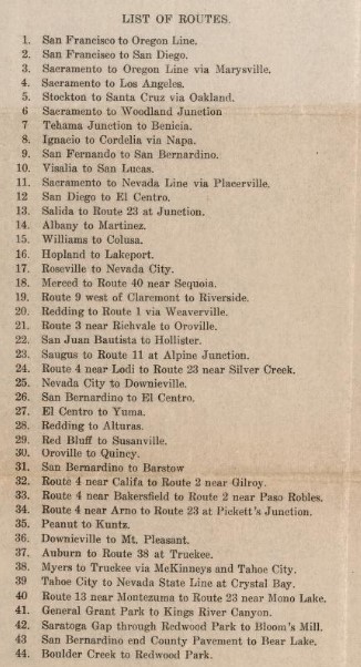
State Highway service would not reach Downieville until the passage of the 1909 First State Highway Bond Act. The 1909 First State Highway Bond Act was approved by voters during 1910 and established many major highway corridors of California as State Highways. Downieville was established as the northern terminus of Legislative Route Number 25. Legislative Route Number 25 as originally defined was aligned between Nevada City and Downieville.
Legislative Route Number 25 appears terminating in Downieville on the 1918 California Highway Commission Map. Traffic could continue east of Downieville over the road to Yuba Pass from the end of Legislative Route Number 25 via the Jersey Bridge.

During 1933 Legislative Route Number 25 was extended north of Yuba Pass to Sattley. This measure brought the original Jersey Bridge over the Downie River into the State Highway System. The extension of Legislative Route Number 25 from Downieville to Sattley was announced in the April 1933 California Highways & Public Works.


The January 1935 California Highways & Public Works announced a new bridge for California State Route 49 to cross the Downie River (mistakenly cited as the North Fork Yuba River) in Downieville had been funded via a Federal Aid Program.
The July 1935 California Highways & Public Works announced an awarded contract to construct a reinforced concrete bridge as the new alignment of California State Route 49 in Downieville.

The June 1936 California Highways & Public Works featured the opening of the new concrete bridge over the Downie River and new alignment of California State Route 49 in Downieville. The new alignment of California State Route 49 bypassed much of Main Street and Commercial Street in downtown Downieville in favor of an alignment much closer to the Downie River/North Fork Yuba River confluence. The new concrete bridge is described as carrying a 24-foot-wide road deck.
The article also describes the history of the original alignment of California State Route 49 on the Jersey Bridge. The Jersey Bridge is cited to have been originally constructed during early years of Downieville. The original Jersey Bridge was the site of the known only hanging of a woman in California history which took place on July 5, 1851, when an individual only known as Juanita was executed at the structure. Juanita is cited to have killed popular Downieville citizen Jack Cannon. The original Jersey Bridge is cited to have been partially destroyed by a flood during the 1880s but was ultimately rebuilt. The load capacity of the original Jersey Bridge is cited to have been rated for 8,000 pounds.


The concrete bridge and new alignment of California State Route 49 was not long lived as it was partially destroyed by a flood on the North Fork Yuba River during December 1937. The flooding along the North Fork Yuba River backed up logs onto the new concrete bridge along the Downie River which eventually broke and flooded into downtown Downieville. The original Jersey Bridge and Durgan Bridge were also destroyed by the flood waters. The partially destroyed concrete bridge at the Downie River can be seen below in a Sierra County History sourced photo.

The destroyed Jersey Bridge can be seen below in a Sierra County History sourced photo.

The January 1938 California Highways & Public Works referenced the destruction of the 1936 concrete bridge on California State Route 49 due to the floods in Downieville the month prior. The approach grades on the new alignment of California State Route 49 are described as being washed away.

The alignment of California State Route 49 was shifted back into downtown Downieville via Main Street and Commercial Street to avoid the confluence of the Downie River/North Fork River. The October 1938 California Highways & Public Works announced an advertised contract to construct a new truss design Jersey Bridge. California State Route 49 has since remained on the 1938 iteration of the Jersey Bridge. The remaining part of the 1936 alignment of California State Route 49 south of the Downie River is now known as Old Highway.

California State Route 49 northbound enters Downieville on Main Street becomes a one-lane highway. California State Route 49 northbound turns right onto Commercial Street towards the Downie River.


California State Route 49 crosses the Downie River along Commerical Street via the 1938 Jersey Bridge.


Below is a reverse view the 1938 Jersey Bridge and California State Route 49 approaching Main Street.


California State Route 49 crosses the Downie River along Commerical Street via the 1938 Jersey Bridge.


Below is a reverse view the 1938 Jersey Bridge and California State Route 49 approaching Main Street.


California State Route 49 northbound and Commercial Street merge in with Old Highway departing Downieville.

Comments