The Baltimore-Washington Parkway is a 32.52-mile limited access highway partially signed as Mary Route 295. The Baltimore-Washington Parkway as the name infers connects the cities of Baltimore and Washington. The Baltimore-Washington Parkway opened in stages between 1950 through 1954 and does not conform to Interstate standards. The Baltimore-Washington Parkway between Baltimore south to Maryland Route 175 is maintained by the Maryland Department of Transportation. From Maryland Route 175 south to US Route 50 the Baltimore-Washington Parkway is maintained by the National Park Service. Featured as the blog cover is southbound Baltimore-Washington Parkway approaching the beginning of the National Park Service maintained segment south of Maryland Route 175.
Part 1; the history of Baltimore-Washington ParkwayPlans for a parkway between the cities of Baltimore and Washington date back to the 1920s. Future Maryland Governor Harry Nice during 1924 would actively campaign for a parkway connecting Baltimore and Washington to be constructed. Increasing traffic on US Route 1 through the 1930s led to increased interest and momentum towards building a parkway between Baltimore and Washington.
During 1942 the Bureau of Public Roads began the process of designing the layout of the Baltimore-Washington Parkway. Design plans on the Baltimore-Washington Parkway would ultimately be finalized by 1945. The final scale of the Baltimore-Washington Parkway would connect from US Route 301 Alternate in Baltimore south to New York Avenue and the proposed Anacostia Freeway at the boundary of the District of Columbia.
During 1947 construction of the northern segment of the Baltimore-Washington Parkway began. Baltimore-Washington Parkway would be formally established by Congress by Public Law 81-643 on August 3, 1950, which formalize the onset of construction of the National Park Service maintained segment. The state-maintained portion Baltimore-Washington Parkway between Hollins Ferry Road in Baltimore to Maryland Route 46 opened during December 1950. The remaining portion of Baltimore-Washington Parkway opened during 1951 which was followed by the segment between Maryland Route 46 south to Maryland Route 175 opening during 1952. The National Park Service segment of Baltimore-Washington Parkway from Maryland Route 175 south to New York Avenue opened during October 1954. As originally opened the Maryland maintained segment was known as Baltimore-Washington Expressway whereas the National Park Service segment was known as Baltimore-Washington Parkway.
A series of November 1952 communications between the Maryland State Highway Engineer and the Bureau of Public Roads Executive Secretary conveyed a desire by the State of Maryland to sign Baltimore-Washington Parkway as US Route 1. Given the then incomplete 19 miles of the National Park Service maintained Baltimore-Washington Parkway was not open to freight traffic a secondary suggestion regarding attempting to petition the American Association of State Highway Officials to assign it as US Route 1 Alternate is brought up. No submission to add US Route 1 or US Route 1 Alternate to the American Association of State Highway Officials seemingly came of the communications.
The southern terminus of Baltimore-Parkway Expressway can be seen on the 1956 Gousha Highway Map of Washington, D.C.
Baltimore-Washington Parkway and Baltimore-Washington Expressway can be seen connecting Baltimore and Washington on the 1956 Gousha Highway Map of Maryland.
The northern terminus of Baltimore-Washington Expressway can be seen merging into US Route 301 Alternate on the
1956 Gousha Map of the Baltimore Area.
During 1963 the Maryland State Road Commission, Bureau of Public Road and National Park Service attempted to transfer the Baltimore-Washington Parkway to Maryland. These plans fell through due to the State of Maryland became reluctant to incur the cost of modernizing the Baltimore-Washington Parkway. During 1968 the Maryland State Road Commission petitioned the have Baltimore-Washington Parkway and Baltimore-Washington Expressway added as chargeable Interstate 295. The Federal Highway Administration approved Interstate 295 during 1969 but the addition was later withdrawn due to a lack of available funds to modernize Baltimore-Washington Parkway and Baltimore-Washington Expressway.
During 1973 Baltimore-Washington Expressway between Monroe Street in Baltimore south to Interstate 695 was assigned as Maryland Route 3 and Mary Route 295 south from Interstate 695 to Maryland Route 175. During 1975 the Baltimore-Washington Parkway was incorporated into the National Capitol Parks. During 1981 the entirety of the State maintained Baltimore-Washington Expressway was reassigned as Maryland Route 295.
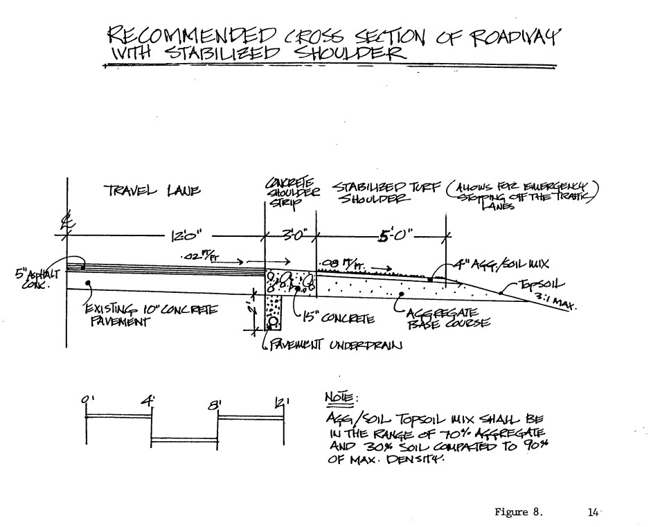
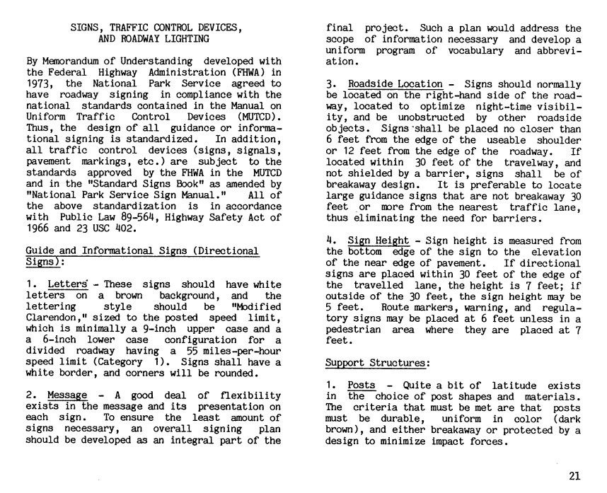
The National Park Service and Federal Highway Administration began to modernize Baltimore-Washington Parkway. The modernization of Baltimore-Washington Parkway would include the reconfiguration of numerous interchanges. The planned redesign of Baltimore-Washington Parkway is featured in the February 1984 document titled "
Baltimore-Washington Parkway design elements."
On May 9, 1991, the Baltimore-Washington Parkway was added to the National Register of Historic Places. During 1990s the Baltimore-Washington Expressway assumed the name "Baltimore-Washington Parkway." During 2002 the 1980s era National Park Service redesign of the Baltimore-Washington Parkway was completed upon the reconfiguration of the Maryland Route 197 interchange.
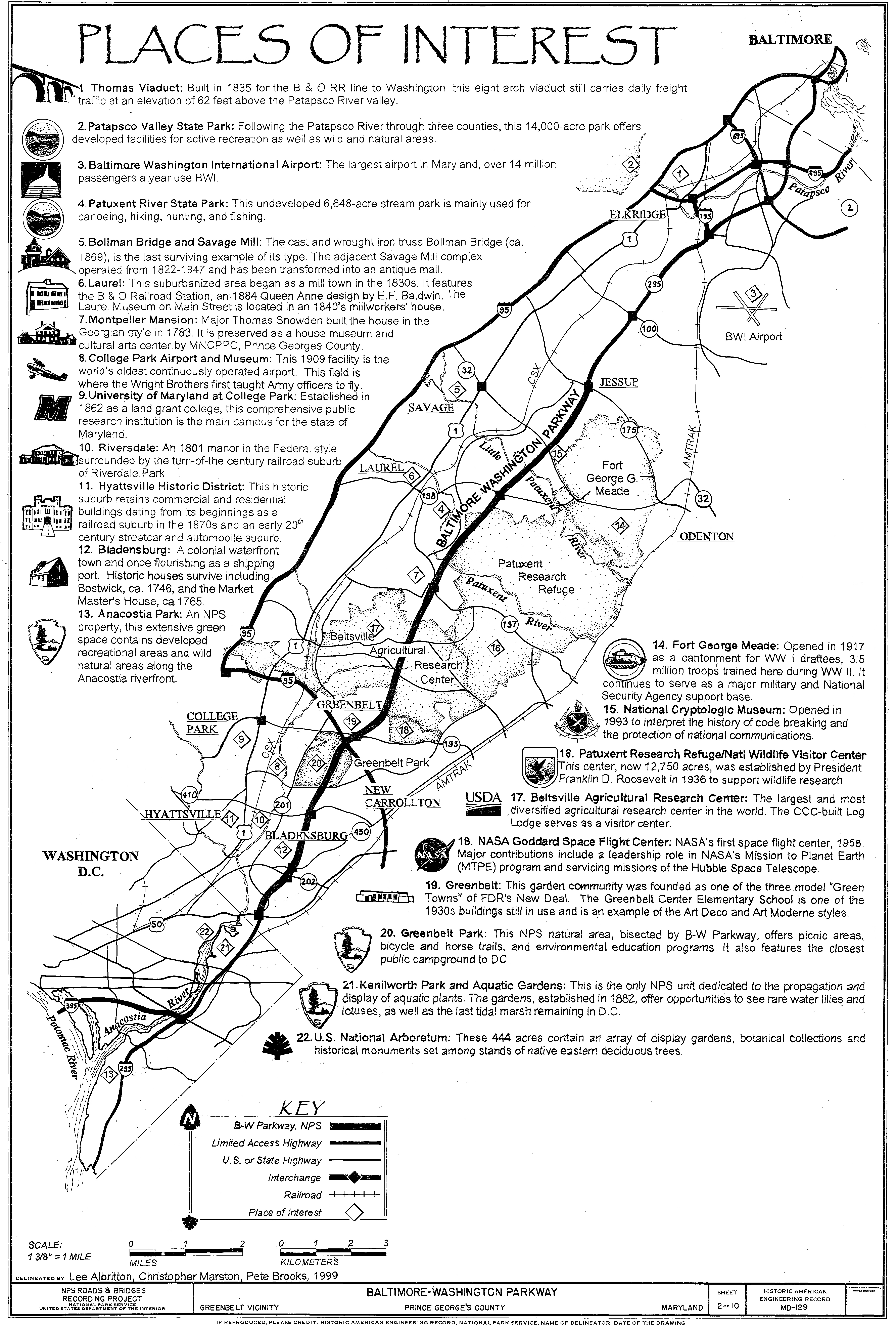
Below the history of the Baltimore-Washington Parkway in the 1954-1999 era can be observed on a Historic American Engineering Record and
National Park Service document.
Part 2; a drive on Baltimore-Washington Parkway
From Interstate 895 westbound Exit 4 traffic can access Baltimore-Washington Parkway/Maryland Route 295 southbound.
Baltimore-Washington Parkway/Maryland Route 295 southbound does not have exit numbers. South of Interstate 895 Baltimore-Washington Parkway/Maryland Route 295 intersects Interstate 695.
Baltimore-Washington Parkway/Maryland Route 295 southbound intersects Nursery Road followed by Interstate 195.
From Interstate 195 a guide sign posts Washington as being 31 miles to the south along Baltimore-Washington Parkway/Maryland Route 295.
Baltimore-Washington Parkway/Maryland Route 295 southbound intersects Maryland Route 100.
Baltimore-Washington Parkway/Maryland Route 295 southbound intersects Arundel Mills Road.
Baltimore-Washington Parkway/Maryland Route 295 southbound intersects Maryland Route 175.
South of Maryland Route 175 maintenance of Baltimore-Washington Parkway transitions to National Park Service maintenance. The National Park Service portion of Baltimore-Washington Parkway even has a large boundary sign similar to what would be seen at a normal National Park operating unit. The National Park Service maintained portion of Baltimore-Washington Parkway is dedicated to Congresswoman Gladys Noon Spellman.
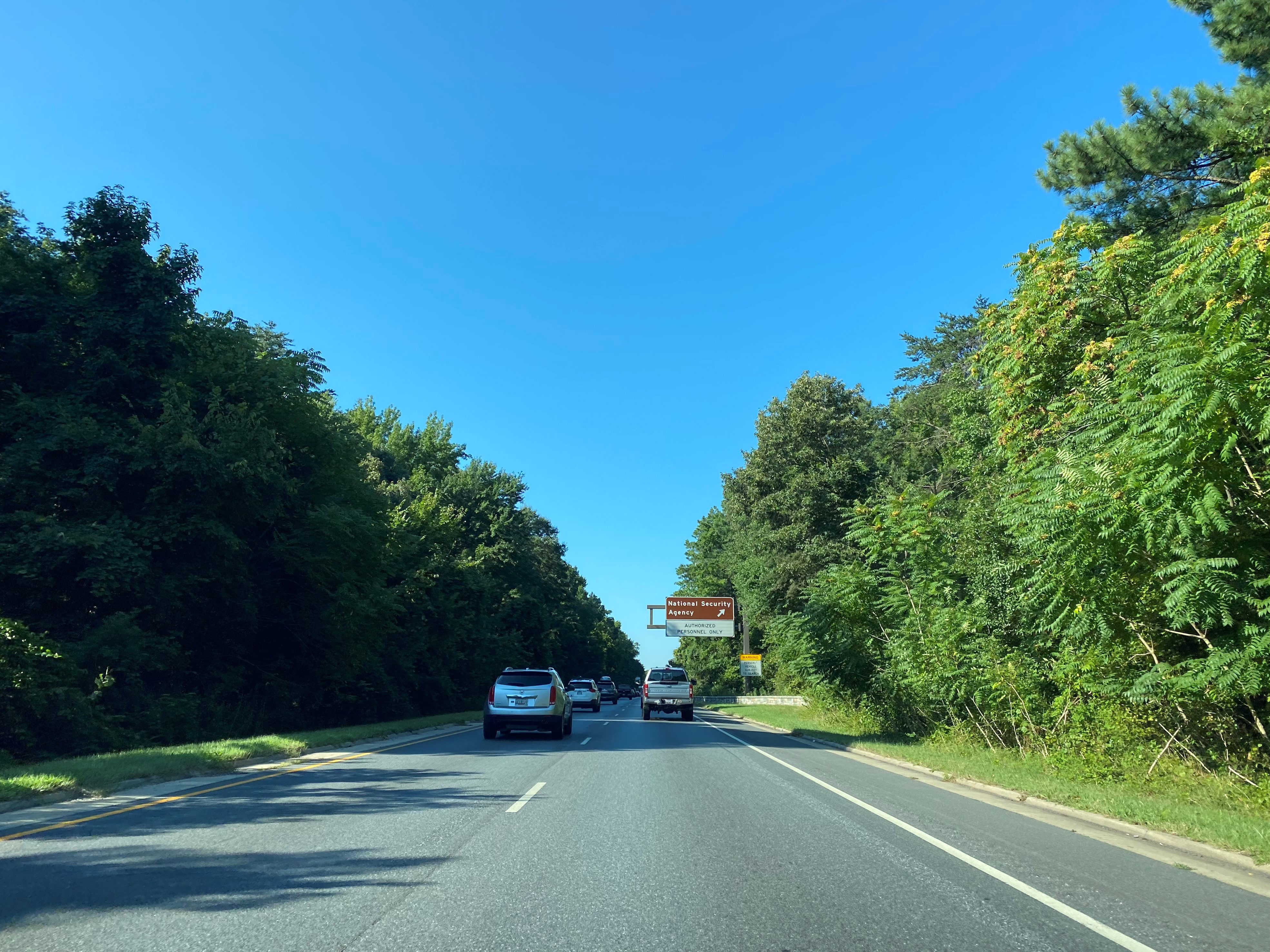
Baltimore-Washington Parkway southbound accesses a non-public exit to the National Security Administration Technology Drive. The immediate differences between the National Park Service maintained portion are immediately apparent with raised shoulders, brown guide signs and brick retaining walls.
Baltimore-Washington Parkway southbound intersects Maryland Route 32.
Baltimore-Washington Parkway southbound intersects Maryland Route 198.
Baltimore-Washington Parkway southbound intersects Maryland Route 197.
Baltimore-Washington Parkway southbound intersects Powder Mills Road.
Baltimore-Washington Parkway southbound intersects a closed exit to the Goddard Flight Center.
Baltimore-Washington Parkway southbound intersects Maryland Route 193 at Greenbelt Road.
Baltimore-Washington Parkway southbound intersects Interstate 495/Interstate 95 at the Capital Beltway.
Baltimore-Washington Parkway southbound intersects Maryland Route 410.
Baltimore-Washington Parkway southbound intersects Maryland Route 450.
Baltimore-Washington Parkway southbound intersects Maryland Route 202.
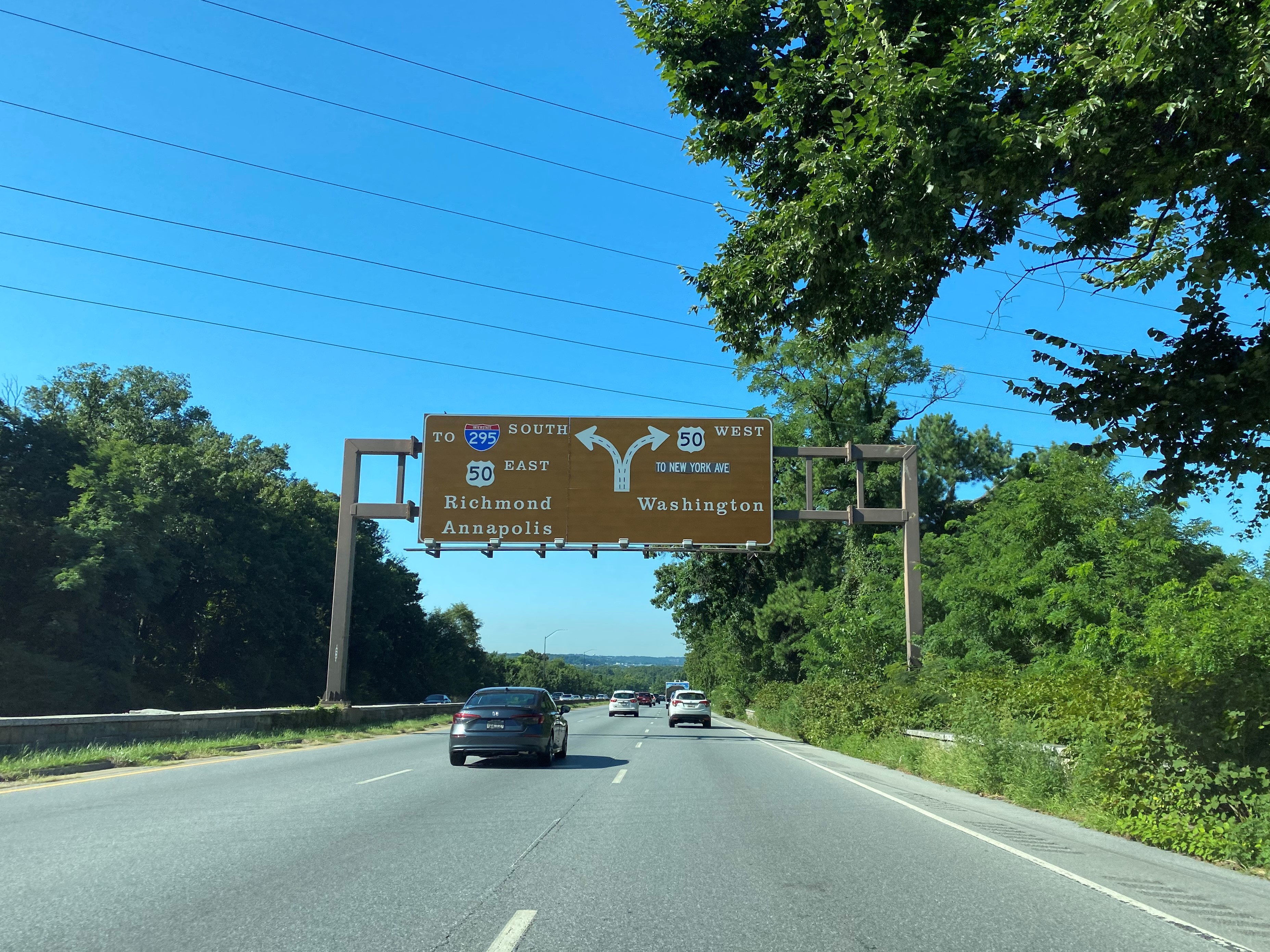
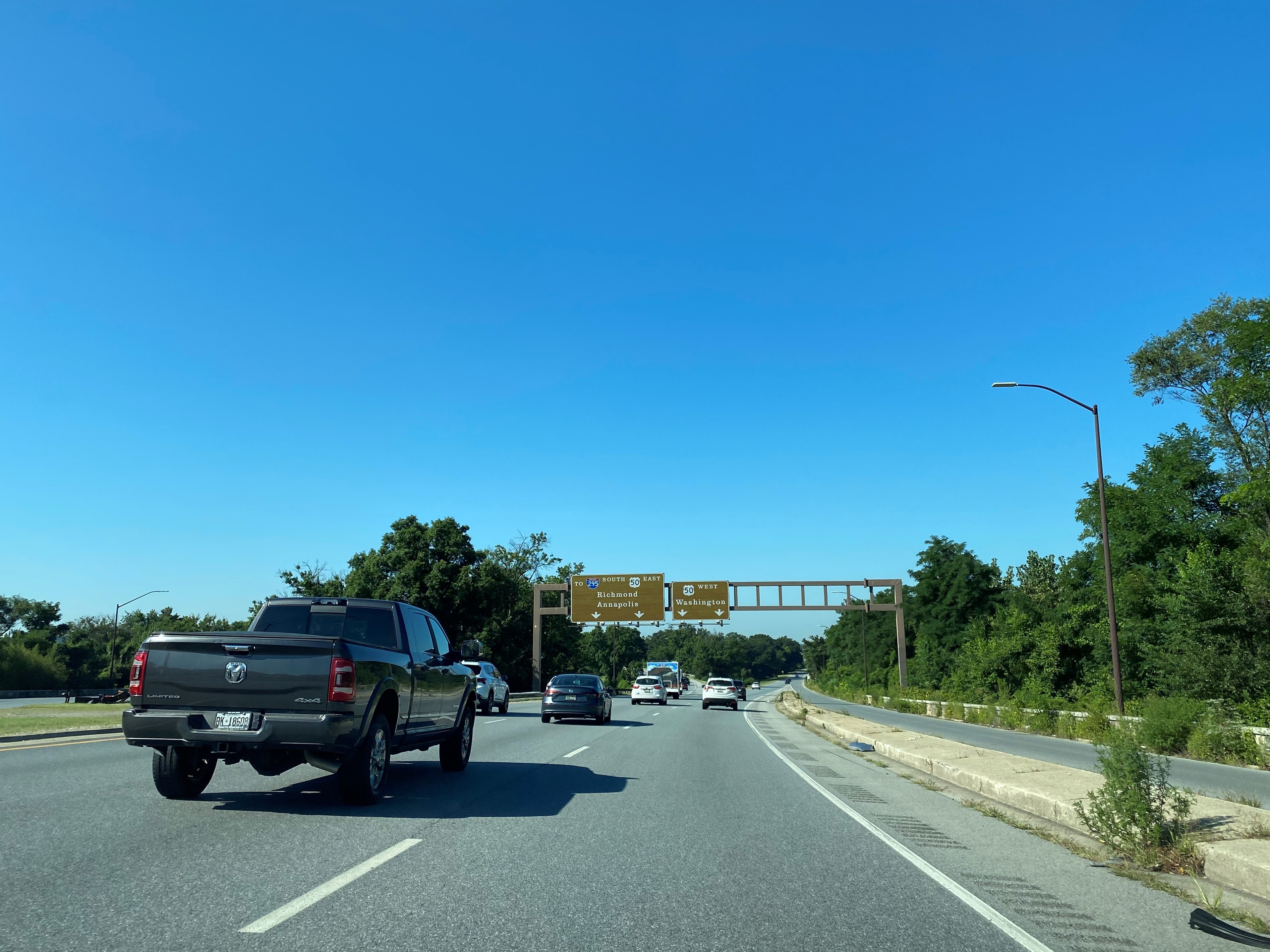
Baltimore-Washington Parkway southbound terminates as it intersects US Route 50. Traffic can follow Anacostia Freeway into the District of Columbia to reach Interstate 295 via District of Columbia 295. Signage directs traffic to follow US Route 50 westbound to reach New York Avenue in the District of Columbia.











Comments