

Part 1; the history of US Route 99 in Red Bluff
Historically US Route 99 ("US 99") entered Red Bluff headed southbound via Main Street on what was Legislative Route Number 3 ("LRN 3"). As US 99 headed south on Main Street it picked up California State Route 36 ("CA 36") eastbound at Beagum Road which was carried by LRN 29. US 99 south/CA 36 east continued south on Main Street/LRN 3 to downtown Red Bluff. At the intersection of Main Street and Antelope Boulevard US 99 split into a East/West Route. US 99E south turned eastbound along with CA 36 eastbound over the Sacramento River via Antelope Boulevard/LRN 3. On the outskirts of Red Bluff CA 36 east split from US 99E south via LRN 29 towards Lassen Volcanic National Park. US 99E make a southward turn towards Marysville and Roseville via LRN 3. The route of US 99W was far more conventional as it headed directly south on Main Street via LRN 7 towards Woodland. The below illustration depicts the historic alignments of; US 99, US 99E, US 99W, and CA 36 in Red Bluff.

Red Bluff is the Tehama County Seat and lies at an elevation of 305 feet above sea level due to it being located on the floor of Sacramento Valley. When gold was discovered in Yreka in 1851 it led to a rush which took travelers through Sacramento Valley. The rush to Yreka led to a small community developing at the confluence of Reeds Creek and the Sacramento River. The community was originally known as Leodocia and Covertsburg before Post Office Service opened as "Red Bluff" in October 1853. The name "Red Bluff" comes from formations near the community which were once apparent on the Sacramento River. When Tehama County was created in 1856 the community of Tehama was the initial County Seat but it was moved to Red Bluff in 1857. The Southern Pacific Railroad reached Red Bluff in 1872 and the community incorporated as a City in March of 1876.
Red Bluff can along the Southern Pacific Railroad on the 1873 Oregon, California, & Nevada Railroad Map.


Very early survey descriptions of LRN 3 and LRN 7 can be found on the January 1915 Highway Bulletin. LRN 7 is described as having an end point at LRN 3 at Tehama Junction (Tehama).


LRN 3 was eventually realigned over the 1915 Paynes Creek Slough Bridge, 1915 Samson Slough Bridge, and 1916 Kauffman Causeway when the State purchased the right of way. The Paynes Creek Slough Bridge and Samson Slough Bridge can both can be found on what is now Belle Mill Road. The 1915 Paynes Creek Bridge can be view on this link on Bridgehunter.com where as the 1915 Samson Slough Bridge can be viewed on this link. The Kauffman Causeway no longer stands but was located west of the Samson Slough Bridge. Michael McCarty of the Historic US Highway 99 Facebook Group expounded on the Kauffman Causeway:
"The Construction of the Causeway began in August 1915; Ross Construction Co., being the winning contractor. The Causeway opened on 23rd December, 1916. Even though the floor had not been sealed as of yet. The flooring was done and finished by the Chico Contracting Co., on 17th November, 1917. In 1921 "lighting" was added to the bridge. The Kauffman Causeway was 2480 ft long, with 31 arches that were 75' from center to center.


The initial draft of the US Route System was approved by the Secretary of Agriculture during November of 1925. The US Route System with in California was approved by California Highway Commission with no changes recommended by January 1926. The initial alignment of US 99 was largely planned to follow the Pacific Highway through Sacramento Valley. US 99 is shown on a map published in the 1926 California Highways & Public Works following LRN 3 into Red Bluff and heading south towards Woodland via LRN 7.


Thusly US 99 appears on the 1925 Rand McNally Map of California as being routed from Red Bluff south on LRN 7 to Woodland.


The January 1928 California Highways & Public Works describes US 99 as a single route heading south out of Red Bluff via LRN 7 towards Davis.

The AASHO data base has information pertaining to a request made by State Highway Engineer to have US 99 become a split route between Red Bluff south to Sacramento. In a letter dated June 13th, 1928 the rationale for splitting US 99 into an East/West Route was a two-to-one traffic ratio on LRN 3 on the east bank of the Sacramento River compared to LRN 7 on the west bank.

The proposed US 99 West/US 99 East split can be seen for the first time on this map (which was scanned upside down in the AASHO database).

The US 99 West/US 99 East split from Red Bluff to Sacramento was approved by the AASHO on August 6th, 1928.

The first map to display US 99 as a split route south of Red Bluff is the 1930 Division of Highways State Map.

During the 1964 State Highway Renumbering much of US 99 in Sacramento Valley was incorporated into Route 5 in anticipation of Interstate 5 being built. Much of US 99E was retained as part of the new Route 99 between Red Bluff and Wheeler Ridge. These changes can be seen on the 1964 Division of Highways State Map.

The opening of Interstate 5 between CA 36 in Red Bluff north to Cottonwood is discussed in the January/February 1965 California Highways & Public Works. The new segment of Interstate 5 is cited to have opened on July 2nd, 1964.
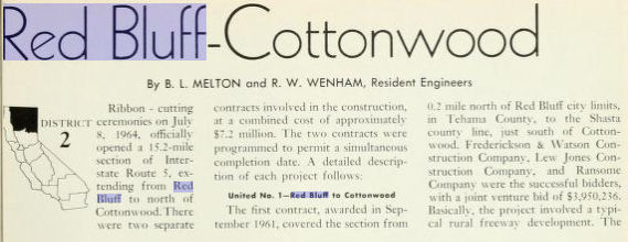


The November/December 1965 California Highways & Public Works cites that a new segment of Interstate 5 from Willows north to Red Bluff was slated to be open by Fall of 1966. This segment of Interstate 5 would connect to the segment constructed north of Red Bluff.

The 1967 Division of Highways Map shows that US 99 had been decomissioned in California. What had been US 99W and mainline US 99 in Red Bluff was replaced by Interstate 5. Former US 99E was replaced with a stand alone CA 36 east on Antelope Boulevard to what was now CA 99. CA 99 is shown to have a planned realignment from Vina to Interstate 5 near the southern outskirts of Red Bluff. This planned alignment of CA 99 was never constructed.

Part 2; a drive on former US Route 99 in Red Bluff
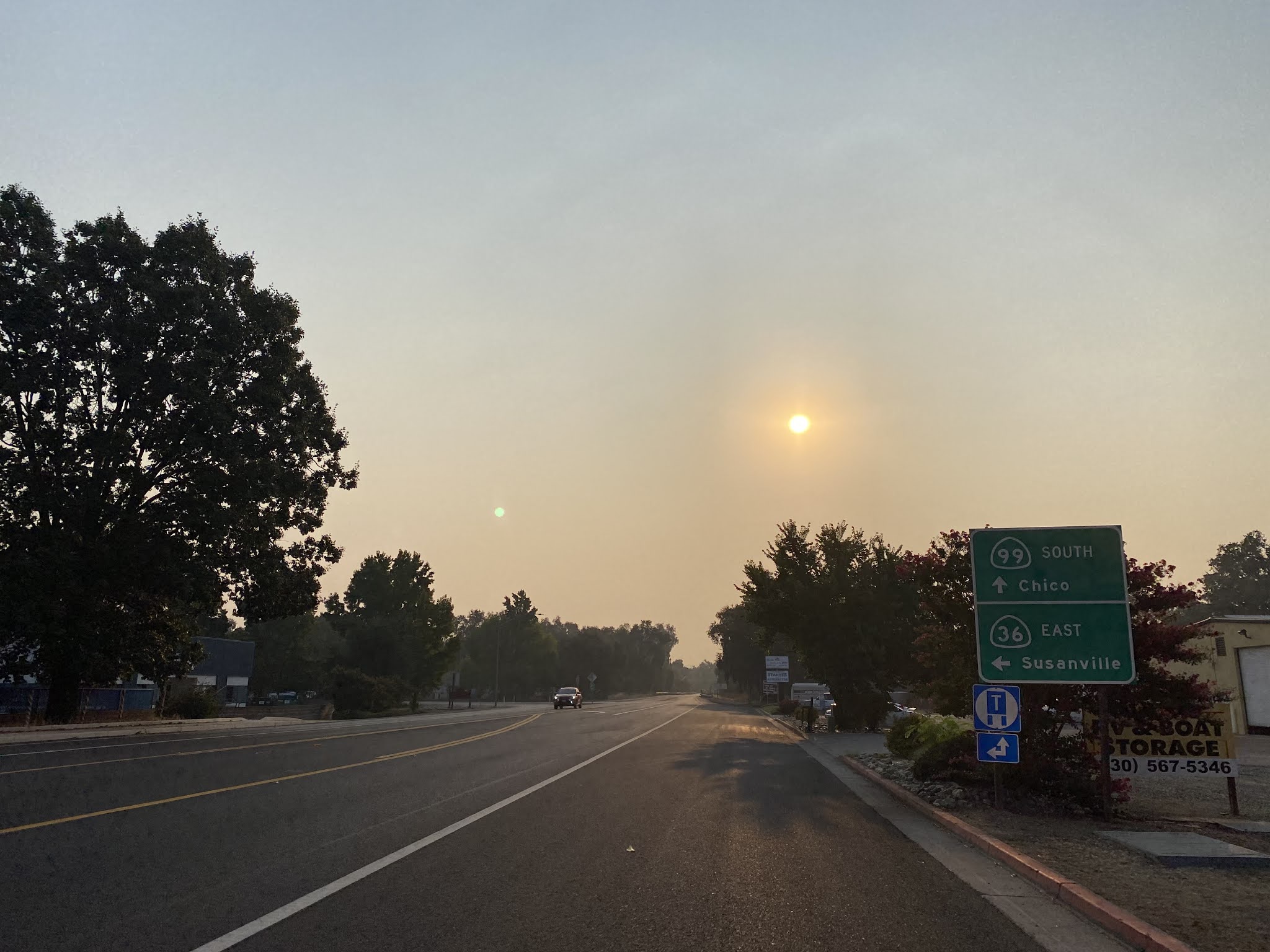
What was US 99W entered Red Bluff headed north on Main Street. Main Street in Red Bluff is presently signed as I-5 Business. This photo was taken at Main Street above I-5 Exit 647. Main Street at Exit 647 is slightly aligned east of where US 99W once was to approximately north to Luther Road. Note; former US 99W south of Red Bluff to 5th Street near Los Molinos is now part of Sign County Route A8.


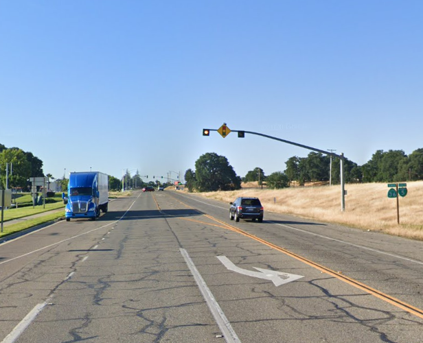
Former US 99W/I-5 Business continues north on Main Street to CA 36 at Antelope Boulevard. As noted above mainline US 99 continued straight on Main Street co-signed with CA 36 west. US 99E began at Antelope Boulevard co-signed with CA 36. The intersection of Main Street and Antelope Boulevard can be seen on in the third photo below.


Part 3; a drive on former US Route 99 East/California State Route 36 in Red Bluff
From the intersection of Main Street and Antelope Boulevard Former US 99E/CA 36 east crosses the Sacramento River and intersects Interstate 5.


CA 36 east of I-5 is co-signed as "TO CA 99" on Antelope Boulevard. At Postmile TEH 44.000 CA 36 east intersects CA 99. US 99E once split from CA 36 where CA 99 now is signed.


Part 4; a drive on former US Route 99/California State Route 36 in Red Bluff
CA 36 east enters the City of Red Bluff via Beagum Road, crosses the Union Pacific Railroad and makes a right hand turn onto former US 99/Main Street at Postmile TEH R41.205. As noted in Part 2 Main Street with in Red Bluff serves as the I-5 Business.


CA 36 east follows Main Street south into downtown Red Bluff. At Postmile TEH L41.283 CA 36 east makes a left hand turn onto Antelope Boulevard towards the Sacramento River onto what was US 99E. As previously noted US 99W once began by continuing south on Main Street.


Comments