This past month while viewing the site of Chisholm Ferry along the Kings River of Kings County I noticed that route being illustrated resembled an early Californian State Highway. My suspicions proved correct as the location of Chisholm Ferry was part of the original alignment of Legislative Route Number 10; a precursor to California State Route 198.

The Facebook in question above was posted on the Antique Images from the Collection of Michael J. Semas and can be viewed below:
Michael J. Semas on Chisholm Ferry and Bridge
The location of Chisholm Ferry is located just south of Jackson Avenue/Old CA 198 on the Kings River about 4 miles west of Lemoore near Avenal Cut-Off Road. This particular section of the Kings River was once the northern most extent of Tulare Lake.
Tulare Lake was once the largest fresh water lake west of the Great Lakes by surface area. Tulare Lake was first surveyed at an approximately 570 square miles in 1849 and was later surveyed to be 690 square miles in 1879. The wild variance in the size of Tulare Lake was due to it's very shallow depth which was completely determined by snow pack melt out of the Sierra Nevada Mountains. Tulare Lake was fed by the Kings, Kaweah, Tule, and Kern River basins which were largely engineered in the 19th Century/early 20th Century for irrigation or flood control. The last major flood of Tulare Lake was back in 1938 when it filled somewhat close to a size seen in the 1870s. There has been occasional floods during heavy winters (1969, 1983 and 1997 are often cited as note worthy years) in the 20th Century that led to floods on the Tulare Lake bed but it largely has remained dry farm land. There were concerns of flooding on the Tulare Lake Bed in the winter of 2016-17 due to heavy run-off from the Sierras.
Tulare Lake had and extremely marshy watershed which coupled with it's wildly varying depths deterred European settlement of the area up until the end of the California Gold Rush. The first major community to appear along Tulare Lake was the City of Lemoore which was organized out of land sub-divisions in 1872 in what was at the time Tulare County. Lemoore being one of the few major settlements made for an attractive siding locale when the Southern Pacific Railroad completed a line between Goshen west to the oil fields of the Diablo Range in 1877. This 1876 map of Tulare County shows how close Lemoore really was to Tulare Lake. The Southern Pacific Railroad line west of Lemoore is shown clambering over the northern most extent of Tulare Lake. The future location of Chisholm Ferry was located approximately where Grid 25 listed with a property owner of Roberts is shown.

A full version of the 1876 Tulare County Map can be seen on the link below.
1876 Tulare County Map
A irrigation map of Tulare Lake and the San Joaquin River was published by Britton & Rey Company in 1877 which shows the water basin of San Joaquin Valley in greater detail.
West Side Irrigation District and Tulare Lake, San Joaquin Valley, California
The Southern Pacific Line west of Lemoore brought additional settlements by way of rail sidings. Most notably Huron was settled west of Lemoore along the Southern Pacific in 1877. The Southern Pacific did construct a bridge next to it's new railroad but a easier route would have been desirable as Tulare Lake began to shrink due to irrigation divisions. At some point during the 1880s Chisholm's Ferry was founded on the Kings River which can be seen southwest of Lemoore on this 1885 Lemoore & Hanford Area Irrigation Map.

On the full version of the Lemoore & Hanford Area irrigation map from 1885 there is some interesting observations to be made about Tulare Lake. The entire Tulare Lake Basin had seen a drastic reduction in size in less than one decade and almost the entirety of historic high point of the lake had been surrounded by a levee system. Given how far the actual waters of Tulare Lake were from the levees it is clear that even by 1885 the watershed was dying rapidly.
1885 Lemoore & Hanford Irrigation Map
At some point between 1885 and 1892 Chisholm's Ferry was replaced by a bridge. I'm sure exactly what kind of structure the Chisholm's Ferry Bridge was but there is a strong chance it was a truss structure like the nearby Kingston Bridge or even the original Lanes Bridge. The Chisholm's Ferry Bridge can be seen on the far left on this snipped image from an 1892 Thompson Map of Tulare County.

By 1893 Kings County was spun off from western Tulare County. Interestingly Chisholm's Ferry seemed to linger on for at least a decade as an active community as evidenced by this 1896 Geo W. Blum Map. Note; the early highway between Lemoore and Coalinga can be seen on the map below.

In 1915 Legislative Route Number 10 was extended west from Hanford over the Diablo Range to San Lucas. This action suddenly would incorporate Chisholm's Ferry Bridge into the State Highway system.
CAhighways.org on LRN 10
LRN 10 west of Lemoore originally was far different than CA 198 turned out to be. The 1917 California State Automobile Association map indicates that LRN 10 used the following route west of Lemoore to Coalinga:
- From Hanford-Armona Road south on Lemoore Avenue/18th Avenue.
- From 18th Avenue west on Jackson Avenue.
- Jackson Avenue west to 21st 1/2 Avenue.
- 21st 1/2 Avenue over the Kings River via the Chisholm's Ferry Bridge to Murphy's Ranch Road.
- From Murphy's Ranch Road southwesterly jog on roadways that appear to no longer exist to Huron.
- From Huron LRN 10 took an unclear path southwest to Jayne Avenue.
- From Jayne Avenue LRN 10 continued west to Polk Street in Coalinga.
The above alignment can be seen on this snip from the 1917 CSAA map. The red line denotes segments of State Highway. What appears to be certain is that the right-of-way between Lemoore and Coalinga essentially existed on whatever roads were present at the time. In the era of the early State Highway system the Department of Public Works would often build new road alignments that incorporated little if any of the previous right-of-way. .

For reference the full 1917 CSAA map can be seen on the link below.
1917 CSAA Map of California
The 1920 State Highway Map shows the planned alignment of LRN 10 between Lemoore and Coalinga as only partially constructed. The route of LRN 10 west from Lemoore was planned to be aligned completely west of Lemoore on Jackson Avenue into the Diablo Range where it would have turned south from the Oilfields to Coalinga. The 1920 State Highway Map shows only the segment of LRN 10 south from the Oilfields to Coalinga as complete.

For reference the 1920 State Highway Map can be seen in full at the link below:
1920 State Highway Map
The 1922 State Highway Map seems to indicate that the new route of LRN 10 west of Lemoore to Coalinga was complete. This is likely when a new bridge over the Kings River replaced the Chisholm's Ferry Bridge.

By late 1934 CA 198 was applied to the entirety of LRN 10. The 1935 Division of Highways Map of Kings County indicates that the Chisholm's Ferry Bridge still existed south of CA 198 on Jackson Avenue. It is unclear when the Chisholm's Ferry Bridge was razed.

For reference the entire 1935 Division of Highways Map of Kings County can be seen below.
1935 Kings County Highway Map
This custom map below shows where Chisholm's Ferry Bridge was in relation to Old CA 198 on Jackson Avenue and the modern CA 198 Freeway.

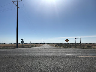
This past week I headed to the Kings River to view the area that Chisholm's Ferry Bridge would have been located. The approach from Jackson Avenue west onto 21st 1/2 Avenue is presently signed as private property. That said, this view would have been of the western approach to the Kings River and the Chisholm Ferry Bridge.

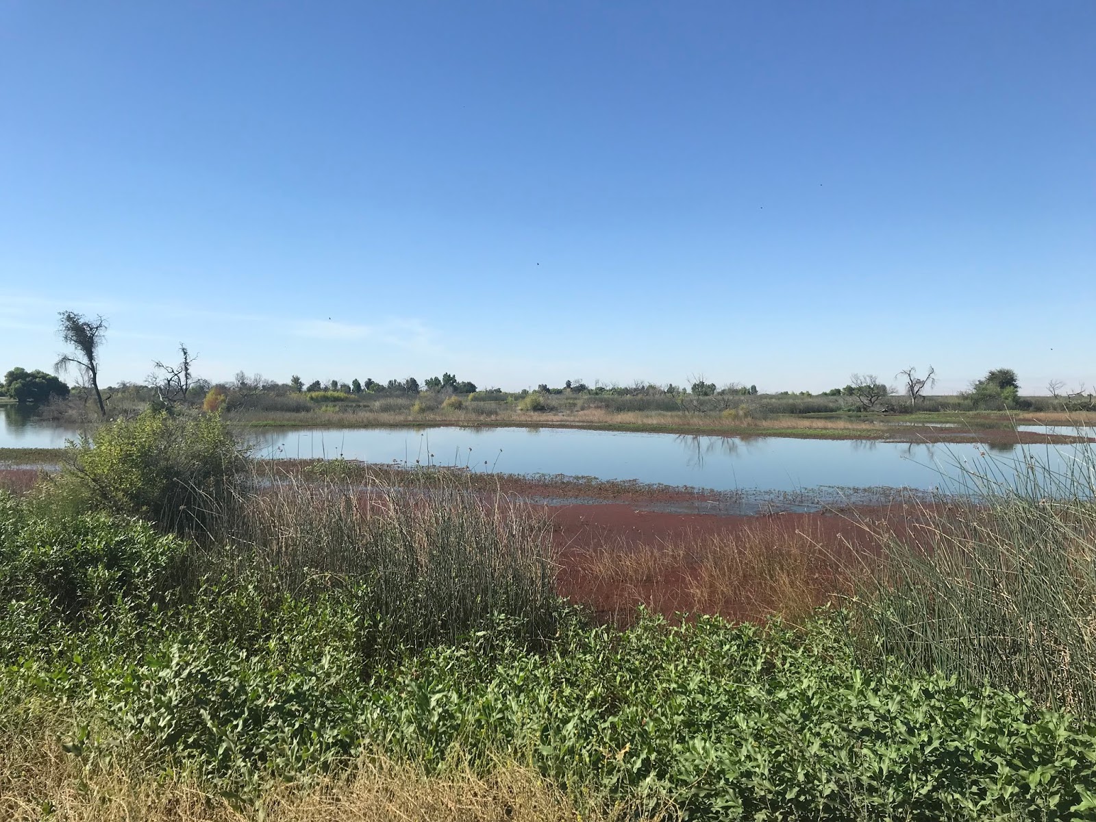
Chisholm's Ferry Bridge was located just south of Old CA 198 on Jackson Avenue. The Chisholm Ferry Bridge location can be seen by looking south from the Jackson Avenue Bridge over the Kings River. It is hard to fathom this entire area being under the waters of Tulare Lake in the 1870s.


The pre-Freeway/Expressway alignment of CA 198 in Kings County was covered on this previous blog.
Old CA 198 in Kings County
From Avenal Cut-Off Road the eastbound approach to what was Chisholm's Ferry Bridge can be accessed on Murphy's Ranch Road. Murphy's Ranch Road doesn't directly access the Chisholm's Ferry Bridge location anymore as there is private property gated off at the Kings River.


The Facebook in question above was posted on the Antique Images from the Collection of Michael J. Semas and can be viewed below:
Michael J. Semas on Chisholm Ferry and Bridge
The location of Chisholm Ferry is located just south of Jackson Avenue/Old CA 198 on the Kings River about 4 miles west of Lemoore near Avenal Cut-Off Road. This particular section of the Kings River was once the northern most extent of Tulare Lake.
Tulare Lake was once the largest fresh water lake west of the Great Lakes by surface area. Tulare Lake was first surveyed at an approximately 570 square miles in 1849 and was later surveyed to be 690 square miles in 1879. The wild variance in the size of Tulare Lake was due to it's very shallow depth which was completely determined by snow pack melt out of the Sierra Nevada Mountains. Tulare Lake was fed by the Kings, Kaweah, Tule, and Kern River basins which were largely engineered in the 19th Century/early 20th Century for irrigation or flood control. The last major flood of Tulare Lake was back in 1938 when it filled somewhat close to a size seen in the 1870s. There has been occasional floods during heavy winters (1969, 1983 and 1997 are often cited as note worthy years) in the 20th Century that led to floods on the Tulare Lake bed but it largely has remained dry farm land. There were concerns of flooding on the Tulare Lake Bed in the winter of 2016-17 due to heavy run-off from the Sierras.
Tulare Lake had and extremely marshy watershed which coupled with it's wildly varying depths deterred European settlement of the area up until the end of the California Gold Rush. The first major community to appear along Tulare Lake was the City of Lemoore which was organized out of land sub-divisions in 1872 in what was at the time Tulare County. Lemoore being one of the few major settlements made for an attractive siding locale when the Southern Pacific Railroad completed a line between Goshen west to the oil fields of the Diablo Range in 1877. This 1876 map of Tulare County shows how close Lemoore really was to Tulare Lake. The Southern Pacific Railroad line west of Lemoore is shown clambering over the northern most extent of Tulare Lake. The future location of Chisholm Ferry was located approximately where Grid 25 listed with a property owner of Roberts is shown.

A full version of the 1876 Tulare County Map can be seen on the link below.
1876 Tulare County Map
A irrigation map of Tulare Lake and the San Joaquin River was published by Britton & Rey Company in 1877 which shows the water basin of San Joaquin Valley in greater detail.
West Side Irrigation District and Tulare Lake, San Joaquin Valley, California
The Southern Pacific Line west of Lemoore brought additional settlements by way of rail sidings. Most notably Huron was settled west of Lemoore along the Southern Pacific in 1877. The Southern Pacific did construct a bridge next to it's new railroad but a easier route would have been desirable as Tulare Lake began to shrink due to irrigation divisions. At some point during the 1880s Chisholm's Ferry was founded on the Kings River which can be seen southwest of Lemoore on this 1885 Lemoore & Hanford Area Irrigation Map.

On the full version of the Lemoore & Hanford Area irrigation map from 1885 there is some interesting observations to be made about Tulare Lake. The entire Tulare Lake Basin had seen a drastic reduction in size in less than one decade and almost the entirety of historic high point of the lake had been surrounded by a levee system. Given how far the actual waters of Tulare Lake were from the levees it is clear that even by 1885 the watershed was dying rapidly.
1885 Lemoore & Hanford Irrigation Map
At some point between 1885 and 1892 Chisholm's Ferry was replaced by a bridge. I'm sure exactly what kind of structure the Chisholm's Ferry Bridge was but there is a strong chance it was a truss structure like the nearby Kingston Bridge or even the original Lanes Bridge. The Chisholm's Ferry Bridge can be seen on the far left on this snipped image from an 1892 Thompson Map of Tulare County.

By 1893 Kings County was spun off from western Tulare County. Interestingly Chisholm's Ferry seemed to linger on for at least a decade as an active community as evidenced by this 1896 Geo W. Blum Map. Note; the early highway between Lemoore and Coalinga can be seen on the map below.

In 1915 Legislative Route Number 10 was extended west from Hanford over the Diablo Range to San Lucas. This action suddenly would incorporate Chisholm's Ferry Bridge into the State Highway system.
CAhighways.org on LRN 10
LRN 10 west of Lemoore originally was far different than CA 198 turned out to be. The 1917 California State Automobile Association map indicates that LRN 10 used the following route west of Lemoore to Coalinga:
- From Hanford-Armona Road south on Lemoore Avenue/18th Avenue.
- From 18th Avenue west on Jackson Avenue.
- Jackson Avenue west to 21st 1/2 Avenue.
- 21st 1/2 Avenue over the Kings River via the Chisholm's Ferry Bridge to Murphy's Ranch Road.
- From Murphy's Ranch Road southwesterly jog on roadways that appear to no longer exist to Huron.
- From Huron LRN 10 took an unclear path southwest to Jayne Avenue.
- From Jayne Avenue LRN 10 continued west to Polk Street in Coalinga.
The above alignment can be seen on this snip from the 1917 CSAA map. The red line denotes segments of State Highway. What appears to be certain is that the right-of-way between Lemoore and Coalinga essentially existed on whatever roads were present at the time. In the era of the early State Highway system the Department of Public Works would often build new road alignments that incorporated little if any of the previous right-of-way. .

For reference the full 1917 CSAA map can be seen on the link below.
1917 CSAA Map of California
The 1920 State Highway Map shows the planned alignment of LRN 10 between Lemoore and Coalinga as only partially constructed. The route of LRN 10 west from Lemoore was planned to be aligned completely west of Lemoore on Jackson Avenue into the Diablo Range where it would have turned south from the Oilfields to Coalinga. The 1920 State Highway Map shows only the segment of LRN 10 south from the Oilfields to Coalinga as complete.

For reference the 1920 State Highway Map can be seen in full at the link below:
1920 State Highway Map
The 1922 State Highway Map seems to indicate that the new route of LRN 10 west of Lemoore to Coalinga was complete. This is likely when a new bridge over the Kings River replaced the Chisholm's Ferry Bridge.

By late 1934 CA 198 was applied to the entirety of LRN 10. The 1935 Division of Highways Map of Kings County indicates that the Chisholm's Ferry Bridge still existed south of CA 198 on Jackson Avenue. It is unclear when the Chisholm's Ferry Bridge was razed.

For reference the entire 1935 Division of Highways Map of Kings County can be seen below.
1935 Kings County Highway Map
This custom map below shows where Chisholm's Ferry Bridge was in relation to Old CA 198 on Jackson Avenue and the modern CA 198 Freeway.

This past week I headed to the Kings River to view the area that Chisholm's Ferry Bridge would have been located. The approach from Jackson Avenue west onto 21st 1/2 Avenue is presently signed as private property. That said, this view would have been of the western approach to the Kings River and the Chisholm Ferry Bridge.

Chisholm's Ferry Bridge was located just south of Old CA 198 on Jackson Avenue. The Chisholm Ferry Bridge location can be seen by looking south from the Jackson Avenue Bridge over the Kings River. It is hard to fathom this entire area being under the waters of Tulare Lake in the 1870s.


The pre-Freeway/Expressway alignment of CA 198 in Kings County was covered on this previous blog.
Old CA 198 in Kings County
From Avenal Cut-Off Road the eastbound approach to what was Chisholm's Ferry Bridge can be accessed on Murphy's Ranch Road. Murphy's Ranch Road doesn't directly access the Chisholm's Ferry Bridge location anymore as there is private property gated off at the Kings River.


Comments