
Small Towns of Virginia Series - Floyd

Floyd is one of the smallest county seats in Virginia.  At a population of just over 400 - Floyd is the county seat of the same county that shares its name.  However despite its small size, Floyd has a colorful history and its downtown is the center of Bluegrass Country.

Downtown Floyd, Virginia
Floyd County was formed in 1831 and named after Virginia Governor John Floyd who was raised nearby.  The county seat of Floyd was established three years later and was originally named Jacksonville after President Andrew Jackson.  The town was incorporated in 1858 and would have its named changed to Floyd in 1896. The town's population has ebbed and flowed around 400 residents since then.
Floyd County Court House and Confederate Soldier Memorial
Floyd is in the heart of Bluegrass County and Virginia's Crooked Road Heritage Trail winds through town on US 221 and VA 8.  The 
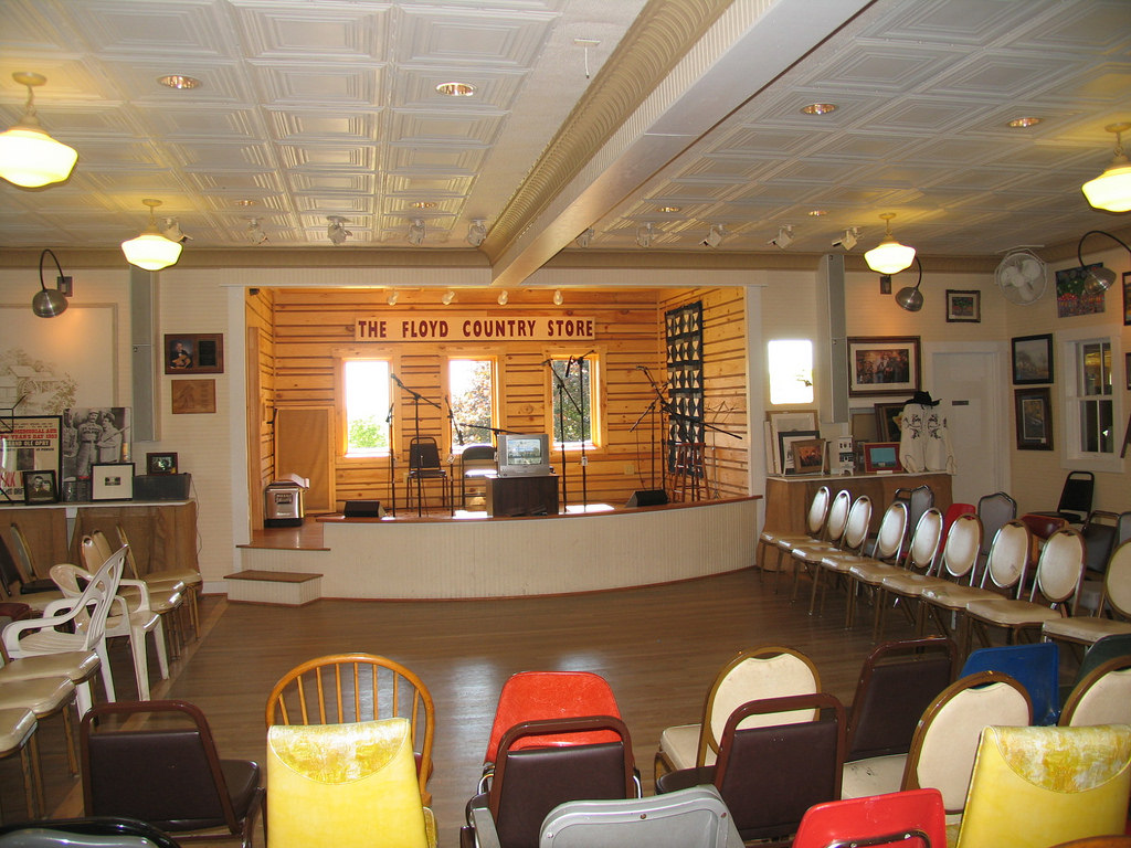
Floyd Country Store is not only a classic small town general store; it is home to the Friday Night Jamboree - a celebration of Bluegrass and Americana music - every Friday Night at 6:30.  Local residents and tourists from throughout the world have taken part in this great tradition.


Stage and Dance Floor at The Floyd Country Store
Floyd is home to numerous festivals and events including the annual FloydFest which is a four day music and arts festival that is located just off of the Blue Ridge Parkway. Floyd may be very small but there's a lot to do, see and enjoy in this tiny but welcoming community.

Site Navigation:

Comments

Popular posts from this blog

Crescent City Connection (New Orleans, LA)

The Crescent City Connection is a massive dual-span steel truss bridge that spans the lower Mississippi River at downtown New Orleans, about 95 river miles upstream from the mouth of the great river at the Head of Passes Light. If counted as a single bi-directional highway bridge, the parallel spans combine to form the single busiest bridge on the Mississippi River and its importance as a linchpin in the region’s transportation network cannot be overstated. While there have been various schemes over the years to construct bridges downriver from Algiers Point, this bridge has been the southernmost bridge on the Mississippi River since its initial construction in the 1950s. The years immediately following the end of World War II were a transformational period in the history of New Orleans. Already one of the great economic and cultural centers of the American Deep South, it was recognized at this time that major changes and improvements to the city’s transportation infrastructure would b...

Old US Route 99 through Tipton, Tulare, and Tagus Ranch

This summer I had a look into the alignment history of US Route 99 through the Tulare County communities of Tipton, Tulare, and Tagus Ranch.  While this slab below might seem like much it is one of the few remaining reminders of how US Route 99 was during the 1920s in Tulare County. This blog is part of the larger Gribblenation US Route 99 Page.  For more information pertaining to the other various segments of US Route 99 and it's three-digit child routes check out the link the below. Gribblenation US Route 99 Page Part 1; the history of US Route 99 in Tipton, Tulare, and Tagus Ranch Tipton and Tulare were both founded in 1872 as sidings of the Southern Pacific Railroad.  The Southern Pacific Railroad laid the groundwork for development of southern San Joaquin Valley.  Previous to the Southern Pacific Railroad travel via wagon or foot in Central California tended to avoid San Joaquin Valley in favor of the Stockton-Los Angeles Road.  The Stockton Los Ange...

Former US Route 101 and California State Route 41 through Paso Robles

Paso Robles is a city located on the Salinas River of San Luis Obispo County, California.  As originally configured the surface alignments of US Route 101 and California State Route 41 converged in downtown Paso Robles.  US Route 101 originally was aligned through Paso Robles via Spring Street.  California State Route 41 entered the City of Paso Robles via Union Road and 13th Street where it intersected US Route 101 at Spring Street.  US Route 101 and California State Route 41 departed Paso Robles southbound via a multiplex which split near Templeton.   Pictured above is the cover of the September/October 1957 California Highways & Public Works which features construction of the Paso Robles Bypass.  Pictured below is the 1935 Division of Highways Map of San Luis Obispo County which depicts US Route 101 and California State Route 41 intersecting in downtown Paso Robles.   Part 1; the history of US Route 101 and California State Route 41 i...