
NYC On Foot

It's been awhile since I've been on here-What can I say, I've been a bit busy lately. Most of you may or may not know that I've been routinely going down to New York City to shoot Punk and Hardcore shows-and that's been the largest part of my photographic output over the last couple of years. But, shows don't run 24-7, and I don't sleep the whole time between any given two shows; so that leaves me with time on my hands, and I really don't dig spending that time sitting around looking at TV in the hostel that I usually stay in.

New York City is a fascinating place. I don't mean just the usual touristy stuff either. Every corner you turn, you can find something interesting and unique. It's almost like a state unto itself: particularly as far as the roads are concerned. The signage is much different than the rest of the state, and the iconic double-guyed traffic lights aren't found anywhere else. In fact, new traffic lights follow the same design used for years. There are street lamps about that have been around since nearly the turn of the last century. And there are bridges.

One of the things about NYC is that it's reasonably pedestrian friendly, and despite cutbacks, it still has one of the best transit systems going. It makes it easier to get up close and personal with the city. Over the New Year's holiday, I had a hankering to go to Rockaway Beach, to see at least a part of the Rockaway Freeway. No problem, I hopped on the Subway and away I went.
I spent a good couple of hours walking around the area, taking pictures. I was particularly interested in the elevated railway over the 'freeway' that carried the 'A' train.


Again, last weekend found me with a nice day and some spare time, so I decided it would be a nice day to take a stroll over the Brooklyn Bridge. It's kind of an odd experience, because auto traffic flies across the bridge as if it were a freeway, yet the pedestrian deck is kind of like a linear park, even a bit festive with people selling T-shirts and souvenirs. Amazingly enough, there was hardly any graffiti-except on some temporary construction structures. Even the taggers respect the bridge.

Since the Brooklyn foot of the Manhattan Bridge was only a few blocks away, I decided to cross back into Manhattan that way. The Manhattan Bridge is not as easily photographed from it's pedestrian deck, though you get some decent views from it, just the same; and there's a nifty portal at the Manhattan foot of the bridge. It lets out in Chinatown at Bowery and Canal-which is not too far from yet another bridge-the Williamsburg which I've crossed over on a couple of times.
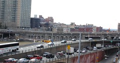
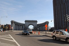


Next on my list is the Queensboro bridge-which should yield some interesting pictures. The 7 train emerges above ground at the bridge plaza, so I've had a chance to at least partially reconnoiter the area.

Comments

Larry G said…
How do you "navigate" NYC on foot?

Popular posts from this blog

Grand Loop Road of Yellowstone National Park

  Grand Loop Road is a 140 mile loop highway which traverses the interior of Yellowstone National Park.  Grand Loop Road connects all of the major attractions and geological features of Yellowstone National Park along with the entrance roads.  Grand Loop Road is a seasonal highway and despite some conjecture never has been part of the US Route System.   Part 1; the history of Grand Loop Road The majority of history pertaining to Grand Loop Road was taken from the below National Park Service article: Historic Roads - Yellowstone National Park (U.S. National Park Service) (nps.gov) Yellowstone was declared the first National Park of the United States on March 1st, 1872.  The first real highway to access Yellowstone National Park came in 1873 when a tolled facility was constructed from Bozeman, Montana via Yankee Jim Canyon to Mammoth Hot Springs.  Numerous attempts were made to fund construction of roadway infrastructure during the early years of Yellows...

The last 1956-63 era California Sign State Route Spade?

Along southbound California State Route 170 (the Hollywood Freeway Extension) approaching the Hollywood Freeway/Ventura Freeway interchange a white California State Route 134 Sign State Route Spade can be observed on guide sign.  These white spades were specifically used during the 1956-63 era and have become increasingly rare.  This blog is intended to serve as a brief history of the Sign State Route Spade.  We also ask you as the reader, is this last 1956-63 era Sign State Route Spade or do you know of others?  Part 1; the history of the California Sign State Route Spade Prior to the Sign State Route System, the US Route System and the Auto Trails were the only highways in California signed with reassurance markers.  The creation of the US Route System by the American Association of State Highway Officials during November 1926 brought a system of standardized reassurance shields to major highways in California.  Early efforts to create a Sign State Route ...

California State Route 70; the Feather River Highway

From 2017 through to early 2019 I drove the majority of the California State Route 70; the Feather River Highway from CA 89 southwest to CA 99. CA 70 is an approximately 178.5 mile state highway which starts at US 395 near the Nevada State Line and travels west through the Feather River Canyon to CA 99.  CA 70 is often referred to as the Feather River Highway" given it's close association with the river.  Historically CA 70 was previously signed as US 40A and CA 24.  The Legislative Routes prior to the 1964 California Highway Renumbering that made up the current route of CA 70 are as follows: -  Legislative Route Number 21 from US 395 westward to Oroville. -  LRN 87 from Oroville south to Marysville. -  LRN 232 from Marysville to the current junction with CA 99.  CA 70 was even dual signed with CA 99 into Sacramento on what was LRN 232 for a time. The change from US 40A/LRN 21/LRN 87/LRN 232 can be seen by comparing the 1963 State Highway Ma...