Two dead in I-88 Washout; NY State Thruway Closed from Schenectady to Syracuse

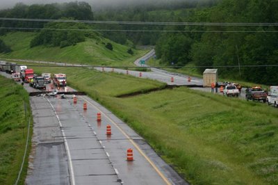
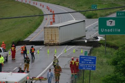
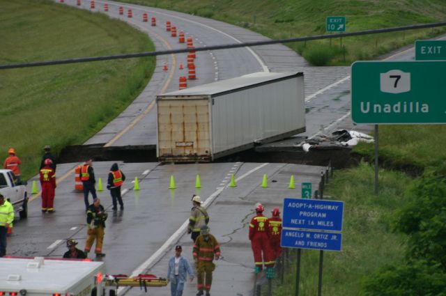
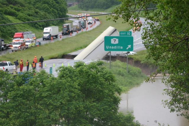
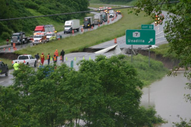
Two truck drivers were killed early this morning on I-88 near Unadilla, NY when their rigs fell into a washout caused by heavy rainfall. The New York State Thruway is closed in both directions from Exit 28 to Exit 31. The closing is indefinite. The Thruway is only open to local traffic from Exit 25A - 28 and Exit 36 - 31. (More from the Albany Times-Union)

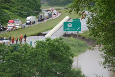
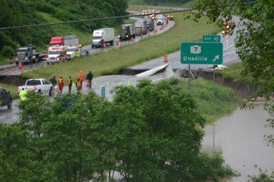
The washout of all four lanes and center median was a result of a failed culvert just beyond the Exit 10 interchange. The drivers, one going eastbound the other westbound, were killed when their trucks fell into the collapsed roadway. Unconfirmed reports have said that the bodies had not been found.

Photos below of the I-88 incident:
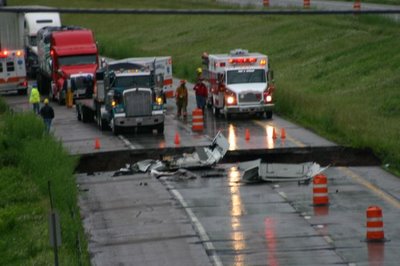


All photos were taken by the New York State Police.

I-90 Westbound was backed up solid from Exit 25A to Exit 25. Traffic is being funneled down to one lane at Exit 25A. DOT and State Troopers are stationed at the merge and are only allowing "local" traffic beyond Exit 25A. At the Exit 25A toll booth, cones block access to the I-90 West onramp and DOT and State Police are also present to allow only "local" traffic through.

I did not take my camera to work with me today, I will tomorrow and will take photos if the closings are still in effect.

The probable detour: I-88, US 20, I -81 to I-90.

Links: WSYR Video of washout and of the Exit 10 sign collapsing
WSYR News Report

Comments

Anonymous said…
I remember this. I drove through 2 feet of water in my 1987 dodge aries and after i had to remove the moldy carpet.. fun times.
Unknown said…
My grandfather died this day he was one of the truckers he was found on July 8th 2006
Tyler Norton said…
I feel this my Pepe Patrick was the trucker that was found in July love you Pepe my first born is named in his honor

Popular posts from this blog

West Canyon Road (Snow Canyon State Park)

West Canyon Road is an approximately four-mile dirt service road located in Snow Canyon State Park.  West Canyon Road follows Snow Canyon from the Whiptail Trail to the northern State Park boundary and intersects numerous trailheads.   West Canyon Road was the original main road through Snow Canyon after it was designated as a Utah State Park in 1957 and opened to the public in 1962. Part 1; the history of West Canyon Road Snow Canyon is located in the Red Mountains north of the city of Ivins in Washington County, Utah.  Snow Canyon is one of many sandstone canyons located in the Red Mountains.  Part of the extinct Santa Clara Volcano punctured the Red Mountains via lava tubes. From approximately the year 200 to 1,250 the area around Snow Canyon was inhabited by the Ancestral Puebloans.  Mormon pioneers established Santa Clara south of Snow Canyon in 1854.  Local legend has it that the settlers discovered Snow Canyon in the 1850s while searching for m...

Indian Gulch Extension and the Indian Gulch ghost town site

Indian Gulch Extension is an approximately 6-mile-long rural highway corridor in the Sierra Nevada foothills of western Mariposa County.  Indian Gulch Extension begins at Indian Gulch Road near the namesake ghost town of Indian Gulch.  From the ghost town site Indian Gulch Extension extends southwesterly to the Merced County line where it becomes Waltz Road.   The former Gold Rush era community of Indian Gulch which was settled near Santa Cruz Mountain in 1849 and had standing structures until the early 1970s.  What is now Indian Gulch Extension was approved for construction by the Mariposa County Commissioners in 1862.  The purpose of the corridor was to provide Indian Gulch with a direct connection westward with the greater Stockton-Los Angeles Road.  The Stockton-Los Angeles Road would go onto define much of the Mariposa County and Merced County line.  Part 1; the history of Indian Gulch and Indian Gulch Extension Indian Gulch Road is named aft...

The reemergence of US Route 99 at the Ventura Freeway/Golden State Freeway interchange

During April 2023 a portion of the sign gantry on the eastbound Ventura Freeway (California State Route 134) approaching the Golden State Freeway (Interstate 5) fell.  The fallen portion of the sign gantry revealed a once covered US Route 99 shield.  The uncovered US Route 99 sign (blog cover courtesy Ian Ligget) is a 1956-63 era freeway specification US Route shield.  This blog will explore in brief how the Golden State Freeway was developed as US Route 99 and US Route 6 before becoming solely Interstate 5.   This blog is part of the larger Gribblenation US Route 99 Page.  For more information pertaining to the other various segments of US Route 99 and it's three-digit child routes check out the link the below. Gribblenation US Route 99 Page Part 1; visiting the US Route 99 shield at the Ventura Freeway/Golden State Freeway Interchange As noted in the introduction the US Route 99 shield can be seen on the eastbound Ventura Freeway (California Sta...