
Oregon Route 273 ("OR 273") is a 12.42-mile State Highway which is begins at Interstate 5 ("I-5") near the California State Line. OR 273 crosses the 4,516-foot highway Siskiyou Pass and winds through the Siskiyou Mountains to a terminus at OR 66 at the southern shore of Emigrant Lake. OR 273 is an original segment of what was once US Route 99 ("US 99"). The map below from Wikipedia depicts the route of OR 273.

This blog is part of the larger Gribblenation US Route 99 Page. For more information pertaining to the other various segments of US Route 99 and it's three-digit child routes check out the link the below.

Part 1; the history of Siskiyou Pass, US Route 99, and Oregon Route 273
Siskiyou Pass of the Siskiyou Mountains has a lengthy history of being a vital transportation corridor between Oregon and California. The first documented European crossing of Siskiyou Pass was made in February of 1827 by a Hudson Bay Company fur trader Peter Skene Ogden. Siskiyou Pass was part of a route which would become a well traveled migrant road by the time of the California Gold Rush. This road was originally known as the Oregon-California Trail but would later be known as the Siskiyou Trail. The Oregonian detailed much of the road based history of Siskiyou Pass in a January 22nd, 1968 article (courtesy Jonathan Ledbetter of the Historic US Highway 99 Facebook Group).

According to the Oregonian the Oregon Territorial Legislature granted a twenty year toll franchise to Micheal Thomas & Associates to operate the Siskiyou Wagon Road Company. Thomas would later sell his franchise toll road rights to Captain Lindsay Applegate. The Siskiyou Mountain Wagon Road would subsequently open on August 28th, 1859. Applegate would later sell his toll franchise rights which in turn eventually changed hands to the possession Clay Dollarhide and George Patterson. Given Oregon had become a State in February of 1859 an agreement was reached which would keep the Siskiyou Mountain Wagon Road under lease for ten years which would then be purchased by Jackson. By 1869 Jackson County did not have the money to purchase the Siskiyou Mountain Wagon Road which was subsequently purchased fully by the Dollarhide family. The Siskiyou Mountain Wagon Road can be seen connecting Ashland, Oregon to Henley, California on the 1872 Bancroft's Map of Oregon, Washinginton, Idaho, Montana, and British Columbia.

By 1887 the Southern Pacific Railroad completed it's line over Siskiyou Pass following the construction of Tunnel #13. The Southern Pacific Railroad followed much of the grade of the Siskiyou Mountain Wagon Road and established siding facilities. The 1903 Rand McNally Map of Oregon shows numerous sidings (Steinman, Siskiyou, Colestin, and Gregory) flanking the Southern Pacific and Siskiyou Mountain Wagon Road.

In 1913 the Pacific Highway was established as an organized Auto Trail Association borne out of the Good Roads movement. According to the Oregonian a new route for the Pacific Highway was plotted following much of the existing Siskiyou Mountain Wagon Road. The State of Oregon faced numerous hurdles attempting to purchase the necessary right-of-way from the Dollarhide Family. Initially only the right-of-way from Barson Ranch to Steinman had been purchased by the State of Oregon but not south to the California State Line. This early right-of-way purchase led to the construction of the 1914 Steinman Overcrossing which can be seen in the photo below during 1920 (credit Daniel Nauman of the Historic Highway 99 Facebook Group).

The Dollarhide Family lost a court injunction in 1915 to block the construction of the Pacific Highway. Subsequent to losing their court battle the Dollarhide's sold their remaining right-of-way to the State of Oregon for $1,000 dollars. The incomplete Pacific Highway can be seen utilizing what remained of the Siskiyou Mountain Wagon Road south of Steinman on the 1917 California State Automobile Association Map. Notably; the incomplete Pacific Highway can be seen entering Siskiyou County, California near the siding of Hilt and following Legislative Route Number 3 via Hornbrook Highway southward towards the Klamath River.

According to the Oregonian the Pacific Highway was completed over Siskiyou Pass by 1920 and reportedly was the first fully paved Auto Trail in the County. This new route over Siskiyou Pass was a vast improvement over the Siskiyou Mountain Wagon Road and was designated as part of Oregon Route 1 in 1917. The Pacific Highway would have crossed into California and Siskiyou County onto Legislative Route Number 3 via what is now Jefferson Road towards Hornbrook. The Pacific Highway, National Park to Park Highway, and Oregon Route 1 can all be seen crossing Siskiyou Pass on the 1924 Rand McNally Map of Washington, Oregon, and Idaho.


Below the Steinman Overcrossing can be seen during an unknown year (courtesy Jonathan Ledbetter of the Historic US Highway 99 Facebook group).

Steinman Overcrossing circa 1920 (courtesy Daniel Nauman of the Historic US Highway 99 Facebook group).

Pacific Highway during the early 1920s crossing the 4,516 foot high Siskiyou Pass (courtesy Daniel Nauman of the Historic US Highway 99 Facebook group).

The Pacific Highway during the early 1920s north of Siskiyou Pass (courtesy Daniel Nauman of the Historic US Highway 99 Facebook group).

In November of 1926 the final version of the US Route System was approved by the AASHO. US 99 was plotted out over Siskiyou Pass and subsequently replaced the Pacific Highway. The 1927 National Map Company Sectional Map shows US 99 crossing Siskiyou Pass and meeting the original terminus of US 97 near Emigrant Lake.

Siskiyou Pass on US 99 circa 1930 (courtesy Daniel Nauman of the Historic US Highway 99 Facebook group).

According to the Oregonian US 99 over Siskiyou Pass became quickly inadequate to meet the needs of modern highway traffic. This led to a new alignment for US 99 between Ashland to Sikiyou Pass being plotted out. The first segment of this new alignment of US 99 from Ashland to Wall Creek broke ground in October of 1933. This new alignment of US 99 may have been part of the reasoning of why US 97 was shifted to a new terminus in Weed, California during 1934. The 1935 Goshua West Coast Road Map shows US 97 shifted off it's original route to California and being replaced with OR 66.

The 1935 Gousha Oregon Map shows the shift of US 97 and the newly designated OR 66 in greater detail.

The new alignment of US 99 can been being constructed below (courtesy Jonathan Ledbetter of the Historic US Highway 99 Facebook group).

A slide on the new alignment of US 99 near Ashland (courtesy Jonathan Ledbetter of the Historic US Highway 99 Facebook group).

US 99's new alignment under the Southern Pacific Railroad in 1938 (courtesy Kirk J. Poole of Historic US Highway 99 Facebook group).


According to the January/February 1950 California Highways & Public Works US 99/Legislative Route Number 3 in California north from Hornbrook to the Oregon State Line was moved to a new 1.84 mile realignment to meet the improved highway over Siskiyou Pass in Oregon circa 1941.


The original Emigrant Creek Reservoir was constructed in 1924. The Bureau of Reclamation later expanded the Emigrant Creek Reservoir in 1960 which consumed the original US 99/US 97 junction. According to the Oregonian the construction of I-5 over Siskiyou Pass began on March 14th, 1963. I-5 from Ashland south towards Siskiyou siding was largely built over existing US 99. I-5 south of Siskiyou siding to the California State Line cut west of Siskiyou Pass to a new grade over Siskiyou Summit (located at 4,310 feet above sea level). I-5 was completed over Siskiyou Summit on June 21st, 1966 according to Oregonian. Former US 99 from Siskiyou siding south over Siskiyou Pass was retained as unnumbered State Highway. On the California side I-5 was not completed north of the Klamath River to the Oregon State Line until 1974 (as indicated from the bridge date stamps on overpass structures).
The AASHO Renumbering database shows that US 99 was approved to be
truncated out of California by the AASHO Executive Committee on June
29th, 1965.


In 2003 the unnumbered "Siskiyou Highway" was assigned Oregon Route 273. Former US 99 on the Siskiyou Highway was designated as such due to a State effort to number all State Highways which did not carry a numeric designation.
Part 2; a drive on former US Route 99/Oregon Route 273 over Siskiyou Pass
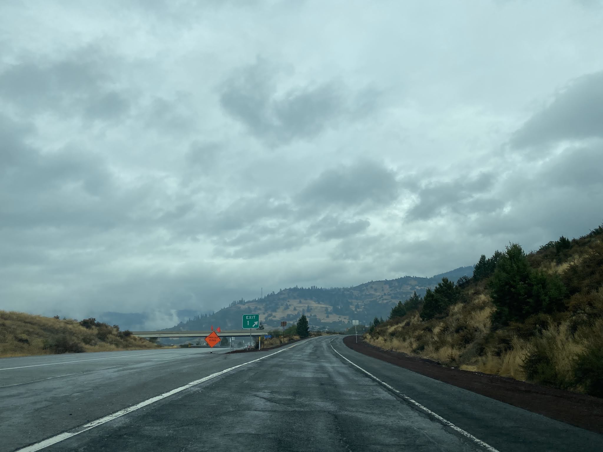
I-5 northbound upon entering the State of Oregon intersects OR 273 at Exit 1. Exit 1 is mistakenly signed as "Siskiyou Summit" and there are no OR 273 shields to be found. Siskiyou Summit as noted above is located on I-5 whereas OR 273 ascends Siskiyou Pass.


OR 273 is known as Old Highway 99 in field. OR 273 northbound makes a fast but steady ascent and climbs to Siskiyou Pass.


There is presently no field signage indicating OR 273 has crossed Siskiyou Pass. Siskiyou Pass offers a southward view through the Siskiyou Mountains into California.


OR 273 northbound crosses under I-5 near Siskiyou Summit.


OR 273 intersects Mount Ashland Ski Road north of I-5. This is where the Siskiyou Mountain Wagon Road would have diverged from the 1920 Pacific Highway alignment westward towards Colestin via Toll Road Gap.

OR 273 north tracks west of I-5 and crosses eastward over it at Exit 6.


OR 273 northbound remains unsigned but a guide sign directs traffic to OR 66 via "Old Highway 99."

OR 273 northbound winds through the Siskiyou Mountains towards the Steinman Overcrossing.


OR 273 descends northward towards to a terminus at OR 66 near the south shore of Emigrant Lake in Rogue Valley.


Former US 99 can be followed north from the modern OR 273/OR 66 junction into Emigrant Lake. When the waters of Emigrant Lake are low one can still find the original US 99/US 97 junction. US 97 entered Emigrant Lake via what is now Old Greensprings Highway.

Note; OR 273 does carry a southbound reassurance shield from OR 66.

Comments
I continue to be impressed by the thoroughness of your research. Max. I can add very little, except, where you noted "OR 273 northbound remains unsigned but a guide sign directs traffic to OR 66 via "Old Highway 99," it just happens that ODOT did once have an OR 273 shield just past that sign, shown in the picture linked below:
https://i.imgur.com/zrNimfO.jpg
https://i.imgur.com/y59mOYJ.jpg
Sadly, it looks like the shield was replaced with the blue sign, which reads "No Gas, No Diesel." Makes me wonder if there was a problem with cars/trucks exiting I-5 looking for fuel?
Anyway, I thought you'd appreciate the info. Keep up the great work, I really enjoy reading your detailed & informative posts.
Chris,
aka xonhulu on AARoads