
Lovers Leap State Park and Falls Bridge - New Milford, Connecticut


Located in New Milford, Connecticut, Lovers Leap State Park is a 160 acre state park. The name Lovers Leap is based on a legend that involves starcrossed lovers; an unidentified white man and Lillinoah, a Native American princess who was the daughter of Pootatuck Indian Chief Waramaug, that chose to leap to their deaths. The park has a number of walking paths and are split into three sections. There are the Old Factory Trails, the Waramaug Loop, and the Hurd Estate Trails found around the park. Each section of the park has their own sights to see, including a castle, ruins and overlooks of Lake Lilinonah.  The historic iron bridge over the Housatonic River is frequently the main attraction.

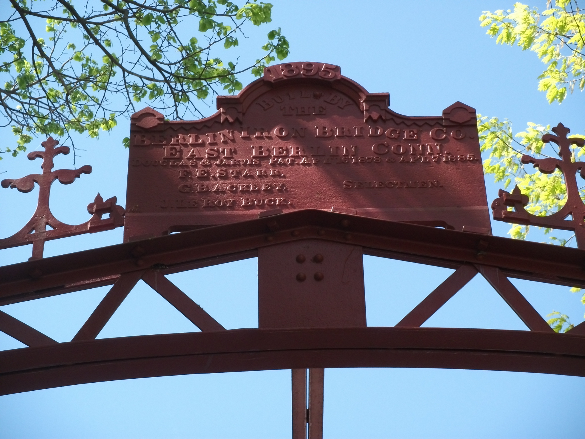
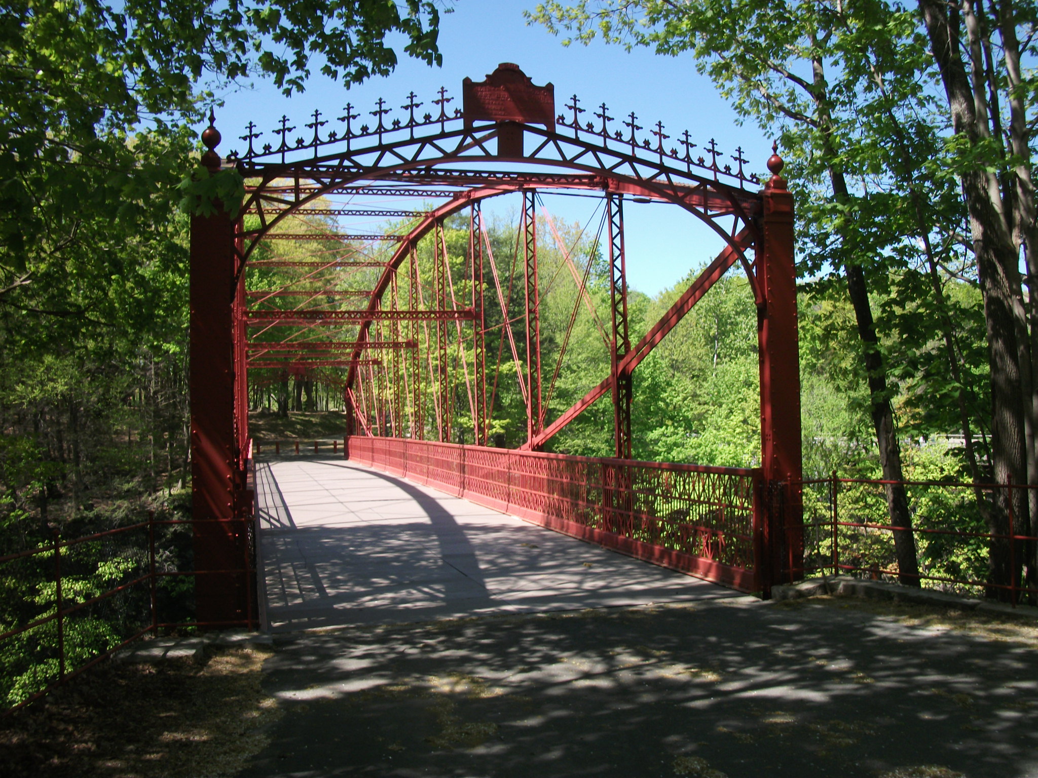
The Falls Bridge, which is an iron bridge built by the Berlin Iron Bridge Company of East Berlin, Connecticut, is a 173 foot lenticular truss bridge over the Housatonic River and was built in 1895. It is one of only a handful of iron truss bridges remaining in Connecticut. A similar bridge upstream on the Housatonic River called the Boardman Bridge was built a few years prior and local officials in New Milford were pleased by that bridge, so when a proposal to replace the Falls Bridge was made, they decided to go with a similar design. Once construction was completed, the bridge cost $7,938 to build. The bridge carried traffic until 1977. In 1994, efforts to restore the Falls Bridge begun, and after securing the $1.9 million in funding, restoration took place between 2004 and 2006, when the bridge reopened for pedestrian use.

Overall, Lovers Leap State Park is a pleasant place to visit and explore. The bridge is one of the focal points of the park and celebrates an era where there were once over 1,000 iron truss bridges crisscrossing the Constitution State. One of the other points of interest in the park is a rock formation with an overlook of Lake Lillinoah, where it is said that the princess and her lover leaped into the river below where they met their watery demise together.



How to Get There:


Sources and Links:
Damned Connecticut - Damned Hike: Lover’s Leap State Park, New Milford
Explore Connecticut - Lovers Leap State Park
CTMQ - TSTL’15.8: Lover’s Leap State Park
Connecticut Department of Energy and Environmental Protection - Lovers Leap State Park

Comments

Popular posts from this blog

Grand Loop Road of Yellowstone National Park

  Grand Loop Road is a 140 mile loop highway which traverses the interior of Yellowstone National Park.  Grand Loop Road connects all of the major attractions and geological features of Yellowstone National Park along with the entrance roads.  Grand Loop Road is a seasonal highway and despite some conjecture never has been part of the US Route System.   Part 1; the history of Grand Loop Road The majority of history pertaining to Grand Loop Road was taken from the below National Park Service article: Historic Roads - Yellowstone National Park (U.S. National Park Service) (nps.gov) Yellowstone was declared the first National Park of the United States on March 1st, 1872.  The first real highway to access Yellowstone National Park came in 1873 when a tolled facility was constructed from Bozeman, Montana via Yankee Jim Canyon to Mammoth Hot Springs.  Numerous attempts were made to fund construction of roadway infrastructure during the early years of Yellows...

The last 1956-63 era California Sign State Route Spade?

Along southbound California State Route 170 (the Hollywood Freeway Extension) approaching the Hollywood Freeway/Ventura Freeway interchange a white California State Route 134 Sign State Route Spade can be observed on guide sign.  These white spades were specifically used during the 1956-63 era and have become increasingly rare.  This blog is intended to serve as a brief history of the Sign State Route Spade.  We also ask you as the reader, is this last 1956-63 era Sign State Route Spade or do you know of others?  Part 1; the history of the California Sign State Route Spade Prior to the Sign State Route System, the US Route System and the Auto Trails were the only highways in California signed with reassurance markers.  The creation of the US Route System by the American Association of State Highway Officials during November 1926 brought a system of standardized reassurance shields to major highways in California.  Early efforts to create a Sign State Route ...

California State Route 70; the Feather River Highway

From 2017 through to early 2019 I drove the majority of the California State Route 70; the Feather River Highway from CA 89 southwest to CA 99. CA 70 is an approximately 178.5 mile state highway which starts at US 395 near the Nevada State Line and travels west through the Feather River Canyon to CA 99.  CA 70 is often referred to as the Feather River Highway" given it's close association with the river.  Historically CA 70 was previously signed as US 40A and CA 24.  The Legislative Routes prior to the 1964 California Highway Renumbering that made up the current route of CA 70 are as follows: -  Legislative Route Number 21 from US 395 westward to Oroville. -  LRN 87 from Oroville south to Marysville. -  LRN 232 from Marysville to the current junction with CA 99.  CA 70 was even dual signed with CA 99 into Sacramento on what was LRN 232 for a time. The change from US 40A/LRN 21/LRN 87/LRN 232 can be seen by comparing the 1963 State Highway Ma...