Dos Palos is a city located in Merced County on California State Route 33. Modern California State Route 33 passes through Dos Palos on a northward course via Elgin Avenue towards the California State Route 152 at Dos Palos Y. Originally California State Route 33 entered Dos Palos via Brannon Avenue and Valeria Avenue from the Fresno County Line. California State Route 33 passed through downtown Dos Palos via Center Avenue and Blossom Street towards Elgin Avenue. North of Dos Palos at Dos Palos Y the routing California State Route 33 joined California State Route 152 via what is now Azusa Avenue. Below the original alignment of California State Route 33 in Dos Palos can be observed on the 1935 Division of Highways Map of Merced County.
Part 1; the history of California State Route 33 in Dos PalosThe origin of the name of Dos Palos dates back to the 1820s and the explorations of San Joaquin Valley by Gabriel Moraga. The area around the modern-day community of Dos Palos was identified by Moraga in his writings by two isolated poplar trees. The two poplar trees were referred to as "Dos Palos" by Moraga when describing the area. The two poplar trees identified by Moraga was cited as the boundary of Rancho Sanjon de Santa Rita when it granted by the Mexican Government during 1841. During the American period of California, the Mexican land grants were honored by the State government. Rancho Sanjon de Santa Rita was ultimately purchased by Henry Miller during 1866, the Dos Palos boundary having stuck as something of a naming convention.
In 1891 Henry Miller was convinced to plot a siding community along the new Southern Pacific Railroad line in western San Joaquin Valley. The location new siding community was given the name "Dos Palos Colony" in reference to the boundary of Rancho Sanjon de Santa Rita. Dos Palos Colony was found to be located poor agricultural land which led to the creation of a second town site being plotted two miles to the east during 1892. The second town site came to be known as "Colony Center" and began to thrive. Dos Palos Colony managed to linger on given it was the location of Dos Palos Station.
During 1906 the United States Post Office designated Dos Palos Colony as "South Dos Palos" and Colony Center as "Dos Palos." The names of both communities ultimately stuck which would culminate with Dos Palos incorporating as a city on May 24th, 1935.
State Highway service did not reach Dos Palos until 1933 when
Legislative Route Number 41 (LRN 41) was expanded west from General Grant National Park (now Kings Canyon National Park) to Tracy. LRN 41 through Dos Palos was announced as part of California State Route 33 (CA 33) in the
1934 California Highways & Public Works. CA 33 was largely aligned through western San Joaquin Valley as a Sign State Route between then Tracy south to Maricopa.


As noted in the intro the original alignment of CA 33/LRN 41 headed northbound crossed the Merced County Line via Brannon Avenue and Valeria Street into the community limit of Dos Palos. CA 33/LRN 41 passed through downtown Dos Palos via Center Avenue, Blossom Street and followed Elgin Avenue towards CA 152 at Dos Palos Y. From Dos Palos Y CA 33 northbound began a multiplex with CA 152 towards Los Banos.
CA 33/LRN 41 can be seen entering Merced County via Brannon Avenue and Valeria Street on the 1935 Division of Highways Map of Fresno County.
CA 33/LRN 41 can be seen passing through Dos Palos via Center Avenue, Blossom Street and Elgin Avenue towards Dos Palos Y on the
1935 Division of Highways Map of Merced County.

In 1964 the Legislative Route Numbers were dropped in favor of field signage. CA 33 was simply reassigned as the new Legislative Route associated with Dos Palos given it was the existing Sign State Route. Despite CA 33 being modernized decades earlier in nearby Firebaugh the initial alignment of the highway remained aligned through downtown Dos Palos. The below image depicts CA 33 on the
1964 Division of Highways Map.
The
November/December 1965 California Highways & Public Works announced CA 33 would be shifted to a bypass alignment of Dos Palos over a 5-mile project zone. The realignment of CA 33 would originate at Laguna Canal in Fresno County and connect with Elgin Avenue in Dos Palos. The realignment of CA 33 included widening the highway on Elgin Avenue to four-lanes. Cost for the realignment of CA 33 in Dos Palos was shared by the State, Fresno County and city of Dos Palos.
The
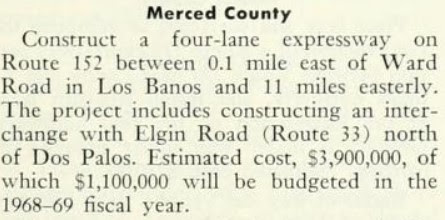
November/December 1966 California Highway & Public Works announced CA 152/CA 33 would be converted to four-lane expressway from Los Banos 11 miles east to Dos Palos Y during the 1968-69 Fiscal Year. The project is stated to include a bypass of Dos Palos Y and a new interchange from which CA 33 would depart towards Dos Palos.
Part 2; exploring the original alignment of California State Route 33 in Dos Palos
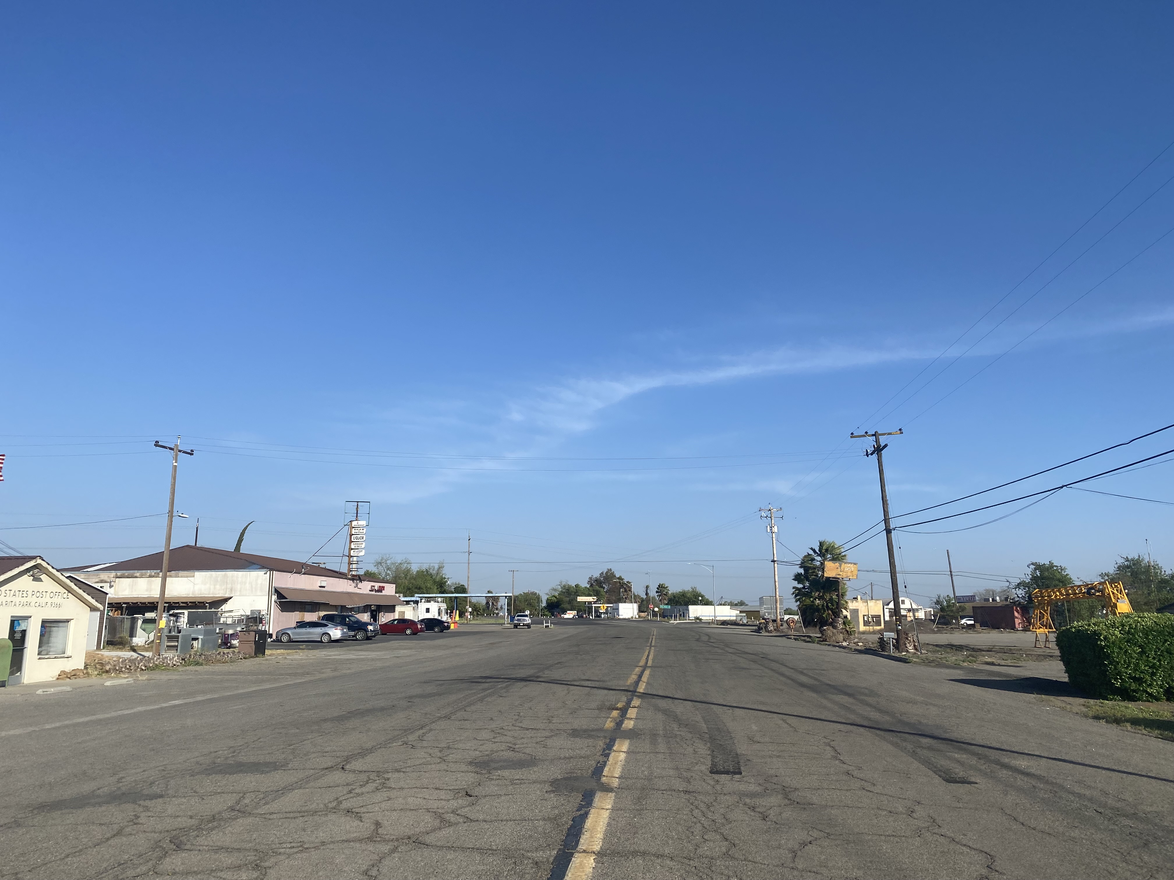
From modern CA 33 southbound/CA 152 eastbound traffic can diverge onto the original alignments of both highways on Azusa Avenue towards Dos Palos Y.
The namesake Dos Palos Wye from which the community of Dos Palo Y derives its name can be found as Azusa Avenue intersects CA 33. CA 152 eastbound would have continued straight on Azusa Avenue towards Chowchilla. Dos Palos Y is not part of the city of Dos Palos and appears to have never been much more than a collection of now derelict roadside services.
CA 33 southbound follows Elgin Avenue south approximately four miles into the city of Dos Palos. At Blossom Street CA 33 southbound would have originally turned left.
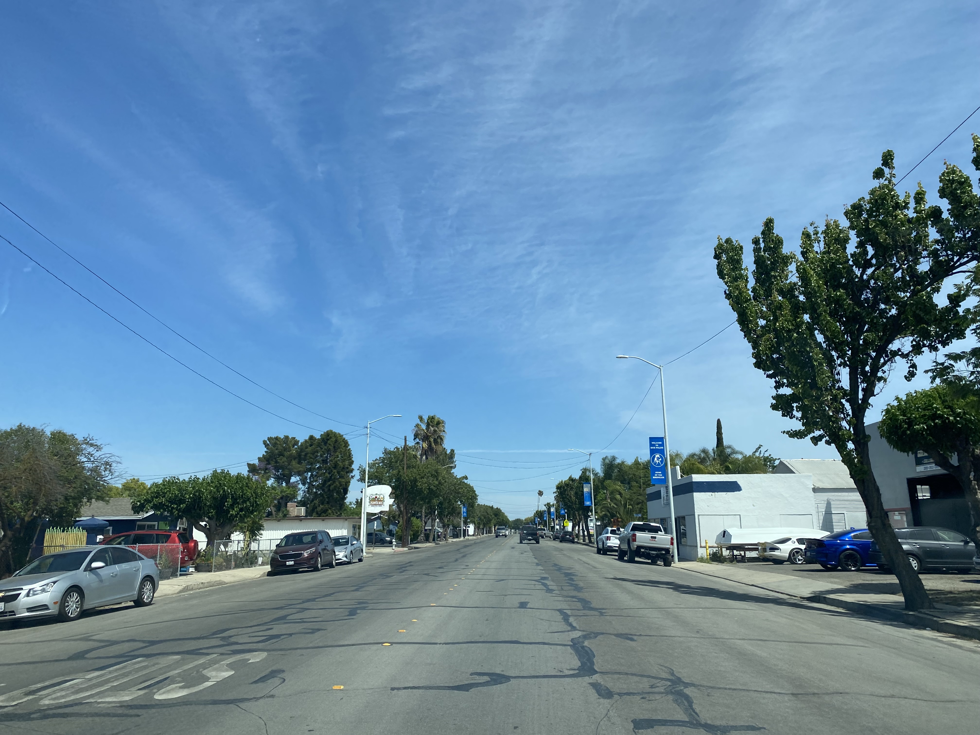
CA 33 southbound followed Blossom Street into downtown Dos Palos and turned right on Center Avenue.
Looking back at the former alignment of CA 33 at Center Avenue and Blossom Street.
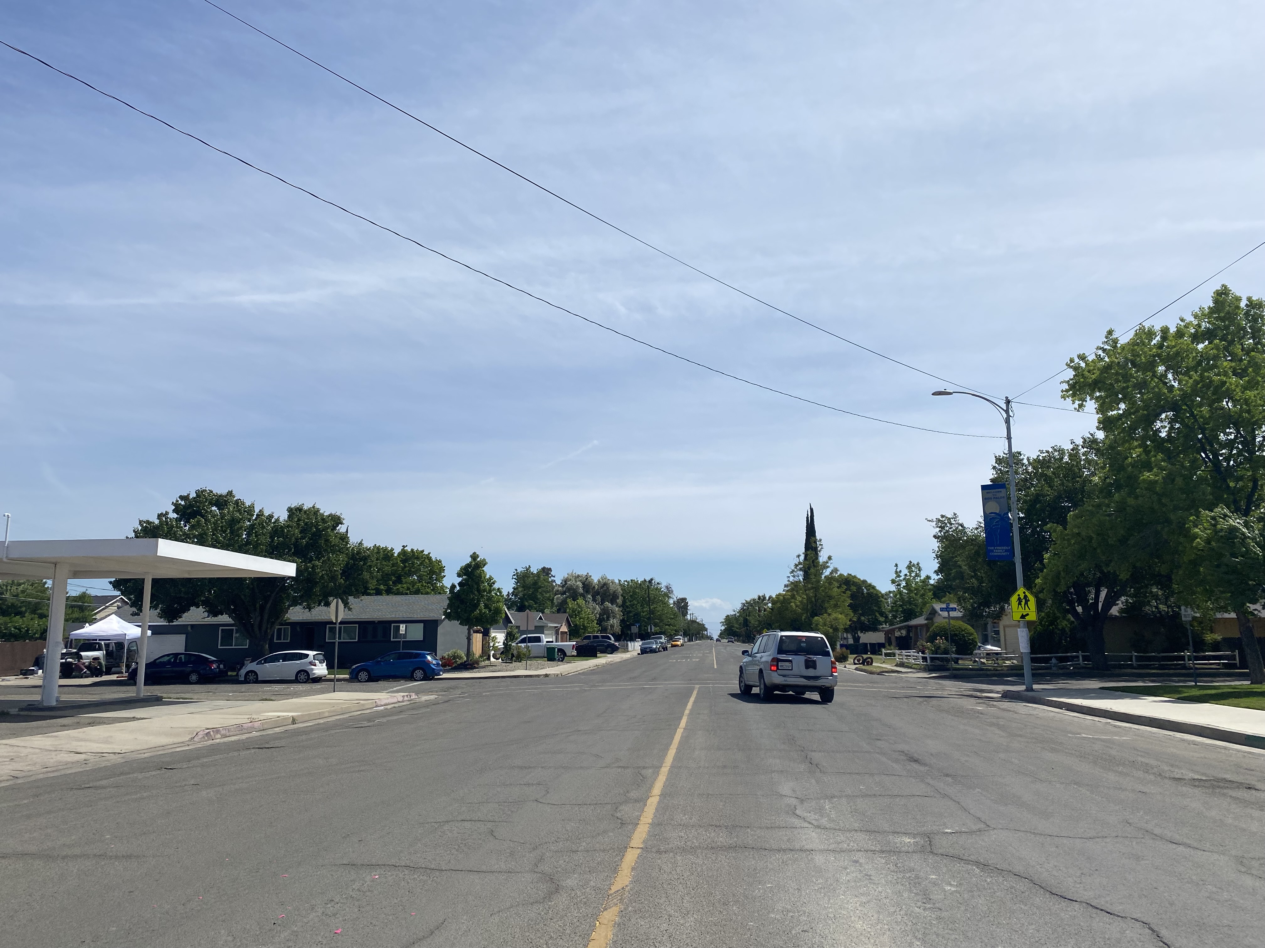
CA 33 southbound followed Center Avenue out of downtown Dos Palos and turned left on Valeria Avenue.
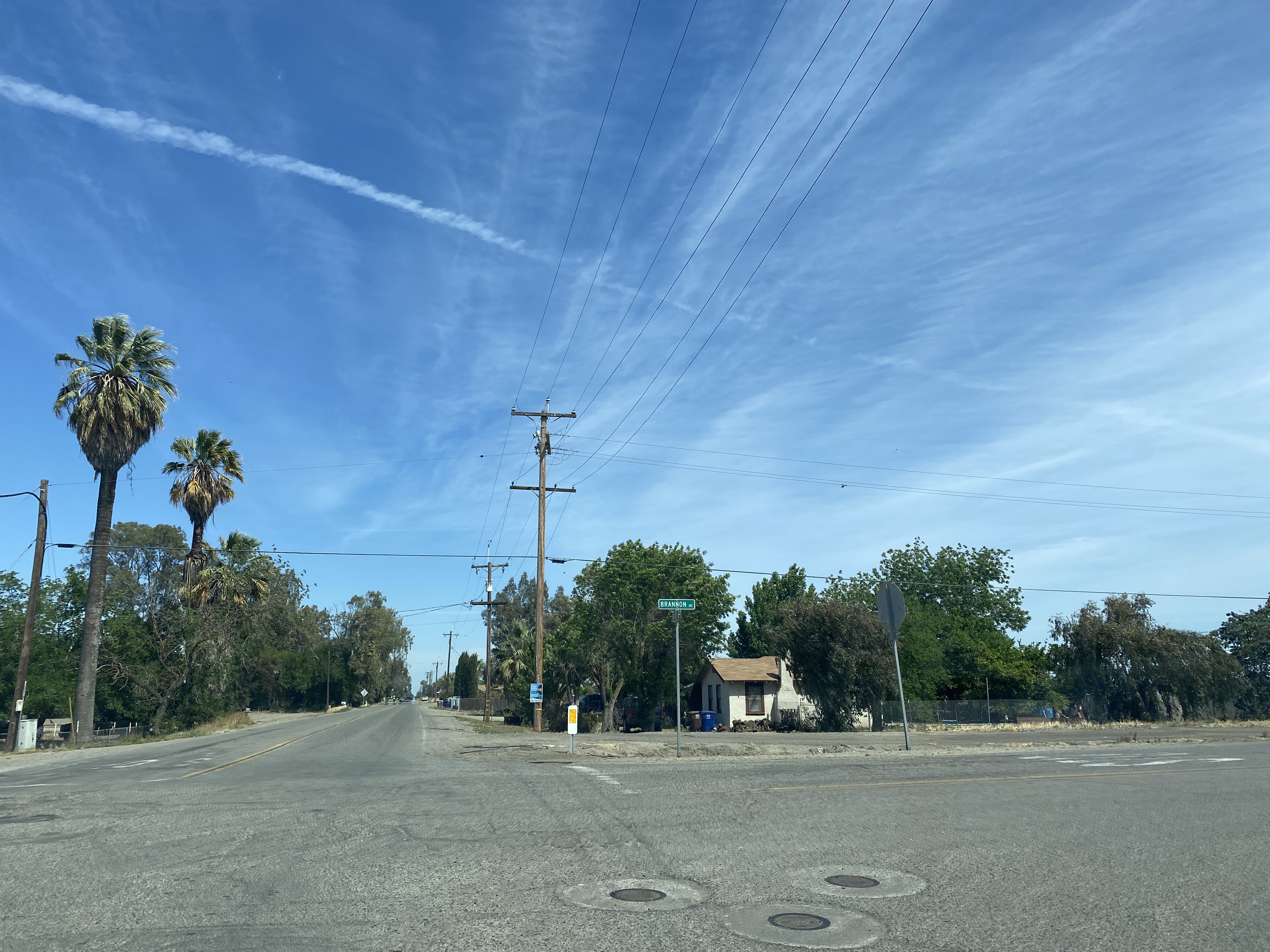
CA 33 southbound followed Valeria Avenue into Fresno County and made a right hand turn onto Brannon Avenue.
CA 33 southbound originally followed Brannon Avenue to the modern alignment at Laguna Canal towards Firebaugh.












Comments