
Part 1; the history of Legislative Route 56 and California Route 1 through the Lost Coast
The Lost Coast region consists of the undeveloped coastal areas of Humboldt County, Mendocino County, and the King Range. The Lost Coast region roughly spans from near Rockport in Mendocino County north to Ferndale of Humboldt County. The Lost Coast region is known for having rugged terrain which rivals what is seen in Big Sur. The Lost Coast has several small communities such as Shelter Cove, Whitehorn, and Petrolia.
In 1933 Legislative Route 56 was extended south to LRN 2 (US 101) near Las Cruces and north to Ferndale to LRN 1 (also US 101). Prior to 1933 the legislative description of LRN 56 had it's north terminus in Carmel and south terminus in San Luis Obispo. The extension of LRN 56 was ambitious and was the first time that the State became involved with a coastal highway in the Lost Coast region.
In the August 1934 California Highways and Public Works Guide the Sign State Routes were announced. CA 1 was applied to LRN 56 from Las Cruces northward towards Fortuna

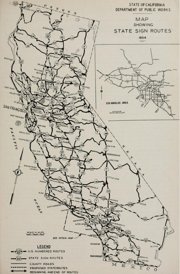
Upon close examination of the map displayed in the August 1934 CHPW shows CA 1/LRN 56 as a functionally existing highway from Westport north to Fortuna. CA 1/LRN 56 is shown to be State maintained on both sides of the Lost Coast.

Closer examination of the 1934 Division of Highways State Map shows State maintenance of CA 1/LRN 56 from Mendocino north to Fort Bragg. From Fort Bragg northward the implied route to Upper Mattole. From Upper Mattole the implied through highway through the Lost Coast to Ferndale.


The 1935 Goshua Highway Map of California provides a great deal of detail as to the existing through highway in the Lost Coast Region. CA 1/LRN 56 is shown to end at Westport and the road continuing north to Kenny on Usal Road. From Kenny the highway to Thorn Junction appears to have followed Briceland Road to Thorn Junction. From Thorn Junction to Ettersburg the highway follows Ettersburg Road. From Ettersburg to Honey Dew the through highway follows Wilder Ridge Road. From Honey Dew the through route in the Lost Coast follows Mattole Road to Ferndale and the north segment of CA 1/LRN 56. The 1935 Goshua Map doesn't offer any evidence that CA 1 was signed by the California State Automobile Association in the Lost Coast.

The 1935 Division of Highways Maps of Mendocino County and Humboldt County corroborate the routing shown by the 1935 Goshua Map.
Mendocino County


Humboldt County
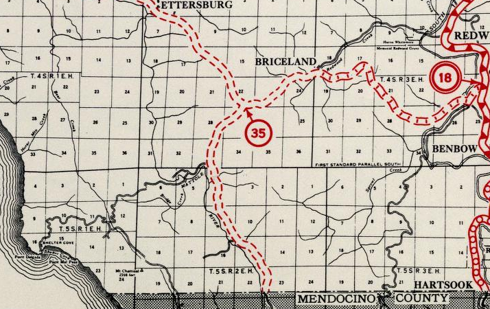
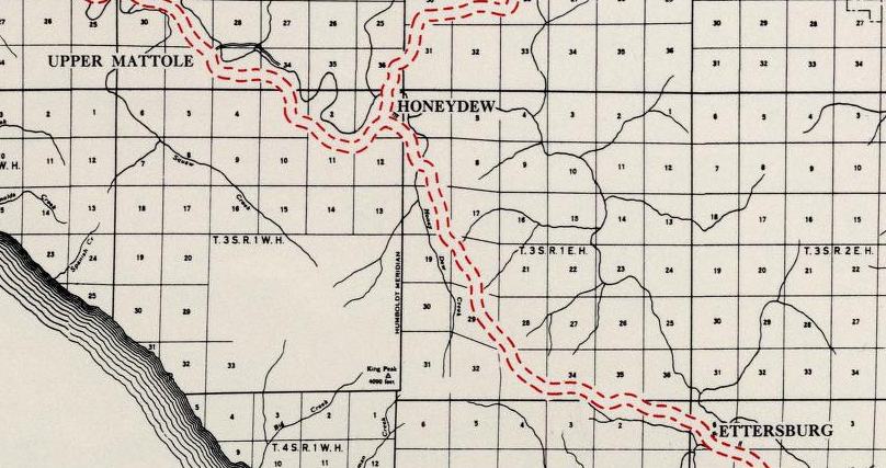


The 1937-38 Division of Highways Map offers no differences to the highway through the Lost Coast. Interestingly the 1937-38 Map doesn't even show a planned extension of CA 1/LRN 56 through the Lost Coast.

Interestingly the May/June 1952 CHPW has an article describing the US Route System and Sign State Route numbering conventions. In said article CA 1 is described as ending in Westport with no further indications for anything north to Ferndale.

The first Division of Highways Map to display a rough planned general alignment of CA 1/LRN 56 in the Lost Coast was the 1953 edition.

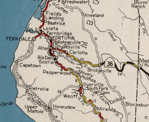
According to CAhighways.org a spur branch of LRN 56 was added to the State Highway System in 1951 to connect to Leggett at US 101/LRN 1. This spur of LRN 56 connecting from Westport to Leggett first appears on the 1958 Division of Highways Map. This spur segment of LRN 56 doesn't appear to have been signed as CA 1. The spur segment of LRN 56 to Leggett seems to be the first real indicator that the Division of Highways wasn't interested in building a highway through the Lost Coast.

A story regarding the new Westport-Leggett Spur of LRN 56 is detailed in the May/June 1958 CHPW. The Westport-Leggett spur of LRN 56 was indeed ultimately signed as part of CA 1 and was part of Federal Aid Secondary Route 504. Mendocino County is said to have pushed during the fall of 1955 to have the planned Westport-Leggett Spur of LRN 56 added Federal Aid Secondary system. The article goes onto cite that part of the 1951 legislation that added the Westport-Leggett Spur of LRN 56 was that the State would not have to maintain the roadway until it was brought up to Division of Highways standards. Maintenance of the Westport-Leggett Spur of LRN 56 began on July 1, 1957.


During the 1964 State Highway Renumbering the Legislative Route Numbers were dropped. What had been the spur of LRN 56 to Leggett was was renumbered to CA 208. CA 1 remained planned through the Lost Coast to Ferndale. These changes can be seen on the 1964 Division of Highways State Map.

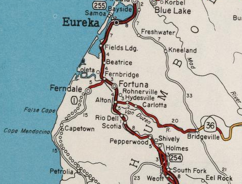
Post 1964 it appears that CA 208 and that CA 1 from Ferndale to Fortuna were never signed. Neither shows on the 1982 Caltrans State Map with State Highway shields.


During 1984 the according to CAhighways.org unbuilt CA 1 in the Lost Coast and from Ferndale to Fortuna was transferred CA 211 (ii) via Legislative Chapter 489. Legislative Chapter 489 also transferred CA 1 over what had been CA 208. The changes described above first appear on the 1986 Caltrans State Highway Map.


Despite popular notion the planned highway through the Lost Coast has never been cancelled. Further, I have never seen a report stating that the a highway through the Lost Coast wasn't possible. It is likely the real answer of why CA 1 was never built through the Lost Coast was that it would have had to happen immediately after CA 1/LRN 56 was completed in Big Sur. Given that the United States ended up being embroiled in World War II a couple years after the completion of the Cabrillo Highway in Big Sur it likely killed any prospect at a Lost Coast Highway. Even the Division of Highways with all it's grandiose visions for freeways and expressways during the late 1950s/early 1960s couldn't find room for a Lost Coast Highway, it wasn't a priority. Given that the environmental red tape post 1970 it would be virtually impossible to build the Lost Coast Highway for political reasons. Nonetheless the planned Lost Coast Highway appears on the 2005 Caltrans State Map as part of unbuilt CA 211.

Part 2; a drive on former CA 1 and current CA 211 (ii) from Fortuna to Ferndale
From US 101 southbound the route of CA 211 south begins at Exit 692. From Exit 692 there is no CA 211 reassurance shields.


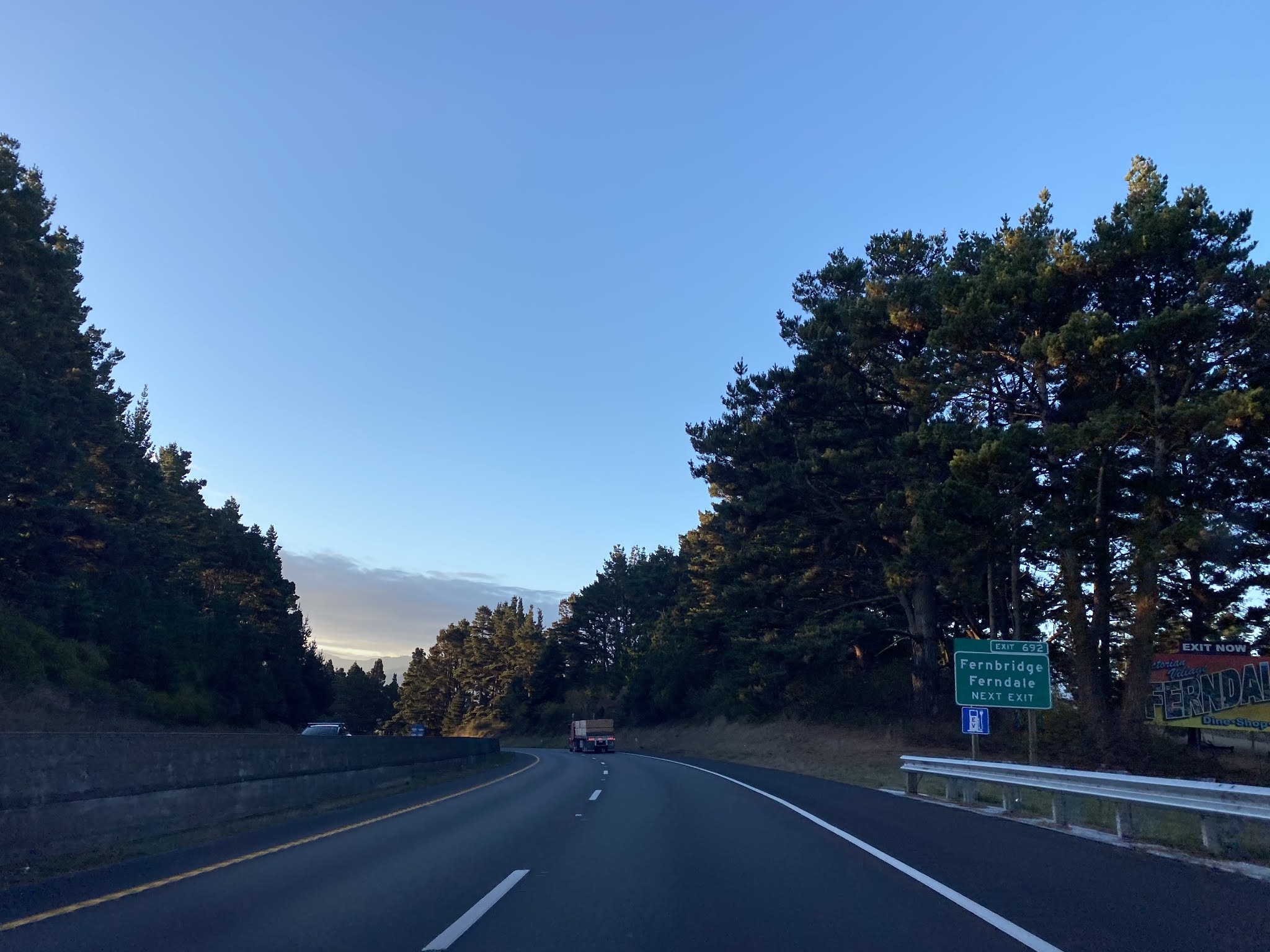


CA 211 from US 101 is signed as 5 miles from Ferndale.

CA 211 south enters the community of Fernbridge at Post Mile HUM 78.586.


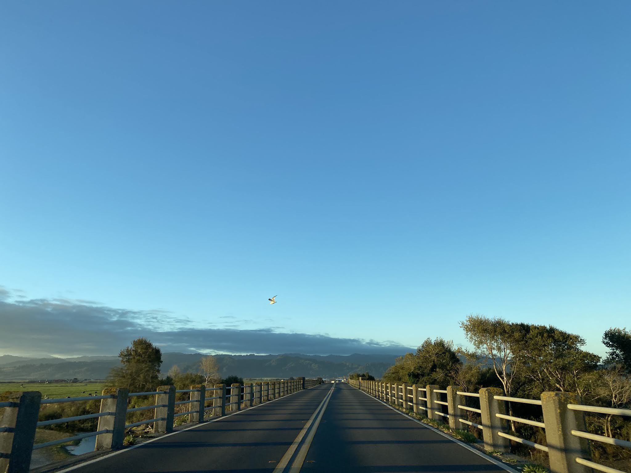


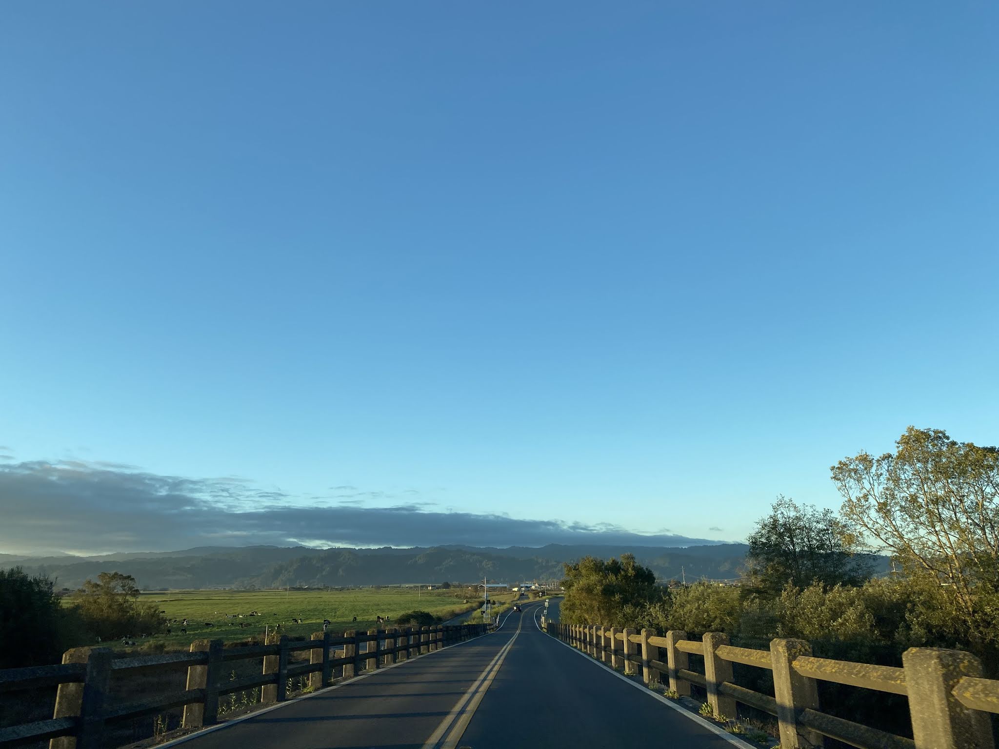


The 1911 Fernbridge was once the longest functional concrete arch bridge in the world at 2,408 feet in length (including the approach spans). The Fernbridge is notable for being one of the few older bridges in California to have survived the major floods of the North Coast Rivers. The Fernbridge stood against flooding on the Eel River during; 1912, 1913, 1914, 1915, 1937, 1953, 1955, 1964, and 1986. In 1987 Caltrans recommended replacing the Fernbridge with a modern span which sparked a local movement to preserve the structure. The Fernbridge was added to the National Register of Historic Places on April 2, 1987. Below are numerous assorted vintage photos of the Fernbridge.

Assorted post cards of the Fernbridge.


Upon crossing the Fernbridge CA 211 south is aligned through a low lying valley along the Eel River. There is several new CA 211 shields on the south side of the Fernbridge.


Comments
Thanks for all the posts on a great site.