This past November I ran the entirety of the Monterey Bay Coastal Trail through the City of Monterey. The Monterey Bay Coastal Trail was built alongside the right-of-way of the Monterey Branch Railroad.

The Monterey Branch was a 18.5 mile standard gauge railroad between Pebble Beach northeast to the Union Pacific Switch in Castroville. The Monterey Branch was partially built upon the narrow gauge Monterey & Salinas Valley Railroad in 1874. The Monterey & Salinas Valley Railroad went bankrupt in 1879 and was purchased by the Southern Pacific Railroad. The Southern Pacific converted their new Monterey Branch to standard gauge in and rerouted it from a terminus in Salinas to Castroville by 1880. The Monterey Branch was noted for carrying passenger traffic between San Francisco and Pebble Beach in addition to freight traffic from Cannery Row. The Monterey Branch Railroad can be seen on George Blum Regional Map of California ending at the second Hotel Del Monte in 1896.

The Monterey Branch can be seen terminating at Pebble Beach on the 1935 California Division of Highways Map of Monterey County.

The Monterey Branch operated passenger lines until 1971. According to abandonedrails passenger service on the Monterey Branch was shuttered because it would only be a service line of 125 miles. A distance of 125 miles was 25 miles shy of the minimum Amtrak was required to operate. Freight operations on the Monterey Branch shuttered in the 1990s with the last train being run by the Transportation Agency of Monterey County in 1999. Also in 1999 the Union Pacific Railroad removed the switch for the Monterey Branch in Castroville. The Monterey Branch was purchased by the Transportation Agency of Monterey County in 2003.
In recent times much of the right-of-way of the Monterey Branch in the City of Monterey was converted to part of the Monterey Bay Coastal Trail. At present moment the Transportation Agency of Monterey County plans to convert the remaining line to light rail use with stations in; Monterey, Sand City, Marina and eventually Castroville.
I began my visit to the Monterey Branch Railroad first stopping at the 1903 Southern Pacific Railroad Bridge over the Salinas River. The 1903 Southern Pacific Bridge is a 718 foot long warren through truss design which is contrasted by the 1943 highway bridge. Interestingly the 1903 Southern Pacific Bridge was pressed into duty as temporary California State Route 1 for military traffic in late 1943. Military traffic was forced onto a planked crossing of the 1903 Southern Pacific Bridge due to a washout on the temporary highway bridge that was being used in the CA 1 realignment project.

Upon completion of my tasks for the day I began my run on the grade of the Monterey Branch Railroad at the City Line of Seaside and Monterey. Traffic on the Monterey Bay Coastal Trail is immediately greeted by derelict standard gauge rail upon entering the City of Monterey.


I followed the Monterey Bay Coastal Trail southwest to a junction with a gate to the Naval Post Graduate School. The Naval Post Graduate School is home to the third Hotel Del Monte which was completed in 1927 and is now the headquarters for the Naval Base.


In 1947 the U.S. Navy purchased the third Hotel Del Monte. The Naval Post Graduate School was moved to Monterey in 1951. The original Hotel Del Monte opened on June 3rd, 1880 and was constructed by the Pacific Improvement Company. The Pacific Improvement Company was a property division of the Southern Pacific Railroad which operated the Del Monte Resort.

The Monterey Bay Coastal Trail has a small historical station detailing the history of the station at the Hotel Del Monte.


Continuing southwest on the Monterey Bay Coastal Trail there is numerous remaining rails from the Monterey Branch. Eventually the Monterey Bay Coastal Trail emerges onto dunes which can be used to easily access Monterey Bay.


Near the beach access there is an historic information plaque detailing the history of the Chinese Workers in the construction of the Monterey Branch.

Continuing southwest on the Monterey Bay Coastal Trail the abandoned rails of the Monterey Branch give way to wide pedestrian path. There is another historical plaque which describes the setting for the construction of the Monterey Branch.


As I continued southwest on the Monterey Bay Coastal Trail I passed by the 1930s era Southern Pacific Railroad Depot which has been converted into a pub.


Next to the Southern Pacific Railroad Depot the 1939 Salmon Troller known as the San Nicola on display on the Monterey Bay Coastal Trail.


The Monterey Bay Coastal Trail continues southwest alongside Lighthouse Avenue to Monterey Harbor and Fisherman's Wharf. The Customs House is located at Fisherman's Wharf and was the main entry point to the City of Monterey when it was completed in 1827. Monterey was the Capital of Mexican Alta California from 1822 to 1846 when it was ceded to American hands.


Fisherman's Wharf was built in 1870 by the Pacific Coast Steamship Company for the unloading of passenger goods. Fisherman's Wharf was taken over by the City of Monterey in 1913 and was a hub of the sardine trade. Fisherman's Wharf today is largely a tourist attraction that caters visitors to Monterey.


I continued southwest on the Monterey Bay Coastal Trail towards Cannery Row. At Wave Streets the remains of a rail crossing is on display.


I followed the Monterey Bay Coastal Trail past a rail car where I turned around at the City Limit of Pacific Grove At David Avenue.


On my return trip I detoured eastbound through Cannery Row. Cannery Row was part of the original alignment of 17 Mile Drive back in 1901. Cannery Row began hosting sardine canning companies starting in 1902. Cannery Row has a website and with good historical references:
Cannery Row History
The canning industry appears to have gone defunct by 1973 and Cannery Row became more of a tourist destination. Pretty much Cannery Row has kept the historic motif which really has been helped by the Monterey Bay Aquarium drawing tourist interest.


My final stop on my return trip following the grade of the Monterey Branch was at the Coast Pier to check out some Sea Lions.


The Monterey Branch was a 18.5 mile standard gauge railroad between Pebble Beach northeast to the Union Pacific Switch in Castroville. The Monterey Branch was partially built upon the narrow gauge Monterey & Salinas Valley Railroad in 1874. The Monterey & Salinas Valley Railroad went bankrupt in 1879 and was purchased by the Southern Pacific Railroad. The Southern Pacific converted their new Monterey Branch to standard gauge in and rerouted it from a terminus in Salinas to Castroville by 1880. The Monterey Branch was noted for carrying passenger traffic between San Francisco and Pebble Beach in addition to freight traffic from Cannery Row. The Monterey Branch Railroad can be seen on George Blum Regional Map of California ending at the second Hotel Del Monte in 1896.

The Monterey Branch can be seen terminating at Pebble Beach on the 1935 California Division of Highways Map of Monterey County.

The Monterey Branch operated passenger lines until 1971. According to abandonedrails passenger service on the Monterey Branch was shuttered because it would only be a service line of 125 miles. A distance of 125 miles was 25 miles shy of the minimum Amtrak was required to operate. Freight operations on the Monterey Branch shuttered in the 1990s with the last train being run by the Transportation Agency of Monterey County in 1999. Also in 1999 the Union Pacific Railroad removed the switch for the Monterey Branch in Castroville. The Monterey Branch was purchased by the Transportation Agency of Monterey County in 2003.
In recent times much of the right-of-way of the Monterey Branch in the City of Monterey was converted to part of the Monterey Bay Coastal Trail. At present moment the Transportation Agency of Monterey County plans to convert the remaining line to light rail use with stations in; Monterey, Sand City, Marina and eventually Castroville.
I began my visit to the Monterey Branch Railroad first stopping at the 1903 Southern Pacific Railroad Bridge over the Salinas River. The 1903 Southern Pacific Bridge is a 718 foot long warren through truss design which is contrasted by the 1943 highway bridge. Interestingly the 1903 Southern Pacific Bridge was pressed into duty as temporary California State Route 1 for military traffic in late 1943. Military traffic was forced onto a planked crossing of the 1903 Southern Pacific Bridge due to a washout on the temporary highway bridge that was being used in the CA 1 realignment project.

Upon completion of my tasks for the day I began my run on the grade of the Monterey Branch Railroad at the City Line of Seaside and Monterey. Traffic on the Monterey Bay Coastal Trail is immediately greeted by derelict standard gauge rail upon entering the City of Monterey.


I followed the Monterey Bay Coastal Trail southwest to a junction with a gate to the Naval Post Graduate School. The Naval Post Graduate School is home to the third Hotel Del Monte which was completed in 1927 and is now the headquarters for the Naval Base.


In 1947 the U.S. Navy purchased the third Hotel Del Monte. The Naval Post Graduate School was moved to Monterey in 1951. The original Hotel Del Monte opened on June 3rd, 1880 and was constructed by the Pacific Improvement Company. The Pacific Improvement Company was a property division of the Southern Pacific Railroad which operated the Del Monte Resort.

The Monterey Bay Coastal Trail has a small historical station detailing the history of the station at the Hotel Del Monte.


Continuing southwest on the Monterey Bay Coastal Trail there is numerous remaining rails from the Monterey Branch. Eventually the Monterey Bay Coastal Trail emerges onto dunes which can be used to easily access Monterey Bay.


Near the beach access there is an historic information plaque detailing the history of the Chinese Workers in the construction of the Monterey Branch.

Continuing southwest on the Monterey Bay Coastal Trail the abandoned rails of the Monterey Branch give way to wide pedestrian path. There is another historical plaque which describes the setting for the construction of the Monterey Branch.


As I continued southwest on the Monterey Bay Coastal Trail I passed by the 1930s era Southern Pacific Railroad Depot which has been converted into a pub.


Next to the Southern Pacific Railroad Depot the 1939 Salmon Troller known as the San Nicola on display on the Monterey Bay Coastal Trail.


The Monterey Bay Coastal Trail continues southwest alongside Lighthouse Avenue to Monterey Harbor and Fisherman's Wharf. The Customs House is located at Fisherman's Wharf and was the main entry point to the City of Monterey when it was completed in 1827. Monterey was the Capital of Mexican Alta California from 1822 to 1846 when it was ceded to American hands.


Fisherman's Wharf was built in 1870 by the Pacific Coast Steamship Company for the unloading of passenger goods. Fisherman's Wharf was taken over by the City of Monterey in 1913 and was a hub of the sardine trade. Fisherman's Wharf today is largely a tourist attraction that caters visitors to Monterey.


I continued southwest on the Monterey Bay Coastal Trail towards Cannery Row. At Wave Streets the remains of a rail crossing is on display.


I followed the Monterey Bay Coastal Trail past a rail car where I turned around at the City Limit of Pacific Grove At David Avenue.

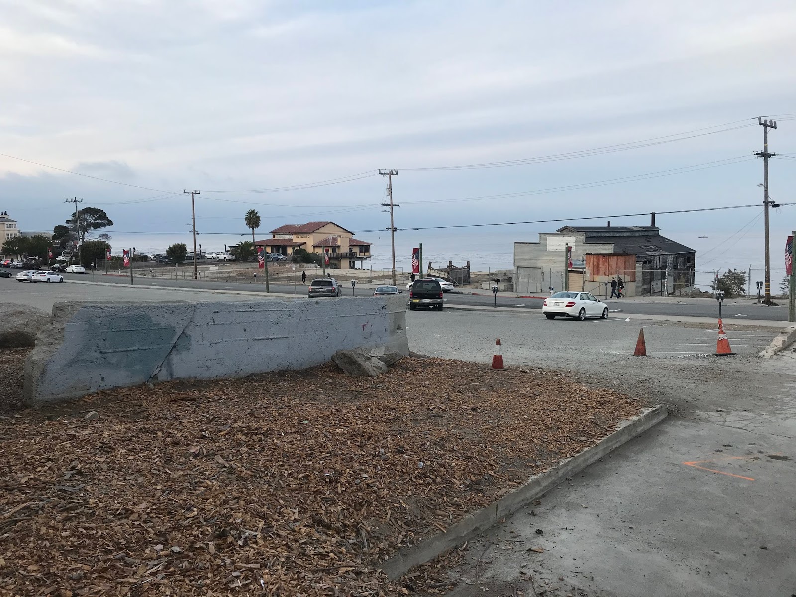


On my return trip I detoured eastbound through Cannery Row. Cannery Row was part of the original alignment of 17 Mile Drive back in 1901. Cannery Row began hosting sardine canning companies starting in 1902. Cannery Row has a website and with good historical references:
Cannery Row History
The canning industry appears to have gone defunct by 1973 and Cannery Row became more of a tourist destination. Pretty much Cannery Row has kept the historic motif which really has been helped by the Monterey Bay Aquarium drawing tourist interest.


My final stop on my return trip following the grade of the Monterey Branch was at the Coast Pier to check out some Sea Lions.


Comments
The Union Pacific did not own the SP until Sept. 11, 1996, so saying that the branch started at the "Union Pacific switch at Castroville" is incorrect.