The current California State Route 7 is a 7-mile State Highway located in Imperial County. California State Route 7 begins at the Mexican border at the East Calexico Port of Entry and terminates at Interstate 8. The current California State Route 7 is the third highway to use the number. The original California State Route 7 was consumed by current California State Route 107, Interstate 405, California State Route 14 (former US Route 6) and US Route 395. The second California State Route 7 was applied to the Long Beach Freeway corridor which is now Interstate 710 and California State Route 710.
The history of California State Route 7
The current
California State Route 7 is the third time the number has been assigned to a Sign Route. The initial run of Sign State Routes was announced in the
August 1934 California Highways & Public Works. The original California State Route 7 was announced as a highway originating at California State Route 3/Legislative Route Number 60 (LRN 60) in Torrance northward to the Nevada State Line which connected through the Reno Area to a second segment to the Oregon State Line. California State Route 7 as originally defined followed the entirety of LRN 164 from California State Route 3/LRN 60 north to LRN 158. California State Route 7 continued north via LRN 158 to US Route 99/LRN 4 near San Fernando where it briefly multiplexed it to LRN 23. California State Route 7 followed LRN 23 along the eastern flank of the Sierra Nevada Mountains to Topaz. From Topaz, California State Route 7 followed LRN 95 to the Nevada State Line where a gap in the highway existed. California State Route 7 emerged at the California/Nevada State Line north of Reno where it followed LRN 29, LRN 28 and LRN 73 towards the Oregon State Line.


The initial large length of the originally truncated even before it could be signed. US Route 395 was approved to be extended into California during 1934 by the American Association of State Highway Officials (AASHO). US Route 395 would consume California State Route 7 from near Bradys north to the Oregon State Line. The initial announcement of US Route 395 entering California can be seen on a September 6, 1934, list of US Routes in California prepared by the Division of Highways.
A full description of US Route 395 in California appears in a letter dated September 4, 1934, the AASHO Executive Secretary.
A letter dated February 1, 1937, by the California State Highway Engineer to the AASHO Executive Secretary shows a detailed description of the planned extension of US Route 6 to Long Beach within California. The extension of US Route 6 would consume the original California State Route 7 from US Route 395 near Bradys to US Route 99 near San Fernando.
A letter dated February 8, 1937, by the AASHO Executive Secretary to the State Highway Engineers of; Colorado, Nevada and California announced the approved extension of US 6 from Greeley, Colorado to Long Beach, California. The extension of US Route 6 into California truncated the northern terminus of California State Route 7 to US Route 99 near San Fernadno.
The original California State Route 7 was truncated again by 1938. The
1938 Division of Highways Map displays LRN 158/Sepulveda Boulevard constructed south of LRN 164/Centinela Avenue to US Route 101A/LRN 60 near the grounds of Los Angeles Municipal Airport. A small segment of LRN 158/Sepulveda Boulevard north of LRN 164/Centinela Avenue is shown as unconstructed. California State Route 7 shown to be realigned following LRN 158/Sepulveda Boulevard south to a terminus at US Route 101A/LRN 158. LRN 164 is displayed for the first time as being assigned as California State Route 107. California State Route 107 seemingly was designated as a child route of California State Route 7 based off the fact it was part of the original routing of the highway.

On June 29, 1956, the Federal Highway Aid Act of 1956 was signed into law on the Federal Level. The Federal Highway Aid Act of 1956 was the genesis point of the Interstate Highway System which would in the coming decade sew the demise of the original California State Route 7. California State Route 7 was slated to be developed into the corridor of the San Diego Freeway which assigned it as chargeable Interstate. The Interstate corridor route numbers in California would be finalized during 1958 and the California State Route 7/San Diego Freeway corridor would be assigned as Interstate 405.
As part of the 1964 California State Route Renumbering multiplexes within the system were largely eliminated. The original California State Route 7 was deleted in favor of Interstate 405.
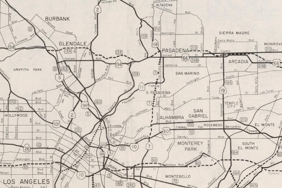
The 1964 California State Highway Renumbering had numerous impacts on the Long Beach Freeway corridor. California State Route 15/LRN 167 was replaced with the second iteration of California State Route 7 to make room to avoid duplication with Interstate 15. The
1964 Division of Highways Map displays the second iteration of California State Route 7 on the Long Beach Freeway corridor.


On September 23, 1983, Caltrans submitted an application to add California State Route 7 and the Long Beach Freeway from CA 1 in Long Beach to Interstate 10 to the Interstate System as Interstate 710. The American Association of State Highway Transportation Officials (AASHTO) approved the addition of Interstate 710 on May 24, 1984. During October 1984 the FHWA would approve the addition of Interstate 710 and the Long Beach Freeway from California State Route 1 to Interstate 10 as non-chargeable Interstate.
On December 8, 1984, AASHTO would approve a second request by Caltrans to extend Interstate 710 to Ocean Boulevard at the Port of Long Beach. 1984 Legislative Chapter 409 defined Route 710 as "Route 1 to Route 210" with additional conditions which would extend it to the Port of Long Beach. Interstate 710 and unsigned California State Route 710 in the Pasadena Gap both appear on the
1986 Caltrans Map.
The third and current iteration of California State Route 7 was defined by 1990 Legislative Chapter 1187 as "from new International Border crossing near Calexico to Route 8 near El Centro." The definition of the third California State Route 7 was changed by 1994 Legislative Chapter 1220 as "from the northerly boundary of the Federal Port of Entry near Calexico to Route 8 near El Centro."
The current California State Route 7 was added facilitate State Highway access to the new
Calexico East Port of Entry. The Calexico East Port of Entry was intended to supplement the original Calexico Port of Entry by moving the trunk entry east of the city. The Calexico East Port of Entry was constructed during 1996. The current
California State Route 7 was completed from the Mexican Border to California State Route 98 during March 1996 but did not open until December 2, 1996. The delay in the opening of California State Route 7 was due to connecting highway in Mexico not being ready.
The initial segment of the current California State Route 7 from the Mexican Border to California State Route 98 can be seen on the
2005 Caltrans Map.


The opening of California State Route 7 from California State Route 98 to Interstate 8 was reported in the
April 17, 2005, Imperial Valley Press. The completed California State Route 7 can be seen in a map prepared by cahighways.org.




Comments