
Mount Orne Covered Bridge - New Hampshire and Vermont


The Mount Orne Covered Bridge is a 266 foot long covered bridge spanning over the Connecticut River, connecting Lancaster, New Hampshire with Lunenburg, Vermont. The bridge is listed in the World Guide of Covered Bridges, Numbers 45-05-03 / 29-04-08, and is also New Hampshire Covered Bridge #30 in New Hampshire's inventory of covered bridges. Replacing a toll bridge that was destroyed by a log jam in 1908, the Mount Orne Covered Bridge was built in 1911 using a Howe through truss design. The towns of Lancaster and Lunenburg each contributed $2,500 towards the construction of the covered bridge, with the remaining $1,678 of the cost having been raised by subscription. The pine timber that was used for the bridge was precut and was assembled on site.

As is the case with many covered bridges, the Mount Orne Covered Bridge has taken a beating towards its longevity over the years. In 1969, a truck loaded with salt dropped through the bridge deck and landed on the ice below. The front of the truck became hooked on one of the bridge's steel rods while the truck's rear rested on the ice. The salt from the truck spilled onto the ice and threatened to melt the ice that held the salt truck from breaking through. The truck was raised, was disengaged from the bridge, and lowered to the ice. The truck was quickly dragged away from the area weakened by the salt, was turned upright and was loaded onto a flatbed on the Vermont side of the river. Additional damage to the covered bridge by tractor trailers took place in 2006, 2010 and 2012.

The covered bridge was closed on July 5, 1983 for twelve weeks for rehabilitation at a cost of $133,000. Funding came from the towns of Lancaster and Lunenburg, the states of New Hampshire and Vermont, along with matching grant a federal Historic Preservation Fund matching grant from the National Park Service of the U.S. Department of the Interior through the New Hampshire Division of Historical Resources. The bridge was rededicated on November 23, 1983. The Mount Orne Covered Bridge is also listed on the National Register of Historic Places.

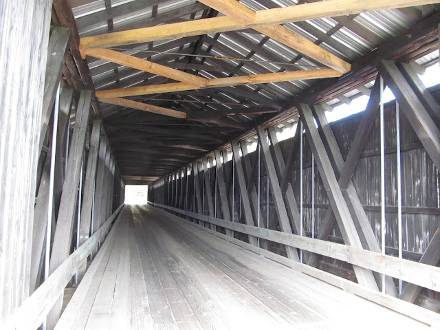
Inside the covered bridge.

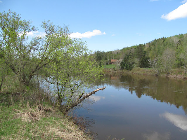
A view of the Connecticut River on a nice spring day.

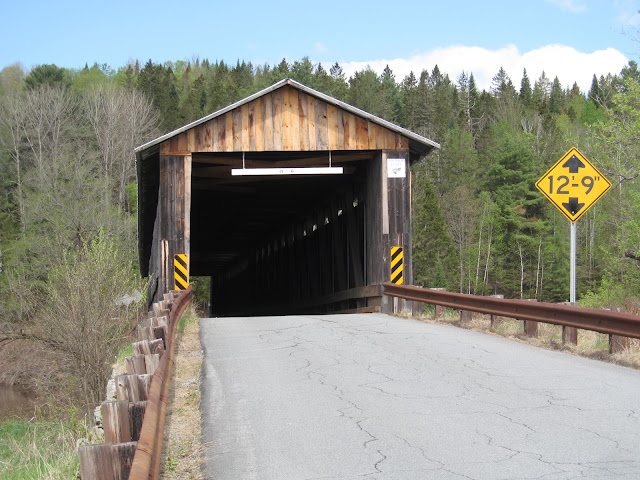
A view of the eastern bridge portal on the New Hampshire side of the bridge.

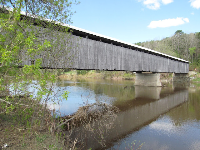
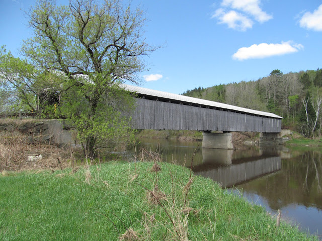
Side profile of the covered bridge.

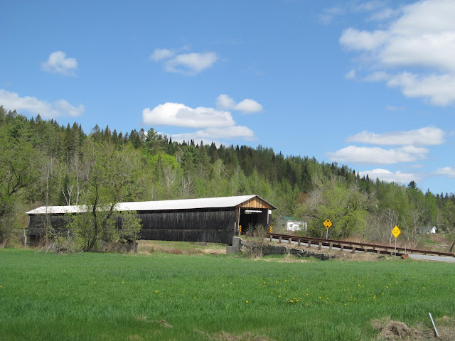
Coming up towards the covered bridge on NH 135.


How to Get There:


Sources and Links:
New Hampshire Bridges - Mt. Orne Bridge
Vermont Covered Bridge Society - The Mount Orne Covered Bridge
Bridgehunter.com - Mt. Orne Covered Bridge 45-05-03 / 29-04-08
NH Tour Guide - Mt. Orne Covered Bridge Lancaster NH and Lunenburg VT

Comments

Popular posts from this blog

Crescent City Connection (New Orleans, LA)

The Crescent City Connection is a massive dual-span steel truss bridge that spans the lower Mississippi River at downtown New Orleans, about 95 river miles upstream from the mouth of the great river at the Head of Passes Light. If counted as a single bi-directional highway bridge, the parallel spans combine to form the single busiest bridge on the Mississippi River and its importance as a linchpin in the region’s transportation network cannot be overstated. While there have been various schemes over the years to construct bridges downriver from Algiers Point, this bridge has been the southernmost bridge on the Mississippi River since its initial construction in the 1950s. The years immediately following the end of World War II were a transformational period in the history of New Orleans. Already one of the great economic and cultural centers of the American Deep South, it was recognized at this time that major changes and improvements to the city’s transportation infrastructure would b...

Old US Route 99 through Tipton, Tulare, and Tagus Ranch

This summer I had a look into the alignment history of US Route 99 through the Tulare County communities of Tipton, Tulare, and Tagus Ranch.  While this slab below might seem like much it is one of the few remaining reminders of how US Route 99 was during the 1920s in Tulare County. This blog is part of the larger Gribblenation US Route 99 Page.  For more information pertaining to the other various segments of US Route 99 and it's three-digit child routes check out the link the below. Gribblenation US Route 99 Page Part 1; the history of US Route 99 in Tipton, Tulare, and Tagus Ranch Tipton and Tulare were both founded in 1872 as sidings of the Southern Pacific Railroad.  The Southern Pacific Railroad laid the groundwork for development of southern San Joaquin Valley.  Previous to the Southern Pacific Railroad travel via wagon or foot in Central California tended to avoid San Joaquin Valley in favor of the Stockton-Los Angeles Road.  The Stockton Los Ange...

Former US Route 101 and California State Route 41 through Paso Robles

Paso Robles is a city located on the Salinas River of San Luis Obispo County, California.  As originally configured the surface alignments of US Route 101 and California State Route 41 converged in downtown Paso Robles.  US Route 101 originally was aligned through Paso Robles via Spring Street.  California State Route 41 entered the City of Paso Robles via Union Road and 13th Street where it intersected US Route 101 at Spring Street.  US Route 101 and California State Route 41 departed Paso Robles southbound via a multiplex which split near Templeton.   Pictured above is the cover of the September/October 1957 California Highways & Public Works which features construction of the Paso Robles Bypass.  Pictured below is the 1935 Division of Highways Map of San Luis Obispo County which depicts US Route 101 and California State Route 41 intersecting in downtown Paso Robles.   Part 1; the history of US Route 101 and California State Route 41 i...