
World Drive and Epcot Center Drive; the weird freeways of Disney World


The grounds of Disney World near Orlando, Florida consist of numerous limited access freeways which connect the annexes of the park.  While Osceola Parkway is the most well known limited access freeway in Disney World others in the form of World Drive and Epcot Center Drive can be found.  Note; if you are looking for a serious overview of Disney World this is not the place to find it.  This blog is decidedly oriented towards the limited access road network of Disney World and may contain several bad jokes.  


A drive on World Drive and Epcot Center Drive

World Drive is the original access road into the Disney World resort which opened alongside the Magic Kingdom during October 1971.  As originally configured World Drive began at US Route 192 in Bay Lake but an extension south to Interstate 4 was later built by Osceola County.  

Eastbound US Route 192 skirts the ESPN Wide World of Sports complex and intersects World Drive in northern Osceola County.  Traffic headed towards Disney World is directed to take northbound World Drive.   


Northbound World Drive initially has MUTCD compliant signage approaching Orange County and Osceola Parkway.  The Orange County Line serves as the boundary of Disney World resort and City of Bay Lake.  Magic Kingdom and Epcot traffic are directed to stay on World Drive northbound.  Traffic headed towards Wide World of Sports, Animal Kingdom and Hollywood Studios is directed to utilize Osceola Parkway.   World Drive does not utilize any Exit numbers despite being mostly a freeway. 


World Drive northbound enters Disney World underneath the archway used as the cover for this blog. 


Guide signage on all three limited access roads in Disney World is purple instead of the standard MUTCD green.  The signage fonts are also far different than what one could normally expect to see on a typical freeway.  Upon crossing under the Disney World archway traffic on World Drive is advised the Magic Kingdom and Epcot are ahead to the north.  World Drive northbound passes under Osceola Parkway.   


The first Exit on World Drive north of Osceola Parkway accesses Buena Vista Drive.  Disney Springs, Epcot Resort Area and Hollywood Studios can be accessed from the Buena Vista Drive Exit.  A large marque for the Tower of Terror can be seen approaching the Buena Vista Drive Exit.  


World Drive passes under Buena Vista Drive and approaches the interchange with Epcot Center Drive.  Traffic headed towards the Magic Kingdom is directed to stay on World Drive northward whereas traffic headed towards Epcot is directed to use the Epcot Center Drive ramp eastward.  


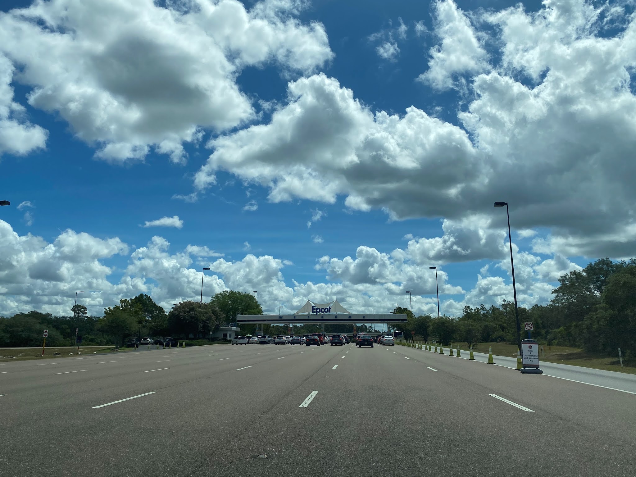
Traffic on World Drive northbound cannot access Epcot Center Drive eastbound directly and must pass through the Epcot Visitor Entrance. 

The giant golf ball I'm told people come from all over to see at Epcot. 


I would say Interstate 4 deserves better, but this seems about right. 


The National Transportation Safety Board hasn't released their results from the latest Arosu derailment incident. 


The recently installed Stargate at Epcot.  This almost makes up for the fact that I didn't visit an Orwellian future city.  


I don't like the fact that the Wilkin's Coffee guy has access to a Stargate after all the horrific things he has done to Wontkins. 


Sweet, an overview of all the things I'm missing in Canada.   


Well, sir, there's nothing on earth like a genuine, bona fide electrified, six-car monorail (it wasn't running). 


Departing the Epcot parking lot traffic can turn west or east on Epcot Center Drive.  Westbound Epcot Center Drive traffic is advised it accesses Florida's Turnpike and Florida State Road 429.  Eastbound Epcot Center Drive is advised it serves as access to Interstate 4 and US Route 192. 


Epcot Center Drive was constructed as an access road for Epcot Annex of Disney World during the early 1980s.  Epcot Center Drive east of the Epcot parking lot intersects Backstage Lane which connects to Buena Vista Drive.  Buena Vista Drive is signed as access for all guest areas whereas as Epcot Center Drive is signed as access for; Interstate 4, Florida State Road 536, US Route 192 and Florida State Road 417.  


As Epcot Center Drive eastbound approaches Interstate 4 it gains MUTCD overhead guide signage.  A makeshift US Route 192 and Interstate 4 shield can be spied approaching the east terminus of Epcot Center Drive.  Epcot Center Drive continues as Florida State Route 536 on World Center Drive which directs traffic to Florida State Route 417.  The eastbound exit from Epcot Center Drive empties onto Interstate 4.


Comments

Popular posts from this blog

Grand Loop Road of Yellowstone National Park

  Grand Loop Road is a 140 mile loop highway which traverses the interior of Yellowstone National Park.  Grand Loop Road connects all of the major attractions and geological features of Yellowstone National Park along with the entrance roads.  Grand Loop Road is a seasonal highway and despite some conjecture never has been part of the US Route System.   Part 1; the history of Grand Loop Road The majority of history pertaining to Grand Loop Road was taken from the below National Park Service article: Historic Roads - Yellowstone National Park (U.S. National Park Service) (nps.gov) Yellowstone was declared the first National Park of the United States on March 1st, 1872.  The first real highway to access Yellowstone National Park came in 1873 when a tolled facility was constructed from Bozeman, Montana via Yankee Jim Canyon to Mammoth Hot Springs.  Numerous attempts were made to fund construction of roadway infrastructure during the early years of Yellows...

The last 1956-63 era California Sign State Route Spade?

Along southbound California State Route 170 (the Hollywood Freeway Extension) approaching the Hollywood Freeway/Ventura Freeway interchange a white California State Route 134 Sign State Route Spade can be observed on guide sign.  These white spades were specifically used during the 1956-63 era and have become increasingly rare.  This blog is intended to serve as a brief history of the Sign State Route Spade.  We also ask you as the reader, is this last 1956-63 era Sign State Route Spade or do you know of others?  Part 1; the history of the California Sign State Route Spade Prior to the Sign State Route System, the US Route System and the Auto Trails were the only highways in California signed with reassurance markers.  The creation of the US Route System by the American Association of State Highway Officials during November 1926 brought a system of standardized reassurance shields to major highways in California.  Early efforts to create a Sign State Route ...

California State Route 70; the Feather River Highway

From 2017 through to early 2019 I drove the majority of the California State Route 70; the Feather River Highway from CA 89 southwest to CA 99. CA 70 is an approximately 178.5 mile state highway which starts at US 395 near the Nevada State Line and travels west through the Feather River Canyon to CA 99.  CA 70 is often referred to as the Feather River Highway" given it's close association with the river.  Historically CA 70 was previously signed as US 40A and CA 24.  The Legislative Routes prior to the 1964 California Highway Renumbering that made up the current route of CA 70 are as follows: -  Legislative Route Number 21 from US 395 westward to Oroville. -  LRN 87 from Oroville south to Marysville. -  LRN 232 from Marysville to the current junction with CA 99.  CA 70 was even dual signed with CA 99 into Sacramento on what was LRN 232 for a time. The change from US 40A/LRN 21/LRN 87/LRN 232 can be seen by comparing the 1963 State Highway Ma...