The next segment of my trip was US Route 41 through the Everglades along a segment of the highway known as the Tamiami Trail.

Technically the 275 miles of US 41 south of Tampa to the City of Miami is officially known as the Tamiami Trail. The Tamiami Trail is a simple combination of the names of the cities of Tampa and Miami although it is typically associated with the Everglades. The Tamiami Trail between Naples and Miami was once signed as US 94 until it was replaced by US 41 in 1949. The Tamiami was completed in segments from 1915 until it was completely finished in the Everglades in 1928 and had drastic effects on water flow through the Everglades.
From CR 951 eastward the city of Miami is 94 miles away along US 41.

The Tamiami Trail quickly drops to a two-lane highway.

Interestingly much of the Tamiami Trail in Big Cypress is signed with night time speed limits due to being in Florida Panther territory. The Florida Panther is nearly extinct and essentially all the remaining habitat is in the Big Cypress. Big Cypress is often mistaken for the Everglades but is actually swamp land on higher terrain.

The Tamiami Trail junctions CR 92 on San Marco Road. CR 92 backtracks southwest to Marco Island.

US 41 in Big Cypress and the Everglades has a bunch of oddly shaped shields. There are some more MUTCD compliant shields like this one intermixed.

The difference between the Big Cypress and Everglades is apparent along this canal. The Everglades has small hammocks on high elevation with mostly a watery/grassy terrain. The Big Cypress is higher in elevation with larger hammocks. Both are equally infested with alligators and other swamp dwelling reptiles. Some of the best hiking in Florida is in both the Big Cypress and Everglades but it can dangerous given the wildlife. Much of the Tamiami Trail east to Miami was dredged out of the ground next to the highway which led to the drainage issues in the Everglades.


The Tamiami Trail junctions FL 29/CR 29 in Carnestown, signage on FL 29 directs traffic to I-75 in Alligator Alley. There is a historical placard detailing the history the Tamiami Trail.


Despite all the time I've spent in the Everglades over the years I've never had been to Everglades City. That being the case I took CR 29 south off of US 41 for a scenic detour.


CR 29 uses Collier Avenue, Broadway, and Copeland Avenue through Everglades City.


Everglades City was first settled in the 1870s and obtained a post office by 1892. In 1923 Collier County split from Lee County and the newly incorporated Everglades City was picked as the first county seat. The county seat was moved in 1962 but Everglades City has remained an incorporated place ever since. The original 1926 Collier County Courthouse is still present in the downtown section of the city. There are some nice older 20th century structures still present in downtown Everglades City.


I followed CR 29 on Copeland Avenue towards Chokoloskee. There was some one-way traffic control on the bridge to Chokoloskee that was managed by a traffic light.

Chokoloskee was apparently founded back in 1874 and somehow has hung on to modern times.

At the very southern tip of Chokoloskee is the Smallwood Store. The Smallwood Store was the original post office for Chokoloskee which was built in 1906. Chokoloskee is located on a bay of the same name whch is connected by a string of islands called "The Thousand Islands" to the Gulf of Mexico.
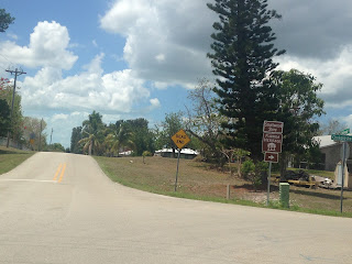


Returning to US 41 and the Tamiami Trail the first of many odd shields made an appearance.


Birdon Road is signed as CR 841 which is odd considering it is a dirt surface. Finding a unpaved road in Florida is extremely difficult at times but Big Cypress and the Everglades have them.


Just east of Birdon Road is Ochopee. Ochopee as established in the 1920s but today is more or less a ghost town. The community is notable for what is reportedly the smallest post office in the county. The current post office was opened in 1953 when the original general store burned down. Supposedly the current post office building was originally a pipe shed that was repuroposed.


East of Ochopee is CR 839.

Further east the Tamiami Trail begins to approach the mainland portion of Monroe County and junctions the Everglades Loop Road which was once CR 94. The junction of the Loop Road and Tamiami Trail was the location of Monroe Station.

The Loop Road travels to/from US 41 through the Big Cypress Preserve in Collier County to Everglades National Park Miami/Dade County. Originally the Loop Road was accepted as the official routing of the Tamiami Trail in 1921. The funding for the Tamiami Trail ran out of money in 1922 and private money was used to route the highway along the modern alignment through Collier County instead of Monroe. The Loop Road is 21 miles long with 14 miles still unpaved through to the Pinecrest Ghost Town. The dirt segment is generally graded well enough for cars to get through provided the waters are low. There is no barrier to keep alligators off the Loop Road so the sign is actually fairly conveys a possible negative encounter.


Monroe Station was a gas station along the Tamiami Trail. Monroe Station was added to the register of historic places in 2000 but it burned down in 2016. Reportedly the reason Monroe Station burned down was due to someone trying to do a light show on the roof by burning steel wool. Apparently this led to the roof collasping and the person burning the steel wool falling inside which led to Monroe Station burning down. All that is left of the station is a concrete stairwell and a couple wood support posts.


East of Monroe Station I stopped at the Big Cypress Visitor Center to see some of the beasts lurking in the murky canal waters up close. Alligators are surprisingly chilled out unless you are small or do something really to piss them off.


East of the Big Cypress Preserve Visitor Center is the Dade-Collier Training and Transition Airport. The airport was envisioned to be a hub Supersonic planes entering the Miami Area. A single 10,500 runway was built before the project was shuttered in 1970. Essentially the airport was designed to choke out the Big Cypress and Everglades by covering close to 40 square miles. The 1970s in general was a big turning point for Everglades and Big Cypress as conservation became a huge concern after decades of attempts to drain the wet lands.

The Tamiami Trail takes a brief southeast bend into Dade County. This happens to be where my favorite US 41 shield is located.


The eastern end of the Loop Road is in Dade County. I took it on a western backtrack into Monroe County to the ghost town of Pinecrest.


Pinecrest in Monroe County is not to be confused with the city of the same name in Miami-Dade County. Pinecrest came to be settled during the construction of the Tamiami Trail and was once even had a hotel owned by Al Capone. Somehow part of Pinecrest has remained in private hands and all that is left is some ruins in a collection in a front yard with "no trespassing" signs. There is a derelict gas station on private property with a 1954 DeSoto rusting away on the side of the Loop Road.


I did find a map of Monroe County from 1937 showing the Everglades Loop Road as pre-1945 FL 27. Pinecrest can be seen along with another settlement called Trail City to the west.
1937 Monroe County Map
Returning to Dade County and the Tamiami Trail I passed the Everglades National Park visitor center at the Shark Valley Loop Road which I had visited back in 2012.

East of Shark Valley there are numerous flood control locks and new construction elevating the Tamiami Trail to improve water flow into the southern Everglades.


The Tamiami Trail bursts back into civilization and Metro Miami at FL 997/Krome Avenue. The Micccosukee Casino is on the fringe of the Everglades and can be seen from miles to the west on the Tamiami Trail. FL 997 was in the process of being upgraded to an expressway but I'll cover that later in this blog series. I continued on US 41 east to Florida's Turnpike where I turned south towards Florida City.
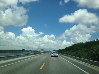

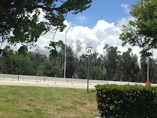

Technically the 275 miles of US 41 south of Tampa to the City of Miami is officially known as the Tamiami Trail. The Tamiami Trail is a simple combination of the names of the cities of Tampa and Miami although it is typically associated with the Everglades. The Tamiami Trail between Naples and Miami was once signed as US 94 until it was replaced by US 41 in 1949. The Tamiami was completed in segments from 1915 until it was completely finished in the Everglades in 1928 and had drastic effects on water flow through the Everglades.
From CR 951 eastward the city of Miami is 94 miles away along US 41.

The Tamiami Trail quickly drops to a two-lane highway.

Interestingly much of the Tamiami Trail in Big Cypress is signed with night time speed limits due to being in Florida Panther territory. The Florida Panther is nearly extinct and essentially all the remaining habitat is in the Big Cypress. Big Cypress is often mistaken for the Everglades but is actually swamp land on higher terrain.

The Tamiami Trail junctions CR 92 on San Marco Road. CR 92 backtracks southwest to Marco Island.

US 41 in Big Cypress and the Everglades has a bunch of oddly shaped shields. There are some more MUTCD compliant shields like this one intermixed.

The difference between the Big Cypress and Everglades is apparent along this canal. The Everglades has small hammocks on high elevation with mostly a watery/grassy terrain. The Big Cypress is higher in elevation with larger hammocks. Both are equally infested with alligators and other swamp dwelling reptiles. Some of the best hiking in Florida is in both the Big Cypress and Everglades but it can dangerous given the wildlife. Much of the Tamiami Trail east to Miami was dredged out of the ground next to the highway which led to the drainage issues in the Everglades.


The Tamiami Trail junctions FL 29/CR 29 in Carnestown, signage on FL 29 directs traffic to I-75 in Alligator Alley. There is a historical placard detailing the history the Tamiami Trail.


Despite all the time I've spent in the Everglades over the years I've never had been to Everglades City. That being the case I took CR 29 south off of US 41 for a scenic detour.
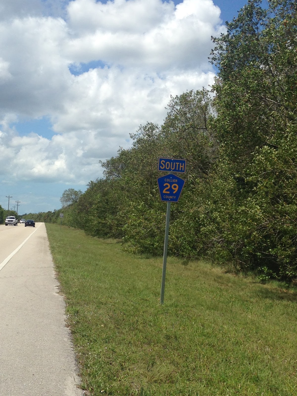

CR 29 uses Collier Avenue, Broadway, and Copeland Avenue through Everglades City.


Everglades City was first settled in the 1870s and obtained a post office by 1892. In 1923 Collier County split from Lee County and the newly incorporated Everglades City was picked as the first county seat. The county seat was moved in 1962 but Everglades City has remained an incorporated place ever since. The original 1926 Collier County Courthouse is still present in the downtown section of the city. There are some nice older 20th century structures still present in downtown Everglades City.


I followed CR 29 on Copeland Avenue towards Chokoloskee. There was some one-way traffic control on the bridge to Chokoloskee that was managed by a traffic light.

Chokoloskee was apparently founded back in 1874 and somehow has hung on to modern times.

At the very southern tip of Chokoloskee is the Smallwood Store. The Smallwood Store was the original post office for Chokoloskee which was built in 1906. Chokoloskee is located on a bay of the same name whch is connected by a string of islands called "The Thousand Islands" to the Gulf of Mexico.


Returning to US 41 and the Tamiami Trail the first of many odd shields made an appearance.

Eastbound the Tamiami Trail finally enters the Big Cypress National Preserve which was established back in 1974. My understanding is that most of Big Cypress was originally meant to be part of Everglades National Park but the land was never annexed when it was created.

Birdon Road is signed as CR 841 which is odd considering it is a dirt surface. Finding a unpaved road in Florida is extremely difficult at times but Big Cypress and the Everglades have them.


Just east of Birdon Road is Ochopee. Ochopee as established in the 1920s but today is more or less a ghost town. The community is notable for what is reportedly the smallest post office in the county. The current post office was opened in 1953 when the original general store burned down. Supposedly the current post office building was originally a pipe shed that was repuroposed.


East of Ochopee is CR 839.

Further east the Tamiami Trail begins to approach the mainland portion of Monroe County and junctions the Everglades Loop Road which was once CR 94. The junction of the Loop Road and Tamiami Trail was the location of Monroe Station.

The Loop Road travels to/from US 41 through the Big Cypress Preserve in Collier County to Everglades National Park Miami/Dade County. Originally the Loop Road was accepted as the official routing of the Tamiami Trail in 1921. The funding for the Tamiami Trail ran out of money in 1922 and private money was used to route the highway along the modern alignment through Collier County instead of Monroe. The Loop Road is 21 miles long with 14 miles still unpaved through to the Pinecrest Ghost Town. The dirt segment is generally graded well enough for cars to get through provided the waters are low. There is no barrier to keep alligators off the Loop Road so the sign is actually fairly conveys a possible negative encounter.


Monroe Station was a gas station along the Tamiami Trail. Monroe Station was added to the register of historic places in 2000 but it burned down in 2016. Reportedly the reason Monroe Station burned down was due to someone trying to do a light show on the roof by burning steel wool. Apparently this led to the roof collasping and the person burning the steel wool falling inside which led to Monroe Station burning down. All that is left of the station is a concrete stairwell and a couple wood support posts.


East of Monroe Station I stopped at the Big Cypress Visitor Center to see some of the beasts lurking in the murky canal waters up close. Alligators are surprisingly chilled out unless you are small or do something really to piss them off.


East of the Big Cypress Preserve Visitor Center is the Dade-Collier Training and Transition Airport. The airport was envisioned to be a hub Supersonic planes entering the Miami Area. A single 10,500 runway was built before the project was shuttered in 1970. Essentially the airport was designed to choke out the Big Cypress and Everglades by covering close to 40 square miles. The 1970s in general was a big turning point for Everglades and Big Cypress as conservation became a huge concern after decades of attempts to drain the wet lands.

The Tamiami Trail takes a brief southeast bend into Dade County. This happens to be where my favorite US 41 shield is located.


The eastern end of the Loop Road is in Dade County. I took it on a western backtrack into Monroe County to the ghost town of Pinecrest.


Pinecrest in Monroe County is not to be confused with the city of the same name in Miami-Dade County. Pinecrest came to be settled during the construction of the Tamiami Trail and was once even had a hotel owned by Al Capone. Somehow part of Pinecrest has remained in private hands and all that is left is some ruins in a collection in a front yard with "no trespassing" signs. There is a derelict gas station on private property with a 1954 DeSoto rusting away on the side of the Loop Road.


I did find a map of Monroe County from 1937 showing the Everglades Loop Road as pre-1945 FL 27. Pinecrest can be seen along with another settlement called Trail City to the west.
1937 Monroe County Map
Returning to Dade County and the Tamiami Trail I passed the Everglades National Park visitor center at the Shark Valley Loop Road which I had visited back in 2012.

East of Shark Valley there are numerous flood control locks and new construction elevating the Tamiami Trail to improve water flow into the southern Everglades.


The Tamiami Trail bursts back into civilization and Metro Miami at FL 997/Krome Avenue. The Micccosukee Casino is on the fringe of the Everglades and can be seen from miles to the west on the Tamiami Trail. FL 997 was in the process of being upgraded to an expressway but I'll cover that later in this blog series. I continued on US 41 east to Florida's Turnpike where I turned south towards Florida City.


Comments